

kvegas-wx
-
Posts
2,073 -
Joined
-
Last visited
Content Type
Profiles
Blogs
Forums
American Weather
Media Demo
Store
Gallery
Posts posted by kvegas-wx
-
-
Golf on Christmas weekend is NEVER a bad thing.

-
13 hours ago, olafminesaw said:
Starting to finally look like a wet period upcoming
.thumb.png.c56ab5bbf5abdc4bfa4159b10546534d.png)
And not a minute too soon. Sauratown Mountain next to Pilot Mt and Hanging Rock State Park had a fire today. Pretty bad one at that. Not sure if they got it under control but at least there was minimal wind. It is CRUNCHY out there!
-
 2
2
-
-
2 hours ago, GaWx said:
If the 12Z GEFS suite were to verify pretty closely, the SE would have a decent shot at one of the coldest Octobers of the last few decades. Let’s say possibly 90% percentile cold in relation to the last 30 years or so. Going to be interesting to see if this model is onto something.
Great, so we have a strong opportunity at 38° and rain a few times later in the month. And then guess what? We get to Jan/Feb and we get °38 and rain again in a mild winter. Give me Indian summers in October. I'll save my below averages for Jan-Mar please.
-
2
-
-
10 hours ago, Jonathan said:
Super Ultra Mega Generational Nino on the way to rain (literally) on everyone's parade for the next two years.
I didn't think this comment was serious at first, but after reading it again I see you added "ultra". Now I'm quite concerned. I plan on adding a canoe and waders to my disaster supplies. I will also go ahead and sell my snow plow blade on Facebook Marketplace while prices are high. Thank you for this information!

-
 2
2
-
-
Man I love coastal storms here in the triad. We get to have the icing and the cake, but don't have to mess with cleaning up the dishes. Nice and cool with a glorious breeze. Perfect night on the deck, but no rain...yet. I'm sure the OBX folks are knee deep in dirty dishes!
-
1
-
-
Ok what is with all the wooly worms?? I have lived here in the Triad for 22 years and not once have I found wooly worms just crawling around my driveway. They are everywhere!! Is this just a local infestation or is mother nature trying to tell me to buy a snowblower??

-
10 minutes ago, nycwinter said:
hurricane delta went from a tropical depression to a cat 4 in less then 24 hours so anything is possible.
Ah! Good call! I agree, anything is possible.
-
2
-
-
7 minutes ago, lilj4425 said:
Decreasing wind shear and hot gulf waters=bad combo. I expect it be at least a weak category 4 by landfall. Nothing preventing it from strengthening rapidly. Just look at what happened with Hurricane Ian last year.
Strengthening rapidly, sure. But time and distance to the coast are both working against Idalia. It will take time to gather the structure needed to support Cat 4 (or high Cat 3) winds. I know we have seen some crazy RI storms the last few years, but 48-60 hours doesnt leave much room for ERCs when she is just now a TS. I would lean towards an intensifying Cat 2 at landfall.
That said, these surface temps are unprecedented, so who knows.
-
1
-
-
15 hours ago, marsman said:
50's showing up for lows in the RDU area late next week.
Maybe... maybe I can actually enjoy an Octoberfest with some October-ish temps.
Just got back from western Montana and I can confirm that 49° mornings are well worth the wait. Bring it on!
-
6
-
-
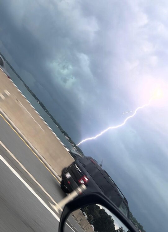
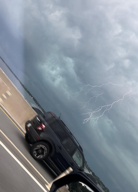
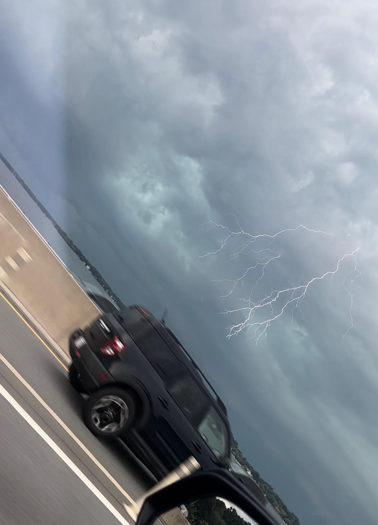
Tornado warning! Statesville area and north Lake Norman. Winds are brutal across a wide area of Lake Norman. Be safe out there!
-
1
-
-
Some very high winds coming into Lake Norman area along with severe lightning. Big storm there....
-
1
-
 1
1
-
-
Never like being the center of attention when it comes to tornado watches and clown maps...unless they are snow maps!
-
1
-
-
First storm of the afternoon up at the farm in Stuart. Looks like a line may develop cells from Lynchburg back to Wilkesboro soon.
-
Man I dont want to see large hail. Some of the videos from AR, MS, TX, CO have me spooked! And I hate to see my hard work on the crops this year go to waste.
Sun is already bright here in the Triad.
-
We are very quickly only going to have 60 days left of avg hi temps above 85° here in the Triad. This is getting close to the summer that never was, but I dont want to jinx us quite yet. So far, I'll take this over torch/humidity any day.
-
5
-
-
1 hour ago, olafminesaw said:
(sorry, can't help myself)

When I fly back from Orlando that day they better have the dang highway plowed.

Honestly this is about the only type of event that would stand a chance of coming to fruition right now so you might as well embrace it while it lasts, which will probably be about 4 more hours.
That drive from Wake to Alamance county though.
-
1
-
1
-
-
Ground is fully covered in Stuart at the farm. Snowing here in Cincinnati this morning too which means I get snow all the way home today!

-
1
-
2
-
-
2 minutes ago, olafminesaw said:

Great, and I will be driving back down I77 from Cincy on the 12th. I mean we're nice people here and we love Mother Nature. Is it too much to ask for rain during warmer months, snow during colder months, and 72° and sunny every Friday, Saturday and Sunday??

-
1
-
-
2 hours ago, GaWx said:
The 12Z GEFS mean has a pretty impressive -NAO that gets going late on 2/28 and then strengthens. The chance of a -NAO getting started very late Feb/start of March is increasing.
Edit: Regarding the 0Z GEFS mean, 25% of the members had a sub -0.25 NAO by Feb 27th. The 12Z GEFS mean is even closer to a -NAO on Feb 27th than was the 0Z. This tells me that the chance of a -NAO starting already in very late Feb is increasing.Edit again: Remember that nice looking -NAO on the Euro weeklies from last Thursday that then didn't look as good on yesterday's weeklies? The latest trends are heading back to that Thursday weeklies look.
I say this with the love of the forum in mind on Valentines Day @GaWx, you have typed volumes of highly valuable information into this thread over the last few weeks. More than most of us will ever understand. And I'm confident it is all accurate given your creds.
But COME ON MAN!!! Despite all of your excellence this forum has seen didly squat!! So in the immortal words of one Elvis Presley, we're gonna need "a little less conversation, a little more action please".
Time to dial up that Amazon truck full of snow sir. My app says he is always 5 stops away and he never shows up!
Appreciate all your efforts!
-
4
-
2
-
8
-
 2
2
-
-
10 minutes ago, Met1985 said:
Im sitting at 34 currently. What's everyone got?
"I gotta rock" - Charlie Brown
Enjoy your snow up there!
-
3
-
1
-
-
1 hour ago, Upstate Tiger said:
Man what impressive dynamics over Mississippi! Not saying it will translate into anything in the lower elevations but someone is going to get raked tonight in the mountains.
Inland hurricane on radar. Looks amazing! I think we should have had a GoFundMe on the forum for a 1040HP up north. I bet we could have bought one.

-
2
-
-
28 minutes ago, StantonParkHoya said:
If anyone outside of the mountains sees snow this dreadful winter, I will eat my hat. It’s time for spring.
Pre-emergent is down. Fertilizing end of Feb and I'll be mowing by mid March. Bank it!!
What an absolute dud of a winter.
-
5 minutes ago, GaWx said:
I was just looking back at old maps for 3/1-2/2009 to see how 2/12/2023 compares:
1) Similar strength of H5 low in low 540s at strongest in SE US but it is progged to remain that strong til well out in the Atlantic vs 2009 opening up:
3/1/2009 H5:
https://www.wpc.ncep.noaa.gov/dailywxmap/dwm_500ht_20090301.html
3/2/2009 H5: no longer closed:
https://www.wpc.ncep.noaa.gov/dailywxmap/dwm_500ht_20090302.html
2) In 2009 there was a big, strong (1044 mb) high to the NW centered over the Plains feeding in cold air:
https://www.wpc.ncep.noaa.gov/dailywxmap/dwm_stnplot_20090301.html
The upcoming case has no high to the NW to speak of to feed in cold air. However, this time there's moderate CAD from a 1027 mb VA high vs no CAD high in 2009.
3) Related to point #2, temperatures were ~10 colder in 2009 to the NW in the area from St. Louis to Chicago (near normal) vs well above normal this time. However, this time out ahead of the low it is ~5-10 colder (like in VA):
https://www.wpc.ncep.noaa.gov/dailywxmap/dwm_minmax_20090301.html
Pretty sure this all nets out to a hill of beans (or driveway full of puddles) unless you are right under the deform banding. And you may need elevation assistance as well. Whoever gets lucky is going to be reaaalllllyy lucky with this one.
-
1
-
-
31 minutes ago, PackGrad05 said:
The probability of 1" or greater improved on both the GEFS and EPS (12Z) as compared to previous runs...for most of central NC.
Still low, but good trends.
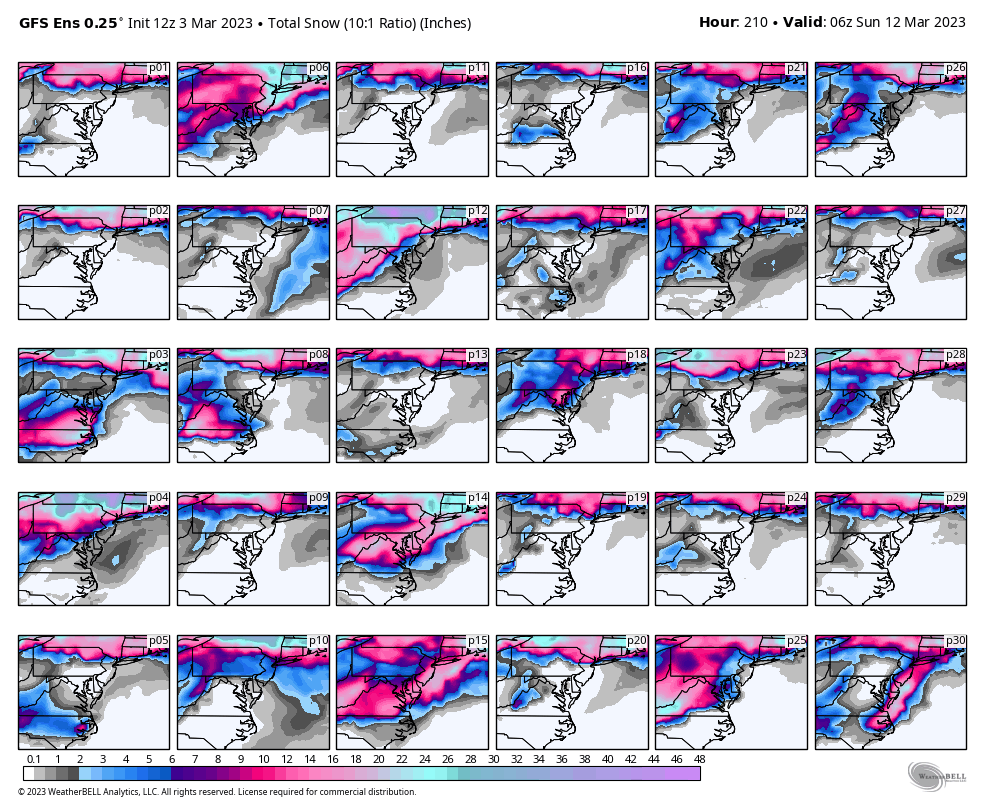
1" of snow (fall) that will add up to precisely zero on the ground. We had a similar event here in the triad a few years ago but the date escapes me. Snowed hard all afternoon and got nothing but some white mulch.
East of 52 and south of 40 is in hail mary land. The ball is long enough, high enough but is likely going to be batted down at the last second.
I'm putting down the pre-emergent tomorrow. Might as well be purposeful.
-
1
-
1
-
 1
1
-
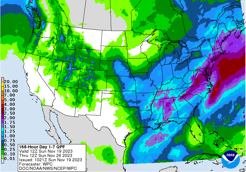
.png.3249778a0110c56838aa5d38a4c89388.png)


Mid to Long Range Discussion ~ 2023
in Southeastern States
Posted
Congrats Milwaukee! After the shifts NW of course. This certainly seems to fit the narrative of the storm track we thought we would have this winter. But can we really keep in HP in place long enough to cash in is the question. Similarly, I'm tired of reading Joe Bustardi tweets selling me snake oil events based on "timing" again this year. Just go back to saying
  cuz we all knew those ducks were decoys to begin with Joe!