

klw
-
Posts
4,487 -
Joined
-
Last visited
Content Type
Profiles
Blogs
Forums
American Weather
Media Demo
Store
Gallery
Posts posted by klw
-
-
Hello GFS, you have my attention

-
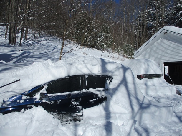
From the cleanup:
-
 7
7
-
-
I guess my 24.5" report wasn't map worthy.

-
2
-
-
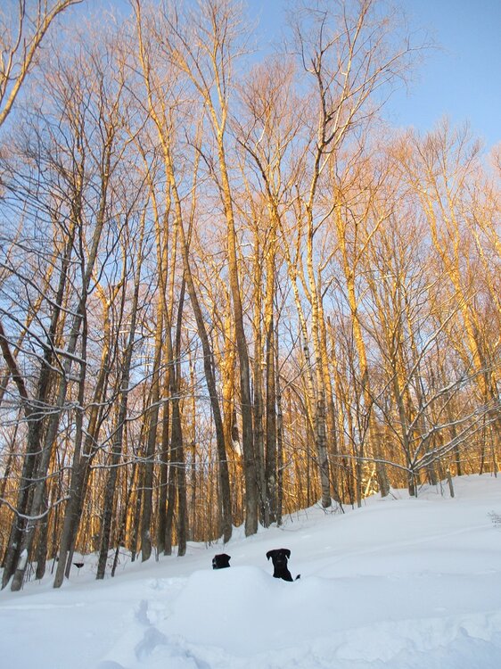
Labs keep on losing their tennis balls by letting go of them into the snow (which has no weight to it)
-
8
-
-
2 minutes ago, Ginx snewx said:
Sweet pics please
I'll what I can get when the light gets better.
-
10 hours ago, klw said:
8pm measurement 6.8 inches, total 23.2"
Unsure how this got double posted.
Ended up with 24.5 after another 1.3 fell after 8 pm.
Pretty sure this is my lifetime highest storm.- only 1996 may have match but my memory is getting 22 or 23 from that.
Got me over 100" on the year as well
-
6
-
-
Should be about to wind down but another inch in past hour has me at 24.2"
-
6
-
-
3 hours ago, mreaves said:
Soooo, you’re saying I shouldn’t install?
Either install or close the window, make up your mind.
-
 4
4
-
-
6 hours ago, klw said:
2pm measurement- 9.1 inches since clearing at 8am
16.4" total
8pm measurement 6.8 inches, total 23.2"
Unsure how this got double posted.
-
4
-
1
-
-
6 hours ago, klw said:
2pm measurement- 9.1 inches since clearing at 8am
16.4" total
8pm measurement 6.8 inches, total 23.2"
I also did first round for clearing the drive. Snowblower ate it up very well. Only lost one shear pin.
-
4
-
-
1 hour ago, CoastalWx said:
Let’s get 2’
20.8" Now (98.8 on the season)
-
4
-
-
2 hours ago, klw said:
2pm measurement- 9.1 inches since clearing at 8am
16.4" total
2.5 in past 2.5 hours. 18.9" total. It will likely be my biggest storm at this house and perhaps ever.
-
6
-
-
8 minutes ago, dendrite said:
Back to all pellets. Roared right back in on CC.
CC?
-
2pm measurement- 9.1 inches since clearing at 8am
16.4" total
-
6
-
-
13.4 now. (6.1 since 8am)
-
3
-
-
BTV
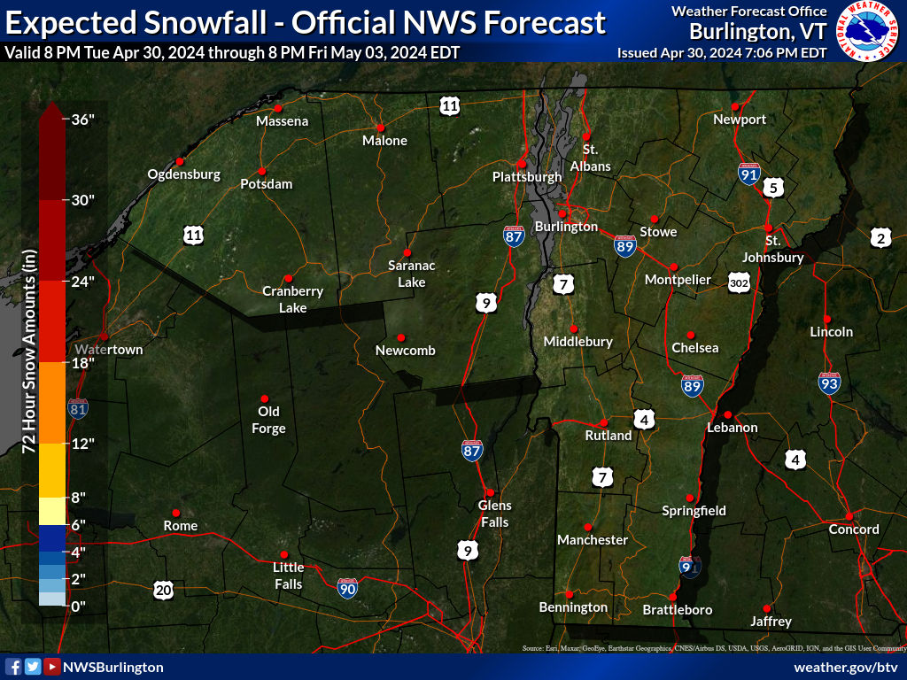
NEAR TERM /THROUGH SUNDAY/...
As of 947 AM EDT Saturday...Based on current stronger fgen band
of heavy snow across south central VT and latest reports,
boosted overall snow totals down in Rutland/Windsor/Orange
Counties up a bit. Also tightened the snowfall gradient in our
far northern counties to show slightly less snowfall due to
somewhat drier air in lower levels and a fairly narrow dendritic
snow growth zone of only a few thousand feet way up around 600
mb. This is why flakes have been on the finer/smaller side in
these areas. Have a great day!
-
4.5 inches new since I cleared at 8am. 11.8 total
-
5
-
-
2 minutes ago, mreaves said:
Feels like BTV was a bit too aggressive with those >15” totals yesterday. I think you’re going to be closer with your 8”-14” call. Of course @klwis piling it up already so maybe the bigger totals are just a bit SE of me.
From the BTV 8 am update
As of 758 AM EDT Saturday...No significant changes made with
the morning update. Barring some unexpected developments, the
snowstorm should be getting more interesting for a larger
portion of the region after heavier snow overnight tended to
stay parked over southern Windsor and Rutland counties where 6
to 8 inches of moderately wet new snow was observed. The
character of the snow has been rather dry farther north so far,
but should trend wetter areawide as previously anticipated.
-
7.3 inches as of 8am
-
2
-
-
51 minutes ago, dryslot said:
Dews here are right at 0°F today.
Have you installed?
I was happy to see this in BTV's more recent discussion:
The one change to the forecast is the expected ptype
across Rutland/Windsor counties where guidance has trended colder in
regard to a warm nose moving in aloft, with now only a small section
of southeast Windsor county forecast to see a changeover to a wintry
mix of snow, sleet, and rain from about noon through 6PM before
going back to all snow. This led to slightly higher snowfall
amounts, and less ice accretion as the probability for freezing rain
is much lower now.
-
3
-
-
12Z Euro Clown:

-
2
-
-
9 minutes ago, CoastalWx said:
Models including euro went south a bit. Looks like a huge mess central NH. Jack maybe between Stowe and Gene? Gfs is very icy for dendrite.
I just looked at a bunch of the models. I better go make sure I have extra gas for the snow blower.
-
2
-
-
BTV has upped totals again, I am a bit too close to the mix line for comfort
-
Warnings here now and BTV upped their map:
-
2
-

March 2024 disco/obs
in New England
Posted
Clown map clearly about 25 miles too far east