SnowLover22
-
Posts
1,285 -
Joined
-
Last visited
About SnowLover22

Recent Profile Visitors


-
Goddammit you jinxed it.
-
Significant Miller B Nor'easter Apr 3rd-4th OBS
SnowLover22 replied to wxeyeNH's topic in New England
Stuck at 5.5 here. 30.5 degrees F -
Significant Miller B Nor'easter Apr 3rd-4th OBS
SnowLover22 replied to wxeyeNH's topic in New England
It isn’t? Or you are saying it is forecasted to be…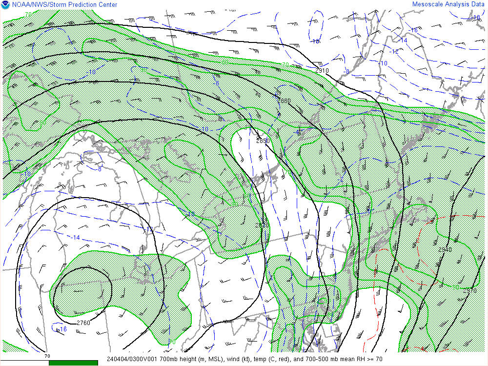
-
Significant Miller B Nor'easter Apr 3rd-4th OBS
SnowLover22 replied to wxeyeNH's topic in New England
-SNRA here. -
Significant Miller B Nor'easter watch, Apr 3rd-4th
SnowLover22 replied to Typhoon Tip's topic in New England
When is ever an appropriate time to use the PDC maps? I am pretty sure they only had 6-8 inches for our region for the last storm and we know how that turned out. -
Significant Miller B Nor'easter watch, Apr 3rd-4th
SnowLover22 replied to Typhoon Tip's topic in New England
Gfs is definitely smoking something, Plymouth with 30 inches and the white mountains with over 50 inches. -
Significant Miller B Nor'easter watch, Apr 3rd-4th
SnowLover22 replied to Typhoon Tip's topic in New England
Never say never but you are probably right. -
Significant Miller B Nor'easter watch, Apr 3rd-4th
SnowLover22 replied to Typhoon Tip's topic in New England
I’ll second what someone else said. The NAM blew the mid level warmth surge forecast last storm. Had sleet/freezing rain up into the white mountains. In reality, only got as far north as knocking on the door of Plymouth. Was off by 25-50 miles up to game time. -
Significant Miller B Nor'easter watch, Apr 3rd-4th
SnowLover22 replied to Typhoon Tip's topic in New England
It does seem it will at least be cold enough to give ski areas some real accumulating snow. Looking forward to that. -
Significant Miller B Nor'easter watch, Apr 3rd-4th
SnowLover22 replied to Typhoon Tip's topic in New England
NS will eventually start acting destructively with the set up if it gets too far behind. The one time the AI model is right is to ruin SNE snow chances. All jokes aside, this storm will be a good test case to see how it does vs the other models. -
Significant Miller B Nor'easter watch, Apr 3rd-4th
SnowLover22 replied to Typhoon Tip's topic in New England
disjointed mess, less effective phasing, ss is more able to run ahead of ns -
Significant Miller B Nor'easter watch, Apr 3rd-4th
SnowLover22 replied to Typhoon Tip's topic in New England
I am good missing out on this one…. 20 inches the other week was enough for me…. -
Significant Miller B Nor'easter watch, Apr 3rd-4th
SnowLover22 replied to Typhoon Tip's topic in New England
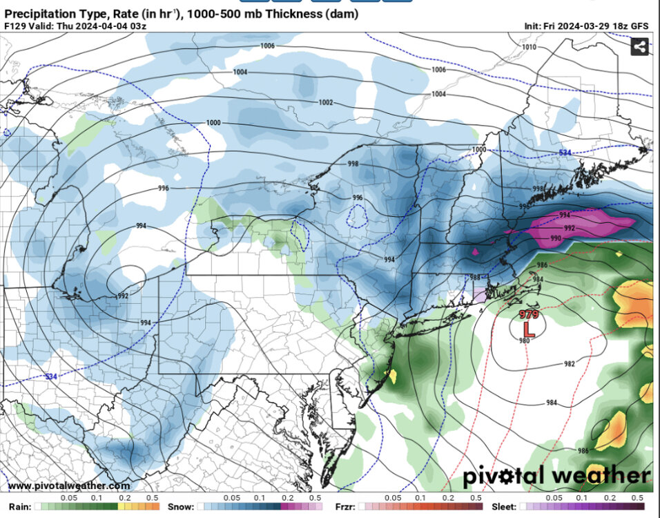
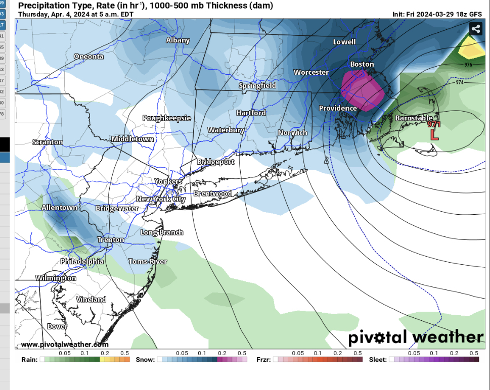
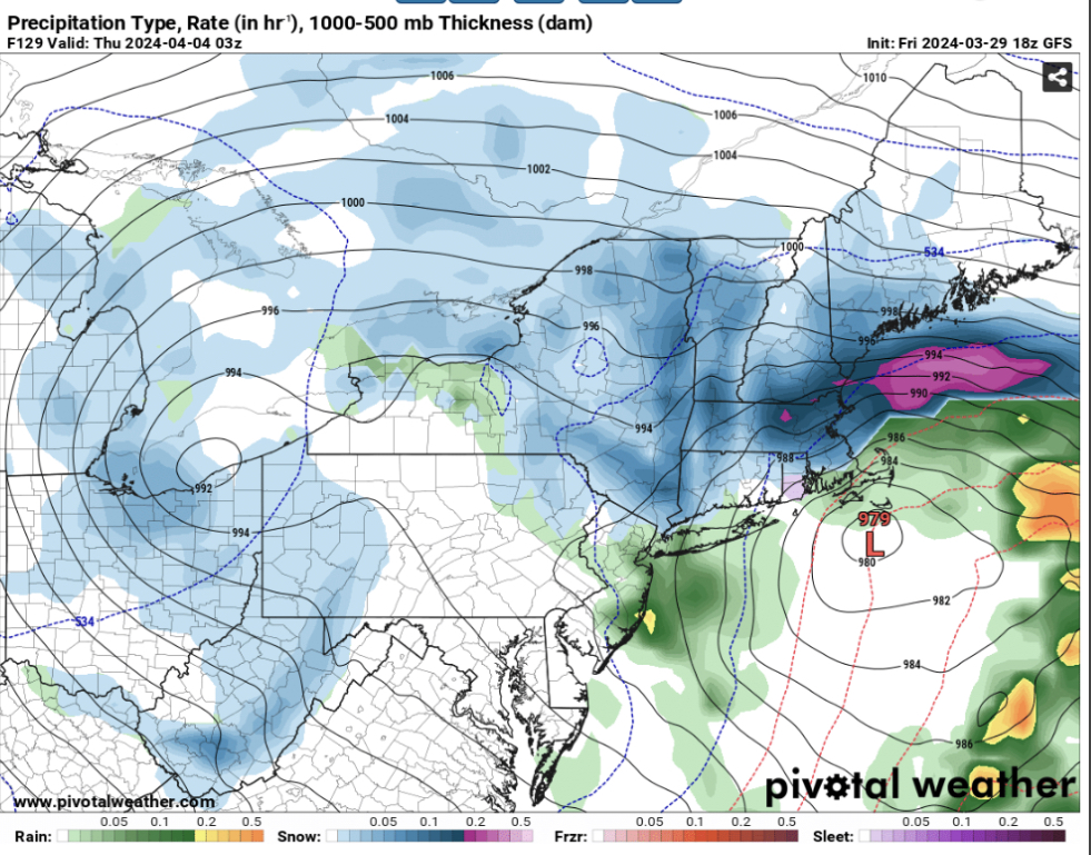
I know it’s a clown map but I’ll leave this here for the SNE peeps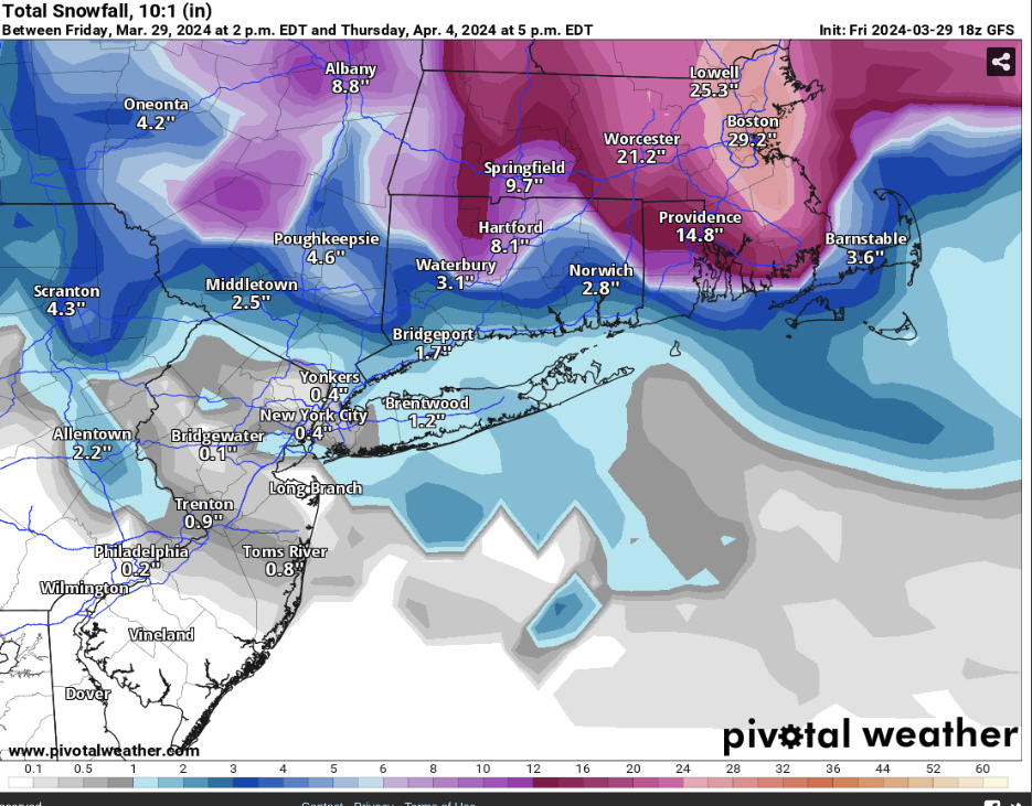
-
Significant Miller B Nor'easter watch, Apr 3rd-4th
SnowLover22 replied to Typhoon Tip's topic in New England
It’s over
-
Significant Miller B Nor'easter watch, Apr 3rd-4th
SnowLover22 replied to Typhoon Tip's topic in New England
Such a step back guys, storm cancel