

Scarlet Pimpernel
-
Posts
6,787 -
Joined
-
Last visited
Content Type
Profiles
Blogs
Forums
American Weather
Media Demo
Store
Gallery
Posts posted by Scarlet Pimpernel
-
-
8 minutes ago, psuhoffman said:

Look at the expanse of the storm, that would rival 1996 in terms of a NESIS score. Keep in mind thats straight 10-1 on a low resolution control run, which would be very low given that h5 and surface depiction. Yes I know its a day 20 snowmap, but it shows the potential of this pattern.
Yeah I know this is a snow map way out there for the control member...but damn, that's still quite an expansive area of 12"+!! I don't know if we've seen that kind of signal yet this year, hopefully it's real.
(ETA: Just as a matter of interest, since you mentioned it, I believe the 1996 storm is one of only two events that hit NESIS level 5? March 1993 being the other one.)
-
11 minutes ago, das said:
Great screen name, btw.
“There’s nothing quite so bad as that which is not so bad”.
Thanks! And it's a great movie, too! That quote you give is one of many good ones in there.
-
5 minutes ago, WxUSAF said:
Boy howdy, GEFS is purty at the end. Woof woof aleet aleet
Folks???
-
15 minutes ago, Heisy said:
Not sure it was posted, this is just for fun with the range , but wow… that’s like a HECS setup cold dome over us and STJ gearing up.


.Verbatim (yeah, I know, ops at 384h!!!) the surface is not great, nor is the 850 hPa level. As depicted it looks a bit too far north? But yeah, definitely agree with you on the overall "look", even if it's a bit off in this run.
(ETA: There is actually a surface low forming off the SC/GA coast at that time as well.)
-
19 minutes ago, ravensrule said:
You have better things to do, like watch me compete in the breaststroke.
Some may find that mildly titillating!

-
 1
1
-
 1
1
-
-
1 hour ago, snowfan said:
The post analysis of why this didn’t turn out to be an epic pattern will be glorious. I’m sure someone already has a few pages typed up just in case.
Watch us get one super-sized HECS or even a BECS sometime later this month, but not much else. You'll have people complaining that we didn't have wall-to-wall snow from Feb. 15-Mar. 15, blah-blah-blah. Or, alternatively, we score like 3 solid moderate events (4-8" or 6-12" variety) with some legit cold like Feb-Mar 2015, but it "wasn't enough for what should have been an epic pattern!"
-
2 minutes ago, stormtracker said:
Yeah. I have faith in our guys here. I really believe this time. I think we'll be tracking before the Super bowl tbh. I just wanna say the F word so bad.
I'm hoping we'll have lots of F-words (of the good variety!) and Jaws music, and maybe declaring things as being "randytastic" (a'la the 2016 blizzard)!!!
-
2
-
-
2 minutes ago, stormtracker said:
It's me. I have vitiligo.
I now know more about Beethoven than I ever thought!!!

-
1
-
-
15 minutes ago, psuhoffman said:
Oh and F all these twitter Johnny come latelies who want to jump on this now when we’ve been tracking it in here so long I think the first thread was chiseled with rock and stone.
-
2
-
2
-
-
11 minutes ago, WxWatcher007 said:
The Cowboys are a national embarrassment.
You obviously haven't grown up as a Cleveland sports fan!!! LOL!!!! They've had plenty of teams that were embarrassments!
-
9 minutes ago, WxWatcher007 said:
The Cowboys are a national embarrassment. They do less with more than any franchise in football. The Ravens will be fine.
Debs unite!
Always love Monty Python references!! But I prefer...BURN THE DEBS (or witch!)!!!
-
1
-
-
14 minutes ago, Yeoman said:
Not yet.. you'll know I've been laid off when I start posting as much as Ji
Well, seeing that you have just recently posted several such Ji-like sarcastic comments, one does wonder...
-
1
-
-
58 minutes ago, psuhoffman said:
Screw that one of my favorite non HECS storms was the March 20 2018 storm. I’ll take snow on July 4 if that’s when I can get it. People around here who are picky about when it snows might need a smack upside the head to remind them where we live.
Totally agree! It's like the complaints about how 2016 was a one-hit-wonder but otherwise sucked. Complaining that 2016 was nothing but one big storm is like saying "other than that, Mrs. Lincoln, how did you like the play?"
And yeah, that March 2018 "first day of spring" event was great! There have been many such snowstorms in March, even if they aren't HECS level.
-
1
-
-
Just now, Yeoman said:
Sounds great, and will do
Can always count on you to be a total sarcastic weenie. Thanks!
-
2
-
-
6 minutes ago, Maestrobjwa said:
So think our usual PD weekend MECS+ threshold would be too soon? (It's not scientific, but the fact it's never happened the last week of Feb is not something I wanna bet on, lol)
Let's just let things unfold as they will, however it happens. We see the remarkable agreement across all ensembles and it has been now showing up in some ops runs more and more in the ops extended ranges. And the extended ensembles/weeklies have been pretty emphatic through the first part of March thus far. Don't worry or get caught up in specific dates or apparent times that "nothing much happened" or "PD is our time!" I mentioned this before, but remember in 2016 there was talk about how we have a relative lack of snow events the 3rd week or so of January...whether due to chance or some actual meteorological reason (traditional Jan. thaw, that sort of thing)? Then something happened Jan. 22-23, 2016...trying to put my finger on it, I recall getting some decent snow then...LOL!!!
-
17 minutes ago, stormy said:
I agree and I believe the greatest opportunity is Feb. 20 - March 15 based on the Euro weeklies.
Some may say, well this is only 25 days. Historically, we have been buried in 15 days with several storms.
We had a ~3 week period from Feb. 14-March 5 or so in 2015 that was absolutely amazing around here. And that followed a rather craptastic pattern at the end of January and into early February. Yet we had epic cold starting Valentine's Day that year along with several decent events. No HECS or anything, but wow, what a stretch of cold and snow! That February ended up at like a -10 departure on temperatures, even after a relatively warm first week or so.
(ETA: And even the record-breaking winter 2009-10, the winter came in concentrated waves...we had 14 days of amazing winter from the end of January through mid-February, and maybe another week or so in December around the HECS that month).
-
1
-
-
2 minutes ago, stormtracker said:
Dude, it’s Weather Will. He’ll post a 5,327 hour map and say the snow mean is great and then the next day post a 540hr paltry map and say things are terrible. Love him or hate him, he’s family.
The snow mean for July 4 weekend is a disaster!! Totally sucks! Summertime HECS cancel!
-
3
-
-
I know there are those in this forum who think early March snow (i.e., first half of the month) is a waste, but we've had some really good cold shots and snows in the first part of that month. We've also had some epically cold periods in February (2007 and 2015 come to mind). Who cares if it's not something that would necessarily stay on the ground for a week or two. Really! If these current indications on the extended and weeklies are correct, we could well easily be tracking things not only the 2nd half or so of February, but also into March. I say bring it on!
-
1
-
-
God's sake, even with every blasted model showing a highly favorable and amazing pattern toward the middle of February into the first part March or so, you still have awful downer posts in the medium range thread! I swear, some people really should be five-posted.
-
1
-
-
4 hours ago, cbmclean said:
I must admit I miss your old name. Zugzwang captures so perfectly the essence of being a snow weenie south of the Mason-Dixon line: doesn't matter which direction the storm moves, it's a fail.
Haha, I guess that's true, it sure does feel like that many times for snow! And kudos for recognizing the meaning of the chess term ("obligation to move" but it puts you in a worse position!)...gotta love those German words for things!
-
1 minute ago, brooklynwx99 said:
absurd split flow
.thumb.png.9f8954870bfe241c79190ebf1300f293.png)
I was just going to mention this is a pretty sick (or slick??) looking pattern at the end of the GFS. Yeah, 384 hour ops and all but I've seen this showing up more out there in ops la-la land, which is nice to see! And I like at the surface how there are some nice highs lined up in Canada on the east side of that PNA ridge.

-
1
-
-
13 hours ago, WxWatcher007 said:
Well hello there!
Well hello!!! Former Panic Room quasi-employees can't hide from the Reaper no matter one's name!
-
1
-
-
1 hour ago, WesternFringe said:
An epic east coast snowstorm. Authors Kocin and Uccellini literally wrote the book on it (2 volumes). Thus, the K and the U.
Northeast Snowstorms Volume 1 and Volume 2 Set. (Volume 32) https://a.co/d/4hzHYhk
eta: ninja’d by GATECH
Right...they have a "severity" scale of 1-5 for the top events, based upon areal coverage, population density, and of course amount of snow. "Lesser" events below the KU scale are the more moderate events which they also cover in those volumes.
I'm more or less in line with what others consider for the categories, and all of them should be warning-level or higher:
SECS...4-8" solid event.
MECS...12"+
HECS...18-24"+, typically covering a wide area of the East Coast. This would also be considered a "KU" storm, one that would be discussed and referred to historically. But even this has nuances for specific "IMBY" amounts...I got ~12" for the Feb. 9-10, 2010 event (though very hard to measure!), but I consider it a HECS based because it had true blizzard conditions, a whiteout for several hours, and it was very cold. Plus other locations nearby got 18" or much more. It also, of course, covered a wide area.
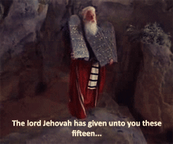
BECS...as I mentioned before, enough snow that Moses would have to part the snow drifts on the DC Beltway!!! Maybe enough snow that @Ji would complain that it's TOO MUCH! Or enough that even @Jebman would decline to attempt shoveling it.
-
3
-
 1
1
-
2
-
-
16 minutes ago, Scraff said:
And for those that went to WVU, I highly recommend picking up a copy of this book…
Is that used for their Atmospheric Dynamics II class, for the Met major???

.png.472fa6d23b95a0402b0931aa37c5a903.png)
Mid/Late February will be rocking. (This year we mean it!) February long range discussion.
in Mid Atlantic
Posted
Yup, most definitely. If (if, if, if!!!) this kind of progression actually occurs, you know there will be tearing of hair and gnashing of teeth with every single ops run once it gets within range to appear on the ops. Of course, if we can manage some event prior to that time, it may mitigate some of that.