

hlcater
-
Posts
2,638 -
Joined
-
Last visited
Content Type
Profiles
Blogs
Forums
American Weather
Media Demo
Store
Gallery
Posts posted by hlcater
-
-
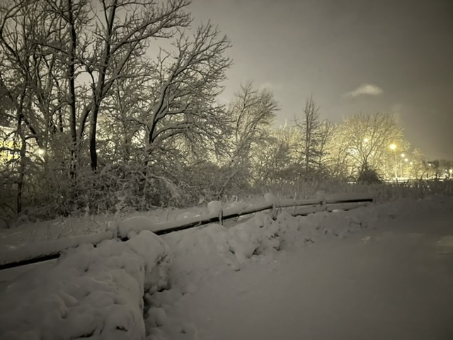
Probably 6" out there right now. Flake size has been small to pixie dust during the entire event. Hoping the coherent defo band out west holds on as it translates east. Otherwise, just gonna be pretty light stuff the rest of the evening. Could still pick up 1-2" but over the course of 7-8 hours...
-
 1
1
-
-
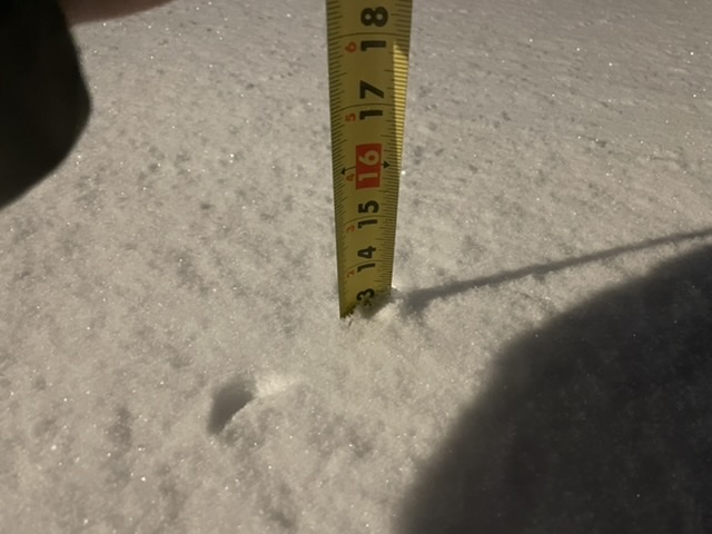
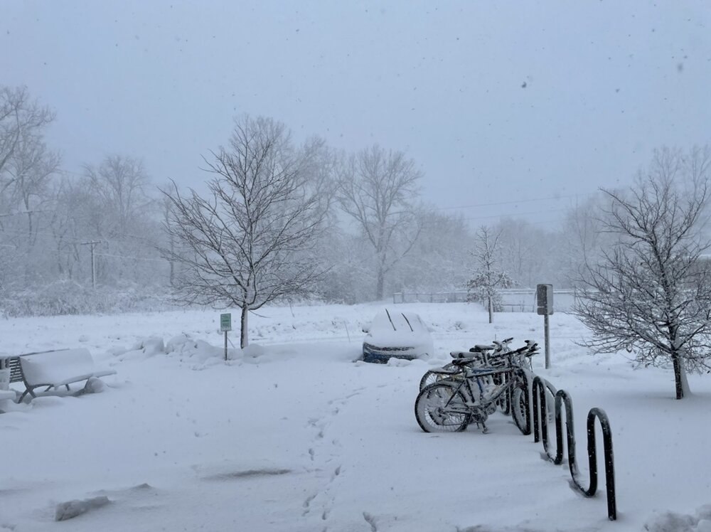
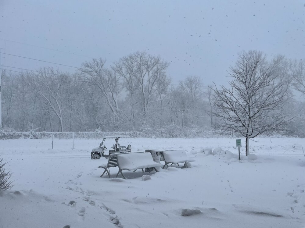
Eyeballing ~5" outside in IC. With all the blowing though, that is kind of a crapshoot. Radar looks good for the first time this entire storm, so I am optimistic that we can still reach the 8-10" advertised.
-
11 minutes ago, hawkeye_wx said:
My final measurement is 11.0", so I've still never measured a foot. Without the blowing and drifting later in the storm, I probably would have. All the spotters in and around Cedar Rapids who are reporting 12-15" must have more favorable locations to measure. Even with a 2-stage blower, cleaning this stuff was a long workout. It's the most wet snow I've ever received.
Models really blew it when they shifted the heaviest snow band southeast yesterday.
The 13.2" report in Hiawatha was mine and is from IC, it's misplaced on the map. I assume because the address associated with my spotter ID is a Hiawatha address. So at least that one is bogus.
-
idk why those are all so blurry but you get the idea
-
12
-
-
2 minutes ago, cyclone77 said:
4.3" with a short while of light snow left. most models showed over 1" of precip so assuming we got that we effectively got 4:1 snow with compaction/melting. Even now you can hear dripping when outside. Felt like an October or April storm. Oh well, on to the next.
Crazy how different the scene is over a relatively short distance. I will end this storm with 13.2" in IC in what will go down as a top 3 storm for me. Rarely do you get the intensity/duration of snow that we did with this storm, and it happened during the day to boot. Started off this morning with giant aggregates and very sloppy ratios (prob 5-6:1) and gradually transitioned towards smaller, drier flakes. The stuff falling in this final band looks and feels north of 10:1.
-
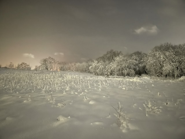
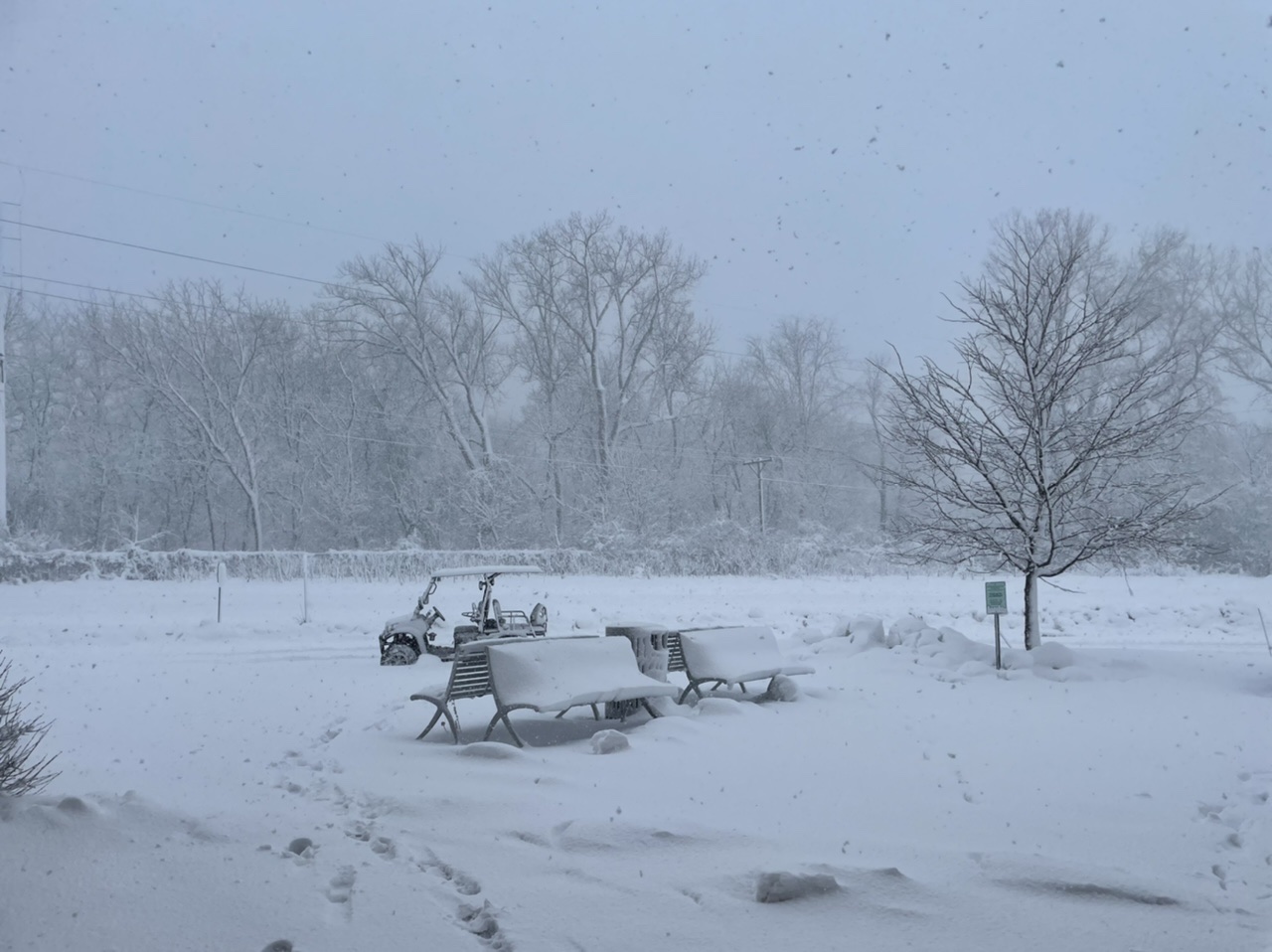
Probably ~9” out there right now and still coming down. Conditions have really deteriorated over the past few hours with vis routinely less than 1/4 mile
-
11
-
-
Closing on 8" in IC.
-
No one likes the GFS anyways
-
 7
7
-
-
2.7" down so far. HRRR is extremely bullish on the defo band tomorrow. If it's right, 10-12 could be achievable. 6" is a lock.
-
2 minutes ago, cyclone77 said:
Yeah looks like we'll both be outside of the heavy swath, but high ratio snows on top of what will already be a deep snowpack will be fun. Will just add even more ferocity to the incoming arctic blast.
Conditions/impacts wise I bet it stacks up well with 12/23/22. 4-6" of snow and 45-50mph gusts seems like a reasonable first guess here.
We're also in the jackpot zone for this storm so we don't really get to complain lol
-
2 minutes ago, glacier said:
lock it in like jeffrey dahmer
???????
-
2
-
-
Was expecting a rug pull this morning and am not seeing one. Just about as locked in for 6-10" as you can be. Let's roll
-
2
-
-
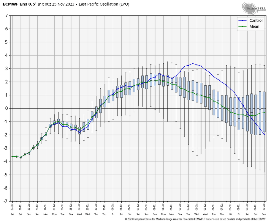
Now this is quite the ensemble mean. More than half the members in the low 970s/960s.
EDIT: Think that's the first time I've seen such a deep mean at this range. If there was any doubt that there was big league potential with this one


-
7
-
 1
1
-
-
Also has a really bizarre (relative to other guidance especially) evolution of the weekend system. Super far NW and a much more anemic looking cold sector. Still gets into the mid 970s however.
-
EPS mean

-
5
-
-
6 minutes ago, cyclone77 said:
Kind of a weird screw job from northeastern Iowa up into Wisconsin. Hopefully a scenario like that doesn't come to fruition lol.

-
1
-
5
-
-
Dw guys it’s coming home. Chicago folks need to get their barometers ready and put eurythmics on blast
-
4
-
-
Looking at the 12z runs

-
1
-
4
-
-
This is one of the worst 384hr GEFS means I can recall... Quite literally zero winners on here.

-
 1
1
-
2
-
 1
1
-
 2
2
-
-
When weak/strung out is an option, its usually a pretty safe bet to go with that
-
Euro continues to be slower and much more amplified. Bomb in the lakes by this weekend.
-
1
-
-
4 hours ago, Frog Town said:
More like WAD...
more like WAP
-
1
-
-
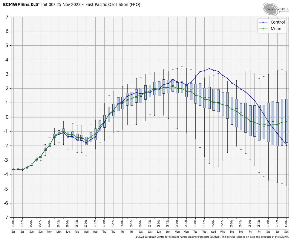
4 hours ago, Cary67 said:
No guarantee this verifies but a -EPO has increased our chances of seeing wintry weather.
Don't know whether you can call that signal after D10 a -EPO
-
This was certainly unexpected

-
3
-


April 16-17 Severe Weather Event
in Lakes/Ohio Valley
Posted