

KingJWx
-
Posts
247 -
Joined
-
Last visited
Content Type
Profiles
Blogs
Forums
American Weather
Media Demo
Store
Gallery
Everything posted by KingJWx
-
Flurries. Closest thing to a white Christmas, I guess.
-
Been hearing sleet pinging for the past hour or so.
-
Just IP/ZR now. Eyeballing 1-2" for my total, pending any backside snow.
-
Flipped to sleet. The heavy snow was fun while it lasted.
-
Pouring fatties!
-
SN+ while I was out for lunch. Went to light snow and now it's puking again.
-
Heavy snow now. The mix line can't be too far off, though.
-
Snow picking up, matches with the yellows on radar approaching from the south.
-
Roads are covered. SN
-
Snow intensity let down for a bit but now getting some bigger flakes mixed in.
-
Woke up just before 11am, already had a coating on the grass and deck. Been snowing nicely for the past 20 minutes.
-
I only got to see 1" of snow last winter, so if this storm can beat that for me, I'll count that as a win. Even the amped/warm runs should do it.
-
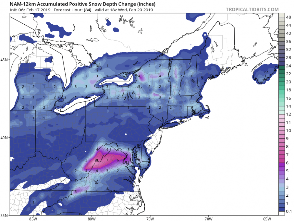
NAM
.thumb.png.2d8777ad8ae9fe425ddb9129032e52fe.png)
-
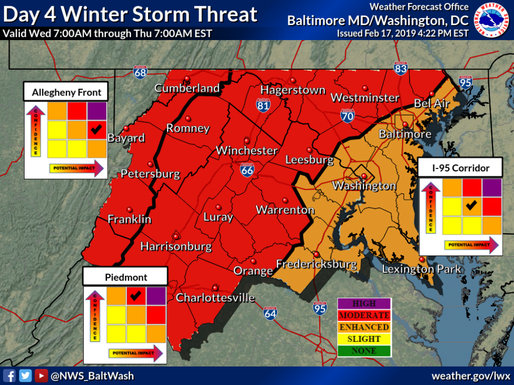
Latest from LWX
-
6z NAM map. Flips to sleet by 18z Wed at DC.
-
IAD now has more snow at this point in the season than 02-03 and 13-14 Hope February will be rocking!
-
Snow has started in Wolf Trap.
-
If only we didn't get the November snow, we could have a shot at the least snowiest winter. Sad!
-
So just like Dec 2011? We all know what happened after that
-
I think RIC got over 10" in Jan 2016
-
00z HRRR has the edge of the storm up to EZF

-
Well, this storm sure has been interesting to track. Still think it's not enough for DC, but we'll see...
-
UKIE also shifted north. Edge of precip is EZF, 0.2" line through CHO, 0.4" RIC
-
Well, CMC holds
.thumb.png.178f71ffed9914adc2312e2538def12b.png)
-
Once again RGEM is an outlier with precip reaching up to DC
.png.31df29117957e653e1ffdb1e90759dc7.png)


.png.1d8c24001f650a27bae591b5cbbac3bf.png)