Blizzard of 93
-
Posts
9,963 -
Joined
-
Last visited
Content Type
Profiles
Blogs
Forums
American Weather
Media Demo
Store
Gallery
Everything posted by Blizzard of 93
-
Accuweather map has all of the southern half of PA in the 3 to 6 range.
-
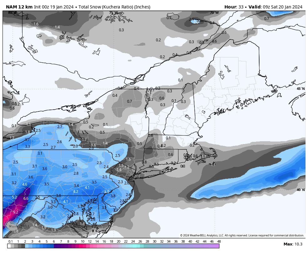
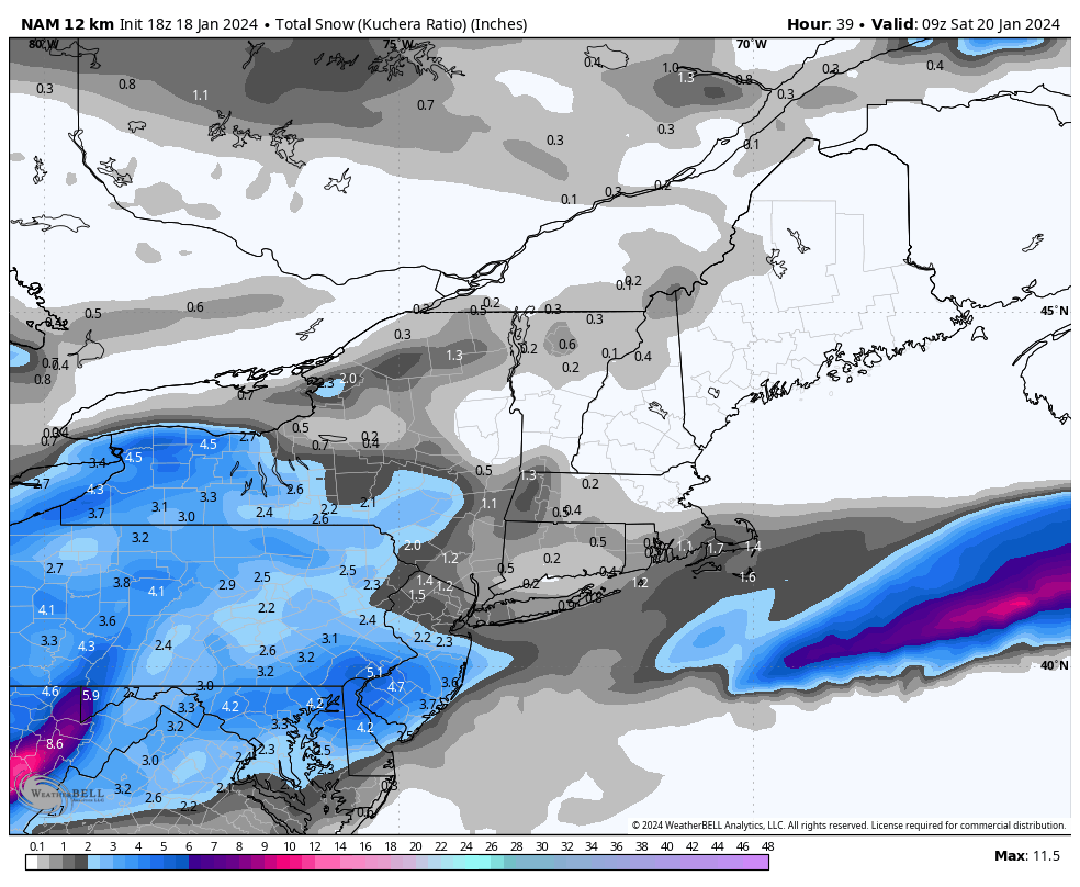
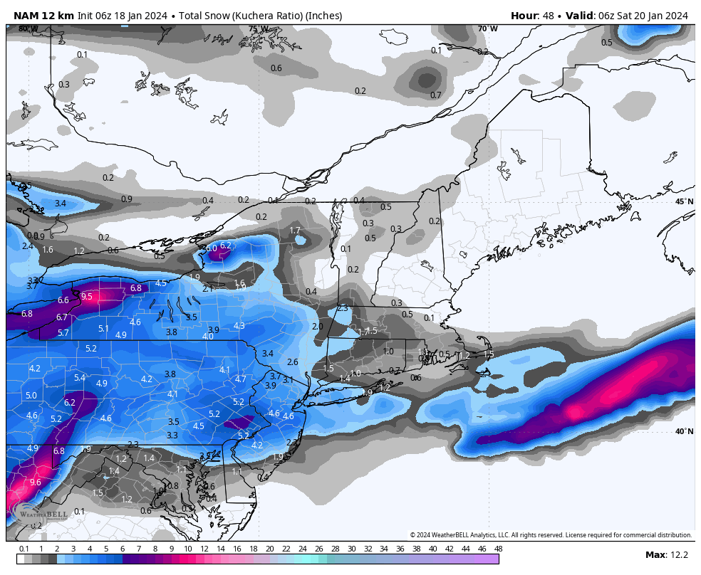
0z NAM has a decent bump up for Harrisburg, Lancaster & York over 18z. 0z top 18z bottom

-
Yes, I just noticed that as well. This is the point & click for Harrisburg International from a minute ago. Maybe they will be bumping up the Advisory amounts again this evening?
-
Remember your photo of your snow covered ride on Front St. on Tuesday?
-
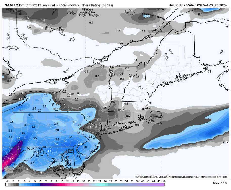
Yes, pretty much a hold on 0z HRRR for the LSV vs. 18z. This 0z run actually has a little more snow for Harrisburg & Lancaster than 18z. 0z top 18z bottom
-
My goal for this storm for MDT is for them to get 3.6 tomorrow to get to an even 10 inches for the season to date. This would make them basically even with the average snow through tomorrow’s date for the season.
-
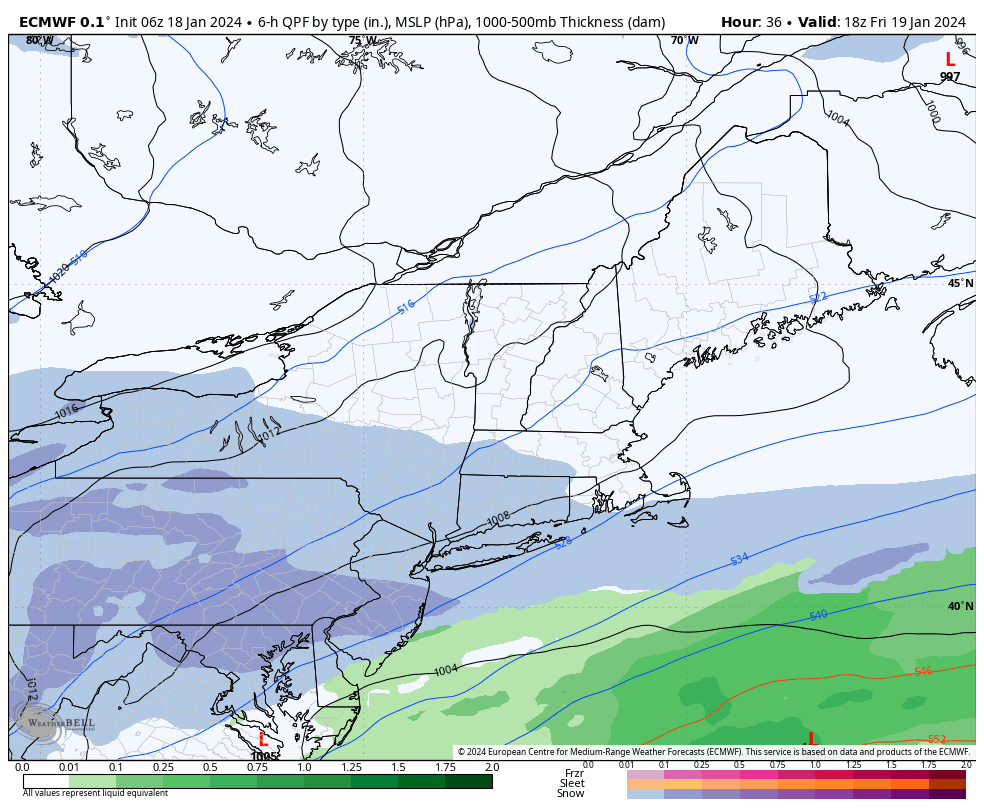
More from the CTP discussion: There could be 1-2 more-consistent, heavier bands of snow, though. One should/likely be a W-E band parallel to the storm track but 100 or so miles north of it, perhaps running somewhere just S of UNV but N of the Turnpike. Much of the forcing is gone by 21Z with another deformation zone and associated snow band possible for the SE as the sfc low starts to deepen as it moves out to sea. A band like this (later in the storm) would likely pivot more NE-SW and affect a wider land area than a W-E band would. The latest guidance infuses more confidence in these slightly higher numbers. Still a bit of spread in storm total QPF from the ensembles, but a 0.25 mean across the SE and 15-18:1 SLR for the afternoon should get them above 3", esp on the hill tops. SLRs remain higher than 15:1 across the region with 20:1 values likely in the NW.
-
Great write up from CTP this evening. The energy diving southeast from the Upper Plains which will make the snow will soon expand and intensify the precip shield over the OH valley. I think it a rather beefy Clipper that taps some GOMEX and Atlantic mstr as it moves toward and across PA. A progressive low track across the Mid-Atlantic just S of PA is classic for light-moderate snowfalls here.
-
CTP has this on their website.
-
Possible! Heck, like @Itstrainingtime mentioned, Williamsport got 5 inches on Tuesday when they were supposed to be on the northern edge of the lighter Advisory for northern CTP.
-
18z Euro improved a bit for many in the LSV. 18z top 12z bottom


-
The latest HRRR looks to be juicing up a bit for the LSV from previous hourly runs. I like where this run ends at 16z tomorrow morning.

-
Not sure if it was posted earlier, but here is DT’s First Call, while we wait for his Last Call. His 4 inch line moved south, but he has a large area of 6+ in the northern half of CTP that really hasn’t showed on the models.
-
The 18z HRRR has to close to the same coverage area of snow with a slight shift south overall from 12z. The 18z run was just drier than 12z. Here they both are to compare. 12z Top 18z bottom
-
The 12z Euro made my lunch break that much better…3 good runs in a row for the LSV.
-
Yes, good run Euro run again at 6z
-
I’ll take DT’s 4 to 6 in my yard & for the Harrisburg area.
-
Low of 8 in Marysville this morning. Coldest morning of the season here. Currently 11.
-
Welcome back neighbor!
-
Winter Weather Advisory URGENT - WINTER WEATHER MESSAGE National Weather Service State College PA 425 AM EST Thu Jan 18 2024 PAZ004-005-010>012-017>019-025>028-034>036-045-049-050-056>059- 063>066-182300- /O.NEW.KCTP.WW.Y.0008.240119T0600Z-240120T0600Z/ Warren-McKean-Elk-Cameron-Northern Clinton-Clearfield- Northern Centre-Southern Centre-Blair-Huntingdon-Mifflin-Juniata- Bedford-Fulton-Franklin-Southern Clinton-Union-Snyder-Perry- Dauphin-Schuylkill-Lebanon-Cumberland-Adams-York-Lancaster- Including the cities of Warren, Bradford, St. Marys, Ridgway, Emporium, Renovo, DuBois, Clearfield, Philipsburg, State College, Altoona, Huntingdon, Mount Union, Lewistown, Mifflintown, Bedford, McConnellsburg, Chambersburg, Lock Haven, Lewisburg, Selinsgrove, Newport, Harrisburg, Hershey, Pottsville, Lebanon, Carlisle, Gettysburg, York, and Lancaster 425 AM EST Thu Jan 18 2024 ...WINTER WEATHER ADVISORY IN EFFECT FROM 1 AM FRIDAY TO 1 AM EST SATURDAY... * WHAT...Snow expected. Total accumulations of 2 to 4 inches. * WHERE...Portions of central Pennsylvania. * WHEN...From 1 AM Friday to 1 AM EST Saturday. * IMPACTS...Plan on slippery road conditions. The hazardous conditions could impact the morning or evening commute.
-
6z HRRR looks good as well with 3 to 4 for most of us. Very nice low placement off of OCMD.
-
6z NAMs bring 3 to 4 to the LSV

-
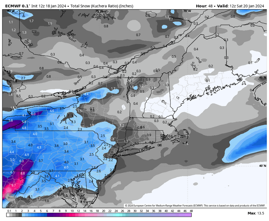
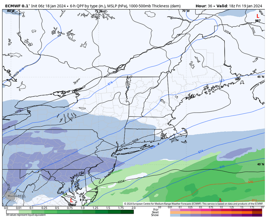
0z Euro improved & gets over 4 inches to all of the LSV this run.
-
I blame jet traffic
-
Seriously, what is up at MDT. Even the surface of hell at Cap City Airport is at 16 currently!