2010 extreme
-
Posts
215 -
Joined
-
Last visited
Content Type
Profiles
Blogs
Forums
American Weather
Media Demo
Store
Gallery
Everything posted by 2010 extreme
-
It was windy for a little while here. LoL at that meso a few minutes ago between Herndon and Reston.
-
FFC should have issued flood watches for at least the southern portions of the Atlanta metro area this morning as it was becoming clear that these heavy bands on the western side storm would interact with the front was being shown by a lot of the guidance. Most of the area currently under the flood waning was never under a watch.
-
DCA: 11/15 BWI: 10/25 IAD: 10/21 RIC: 11/9 Tiebreaker: 3.42
-
This is the third time in about the last month that a small and relatively isolated storm has popped up over Burke in a weak flow environment with boundaries as the main forcing mechanism. Reminds me of 2012 when that also happened several times.
-
SEL6 URGENT - IMMEDIATE BROADCAST REQUESTED Severe Thunderstorm Watch Number 116 NWS Storm Prediction Center Norman OK 230 PM EDT Tue May 22 2018 The NWS Storm Prediction Center has issued a * Severe Thunderstorm Watch for portions of District Of Columbia Central and Southern Maryland Northern and Central Virginia Coastal Waters * Effective this Tuesday afternoon and evening from 230 PM until 900 PM EDT. * Primary threats include... Scattered damaging wind gusts to 70 mph likely Isolated large hail events to 1.5 inches in diameter possible SUMMARY...Storms moving eastward off the Blue Ridge Mountains are expected to intensify as they progress eastward with potential to produce primarily damaging wind gusts and isolated hail. The severe thunderstorm watch area is approximately along and 60 statute miles east and west of a line from 35 miles west southwest of Richmond VA to 25 miles northwest of Washington DC. For a complete depiction of the watch see the associated watch outline update (WOUS64 KWNS WOU6). PRECAUTIONARY/PREPAREDNESS ACTIONS... REMEMBER...A Severe Thunderstorm Watch means conditions are favorable for severe thunderstorms in and close to the watch area. Persons in these areas should be on the lookout for threatening weather conditions and listen for later statements and possible warnings. Severe thunderstorms can and occasionally do produce tornadoes. && OTHER WATCH INFORMATION...CONTINUE...WW 115... AVIATION...A few severe thunderstorms with hail surface and aloft to 1.5 inches. Extreme turbulence and surface wind gusts to 60 knots. A few cumulonimbi with maximum tops to 500. Mean storm motion vector 27020.
-
I was driving and never felt it.
-
It was at this time mid night sunday morning walking north on my street in nearly knee deep snow I could see clear sky to my west and and a definitave back edge of the clouds looking east as the last flurries were flying. It was a spectacular end to the storm.
-
It was at this time friday evening snow had started to overspread much of the area.
-
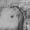
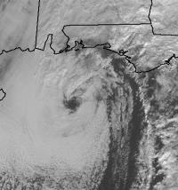
That storm was a nearly perfect miller a for ma, very similar to Feb 1983. The storm already had an eye and tons of moisture ahead of it before before it made land fall in western Florida! I was supposed to work from 10am to 6pm that day which was the time the worst would be. Im glad I called out even they were pressuring me to come in that morning because by the evening there was a solid 18-22 inch wall of snow between the main road and my street. Since I drive a corolla that would have been a disaster.