OhioWX
-
Posts
173 -
Joined
-
Last visited
Content Type
Profiles
Blogs
Forums
American Weather
Media Demo
Store
Gallery
Everything posted by OhioWX
-
Yikes...

-
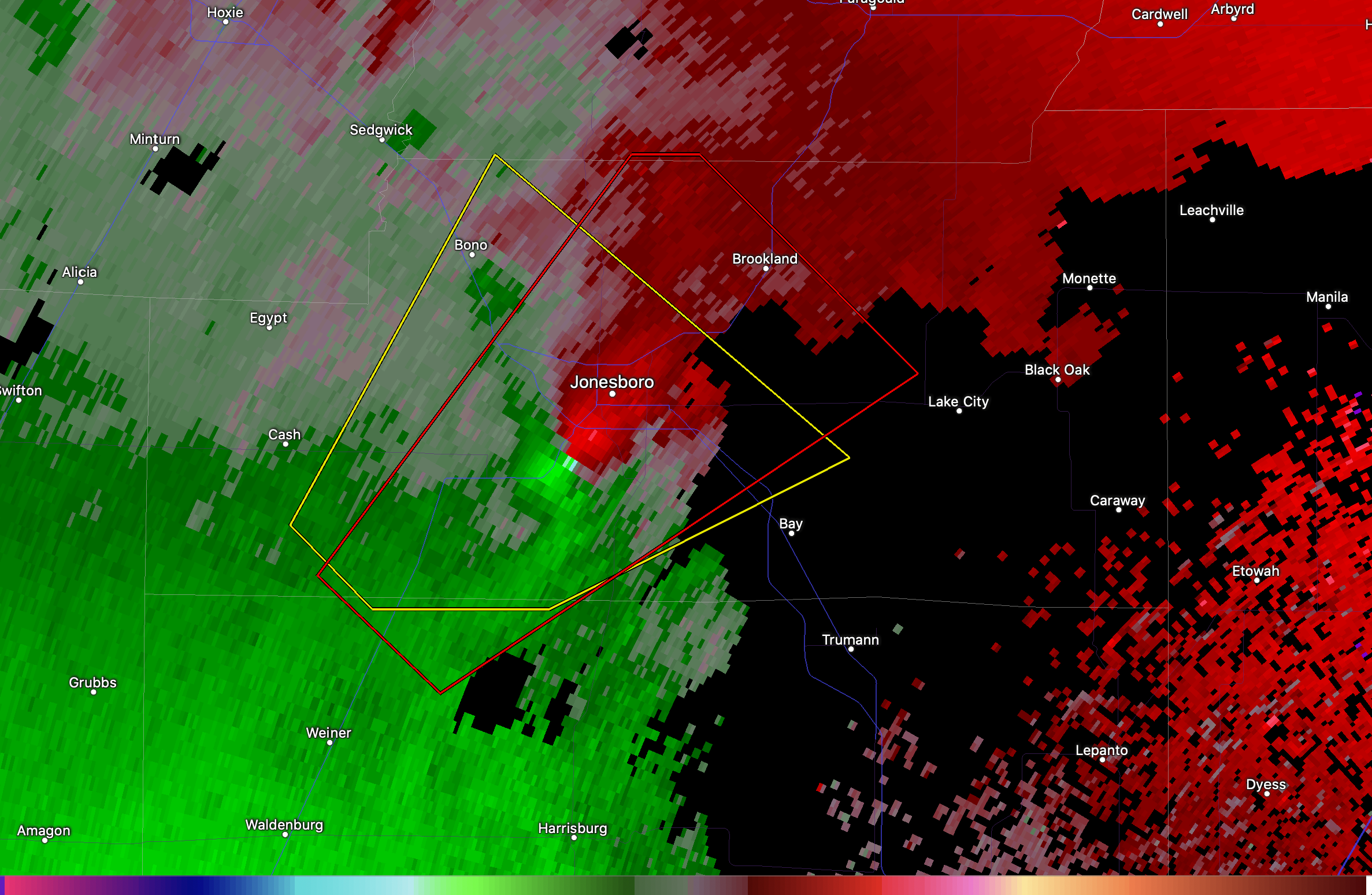
A bit outside the Great Lakes/Ohio Valley area, but there's a strong couplet with a tornado warned storm SW of Jonesboro, AR. Edit: CC drop just south of Amagon.
-
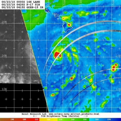
 Typhoon Hagibis approaching the Marianas. Easily one of the most impressive displays of rapid intensification I’ve personally seen. Up there with Wilma?
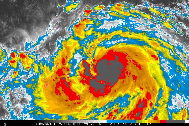
-
EF3 damage confirmed in Trotwood.
-
ILN has confirmed at least EF3 damage in Beavercreek.
-
Looks like it may have just happened. TDS just north of town.
-
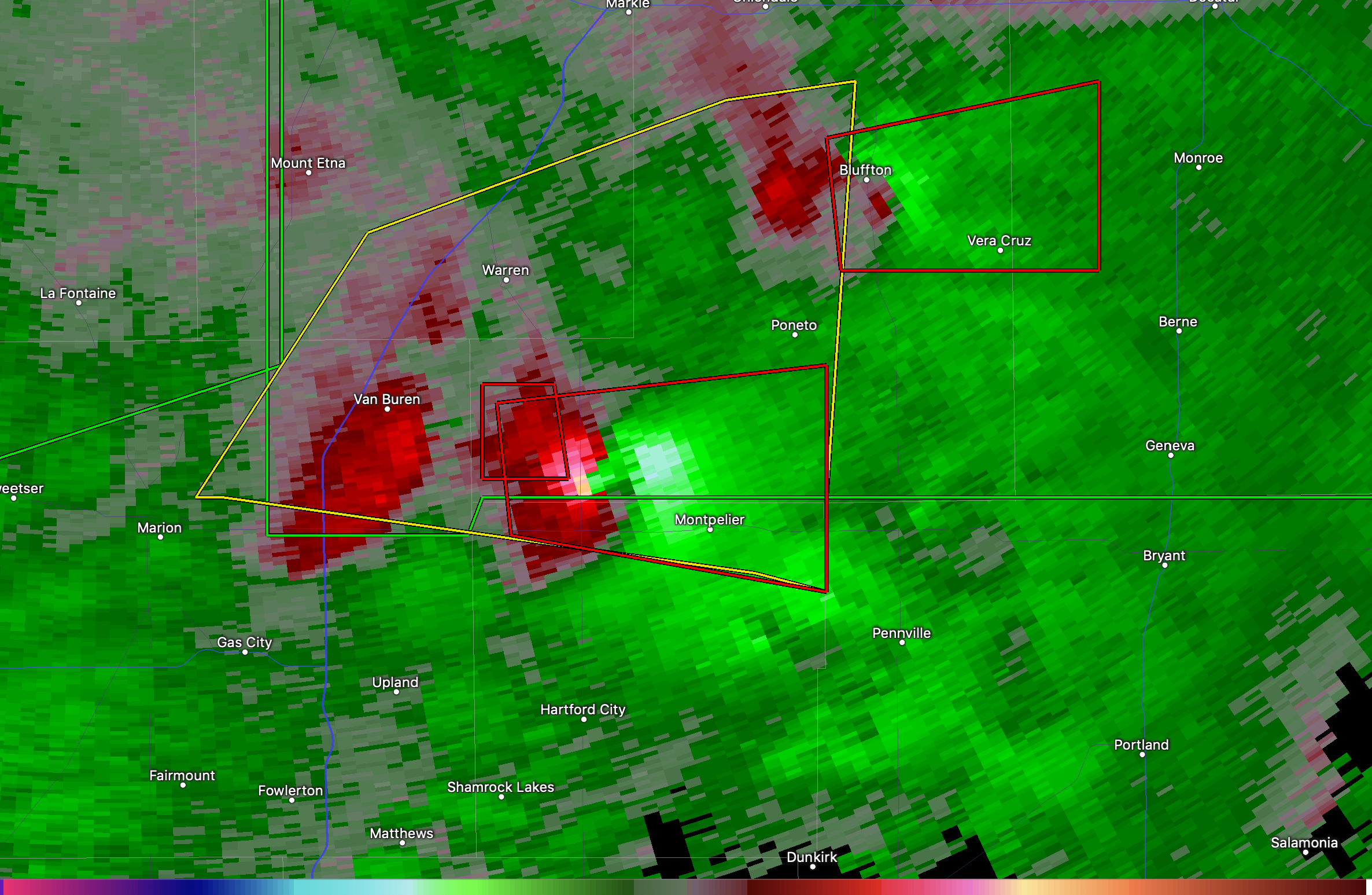
Very nasty looking couplet near Montpelier, IN.

-
A tornado just hit Pendleton, IN. CC drop over the north side of town.
-
-
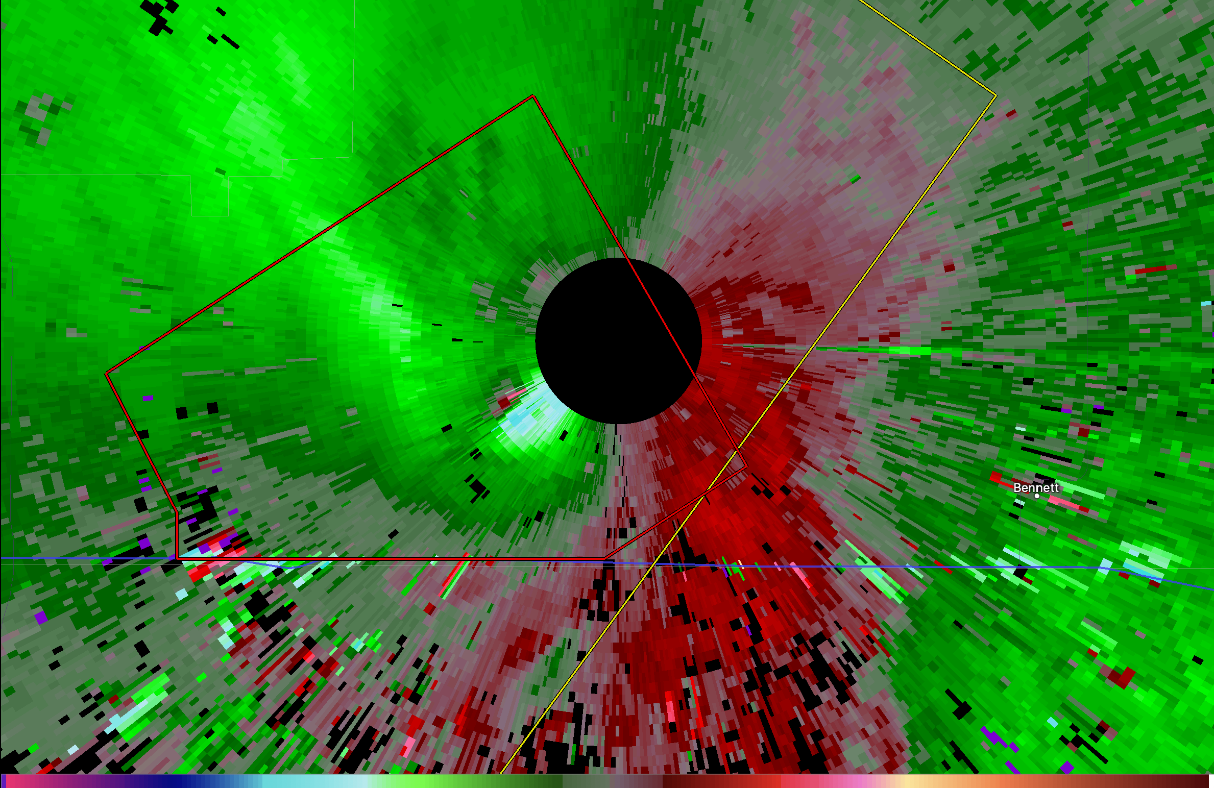
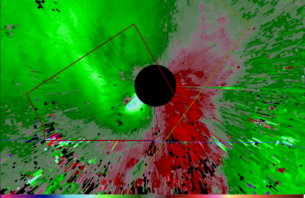
Likely a tornado passing right over or very close to the Denver radar site.
-
2019 Short/Medium Range Severe Weather Thread
OhioWX replied to snowlover2's topic in Lakes/Ohio Valley
I think that cell's done for. The updraft is really being stretched out. -
Screenshot from Cory Inmon's stream.

-
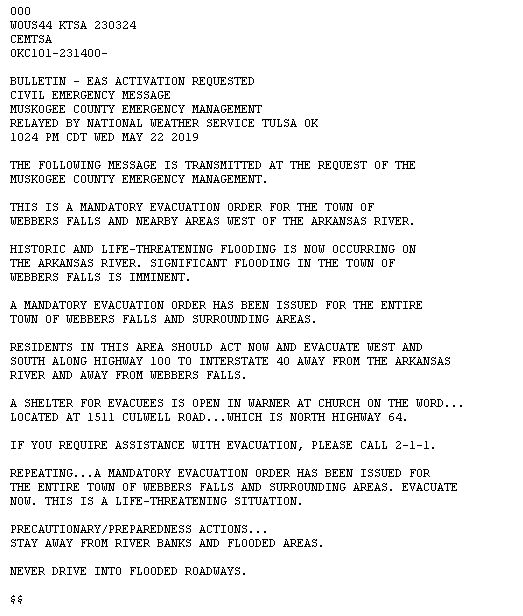
-
Severe thunderstorm in southwest OK bears watching.
-
This is becoming a very problematic situation. Multiple tornado producing supercells and daylight will soon be gone.
-
Big time CC drop just east of Carl Junction.
-
Saw that too. New circulation getting stronger and heading directly for Okmulgee.
-
Looks like a new circulation may be forming to the east of the current tornado. Watch out Okmulgee!
-
Confirmed tornado north of Clearview.
-
Don't write off the Lawton cell just yet. Looks to be quickly restrengthening. Edit: Never mind. Fizzling out again.
-
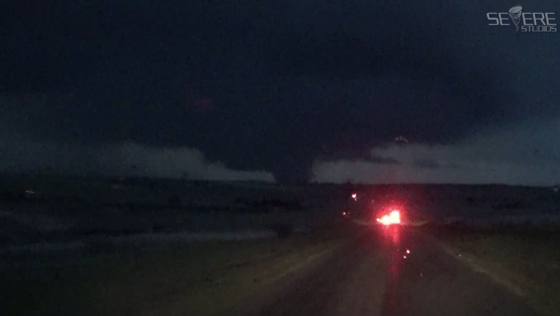
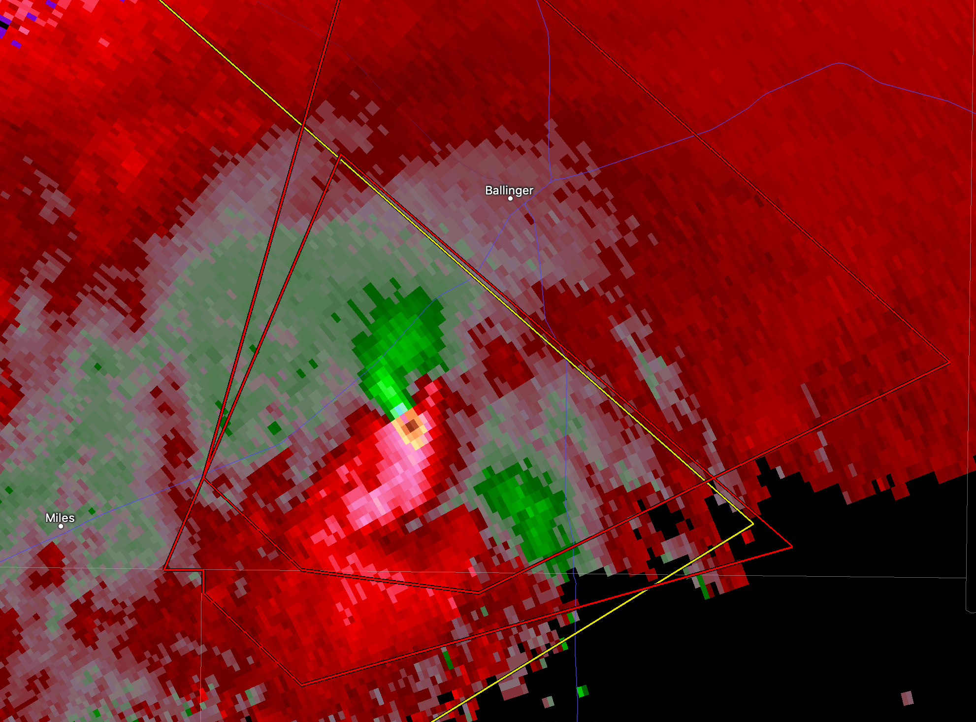
There's likely a very significant tornado ongoing southwest of Ballinger, TX.

-
I don't think it'll be long before that cell drops a tornado. Edit: Tornado warned
-
Franklin is taking a direct hit.
-
Gnarly looking CC drop. Surely doing some major damage.
-
It isn't undergoing ERC right now. Wind shear seems to be biggest factor in its degraded appearance.