

shaggy
-
Posts
7,428 -
Joined
-
Last visited
Content Type
Profiles
Blogs
Forums
American Weather
Media Demo
Store
Gallery
Posts posted by shaggy
-
-
1 hour ago, NorthHillsWx said:
That’s an incredible stat for both basins
The ATL has had its fair share of majors as well
-
-
Guam and Rota dodged a bullet as blohaven has exploded after passing by the islands.
https://www.tropicaltidbits.com/sat/satlooper.php?region=15W&product=ir
-
1 hour ago, NorthHillsWx said:
Bad surge in little Washington right now. Friends boat getting washed off lift
Should see it drop fast as the winds rotate to the SW. Couldn't have come quick enough as they were approaching major flood stage downtown with a 6.69 foot level......major starts at 7 feet
-
 1
1
-
-
Been gusting into the 40s for 5 or 6 hours with maybe a few touching 50.
-
21 minutes ago, jbenedet said:
Not sure why so little interest in this.
Convection now wrapping over the CoC. Very interesting 12 hours in play.
Need that center to tuck a little west under that convection
-
4 minutes ago, olafminesaw said:
Also moving more due N rather than NE, as depicted by the GFS, at landfall. Indicates more impact further inland. I think I95 East is a near lock for a moderate impact event. And between Raleigh and I95 is still up in the air depending on track. The Western piedmont should be relatively low impact as of now
Hi res are all more cape fear to lookout globals more over bogue banks to obx
-
1
-
 1
1
-
-
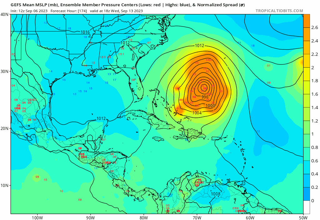
4 hours ago, GaWx said:
0Z Euro at 48: strongest run yet at 997 mb 150 mi SE of Wilmington, NC
Seems to be 2 camps. Hi res models are much stronger and show a stronger capture with the west turn before releasing it north. All show a potential hurricane. Globals don't show as much of a capture or as strong of a system
-
 1
1
-
-
2 hours ago, GaWx said:
This only quite vaguely resembles 1984 (Diana), which originated from the tail end energy on a rather strong cold front going offshore/nontropical which quickly became tropical. But 1984 was an extremely rare storm (100+ year storm?) and it occurred two weeks earlier during heart of the season. I don’t look for anything like that of course and this could easily turn out to be no big deal other than a good rainfall producer for some areas. However, in the extreme, this could be a STD/STS that becomes a TC (especially if it then moves NE offshore). Regardless, it is an interesting situation due to uncertainty.
Edit: late August of 1898 may have been somewhat similar to 1984 that also became a hurricane that came back into the SE coast.
Neither 1898 nor 1984 was during El Niño by the way. I’ll look to see if I can find more. But those are two of the most extreme cases off the top of my head.
This is more or less a potential “ridge over troubled waters” setup where a rather strong surface high to the north provides lower level convergence to the south, which leads to lift and then the formation of a sfc low.
I believe Gustav 2004 also quickly developed as it moved onshore SC.
Nothing suggest anything similar here though
-
1
-
-
35 minutes ago, GaWx said:
Yeah, probably ST. The UKMET has a hybrid low form in the E GOM instead.
In this situation the hybrid or ST will likely bring bigger impacts to larger areas of the coast versus a true TD/TS. Gfs has a decent area of gale force winds up the southeast coast far away from the center
-
1
-
-
2 hours ago, WxWatcher007 said:
Yeah pretty solid homebrew/hybrid signal for next weekend off the SE coast.
Icon coming in the furthest east at 12 with a weak low with the strongest winds displaced far to the north. Certainly not a fully tropical look to it was
-
6 minutes ago, jdj5211 said:

That’s a pretty drastic lean to the SW from earlier runs
.Had a few flirting with the OBX

-
1
-
-
0z Hafs-A is coming in south of 18z by a good but. At 18z it was just about to hit 23N and now at the same time frame its just about to hit 22N so almost 1 whole degrees.......if my tired eyes are reading it right
-
4 minutes ago, GaWx said:
0Z CMC landfall Eastport, ME, on 9/16. Eastport has the largest tidal range of any place on the E coast by the way.
Gefs spread really opened up again threatening the NE even more again. Also did I see the hafs-A jump almost an entire degree south at 0z out to 75hrs
-
1
-
-
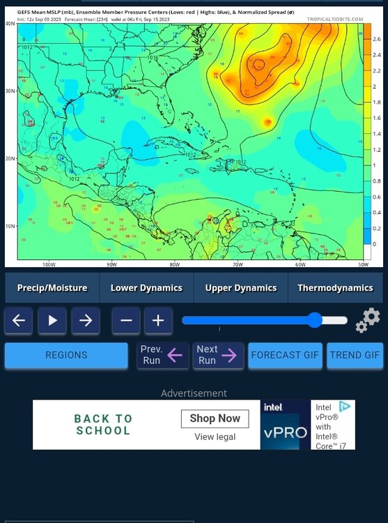
4 minutes ago, Random Chaos said:
Everyone keeps talking about 70W. Well, here’s tonight’s GEFS run at hr 168. Never assume something is impossible with tropical cyclones when it’s more than 3 days out.
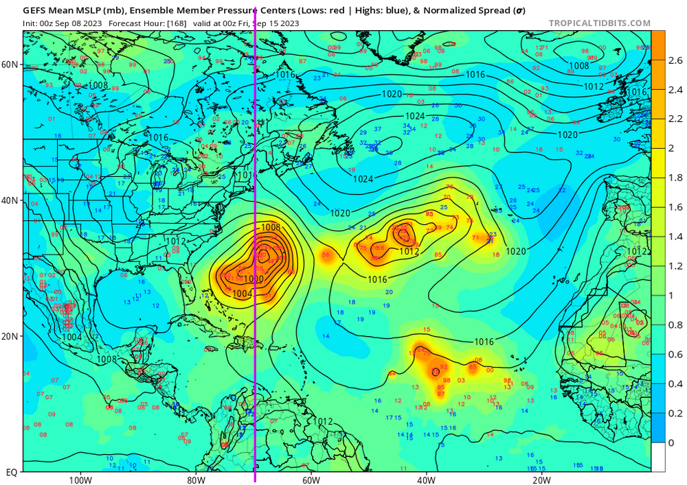
Until the turn is made NE needs to watch this one
-
1
-
-
Well then
-
3
-
-
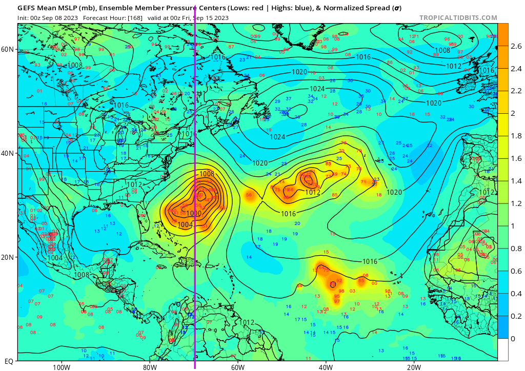
2 minutes ago, GaWx said:
12Z Euro at 168 is ~200 miles SSE of the 0Z at 180.
Still such a huge spread and enough run to run inconsistency to be patient and cautious at the same time
-
1
-
-
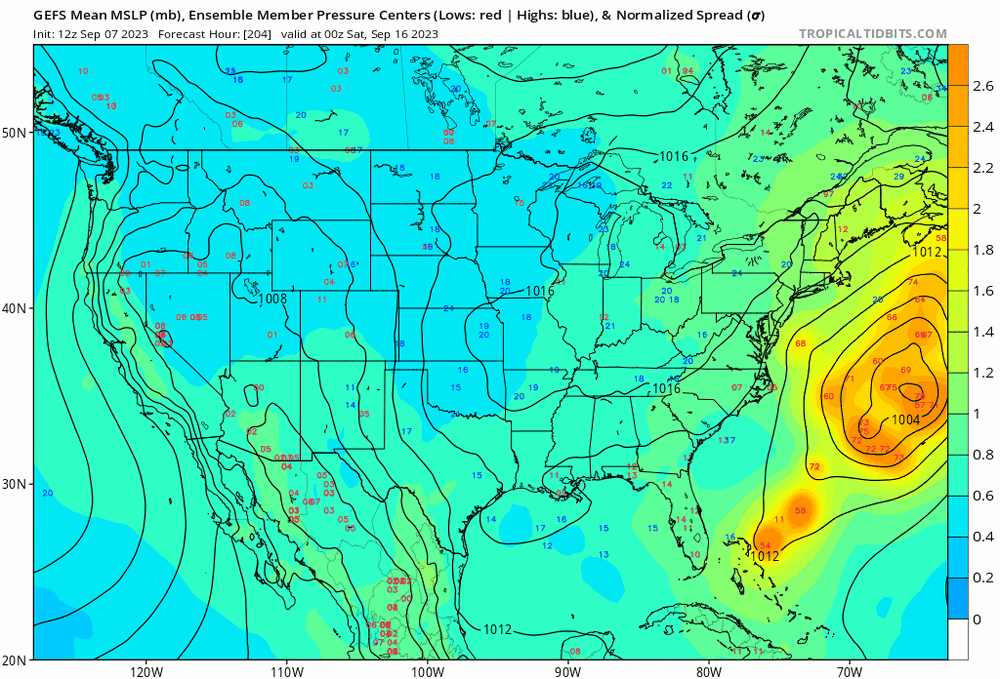
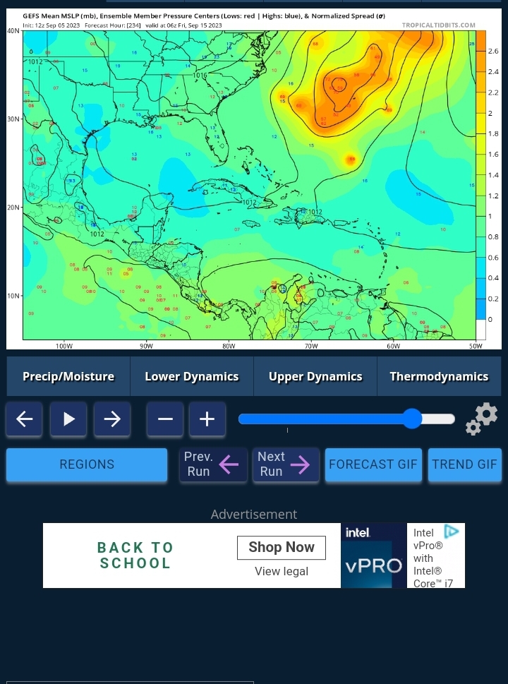
How anyone cN take a look at the gefs at 11z with the huge differences in timing spread and location spread and say what the deal is right now is funny to me. It could be off Nova Scotia or that one member doing an Irma track
-
1
-
5
-
-
1 hour ago, bigtenfan said:
Would the exiting Lee leave a weakness allowing that storm to safely recurve?
Not necessarily. 1996 is a good reference in regards to a strong recurving cane followed by a east coast hit a few days later
-
1
-
1
-
-
Intriguing
-
3
-
-
Am I wrong in thinking this is a major shift in the ensembles?
EDIT

-
So far ensembles are better clustered and a few western strays
-
1
-
-
5 minutes ago, StantonParkHoya said:
Trough is actually more amped this run and further east
Yup i was only out to 138hrs and looked less amped but then it really digs in. This is gonna be an easy kicker scenario
-
Trough looks less amped in the great lakes when he makes the turn


Central & Eastern Pacific Thread
in Tropical Headquarters
Posted
Might be one of the biggest pressure drops in history. Anyone have the stats on that?