audioguy3107
-
Posts
914 -
Joined
-
Last visited
Content Type
Profiles
Blogs
Forums
American Weather
Media Demo
Store
Gallery
Everything posted by audioguy3107
-

Mid to Long Range Discussion ~ 2022
audioguy3107 replied to buckeyefan1's topic in Southeastern States
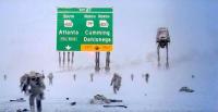
18Z GFS shows a classic, if we could follow up this event with one next Friday it would be epic. We're at about 3.5 inches of snow on top of sleet here NE of Atlanta. -
Winter Storm Izzy Obs Thread
audioguy3107 replied to Prismshine Productions's topic in Southeastern States
CAD in effect now NE of Atlanta, winds are howling out of the NE, down to 42 here. - Buck -
It really has been consistent with this solution for quite awhile now, It’ll be a nice win if it nails it. If we can get the low to swing though and give us another couple of inches like SnowGoose said on the backside it would really be a great event.
-
FFC just added a few more metro Atlanta counties to the Winter Storm Warning including Forsyth and Gwinnett, also as L.G.L. Just said above, a high wind warning as well, regardless of amounts here this looks like it’ll be a real mess. - Buck
-
backside snowfall still going on as far west as western Alabama at hour 84, unreal.
-
Oh man, the NAM verbatim is a monster for north Georgia, by hour 69 has the rain snow line south of Atlanta, hr. 72 has mixing well into middle Georgia, temps below freezing well south of Atlanta. If this were to verify being less than 70 hrs out, it would be a pretty big one. - Buck
-
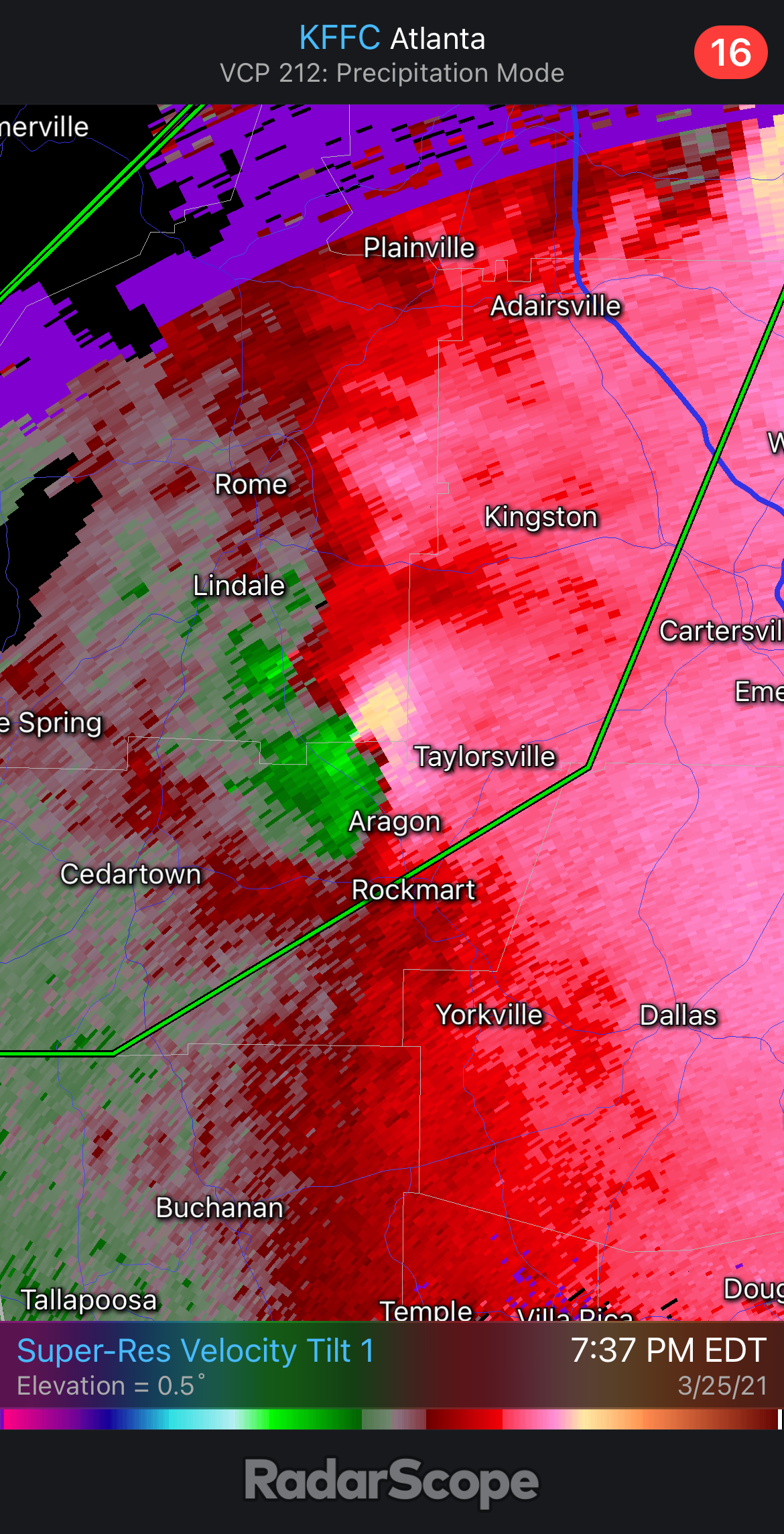
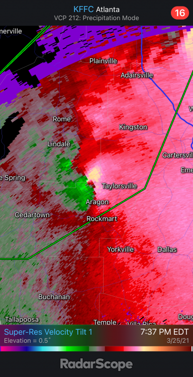
Definite TDS southwest of Newnan now.
-
Newnan is a very large suburb. This better lift soon or there’s gonna be major issues.
-
It’ll move well south of the city itself, but it is making a beeline for the FFC radar site.
-
It’s going to be entering the southern Atlanta suburbs in the next hour. If it holds together. Yikes.
-
If one’s gonna get Atlanta, that’s probably it. The environment down there is relatively undisturbed compared to further north.
-
NW of Atlanta
-
-
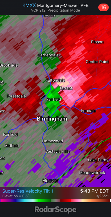
Looks like a Tornado Warning may be needed ASAP for the Birmingham cell near Fultondale very soon.
-
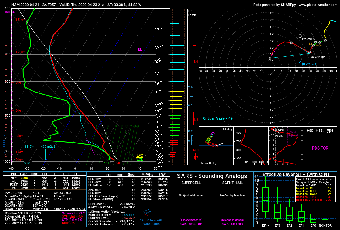
12z NAM sounding on Thursday afternoon evening for points just west of Atlanta, Ga.

-

-
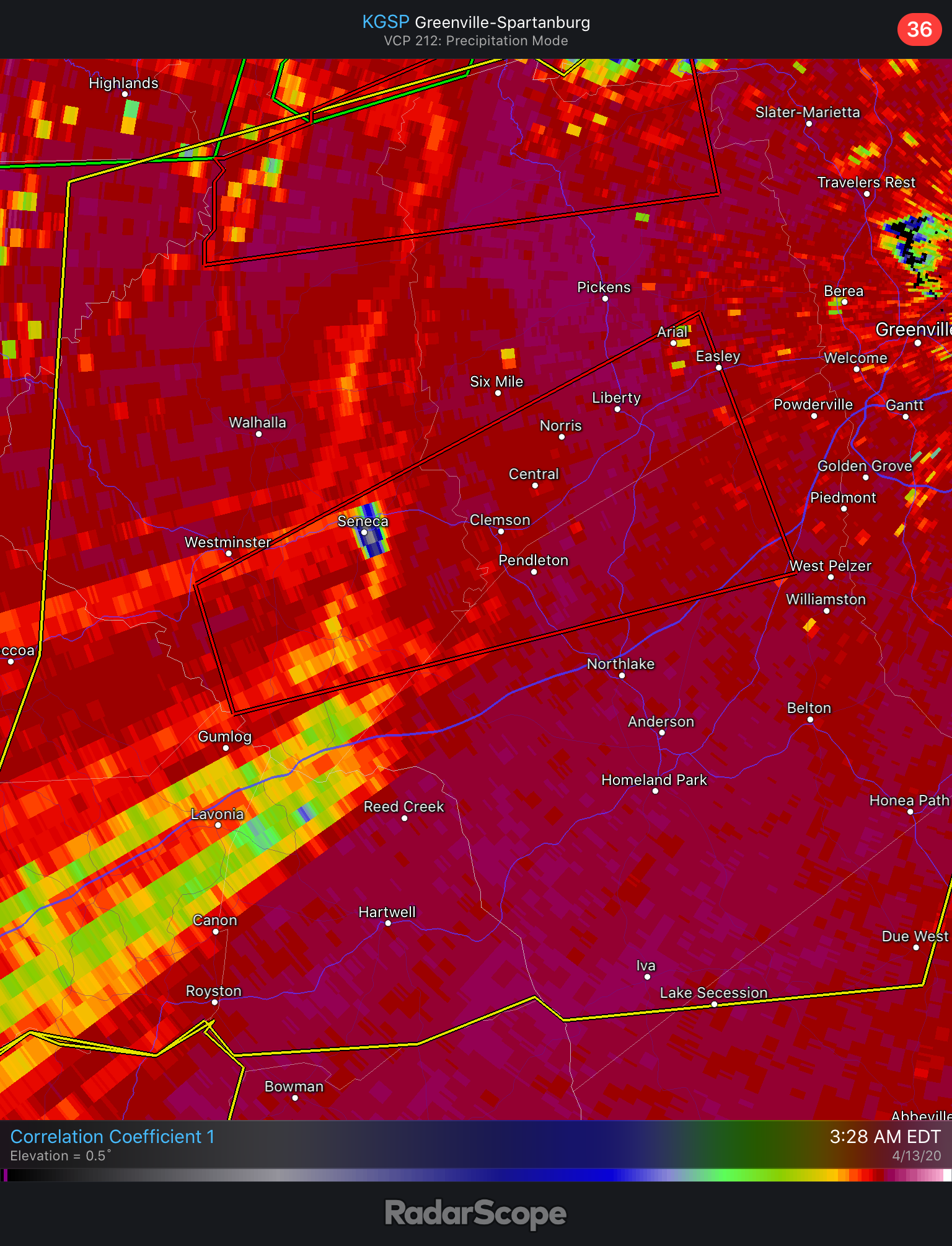
Major debris signature over Seneca, SC heading towards Clemson.
-
Metro Atlanta needs to pay attention to the cell near Sylacauga, AL.....that may show the best chance for something to develop as it moves over the border.
-
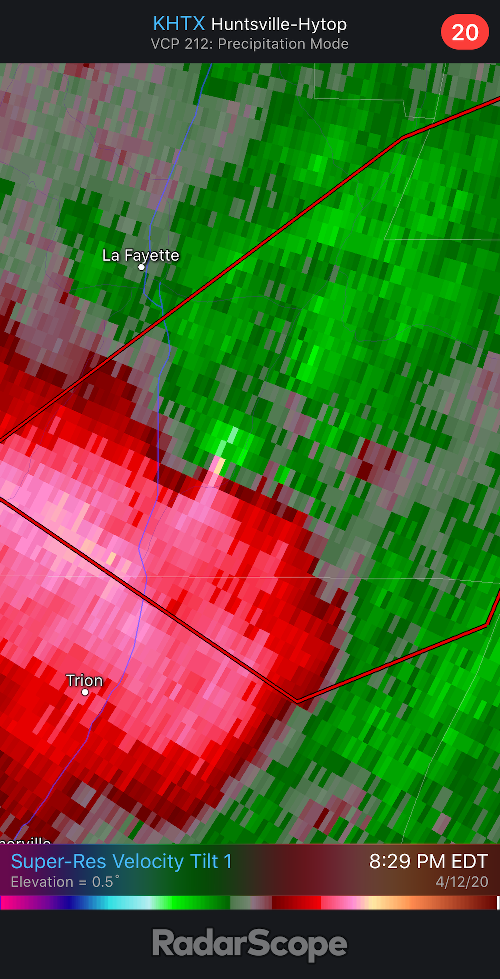
KFFC Whitfield GA-Walker GA-Chattooga GA- 833 PM EDT Sun Apr 12 2020 ...A TORNADO WARNING REMAINS IN EFFECT UNTIL 900 PM EDT FOR SOUTHWESTERN WHITFIELD...SOUTHEASTERN WALKER AND NORTHEASTERN CHATTOOGA COUNTIES... At 832 PM EDT, a confirmed tornado was located near Suttles Mill, or near Lafayette, moving northeast at 35 mph
-
Radar shows TOG on the NW Georgia cell

-
From the radar, it does appear that the line of storms in Mississippi is breaking up....whether this translates into more dangerous discrete cells remains to be seen.
-
The Atlanta metro is definitely in play for the chance of significant severe including a tornado or two, but as it happens almost 100% of the time with these setups, the instability and threat for major severe always diminishes the further east, especially as you go into the overnight hours. We call it the north Georgia storm shield.
-
Hmmmmm, "historic" wording from FFC is, needless to say, extremely unusual. Haven't heard them honk this much since April 2011 and along with everyone else, hard to see something like that verifying. Wonder what their thinking is, especially since ATL is further east (as usual) from the greatest threat area.
-
Mid to Late May 2019 Severe Threats
audioguy3107 replied to Quincy's topic in Central/Western States
Man, that Commerce supercell is gonna be a close call for the NW side of Joplin.......jeez. -
News 9 OK has a live tornado on the ground near Okemah.