

Rvarookie
-
Posts
698 -
Joined
-
Last visited
Content Type
Profiles
Blogs
Forums
American Weather
Media Demo
Store
Gallery
Posts posted by Rvarookie
-
-
1 hour ago, TSG said:
Can we seriously stop with the "doom-posting"? I've been on here for 10 years now at varying capacities and it's the worst it's ever been. It's becoming unbearable. I'm not going to point fingers, but there's a solid crew accumulating here that really don't contribute anything to the conversation at all. Worse, y'all seem to just spew the first thought that comes into your head. A thought that has likely been stated multiple times the same week/day/hour. It feels like I read the exact same post from the exact same set of "doomers" every day on a different page. It's like a 10:1 ratio of garbage to actual discussion sometimes and is likely a large part of the reason some of our most experienced forum members have been leaving the past few years.
Give it a rest. If you don't have anything to say other than "oh no, what will we do if we don't score this month?!?", then please just keep it to yourself.
I'm not even pointing at posters like Ji... he contributes, even if it comes with a bunch of attitude.
You waited until last sentence to lose your credibility.
-
 5
5
-
-
5 minutes ago, psuhoffman said:
Wrt Friday...most guidance tracks the surface low over the outer banks and the upper low across southern VA. That’s a track that normally would get some snow into DC. And you can see hints at that on the moisture and RH fields. But the NS is nowhere to be found. A rotting airmass with a crap weak baroclinic zone so very little lift and no organized precip outside the convective banding under the upper low just NW of the surface low.
How does that impact RVA?
-
Least we used to have Bob chill to balance out vajinas posts
-
2
-
-
Let’s just cut the bs. When tf is it going to snow?
-
4
-
-
RVA is destined for this one. Has my name written all over it

-
 1
1
-
-
I think I should start a thread for this one. It’s a lock

-
1
-
-
I hope RVA gets smoked and osubum is left questioning the MA boundaries
-
 1
1
-
-
thanks again for the enlightening discussion and optimism folks. I expect to be let down but least we have hope this year.
-
2 hours ago, WxWatcher007 said:
This is just an observation, and it isn’t directed at a particular individual or subforum, but it looks like we (collective we) are far more invested in what happens this winter season than any other I’ve seen in recent memory.
Reaper bit aside, I hope we’re able to produce because I don’t want to see what these subforums look like if we’re strung along.
Does feel like we are little on edge yet pretending we’re not lol.
If we do strike out this year, I hope we can remember the times last year where we said we just wished we had something to discuss. Least it’s not super boring and we have few survivors left to provide play by play. Rip to those we lost last winter...
-
1
-
-
2 minutes ago, CAPE said:
Some of us don't honk. We just state what the current guidance is depicting, add a little context, and speculate a bit.
Ofc I am probably not a well respected poster, so no one really cares what I say.
Def well respected to me. Appreciate the effort
-
1
-
-
1 minute ago, psuhoffman said:
I mean we pretty much know the next 2 weeks is probably lost. Maybe we get lucky but...the gfs does get the pac right by day 14 and the high latitudes are still very workable.
Appreciate being straight shooter this year without same long essays over and over. Don’t let them suck you into telling us 500000 different ways this will suck.
-
1
-
-
Hoping DC gets some snow over holiday so can grab some devils lettuce and jebwalk around town

-
1
-
-
@osfan24 you ok bro? Always bitching these days...
-
1
-
 1
1
-
2
-
-
4 minutes ago, mappy said:
Your comment

I always rely on you to cover for me and hide my posts whenever needed. Unlike others I appreciate it

-
3 minutes ago, mappy said:
Dude.
?
-
Hoping we all cash in this year. Pretty sure we have earned it.
-
2
-
-
9 minutes ago, Dendrimer77 said:
Yeah, I get it. The entire event could implode and it's definitely not region wide either way. The comments just came off as petty. We all need to see a few flakes for the vibes to improve I think.
Yeh I should have just let it slide. Obvious folks are on edge, but he just came in a little too hot on that one...
-
1
-
-
Just now, osfan24 said:
Internet tough guy number 2. Must be something in the water down there.
I also find it interesting that these posters who I've never seen post here before come out of the woodwork now. Like someone said, Richmond is a part of another forum and their weather is quite often very different than here. It would be like someone going into the Philly forum and talking about the snow in DC.
I think that comparison is far off, but all good man. Hope you get some snow this year.
-
1
-
-
1 hour ago, psuhoffman said:
Long range and especially seasonal is getting increasingly difficult because we are seeing some influencers configured in ways we’ve never seen before. The pacific sst is completely out of wack and the QBO has been behaving odd the last several years. Add in warning across the board and historical analogs are less useful.
I am guarded but getting somewhat optimistic this ninoesque pattern is real. It’s pretty consistent across all guidance and getting closer everyday. It’s being driven by IO convection and the retrograde of the AK vortex, both of which is well underway.
But I think 2 factors determine if we end up with a December that produces and doesn’t just tease. We’ve had some decent patterns in Dec recently that did us no good. The first 10 days I think might be a challenge due to the lack of any true cold air source. The recent pattern has prevented any cold from building on our side of the pole. It will take a while to fix that and initially the ridge in Canada is a bit too far southeast to allow cold into the equation. That may change as the pna ridge retrogrades in response to the AK vortex retrogression. In the meantime we’re dealing with a crap airmass. It could work with a perfect track and timing but it could be frustrating if things don’t come together perfectly.
The last factor is what happens after Dec 10. I think the MJO will give a big clue as we get closer. There are signs it may finally try to propagate through the Maritime Continent mid December. Those are the warm phases for us. However...I’ve found that when you get a weak or fast wave through phases in conflict with the base state it doesn’t have as much impact. That’s why some weak MJO waves in cold phases didn’t save us the last few years and it’s why some warm phases didn’t kill us in colder years. As we get closer if we see signs the mjo is racing through the MC at a weak amplitude that is a very good sign this pattern may persist. If we start to see signs it wants to stall and amplify while near the MC that would hint this was just a very temporary blip and the base state to the winter pattern is likely to be hostile. It’s too soon to say right now. We will start to get hints soon.
Happy Thanksgiving
Thanks for sharing. Hope you and fam have good thanksgiving
-
1 hour ago, psuhoffman said:
1996 lol
There were also a couple Nina's early in the 1900s that judging by the statistics definitely did not behave like what we consider a "typical" nina today.
NOT saying that is what is happening here....yet.
Many have pointed out the enso north pacific sst combo is very unusual so maybe a canonical nina isn't in the works. Way too early to draw any conclusions though.
You have quite bit of knowledge and always seem to be less weenie...How do you think this plays out for December?
-
2 hours ago, Weather Will said:
I like to lighten the mood with the snow maps with all of the gloom and doom about the winter forecast. I realize they are mostly fantasy but can in a general sense signal windows of opportunity. Lot of Eeyores in this group. I can get that watching the news every night...
Eeyore is a character in the Winnie-the-Pooh books by A. A. Milne. He is generally characterized as a pessimistic, gloomy, depressed, anhedonic, old grey stuffed donkey.

Least he’s not full of shit
-
1 hour ago, WinterWxLuvr said:
Mow them. Does great and is good for your grass. Just wait until they are dry.
I refuse to rake or bag leaves. I just mow each week to keep up until they all fall
-
Hardywood gbs always sets the tone for this time of year. Looking forward to the release on Saturday
-
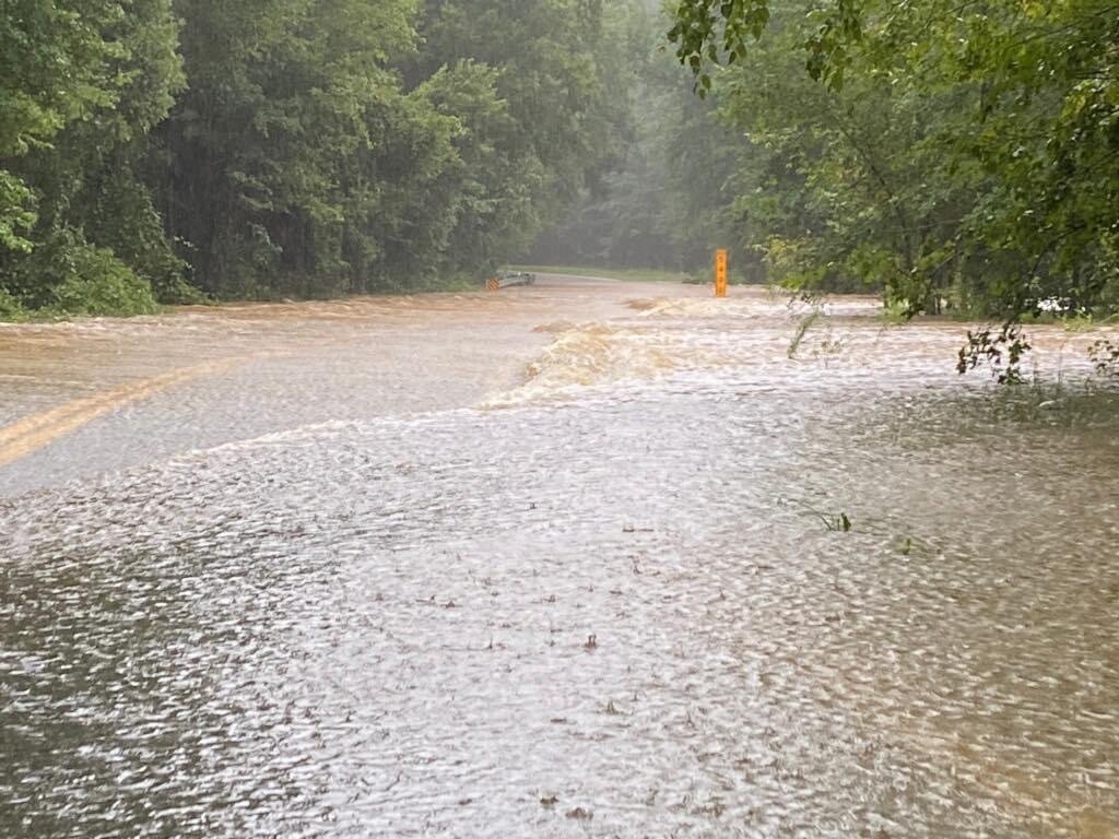
1 hour ago, lawone9 said:
Been raining here for hours. Weather radio and phone alerts since early morning. Massive flooding and road closures in Chesterfield County, VA.
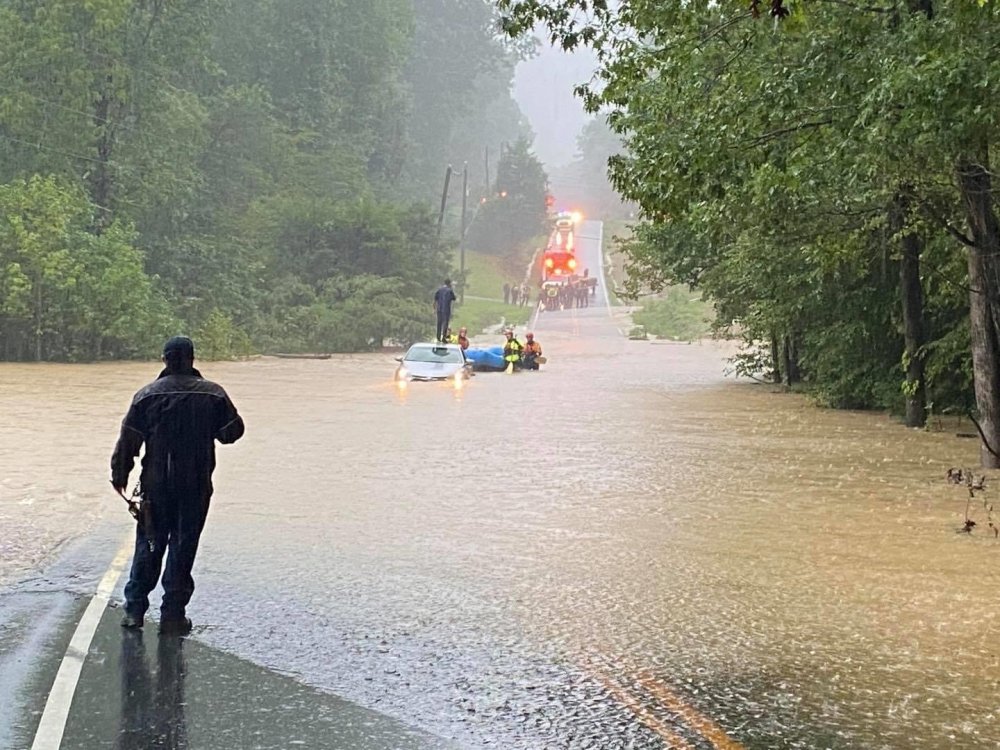
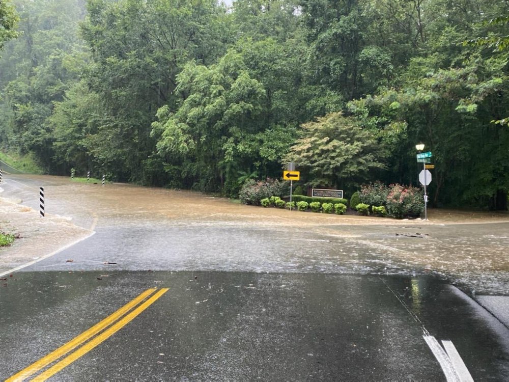
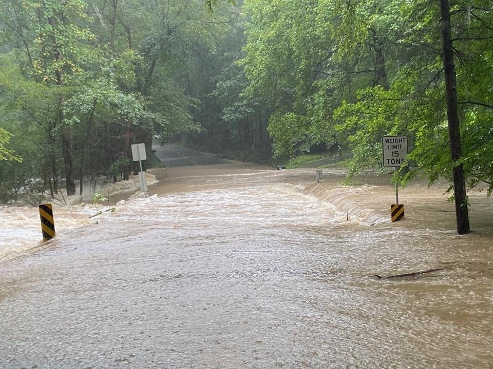
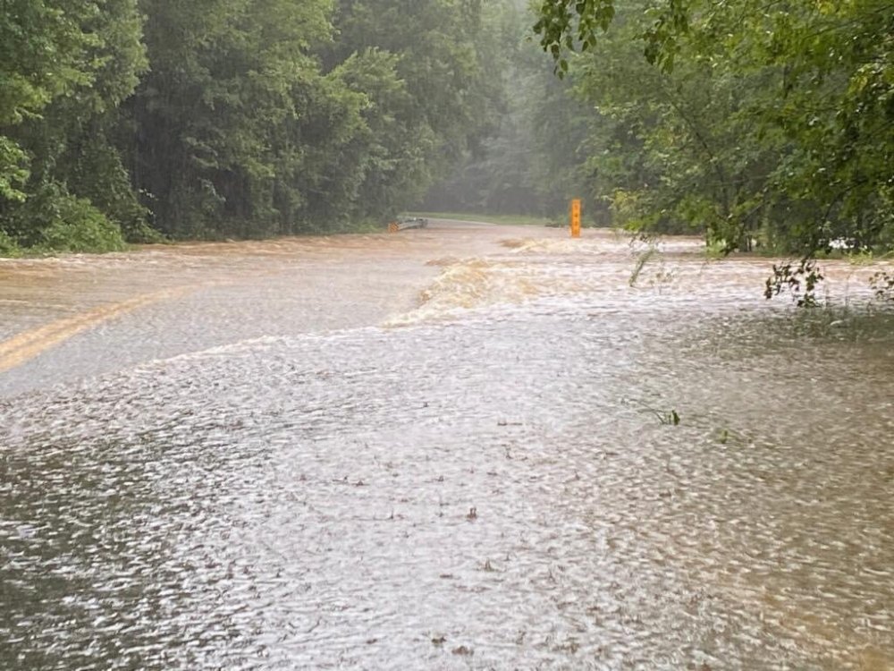
Had to pack the car for the beach in that mess


January Long Range Disco Thread
in Mid Atlantic
Posted
Yeh man you get little doom and gloomy at times, but so much more chill than vajina. He's just so oversaturated