All Activity
- Past hour
-
Its slightly south of 6Z. Hopefully the northern trend stops
-
March will rock…patience!
-
It is. December also is a month for cutters. Deeper into winter while they still occur, they are less frequent. Unfortunately Kevin thinks it’s a winter month when it really isn’t a deep winter month, especially first half.
-

Dec 6-7th (It's not a clipper) Clipper
TheNiño replied to Chicago Storm's topic in Lakes/Ohio Valley
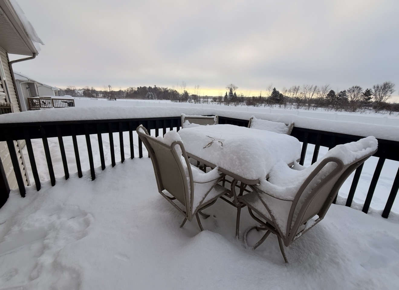
Ended up with ~4in. I’ll definitely take it. -

Dec 6-7th (It's not a clipper) Clipper
Sciascia replied to Chicago Storm's topic in Lakes/Ohio Valley
-
The 3k NAM is a thing of beauty
-
One heck of an inversion.
-
impossible to predict anything with confidence past 5 days in this fast flowed pattern with very cold air and above average snow cover always to our north and west with the southern jet getting more involved in the pattern..............
-

December 2025 regional war/obs/disco thread
Kitz Craver replied to Torch Tiger's topic in New England
Alright, I get that, but I think 20th on with a nice pack intact is pretty grinchy -
Why can’t you do your own measurements? You had something more important to worry about other than snow??? I think not. You need to get your priorities straight.
-
Morning low of 1F. Couldn’t quite get below zero with the light snow and clouds lingering around into the overnight hours.
-

2025-2026 Fall/Winter Mountain Thread
Buckethead replied to Buckethead's topic in Southeastern States
And I'm starting out at 34 lol. Sent from my Pixel 10 Pro using Tapatalk -

Dec 6-7th (It's not a clipper) Clipper
OrdIowPitMsp replied to Chicago Storm's topic in Lakes/Ohio Valley
0.5” at MSP. Models nailed this one imby -
Was a dang cold morning and frosted to heavy it looks like snow. Low of 20 degrees with was well below the forecast.
-
And it was AN for November and December and we've seen how that's turned out. All those seasonal models, except the Cansips, are seemingly programmed for AN as the default.
-
The 12Z HRRR is not much different than the 6Z when you look at total moisture and placement.... The difference with the snowfall map is due to difference in temperatures which keep most of it cold rain for the areas that are "blanked." I'm not surprised by this because the cold air is chasing the moisture and surface temps will likely be above freezing until sunset. So there could definitely be a mix or snow falling, but not sticking.
-
12z 12K NAM is pretty aggressive up this way but its a small area that gets thumped.
-
12z FV3 still about the same.
-
Definitely some needed snow for the mountains. Too bad us high plains folks aren't going to see any snow any time soon
-
LWX did that to me once last winter but under reported my total. I sent an email with a photo of my measurement and they fixed it.
-
Yeah, but I also feel like that timeline is expanding. Like getting a cutter on the 18th and 19th doesn’t really mean a grinch storm. Getting one on the 24th sure does.
-
Daylight: 9H21M:10S. We'll lose another 6 minutes but way of later sunrise. We are in the earliest sunsets and will gain 10 mins back on sunsets by Dec 31st but continue to lose time at the sunrise netting a 3m increase in daylight post solstice by 31st.
-
I swear the atmosphere has muscle memory sometimes. The northern shift creates eye strain and even some tears for us in NC.
-
ecords: Highs: EWR: 76 (1998) NYC: 75 (1998) LGA: 75 (1998) JFK: 75 (1998) Lows: EWR: 16 (1954) NYC: 10 (1926) LGA: 17 (1954) JFK: 20 (1964) Historical: 1740 - In early December two weeks of mild and rainy weather culminated in the worst flood in fifty years in the Lower Connecticut River Valley. The Merrimack River swelled to its highest level, and in Maine the raging waters swept away mills, carried off bridges, and ruined highways. (David Ludlum) 1830: The winter of 1830-31 was known as the "Winter of the Deep Snow" in Illinois. Records from Fort Armstrong (presentt-day Moline), Fort Dearborn (persont-day Chicago), and Augusta indicated that heavy snowfall of 2 to 3 feet had fallen during the month of December. This severe winter, along with a poor corn harvest, compelled northern Illinoisans to seek grain in southern parts of the state, which had escaped the extreme conditions of the north. The furnishing of grain led to the use of the term "Little Egypt" being used to describe southern Illinois. (Ref. Wilson Wx. History) 1927: Blizzard hits the arrowhead with heavy snows and 70 mph winds at Duluth, MN. (Ref. AccWeather Weather History) 1935 - Severe flooding hit parts of the Houston, TX, area. Eight persons were killed as one hundred city blocks were inundated. Satsuma reported 16.49 inches of rain. The Buffalo and White Oak Bayous crested on the 9th. (6th-8th) (The Weather Channel) 1972: Brutal record cold prevailed from the Lakes to the Pacific Northwest. Record low temperatures for the date included: Great Falls, MT: -30 °F, Williston, ND: -30 °F, Bismarck, ND: -28 °F, Rochester, MN: -28 °F, Helena, MT: -28 °F, Green Bay, WI: -21 °F, Minneapolis, MN: -20 °F, Billings, MT: -20 °F, Casper, WY: -18 °F, Sheridan, WY: -18 °F. Most of Florida escaped the deep freeze and a few locations reported record high temperatures for the date including: Vero Beach, FL: 87 °F, Fort Myers, FL: 86 °F and Tampa, FL: 85 °F-Tied. (Ref. Wilson Wx. - Additional Temperature Records Listed) 1987 - Heavy rain fell across eastern Puerto Rico, with 19.41 inches reported at Las Piedras. Flooding caused five million dollars damage. Another in a series of storms hit the northwestern U.S., with wind gusts above 100 mph reported at Cape Blanco OR. While snow and gusty winds accompanied a cold front crossing the Rockies, strong westerly winds, gusting to 93 mph at Boulder CO, helped temperatures in western Kansas reach the 60s for the sixth day in a row. Freezing drizzle in northeastern slowed traffic to 5 mph on some roads in Morrow County. (The National Weather Summary) (Storm Data) 1988 - An outbreak of cold arctic air brought up to 18 inches of snow to the Colorado Rockies, with 14 inches at Boulder CO, and seven inches at Denver. Heavy snow blanketed New Mexico the following day, with 15 inches reported near Ruidoso. (Storm Data) (The National Weather Summary) 1989 - A storm moving out of the Central Rocky Mountain Region spread snow across Kansas and Oklahoma into Arkansas and Tennessee. Snowfall totals ranged up to 7.5 inches at Winfield KS. Freezing rain on trees and power lines cut off electricity to 24,000 homes in northeastern Arkansas, and 40,000 homes in the Nashville TN area were without electricity for several hours. (Storm Data) (The National Weather Summary) 1996: A rapidly deepening coastal storm crossed New England, giving the region its second heavy snowfall in as many days. 20.5 inches of snow fell at Groton, VT, 19.5 inches was recorded at New Ipswich, NH, 18 inches piled up at Ashburnham, MA, and 16.5 inches was measured at Union, CT. Over eastern Massachusetts and southern New Hampshire, the snow was extremely wet. Snow was still on trees and other objects from the previous day's storm, and this combined with the new snow and some rain mixing in resulted in an enormous amount of tree damage. Over 900,000 people lost power with 500,000 in Massachusetts alone. 113,000 people in Massachusetts were without power for several days. This was the most extensive and costliest weather related power outage in New Hampshire's history as 94,000 lost power during the storm. (Ref. AccWeather Weather History) 1998: The highest temperature ever recorded in Richmond, VA in December was 81 °F that occurred on two dates. The other date is December 6th in 1998.(Ref. Richmond Weather Records KRIC) Overall, 70 all-time December temperature records and 700 daily records were broken during the first 8 days of the month as an unprecedented late autumn heat wave occurred from the Rockies to the East Coast. The following locations set their all-time December record high: Wilmington, NC: 82 °F, Richmond, VA: 81 °F-Tied, Washington, DC: 79 °F, Lynchburg, VA: 79 °F-Tied, Greensboro, NC: 78 °F-Tied, Atlantic City, NJ: 77 °F, Islip, NY: 77 °F (broke previous daily record by 19 degrees), Providence, RI: 77 °F (broke previous daily record by 14 degrees), Baltimore, MD: 77 °F-Tied, Newark, NJ: 76 °F, Boston, MA: 76 °F (broke previous daily record by 10 degrees), Windsor Locks and Bridgeport, CT: 76 °F (broke daily record by 14 degrees), Hartford, CT: 76 °F (broke previous daily record by 14 degrees), New York (Central Park), NY: 75 °F, New York (Kennedy Airport), NY: 75 °F (broke previous daily record by 16 degrees), New York (LaGuardia), NY: 75 °F, Harrisburg, PA: 75 °F-Tied, Milton, MA: 74 °F (broke previous record by 12 degrees), Concord, NH: 73 °F, Philadelphia, PA: 73 °F-Tied, Worcester, MA: 72 °F and Portland, ME: 71 °F-Tied (broke previous daily record by 12 degrees). (Ref. Wilson Wx.- Additional Temperature Records Listed at This Link) 2002: Fog reduced visibility on I-65 near the Tennessee River in Northern Alabama during the early morning hours. A tractor trailer jackknifed, leading to a chain reaction accident that involved 18 vehicles. (Ref. Wilson Wx. History) 2003: December 5th through the 7th, New York and New England: The greatest Nor'easter snowstorm in recent memory strikes New York and New England. In Central Park, New York City, the accumulation reaches 14 inches. The greatest accumulation buries Pinkham Notch at Mount Washington in New Hampshire: 47 inches. (Ref. WxDoctor)
-
Just in time for a mid month warmup, as was a bit expected, but hopefully it doesn’t become like the infamous December 2023 jet extension where we roasted for the rest of the month