All Activity
- Past hour
-

First Winter Storm to kickoff 2025-26 Winter season
TauntonBlizzard2013 replied to Baroclinic Zone's topic in New England
Let’s get Boston to that 6” futility record. -

E PA/NJ/DE Autumn 2025 Obs/Discussion
LVblizzard replied to PhiEaglesfan712's topic in Philadelphia Region
Don’t look at the NAM…massive torch for everyone including the Poconos. I’m writing it off as the NAM being the NAM. Just posted my first call on my page, I think the Lehigh Valley sees 1-3” followed by a wintry mix and rain. -
First Winter Storm to kickoff 2025-26 Winter season
dryslot replied to Baroclinic Zone's topic in New England
Reggie looks good. -
Nov 28-30th Post Turkey Day Winter Storm
ChiTownSnow replied to Chicago Storm's topic in Lakes/Ohio Valley
Flake quality increasing overhead. -
Seeing the snow showers yesterday got my winter juices flowing... up until then I really wasn't engaged. Im not predicting any sort of accumulations on Tuesday but I'm sorta pumped to potentially see some flakes falling
-
First Winter Storm to kickoff 2025-26 Winter season
radarman replied to Baroclinic Zone's topic in New England
RGEM a bit stronger. Elevated interior snows NOP. -

First Winter Storm to kickoff 2025-26 Winter season
dendrite replied to Baroclinic Zone's topic in New England
Yeah I don’t think anyone denies the H5 improvements over time. And I think we forget how off and how coarse the solutions were at d5+ over a decade ago. I almost feel like there’s too much resolution in the long range combined with the increasing error and you start ending up with more chaos with the deterministic solutions and we start overanalyzing details like QPF and temps too far out. -

Nov 28-30th Post Turkey Day Winter Storm
cyclone77 replied to Chicago Storm's topic in Lakes/Ohio Valley
That dry pocket was heading this way and I was like nope, not today ma nature and she filled it back in. -
The Ravens snow game was that day. Unforgettable snowstorm for these parts.
-

First Winter Storm to kickoff 2025-26 Winter season
moneypitmike replied to Baroclinic Zone's topic in New England
ICON is solid for many. I think it looks a lot like Ray's map IIRC. -

Nov 28-30th Post Turkey Day Winter Storm
hawkeye_wx replied to Chicago Storm's topic in Lakes/Ohio Valley
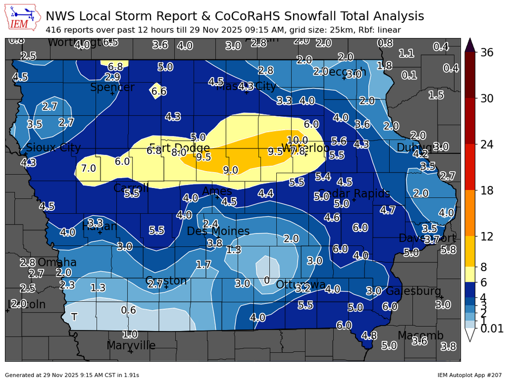
Winners and losers so far. Parts of southern Iowa are getting hosed by a persistent dry pocket that models absolutely did not show at all. -
$20 says Partkon mesonet site gets its first inch. Every mile counts in these set ups Most epic early season forecast boom in my life. Forecast was 2"-4" of snow in western Carroll County and I got 8". We also got two NFL snow games that day.
-

First Winter Storm to kickoff 2025-26 Winter season
bristolri_wx replied to Baroclinic Zone's topic in New England
Hard for me to get excited about this storm for anyone in New England just yet. We are still a couple of days from the southern component of this storm from forming, and there's still three different camps of thought on how it develops and tracks. I feel like Sunday morning is when we will get some consensus, when we start to get into the range of the high-res models sorting things out. That being said I feel like there's more of a chance of this storm being suppressed and progressive and missing most of the area instead of it being overly amped and flooding New England with cold rain. I don't think the SE ridge is going to be the main influence on this storm... -
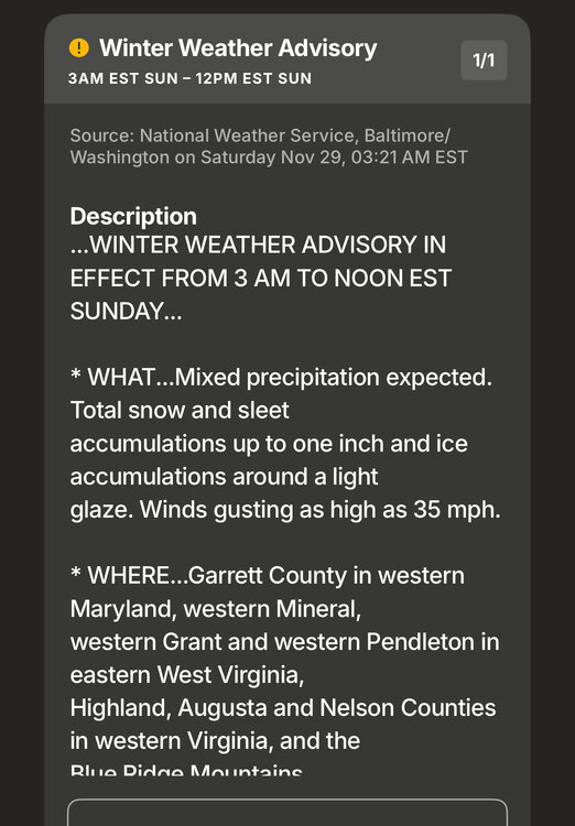
Saw flurries yesterday and last night for the 5th or 6th time this year, which is a good sign. 32° currently under a winter weather advisory tonight here in Augusta County northwest of Staunton.
-
First Winter Storm to kickoff 2025-26 Winter season
dryslot replied to Baroclinic Zone's topic in New England
12z ICON was close to you too. -
y'all enjoy. I'll just take the rain.
-
-
may the lunch GFS and Euro be ever in our favor!
-
(002).thumb.png.6e3d9d46bca5fe41aab7a74871dd8af8.png)
Central PA Fall Discussions and Obs
ChescoWx replied to ChescoWx's topic in Upstate New York/Pennsylvania
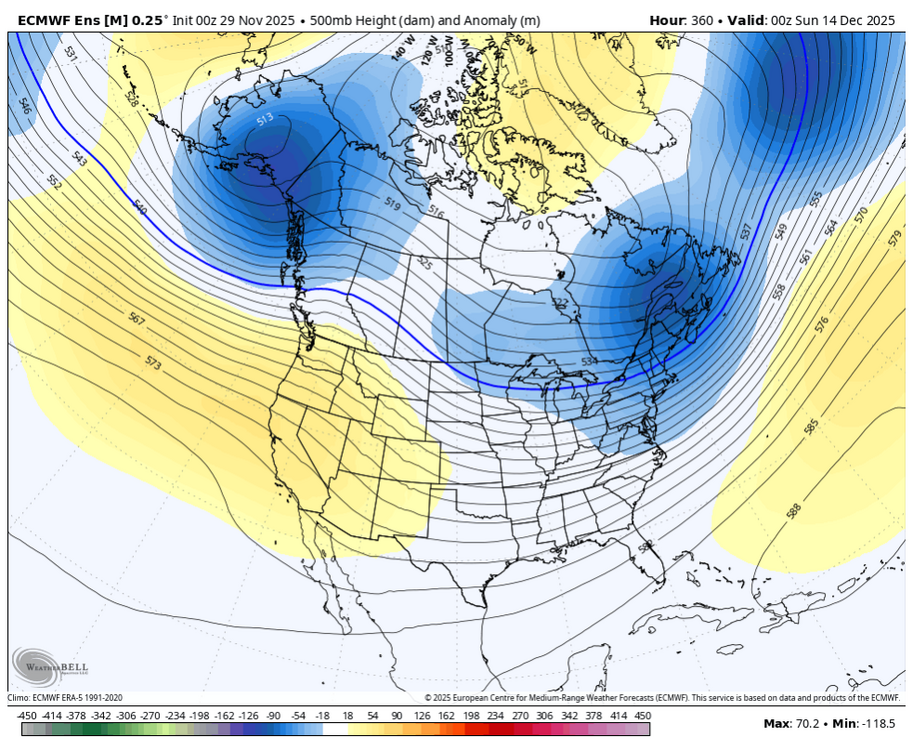
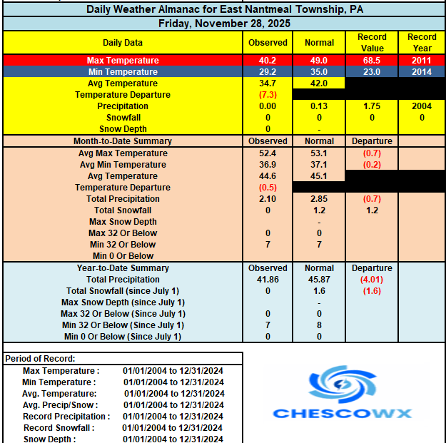
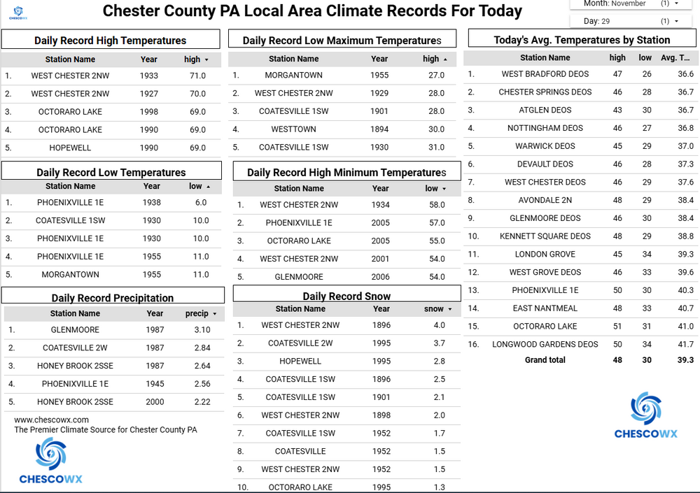
This morning was the coldest morning (26.1) here in East Nantmeal since last April 9th at 25.8. Warwick was the area cold spot at 22.1 degrees this morning. Sunny and chilly today with highs struggling to escape the 30's in the hills with low 40's in the valleys. Clouds increase tonight with some light snow or a mix of rain/snow arriving tomorrow morning before a quick change to plain rain. Monday looks sunny before snow arrives toward Tuesday morning. We should see a pretty steady transition from snow to rain from SE to NW across the area. The best chances for a small accumulation will be across far NW Chester County and into Berks and Lehigh counties. We keep temperatures well below normal all week with the coldest weather of the season arriving to close out the week. Temperatures on Friday may not even reach freezing for high temperatures. -
(002).thumb.png.6e3d9d46bca5fe41aab7a74871dd8af8.png)
E PA/NJ/DE Autumn 2025 Obs/Discussion
ChescoWx replied to PhiEaglesfan712's topic in Philadelphia Region
This morning was the coldest morning (26.1) here in East Nantmeal since last April 9th at 25.8. Warwick was the area cold spot at 22.1 degrees this morning. Sunny and chilly today with highs struggling to escape the 30's in the hills with low 40's in the valleys. Clouds increase tonight with some light snow or a mix of rain/snow arriving tomorrow morning before a quick change to plain rain. Monday looks sunny before snow arrives toward Tuesday morning. We should see a pretty steady transition from snow to rain from SE to NW across the area. The best chances for a small accumulation will be across far NW Chester County and into Berks and Lehigh counties. We keep temperatures well below normal all week with the coldest weather of the season arriving to close out the week. Temperatures on Friday may not even reach freezing for high temperatures. -
I wonder if the “2nd thread rule” will apply this year?
-

First Winter Storm to kickoff 2025-26 Winter season
radarman replied to Baroclinic Zone's topic in New England
It would be great to window that over the northeast US and limit it to known winter precip events. Yes it's an IMBY interest but not just as a weenie... in terms of weighted impact those are the highest value runs. -
First Winter Storm to kickoff 2025-26 Winter season
dryslot replied to Baroclinic Zone's topic in New England
That will be the question going forward i guess, Do they stay separate? Or do we get a partial or full phase. -
NorthArlington101 started following 12/2 Cold Rain and High Elevation Snow
-
Sorry, the Arena Football League is defunct. However, the Phillies season begins on Thursday, March 26, 2026.
-
First Winter Storm to kickoff 2025-26 Winter season
Snowcrazed71 replied to Baroclinic Zone's topic in New England
So... I'm still not in the GFS camp... But, I have noticed it settling back over the last few runs. In the end.. I think the middle ground will have us ( everyone 84 on north ) more wintry than rain. The question remains.... Will it stay predominantly snow or be more of a mix. TBH.. I'd be happy even if it is a mix over rain.


