All Activity
- Past hour
-

Nov 28-30th Post Turkey Day Winter Storm
Jackstraw replied to Chicago Storm's topic in Lakes/Ohio Valley
Best disco for those of us on the southern edge. Shallow warm layers in these setups tend to produce little liquid. Takes a little more umph/depth in temp rise right along the transition to produce more robust liquid, especially with a fresh snow pack preceding. I've rarely seen more than light drizzle in setups like these, better chances of a full light or heavier rain switch with temps above 34 and at least a +freezing 850 nose to help. Not saying it cant but this setup is half my winters lately. Now where and how long does it last? Starting to call my area Kitchen Sink Canyon lol -
Looks like amounts really dropped off south of I-89. Judging from webcams, probably 1-2 windblown inches at MRG/Sugarbush
-

Nov 28-30th Post Turkey Day Winter Storm
Harry Perry replied to Chicago Storm's topic in Lakes/Ohio Valley
-
9" measured on elevated surfaces within 24 hours is a solid snowfall (1-1.5" before the flip). Closing in on a half inch per hour average over an entire calendar day. That's a good shot of snow for the northern Greens as the trough moves through.
-
First Winter Storm to kickoff 2025-26 Winter season
MegaMike replied to Baroclinic Zone's topic in New England
I completely agree. It was recently made operational (Feb. 2025) and its primary purpose (imo at the current moment) is to provide an efficient (few resources and fast to simulate), medium/long range ensemble... I consider it a less accurate version of the CFS, honestly. They're years, if not decades, away from making the AIFS comparable to any traditional NWP modeling system. I'm not even fully sold on that being a possibility either... I'll take it seriously when the AIFS outperforms the IFS at the surface and not 500-50mb Vendors will provide any modeling system to stand out, unfortunately... At this range, I'd primarily consider the ECMWF, GFS, CMC, ICON, and UKMET (with more emphasis on their ensembles). Maybe look at trends of the AIFS for S&Gs. -
Tuesday morning could be interesting for the escarpment and immediate lee.
-
8 new 9 24 hrs nice recovery on the slopes
-
Nov 28-30th Post Turkey Day Winter Storm
ChiTownSnow replied to Chicago Storm's topic in Lakes/Ohio Valley
IMO the low placement favors Wisconsin shore more than Illinois. Between mke and Sheboygan in WI look money with those SE winds -
Nov 28-30th Post Turkey Day Winter Storm
homedis replied to Chicago Storm's topic in Lakes/Ohio Valley
From what I see on most guidance, it’ll increase QPF but will also reduce the ratios due to the warmer lake waters, so it’s almost a net zero. Not sure what will actually happen -
Nov 28-30th Post Turkey Day Winter Storm
TheNiño replied to Chicago Storm's topic in Lakes/Ohio Valley
What are the thoughts on lake enhancement? MKE is mentioning it will increase totals but LOT seems to disagree. -

Nov 28-30th Post Turkey Day Winter Storm
cyclone77 replied to Chicago Storm's topic in Lakes/Ohio Valley
Probably backing down more towards reality. Still high-end event nonetheless. -
I’m in Maine but I heard I-89 has had quite a few accidents on the high ground between Randolph and Berlin.
-

Nov 28-30th Post Turkey Day Winter Storm
Chicago Storm replied to Chicago Storm's topic in Lakes/Ohio Valley
Has to do with placement/handling of heavier and more convective precip, not actual drying per-se. -

First Winter Storm to kickoff 2025-26 Winter season
40/70 Benchmark replied to Baroclinic Zone's topic in New England
Yea, I text him ...work been nuts. In Asia alot -
Nov 28-30th Post Turkey Day Winter Storm
Radtechwxman replied to Chicago Storm's topic in Lakes/Ohio Valley
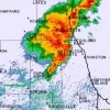
Watch it be right. Lol. I hope this precip shield fills in south like hrrr shows later. Right now main waa band setting up pretty north in Iowa. Always nail biting watching these evolve. -

Nov 28-30th Post Turkey Day Winter Storm
Chicago Storm replied to Chicago Storm's topic in Lakes/Ohio Valley
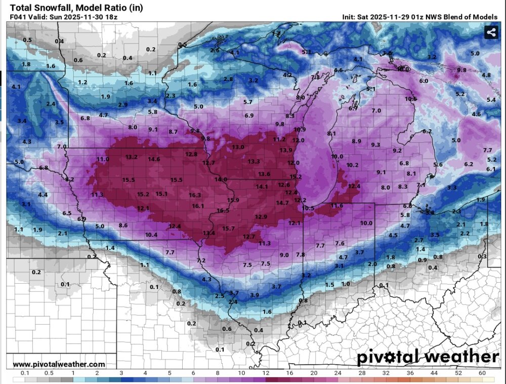
I don't think it will be high end around our area (probably no widespread 12"+ totals that is, unless ratios surprise, which seems doubtful at this time). The metro region as a whole will likely see a general 6-10" overall (locally higher), though. Highest totals will likely be western areas, with the overall setup peaking west and slowly dampening out as it heads east. -
First Winter Storm to kickoff 2025-26 Winter season
dryslot replied to Baroclinic Zone's topic in New England
I want frozen ground, But we don't always get what we want. -
You may do it, sure enough. Thinking I might bottom out around 24-25.
-

First Winter Storm to kickoff 2025-26 Winter season
HoarfrostHubb replied to Baroclinic Zone's topic in New England
I agree. Not an ideal time for it for me. But oh well. -

Nov 28-30th Post Turkey Day Winter Storm
Harry Perry replied to Chicago Storm's topic in Lakes/Ohio Valley
0z NAM is doing NAM things… drying out quite a bit in some of the expected higher-end areas in eastern Iowa/western Illinois. DVN goes from over a foot down to 9” this run. -
34.7 at 9pm and my coldest at midnight is 32 .
-
Central PA Fall Discussions and Obs
mitchnick replied to ChescoWx's topic in Upstate New York/Pennsylvania
Climo is always a viable option forecast at 4-5 days. It may be right, but it may be wrong. It's too early on this one. I will say that I'd love to see this a hit along the lines of the Euro 12z because I'm a firm believer that the first threat event gives a strong hint at the winter's seasonal pattern. - Today
-

First Winter Storm to kickoff 2025-26 Winter season
kdxken replied to Baroclinic Zone's topic in New England
Couple folks asked about Runaway / Luke. He's fine just busy. -

First Winter Storm to kickoff 2025-26 Winter season
kdxken replied to Baroclinic Zone's topic in New England
Hope you're wrong. Don't want it. -

First Winter Storm to kickoff 2025-26 Winter season
ORH_wxman replied to Baroclinic Zone's topic in New England
Not a bad first guess, Ray. Kind of feels like a pretty decent 128 gradient if we get a blend of Euro/GFS. I feel like both of those solutions at 18z are pretty outlier-ish

