All Activity
- Past hour
-
Warm asphalt lol
-

12/3 Snow/Sleet/Mix Bag of Everything Discussion/OBS
LVblizzard replied to Mikeymac5306's topic in Philadelphia Region
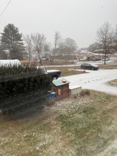
Steady snow in Allentown. Coating on the ground so far. A bit concerned about a changeover happening earlier than expected looking at radar…we should at least get an inch, maybe two before that happens though. -
Flakes have now become legit....nice to see. 12z HRRR a little more promising for my hood (if I'm reading it correctly).
-
Been jumping between 32.2 and 32.4. Yuck.
-

December 2025 regional war/obs/disco thread
Kitz Craver replied to Torch Tiger's topic in New England
Yup, these are my thoughts. Nothing imminent -

First Winter Storm to kickoff 2025-26 Winter season
Ginx snewx replied to Baroclinic Zone's topic in New England
Yes we snowed. Head up to Burriville get in that band. -

First Winter Storm to kickoff 2025-26 Winter season
moneypitmike replied to Baroclinic Zone's topic in New England
For the most part, 12z HRRR continued colder....though curiously it warms things up here early evening.......that seems off. -
First Winter Storm to kickoff 2025-26 Winter season
Ginx snewx replied to Baroclinic Zone's topic in New England
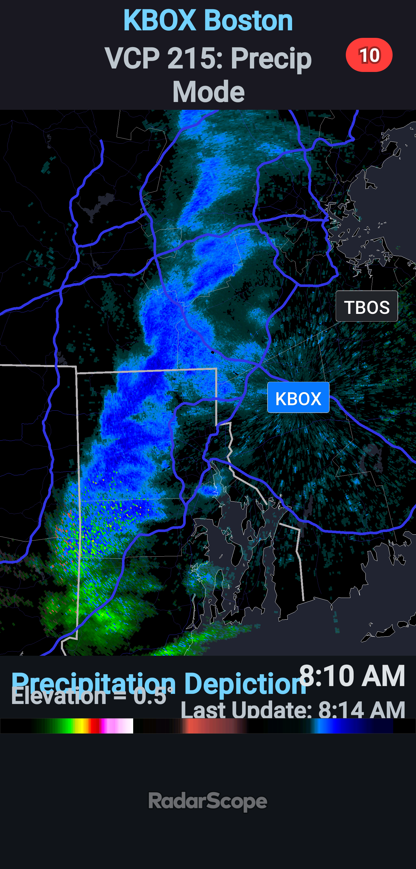
Some getting nice band in RI.Mass Maybe whiner Cory should wake up. No snow in RI?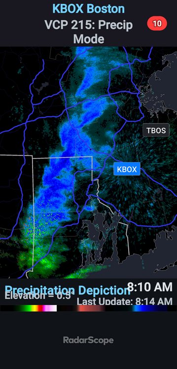
-
Started out like that here too before flake size improved.
-
Just wait, it's only 0800, the sun angle will start the melt going any second.
-

Let’s talk winter!! Ohio and surrounding states!! 24'-25'
pondo1000 replied to buckeye's topic in Lakes/Ohio Valley
4.5 inches here in Powell next to the zoo. -

First Winter Storm to kickoff 2025-26 Winter season
Modfan2 replied to Baroclinic Zone's topic in New England
Traveling RT 6 from CT into RI, snow and sleet on the ground just east of I 395 right into Scituate into Johnston, temp 29F/30F -

12/3 Snow/Sleet/Mix Bag of Everything Discussion/OBS
Birds~69 replied to Mikeymac5306's topic in Philadelphia Region
Yep, cold ass rain. Didn't see a flake...
-

December 2025 regional war/obs/disco thread
SouthCoastMA replied to Torch Tiger's topic in New England
Best chance seems to be a redeveloping clipper around 12/11..but far to go on that one. Then hopefully we are looking at a few more chances post 12/18 after the huge cutter/warmup mid month. Better then than on 12/24, but never a good idea to rule out a grincher. -
Perfect dendrites in the northern tip of that convective band.
-
21f/sn. LFG
-

Central PA Fall Discussions and Obs
WmsptWx replied to ChescoWx's topic in Upstate New York/Pennsylvania
Ripping snow. -
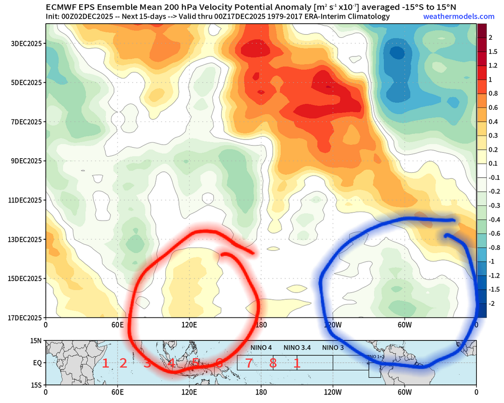
I think this whole process was slowed down a little by the original Kelvin wave coming in stronger than longer range guidance was suggesting. So a little after mid month now looks like a better bet. After that period of destructive interference this is a pretty nice look starting to show up. And with the next Kelvin wave about to constructively interfere with it just beyond this.
-

Kick-Off '25-'26 Winter Storm Obs
AstronomyEnjoyer replied to 40/70 Benchmark's topic in New England
21.4°/19.8°, moderate SN, 0.5" new. -

Central PA Fall Discussions and Obs
canderson replied to ChescoWx's topic in Upstate New York/Pennsylvania
Same in the city. All surfaces covered. -
First Winter Storm to kickoff 2025-26 Winter season
Ginx snewx replied to Baroclinic Zone's topic in New England
Still don't know why you said that to him. -

December 2025 regional war/obs/disco thread
TauntonBlizzard2013 replied to Torch Tiger's topic in New England
I truthfully don’t really see anything interesting for SNE through mid month. Sure something small could pop, but it looks like we wait until late month -
I mean how effing dumb was that?
-
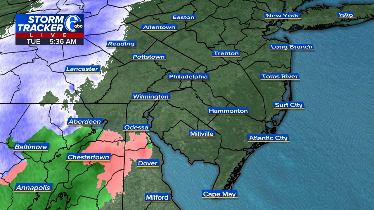
 According to NWS data, the 8 am temperature in the Bronx was 36°. Even as there remains a chance that some snow/sleet could be seen at the onset of the precipitation, no accumulation is likely. As per mPING, the precipitation arrived as light rain in Union, NJ. We'll see whether it briefly flips to sleet/snow upon growing heavier. If not, that's not a good sign for the NYC area.
 -

First Winter Storm to kickoff 2025-26 Winter season
CoastalWx replied to Baroclinic Zone's topic in New England
You’ll wetbulb a little. I know it’s a race