All Activity
- Past hour
-

November 2025 general discussions and probable topic derailings ...
WinterWolf replied to Typhoon Tip's topic in New England
Of course…just take the exact opposite of what the Pope says, and then you’re usually closer to reality. -
November 2025 general discussions and probable topic derailings ...
WinterWolf replied to Typhoon Tip's topic in New England
He will chime in as we close in… -
Same ole crap. We'd be lucky to get 1 winter storm all winter.
-

November 2025 general discussions and probable topic derailings ...
CoastalWx replied to Typhoon Tip's topic in New England
Dude it’s like 10+ days away. lol. Saying “may need to watch” Isn’t exactly a proclamation. -
Up to 63 - gorgeous fall day.
-
 Not until Will comes back
 -

2025-2026 ENSO
donsutherland1 replied to 40/70 Benchmark's topic in Weather Forecasting and Discussion
I agree with your post. IMO, those maps should not be published on any credible site. Such wild swings and extremes on a run-to-run basis are not too surprising. That's why NCEP blends multiple cycles. -
 Yeah first third of November doesn’t look that warm to me. In fact, I think we have a good chance for first measurable (.1”) away from the coast.
 -
Most snow lovers want snow whenever they can get it. Winter-season snow sticks around longer and holiday snow enhances the season. So we'd choose those scenarios if given a trade option. But it doesn't work that way. Any apparent correlation between early season snow and winter snow is likely coincidental and skewed by a small sample size.
-
November 2025 general discussions and probable topic derailings ...
CoastalWx replied to Typhoon Tip's topic in New England
EC AIFS shows something too. Euro op and EPS aren’t enthused. May need to watch that 11/10-11/15 period. -
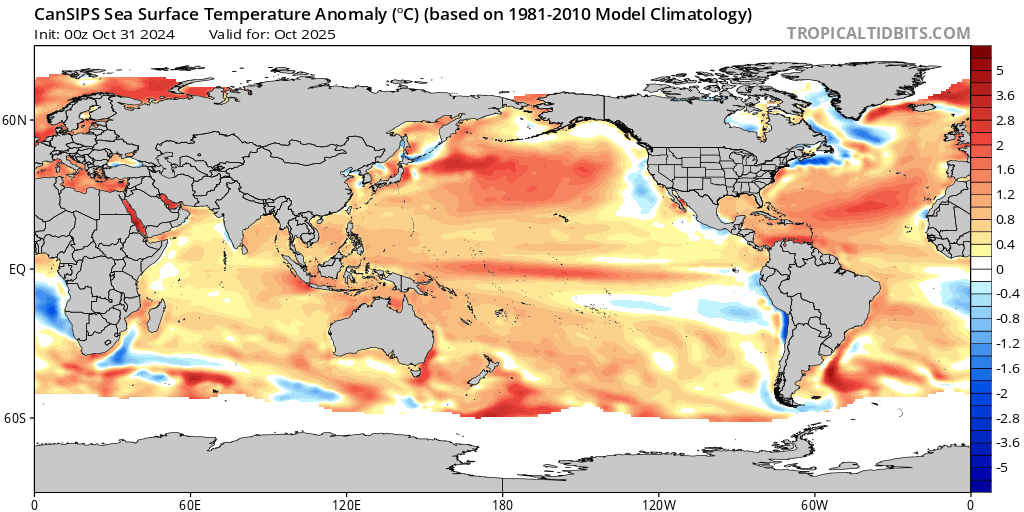
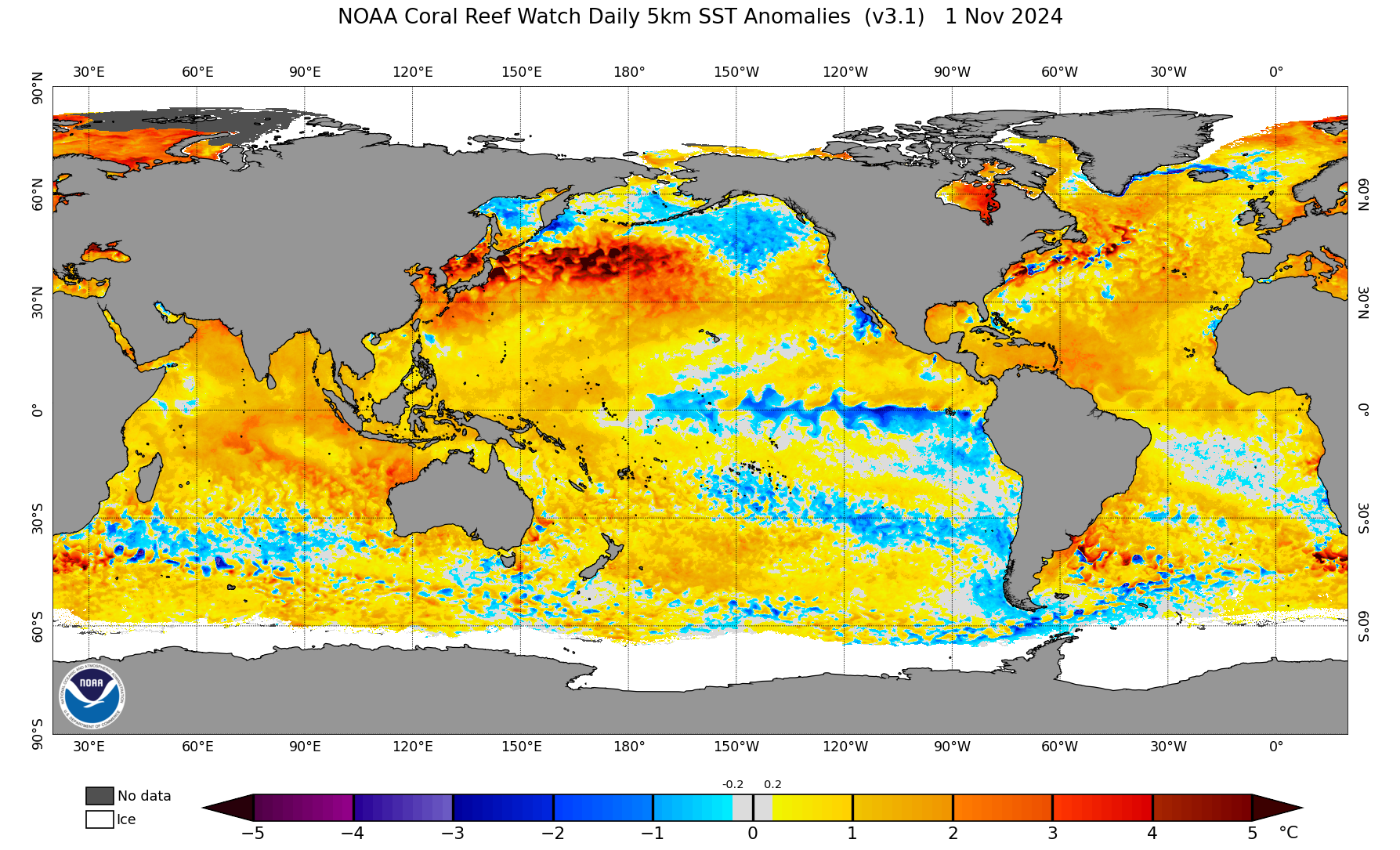
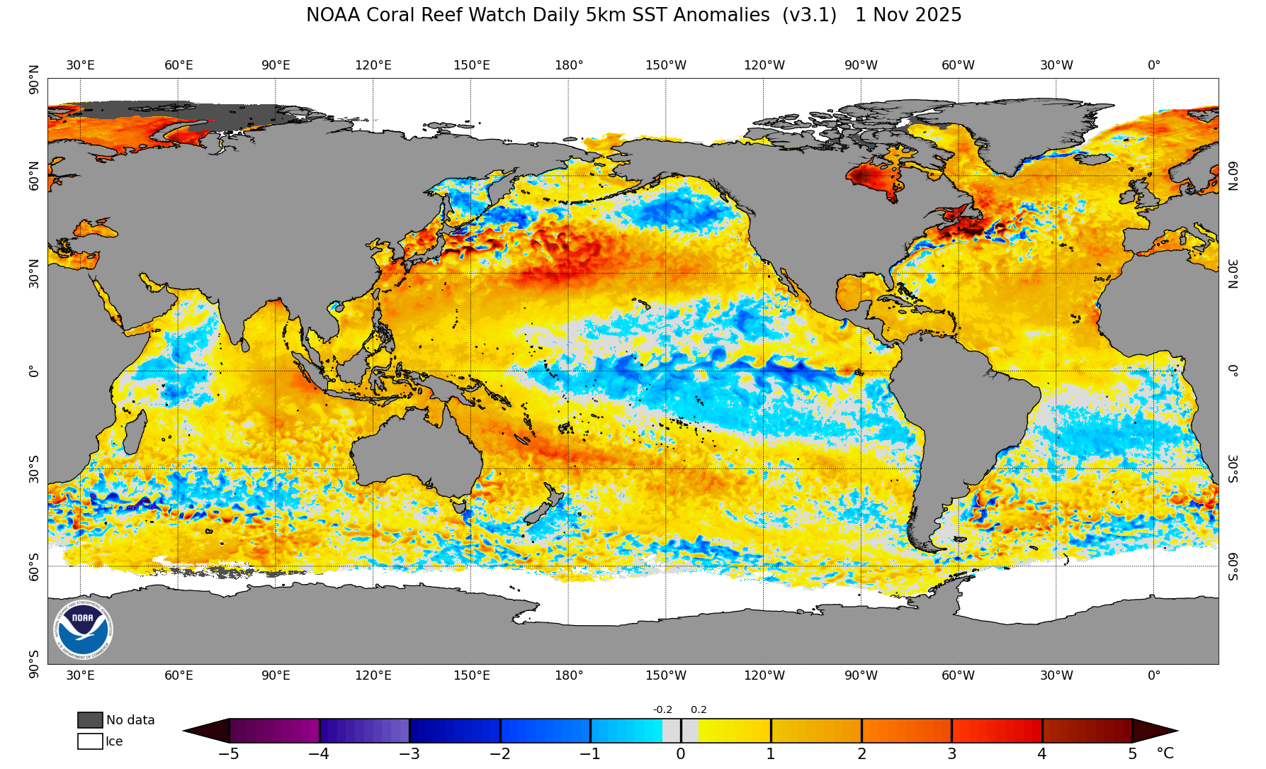
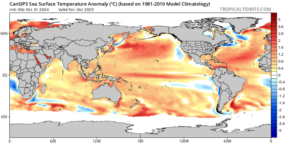
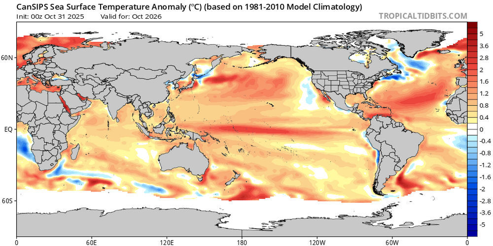
Hey Mitch, I’d love to see it! But a huge grain of salt is advised. One year ago the CANSIPS was forecasting a Modoki Nino for now, about which I posted last year and got excited. Obviously, that failed miserably and I’ve learned from it. One year ago, CANSIPS forecast this for Oct of 2025: Compare that to the new CANSIPS for Oct of 2026: the entire globe looks so similar that it almost looks like a copy and paste although it’s slightly warmer in Nino regions. Hopefully this new CANSIPS for next Oct won’t also verify way off! @Carvers Gap@donsutherland1
-
November 2025 general discussions and probable topic derailings ...
WinterWolf replied to Typhoon Tip's topic in New England
Nahhh…The Pope says big warm up coming (Torch is what he said actually) is “confirmed.” -
Is this true ?
-
2012-13?
-
The higher resolution ensemble charts are showing the same scenario. Very fast Pacific flow with warm ups followed by brief cooldowns. Storm track from east to west the through the Great Lakes and exiting to the east of New England. Very little room for an amped coastal track close to the coast like the OP GFS has with that much snow. Any trailing energy lagging behind the main low looks pretty weak and sheared out to our east. But it’s possible the upper low behind the main low could cause some moisture to linger for flurries especially higher elevations in our area. We can always get some flurries even near the coast this time of year especially early in the day if the timing is right.
-
too early, you don’t want accumulating snow yet in city… or your winter is fucked. Any time after the 15th is good before that no Bueno if you like snow
-
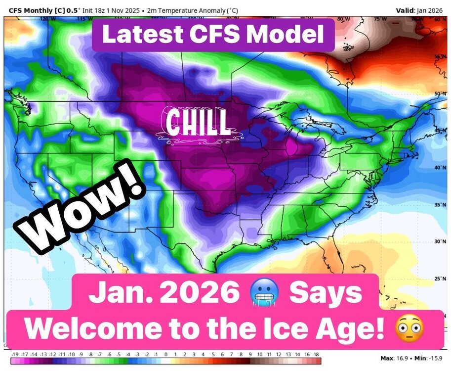
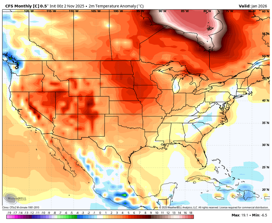
Here’s a WxBell CFS control Jan map (originally posted today by an unknown person, who added his own comments) that was reposted today at another BB by someone who got this in his FB feed (i.e., this is NOT a WxBell post..it is someone else posting a WxBell map with his own commentary): Here was my response: This is a control run (18Z of yesterday) of the WxBell CFS being forecasted out 2 months. Even calling this map less than worthless is being kind. Keep in mind that these are in C, not F. So, it gives the majority of the middle 1/3 of the US a record obliterating cold Jan. To show how silly this run is, it has Chicago at an obliterating alltime record breaking cold Jan of 14C/25F BN, which is -1F! The coldest Jan (and any month for that matter) on record back to 1873 is +10.1F (1977). So, this CFS control run is forecasting Chicago to have a Jan that is 11F colder than any month they’ve had during the last 153 years! Now here’s the very next CFS control run, the 0Z 11/2 run: Instead of mid-America having a record obliterating cold Jan, it has much warmer than normal in much of the same area! It has Chicago only 3 F AN because the WxBell CFS maps always show a funky cold spot centered on Lake Michigan (funky WxBell CFS algos is another issue for another time that I’ve posted about before). So, it has Chicago at an AN +27F vs -1F on the prior run or 28F warmer lmao! @donsutherland1
-
Almost time for my migration from real life back to this fucking place. I've missed yall. This year, some of us will not make it. It is a sacrifice I am willing to make.
-

E PA/NJ/DE Autumn 2025 Obs/Discussion
MGorse replied to PhiEaglesfan712's topic in Philadelphia Region
33F for a low early this morning with frost. -
Euro is also showing a big cold blast like the cmc and gfs.
-

November 2025 general discussions and probable topic derailings ...
MJO812 replied to Typhoon Tip's topic in New England
Euro is also showing a big cold blast -
I agree that a wintry coastal storm is unlikely. But I think your MSLP graphic at 198hrs is misleading. First, it's a snapshot in time at long range. And second, at first glance the color schemes resemble height anomalies, which is confusing. The ensemble averaging effect almost always produces noticeable differences between an individual operational run and its ensemble average at that time range. But to my eye, the op and ensembles are in reasonably good agreement with some kind of cold wave centered around the 10th. To argue otherwise seems somewhat disingenuous. But if the intent is to merely downplay the likelihood of accumulating snow from a coastal storm at the coast, I completely agree. But I don't think you need to label the op run as an outlier to make that point. The 1009mb off the Delaarva at 192hr on the 12z GFS is 12 hours earlier than a cluster of SLPs associated with the shortwave on the individual ensembles. But the broad representation is consistent.
-

2025-2026 ENSO
so_whats_happening replied to 40/70 Benchmark's topic in Weather Forecasting and Discussion
If you don't wish to post photos it is fine, I do wish you would at least reference the sites so that people could see what you are mentioning is all.

- Today
-
12z EURO has plausible first flakes/flurries for the next Monday/Tuesday period. First “threat window” maybe
-

November 2025 general discussions and probable topic derailings ...
dendrite replied to Typhoon Tip's topic in New England
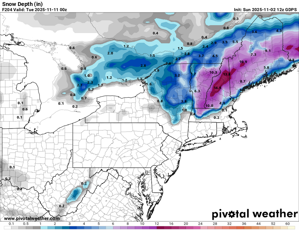
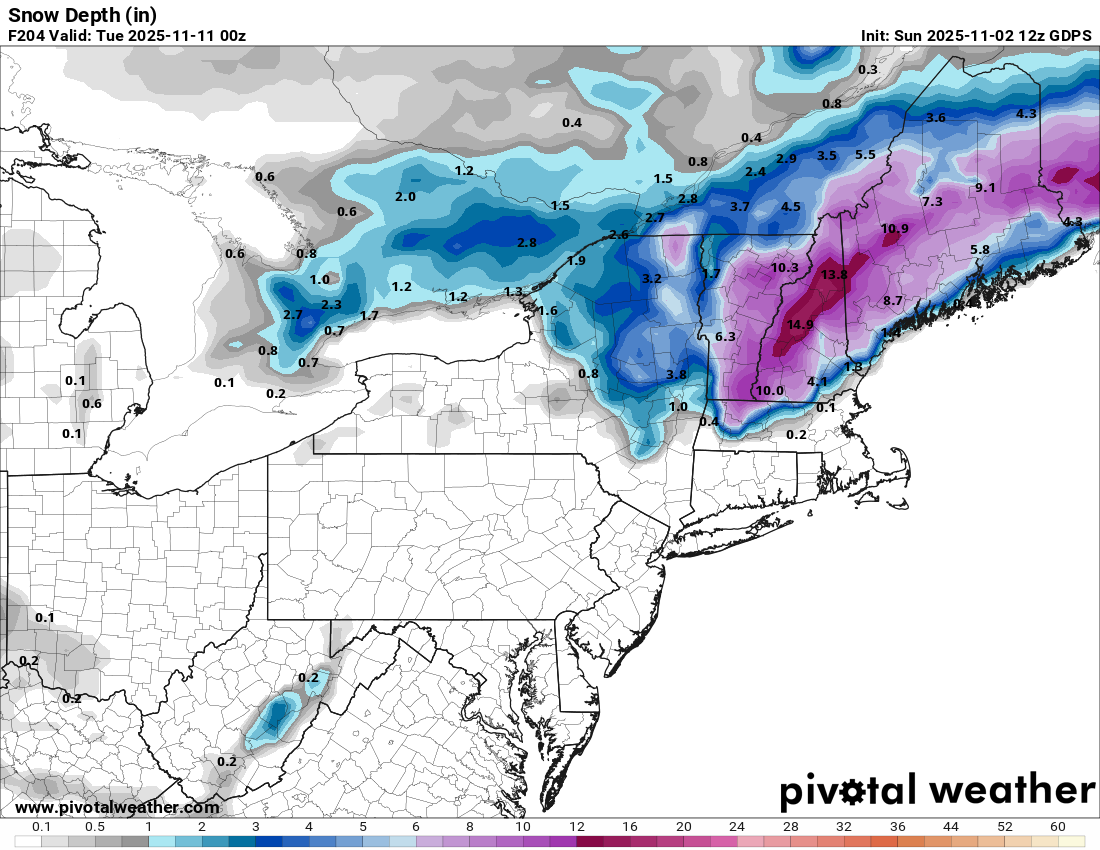
Even the modeled snow depth was lol