All Activity
- Past hour
-

July 2025 Discussion-OBS - seasonable summer variability
winterwarlock replied to wdrag's topic in New York City Metro
disgusting is days and days of rain chances so hopefully no -
July 2025 Discussion-OBS - seasonable summer variability
winterwarlock replied to wdrag's topic in New York City Metro
pouring here..what else is new..another rainy late afternoon in the summer...seems like a broken record hit 91 with peak heat index of 103 -

July 2025 Obs/Disco ... possible historic month for heat
weatherwiz replied to Typhoon Tip's topic in New England
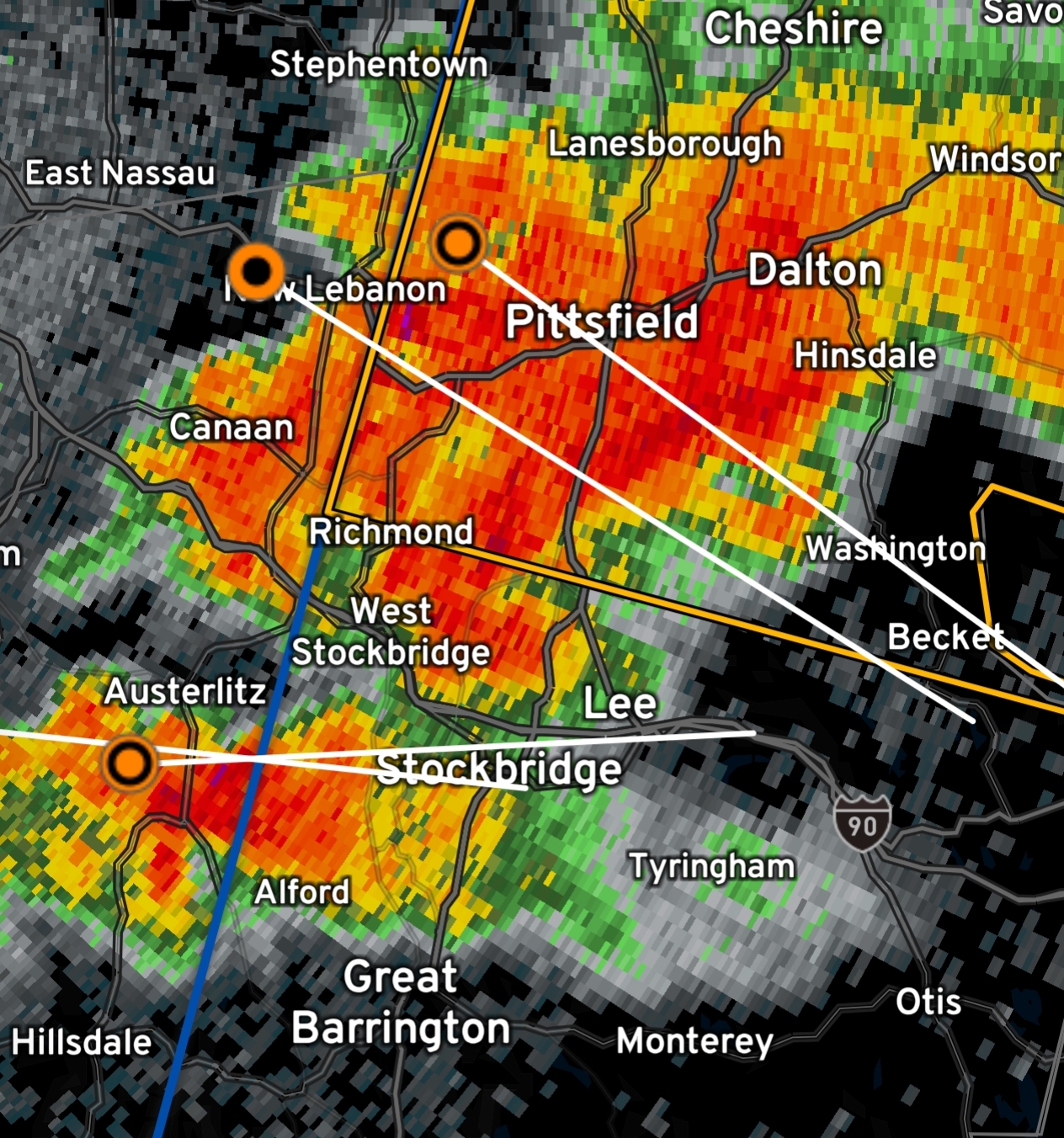
there is some weak rotation over Beckett -
La Niña cometh
-

July 2025 Obs/Disco ... possible historic month for heat
aldamon replied to Typhoon Tip's topic in New England
Shocked this wasn't a spinup south of Pittsfield.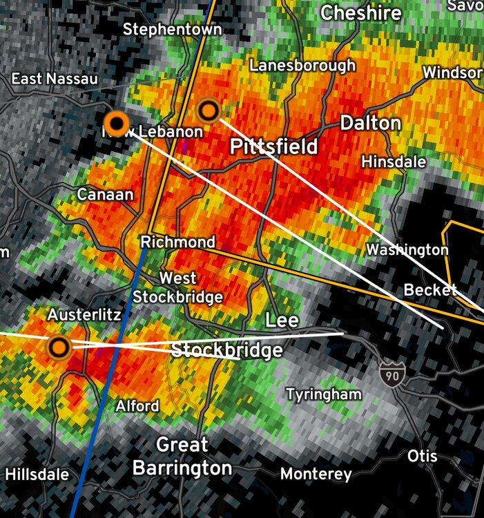
-

July 2025 Obs/Disco ... possible historic month for heat
Torch Tiger replied to Typhoon Tip's topic in New England
Any mesos at all? -
That was a real rainfall producer. Was coming down in sheets, no thunder or wind, just heavy tropical like rains. Dropped .65 here. Grass is happy.
-

July 2025 Discussion-OBS - seasonable summer variability
Poker2015 replied to wdrag's topic in New York City Metro
.06" here...whiff -
July 2025 Obs/Disco ... possible historic month for heat
Torch Tiger replied to Typhoon Tip's topic in New England
that SW flank will probably fill more -

July 2025 Discussion-OBS - seasonable summer variability
FPizz replied to wdrag's topic in New York City Metro
Got .12" from it -

July 2025 Obs/Disco ... possible historic month for heat
Snowedin replied to Typhoon Tip's topic in New England
It’s actually a bit sticky out here atm. Currently watching two red squirrels squabble at the bird feeding area. Those little gremlins are true to their name! -

July 2025 Obs/Disco ... possible historic month for heat
Damage In Tolland replied to Typhoon Tip's topic in New England
Maybe .. I just watered the garden and plants . It’s possible that southern flank clips NECT -

July 2025 Discussion-OBS - seasonable summer variability
winterwx21 replied to wdrag's topic in New York City Metro
And it appears that cell is gonna miss me just to the south. That heavy downpour in southern Somerset County is gonna go into central and southern Middlesex County. -
July 2025 Obs/Disco ... possible historic month for heat
Torch Tiger replied to Typhoon Tip's topic in New England
I could see N /E CT getting in on some storms a while later. definitely some southerly development/ saggers going on with that line as it pushes east -

2025-2026 ENSO
Stormchaserchuck1 replied to 40/70 Benchmark's topic in Weather Forecasting and Discussion
30-day SOI is back above +5. 17/20 +SOI days in July so far. -3c pocket developing in the ENSO-subsurface -

July 2025 Obs/Disco ... possible historic month for heat
Cyclone-68 replied to Typhoon Tip's topic in New England
Route 2 or…..route “screw”? And yes I’ll let you use that lol -
July 2025 Obs/Disco ... possible historic month for heat
Torch Tiger replied to Typhoon Tip's topic in New England
can see the broken line split happening MA/VT/NH border to route 2 already. lol -

July 2025 Obs/Disco ... possible historic month for heat
bristolri_wx replied to Typhoon Tip's topic in New England
Looks like most of Southern New England is under a Severe Thunderstorm Watch for the evening…
-
July 2025 Discussion-OBS - seasonable summer variability
FPizz replied to wdrag's topic in New York City Metro
Raining pretty hard, worst looks to go just south, maybe by warlock -
July 2025 Obs/Disco ... possible historic month for heat
Torch Tiger replied to Typhoon Tip's topic in New England
is that the closest store? -

July 2025 Obs/Disco ... possible historic month for heat
ineedsnow replied to Typhoon Tip's topic in New England
Hoping for something heading to Walmart in Rindge -
It's headed for your yard.
-
The sun won. Turned into an outstanding afternoon.
-

2025 Lawns & Gardens Thread. Making Lawns Great Again
Chrisrotary12 replied to Damage In Tolland's topic in New England
Boy did the grass get crunchy the last 10 days while I was gone. -
Interesting cell near Chesapeake City, MD. moving generally SE.