All Activity
- Past hour
-
Central PA Fall Discussions and Obs
Blizzard of 93 replied to ChescoWx's topic in Upstate New York/Pennsylvania
-
Tech Attachment from 1989 attached> references an older set of models but the pattern still applies. See the checklist. https://www.weather.gov/media/erh/ta/ta88-17b.pdf
-
10.8 this morning. Coldest so far this year by 6 degrees.
-

First Winter Storm to kickoff 2025-26 Winter season
ORH_wxman replied to Baroclinic Zone's topic in New England
GGEM was even slower than the GFS to turn the low and midlevels out of the east. And it’s because of how it handles the vort. It keeps a strong vort tracking through western NY. You aren’t getting big snowstorms for a good chunk of New England like that. -
First Winter Storm to kickoff 2025-26 Winter season
dryslot replied to Baroclinic Zone's topic in New England
Just based it off of the track, I don't generally dive very deep into the GGEM. -

First Winter Storm to kickoff 2025-26 Winter season
ORH_wxman replied to Baroclinic Zone's topic in New England
Similar but def warmer. -
Of course I change jobs and the snow possibilities plummet for my new work location vs old
-
Nov 28-30th Post Turkey Day Winter Storm
metallica470 replied to Chicago Storm's topic in Lakes/Ohio Valley
In it right now. Its the real deal! Looks like a snow globe out here! -
First Winter Storm to kickoff 2025-26 Winter season
dryslot replied to Baroclinic Zone's topic in New England
It was similar to the 12z GFS. -

First Winter Storm to kickoff 2025-26 Winter season
TauntonBlizzard2013 replied to Baroclinic Zone's topic in New England
It’s really warm. Good snow confined to NW of Worcester to SNH -
Nov 28-30th Post Turkey Day Winter Storm
NEILwxbo replied to Chicago Storm's topic in Lakes/Ohio Valley
Last hour received 0.4” at ORD, with heavier returns moving in now & vis down to 1/2SM, should be north of 0.5/hr rate going forward for awhile. -

First Winter Storm to kickoff 2025-26 Winter season
Lava Rock replied to Baroclinic Zone's topic in New England
If he cant get snow, nobody can Sent from my SM-S921U using Tapatalk -
The temperature dropped to 16.7° in my backyard just west of Eden. The coldest temperature I could find in Rockingham County was near Madison where a station recorded a low of 15.8°. KSIF dropped to 17.6°.
-

Central PA Fall Discussions and Obs
GrandmasterB replied to ChescoWx's topic in Upstate New York/Pennsylvania
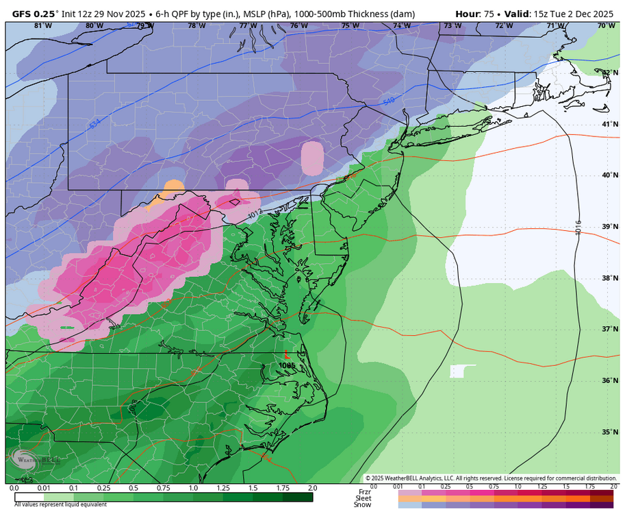
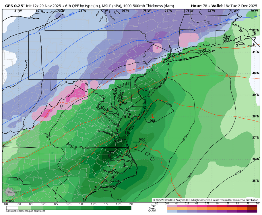
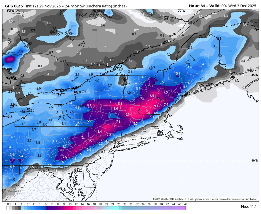
12Z GFS colder on the front end and overall better for us southerners. True central smoked. Noticeable move to the Euro. -
For what this is worth... has anyone checked BOX, OKX and discussions... I dont quite have time... but I'm thinking this rapid transition of an end moving- strengthening shortwave across our area with strong LFQ and even stronger RRQ of 250-300MB jets may fit the bombogenesis profile. Let us know if anyone has mentioned this? PPP drops at least 24 MB in 24 hrs 12z Tue-12zWED. I'm believing rapid intensification and now it's a matter of thermal profiles. Going to be an interesting day in these parts with R+ LI and a "period "of S+ wet snow inland. mPing of value Tuesday including the possibility of a northernly jet 40kt plus on the backside over LI as the storm rushes east northeast.
-
24 for a low watching when the cloud cover comes in and the dews. If we can drop back to about 32 when cloud cover takes over the dews should be about 22 and that would make an interesting precip onset later on
-

Nov 28-30th Post Turkey Day Winter Storm
sbnwx85 replied to Chicago Storm's topic in Lakes/Ohio Valley
Things are on track here. It’s been snowing for a couple of hours and we have about a half inch so far. Consistently snowing with flake size and rate gradually improving. The radar looks great. -
First Winter Storm to kickoff 2025-26 Winter season
TheMainer replied to Baroclinic Zone's topic in New England
I agree, I think that's where we'll end up, enough to whiten the ground with a few inche, hopefully not enough to insulate it though. Think I'll sneak maybe an inch or two Sunday night and then it'll wash away. -
Winter 2025-26 Medium/Long Range Discussion
mimillman replied to michsnowfreak's topic in Lakes/Ohio Valley
This looks like 1-2” max but should be a nice refresher and a very rare snow on snow for early December -
First Winter Storm to kickoff 2025-26 Winter season
dryslot replied to Baroclinic Zone's topic in New England
12z GGEM goes over SE MA/Cape -

First Winter Storm to kickoff 2025-26 Winter season
40/70 Benchmark replied to Baroclinic Zone's topic in New England
I wouldn't worry about the OP details yet...like where we stand. -
Nov 28-30th Post Turkey Day Winter Storm
ChiTownSnow replied to Chicago Storm's topic in Lakes/Ohio Valley
Some specs of 25-30 dbz starting to show up on radar -
Here is today’s 12z gfs from 45 and 102 hours. Looks very similar, pattern repeating itself. It is decent just gotta take advantage of one of these waves. Cold source nearby. Also, this might produce… .
-
Nov 28-30th Post Turkey Day Winter Storm
jlauderdal replied to Chicago Storm's topic in Lakes/Ohio Valley
Heavy snow is ahead of schedule(wasnt looking good earlier), math is in our favor to hit double digits after that last uptick and it looks good upstream. I will be on the move shortly, will see how the afternoon goes. Congrats to the board , I know its been a tough, I sense PTSD, lol.


