All Activity
- Past hour
-
-
-

December 2025 regional war/obs/disco thread
40/70 Benchmark replied to Torch Tiger's topic in New England
In my view, the 2"+ that I have is a bonus....I didn't expect anything yet. I bet most would feel the same had they not been focused on the southern mid atl. -
Occasional Thoughts on Climate Change
TheClimateChanger replied to donsutherland1's topic in Climate Change
-

December 2025 regional war/obs/disco thread
weatherwiz replied to Torch Tiger's topic in New England
Yeah its way too early to be cancelling anything. I mean what's climo right now...probably ranging from 2-5" and of course probably even under 2" closer towards the coast. Not having snow on the ground on Dec. 9 doesn't mean winter is cancelled or winter will be bad. -
and fireworks
-
i believe in 2015 we were sitting outside, because it was too hot inside and the ac vents had all been closed for the winter....
-
Low of 16. The Bush River is frozen over.
-

December 2025 regional war/obs/disco thread
weatherwiz replied to Torch Tiger's topic in New England
Makes total sense...that's along the lines of what I was figuring you were getting at. -
12z NAM 3km is showing a hell of a Northwest flow tomorrow night. Winds gusting over 40mph for most and temps in the mid 20’s. That’s a good recipe for snow showers to break containment and make it even into the valleys.
-
This. In previous years Canada was torching so even when we did get a decent H5 pattern the airmass still wasn't great. Looks like good cold air in Canada to tap into. Obviously all subject to change but it's not a close the blinds look at all. And for your yard and my yard when it's been a really cold pattern I don't have any ground truth snow cover to speak of. It's all been south of our area. It's been that way for the last few years really.
-
Fwiw, 12z ICON not interested in the Friday/Friday night idea... Saturday night is up in PA
-
12/5 - 3.1" 12/8 - 2.8" Total: 5.9" What a start to the season for the southern crew
-
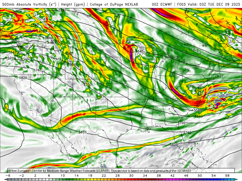
I’m not really trying to quantify it. I’m just thinking H5 shortwaves and vortmaxes and where they tend to move through the eastern US. But when I see this south of the Delmarva in early December, with cold in place, I just think of it as in the southerly extreme of probable outcomes.
-
Latest Cfs2 weekly temp forecast. Not bad and looks familiar too. https://www.tropicaltidbits.com/analysis/models/?model=cfs-avg®ion=us&pkg=T2maMean&runtime=2025120900&fh=168
-
This made me LOL. The amount of psychological hedging on here is hilarious. We’ve got people calling off the Sunday storm despite it still being on a decent number of ensembles. Then canceling winter. Crazy stuff.
-
Mid to long range discussion- 2025
WinstonSalemArlington replied to wncsnow's topic in Southeastern States
Friday may deliver another snow for the Virginias -
-PNA did not help the shortwave dig at all, so we just got weak sauce.
-
Low of 17.8 this morning here at the beach. Impressive.
-

Central PA Winter 25/26 Discussion and Obs
Superstorm replied to MAG5035's topic in Upstate New York/Pennsylvania
Welcome back 70s and 80s . -
Very similar to the Cansips that keeps cold lurking to our north most of the winter. Here's a link to 2m temps starting in January. Cansips actually likes January for temps over December, thoigh we've built up quite a deficit so far and will maintain most of it before the pattern breaks down. https://www.tropicaltidbits.com/analysis/models/?model=cansips®ion=us&pkg=T2ma&runtime=2025120100&fh=0 If you look at 5H anomalies, Cansips wants to have higher heights draped across most areas in the country south of 39-40N. It still gets at or a little BN temps in our area with the WxUSAF slow bleed idea. It's going to be low level, which will likely cause angst (zr/ip) threats, as 850 anomalies are not as favorable. All in all, we should still have decent chances in January if the Cansips is close to being right, and that map above says it may end up right imho.
-
.
-
2025-2026 ENSO
TheClimateChanger replied to 40/70 Benchmark's topic in Weather Forecasting and Discussion
-
Touched 8 in Chester at 6:00 or so. Up to a balmy 22 now.


