All Activity
- Past hour
-
Heaviest snow I've seen all day so far now in westfield. 100% snow again here. Heading out now to hit the plow route in Simsbury
-
I have to give credit to the HRRR for the little weenie streak on the west side of Quabbin, even if it was a bit too high in general. We had just barely enough lat / lng / alt
-
Very icy outside....31F right now. Epic fail on the sfc temps. Not totally uncommon to happen but a bit more surprising since we had no high to the north. But that sfc low kind of elongating to the northeast probably really turned ageo flow more northerly.
-

Kick-Off '25-'26 Winter Storm Obs
AstronomyEnjoyer replied to 40/70 Benchmark's topic in New England
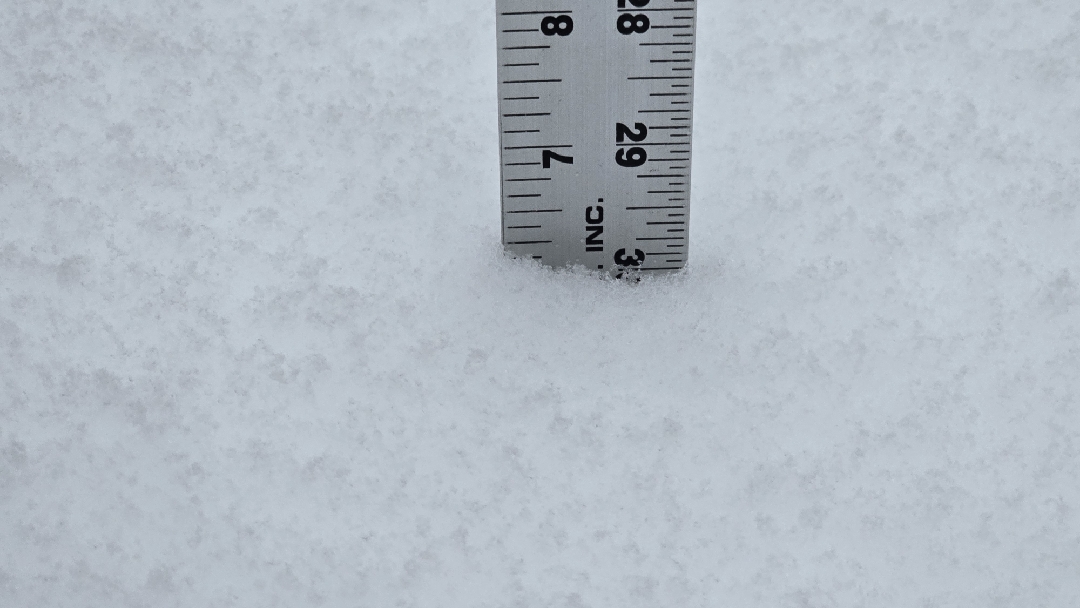
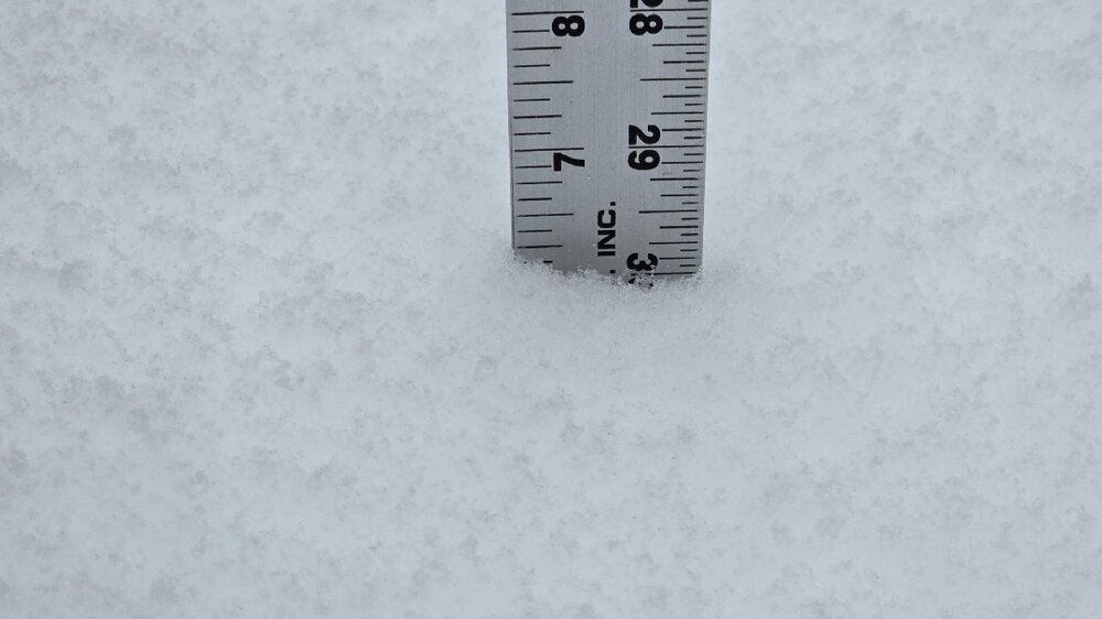
25.7°, 4.9" new. In a bit of a lull for the time being. -
Top 10 Snowiest November's 1. 14.8" - 1940 2. 14.5" - 1895 3. 14.3" - 1951 4. 12.7" - 2018 5. 11.2" - 2015 6. 10.8" - 1975 7. 10.4" - 2025 8. 7.6" - 1953 9. 7.5" - 1893 10. 7.1" - 1978
-

Chicago Weather Records Tracking
Chicago Storm replied to Chicago Storm's topic in Lakes/Ohio Valley
Top 10 Snowiest November's 1. 14.8" - 1940 2. 14.5" - 1895 3. 14.3" - 1951 4. 12.7" - 2018 5. 11.2" - 2015 6. 10.8" - 1975 7. 10.4" - 2025 8. 7.6" - 1953 9. 7.5" - 1893 10. 7.1" - 1978 -
Dry with lots of up and down cold my way with that pattern. I'd like to see even some rain at this point.
-
Yep, the NAM seems to have a better handle on the mid-level warm layer compared to the HRRR. Having said that, it looks like the northward progress of the mix line MAY have halted or even been knocked back a bit over Essex County MA...but could be just a temporary trend. Hard to say at this point if we have a snowy or an icy evening coming up.
-
Not really. There's never more than 2. We come out a little ahead hen we fix them up and decide to move. We're not flippers though, we just move for new projects. Always try to buy a fixer-upper with a good location. I think the new Pit might be a keeper though. It's an 1820 in really rough shape.......but it's in the village two houses from the water. Got a good deal on it.....but man will it be a project. Time and dollars. My wife said all our other houses have prepared us for this moment.....sigh.
-
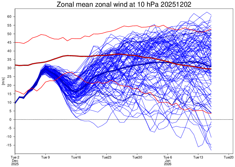
Increasing support for a temporary weakening of the PV mid month. At least enough to keep it from being too strong for now but its still going for near normal strength by January.
-
Where are you located now?
-

Central PA Fall Discussions and Obs
Voyager replied to ChescoWx's topic in Upstate New York/Pennsylvania
After shoveling out 3 cars and 2 sidewalks, I'm beat already. At 58 years old, I'm not built for heavy work in cold temps. I really wish my wife would have wanted to move to Arizona. I'd have tried to keep my mom's house, and would have lived happily ever after. Instead, I'm stuck here... -
back edge approaching here-what an awful day with rain and 33-34
-
Compared to December 2015, 2021, 2019 its still an ice box though
-
I’m a snowpack guy myself. I think we keep the grass covered for December
-
0.95” of cold rain
-
Moderate snow continues.
-
Still all snow here, 28 degrees
-
ORD received 8.4" of snow on November 29th, which broke the record snowfall total for the date of 2.4" (1953). ORD received 8.4" of snow on November 29th, which broke the November all-time calendar day record snowfall total of 8.0" (November 6th, 1951).
-
Been holding a steady 28 here toward the coast all day long. Bounced from 28.2 - 28.9 at the peak but sitting solid at 28.0 even again now. Hoping it stays that way!
-
Chicago Weather Records Tracking
Chicago Storm replied to Chicago Storm's topic in Lakes/Ohio Valley
Chicago/O'Hare received 8.4" of snow on November 29th, which broke the record snowfall total for the date of 2.4" (1953). Chicago/O'Hare received 8.4" of snow on November 29th, which broke the November all-time calendar day record snowfall total of 8.0" (November 6th, 1951). -
Spent most of the day in S RI and rain and temps around 45F, now home in E CT and temp 34F and .40” of rain so far
-
Bro you must make some big cash…got so many Pits I can’t keep up. Holy smokes.
-
LWX mentions the next 2 chances... Model guidance is in relatively good agreement that a low amplitude shortwave embedded in west-southwesterly flow aloft will track across the Tennessee Valley toward the southern Mid-Atlantic during the day on Friday. Meanwhile, high pressure will be in the process of retreating offshore. While models are in agreement that this general pattern will unfold, there are still some discrepancies with respect to how far north precipitation will make it, and also what the precipitation type will be. The majority of solutions have cold air in place at the surface, which would favor wintry precipitation (either a wintry mix or snow). However, there are some solutions that show rain across southeastern portions of the forecast area. Overall, precipitation totals should be on the lighter side. Depending on the track of the system, a couple inches of snow or a light wintry mix may be possible across portions of the forecast area Friday afternoon into Friday night. We`ll continue to monitor this system over the coming days. Dry, but chilly conditions are expected across the area this weekend. High temperatures are forecast to be in the upper 30s and lower 40s, with low temperatures in the 20s. Forecast confidence decreases significantly by Monday, with some solutions developing an area of low pressure nearby as a shortwave trough moves through aloft. Other solutions maintain dry conditions.
-
Completely agree. The pattern looks extremely hostile to KU’s up the coast through at least mid-December and very likely beyond that time frame