All Activity
- Past hour
-

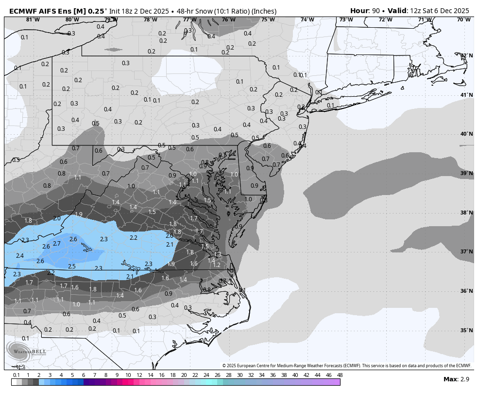
The Return of the 12/5 Snowstorm
NorthArlington101 replied to SnowenOutThere's topic in Mid Atlantic
AIFS ens a very minor tick better, but when you’re talking tenths of inches, ya take what you can get.
-
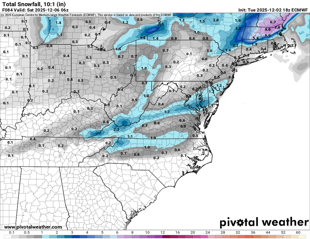
Been a snowy day but not accumulating very well. Some IP has mixed in here. Thinking about 3" now and will check later. Cold has been stubborn...could be the first <32F high of the season. Just sitting a little under 31F at the moment.
-

December 2025 Short/Medium Range Forecast Thread
Carvers Gap replied to John1122's topic in Tennessee Valley
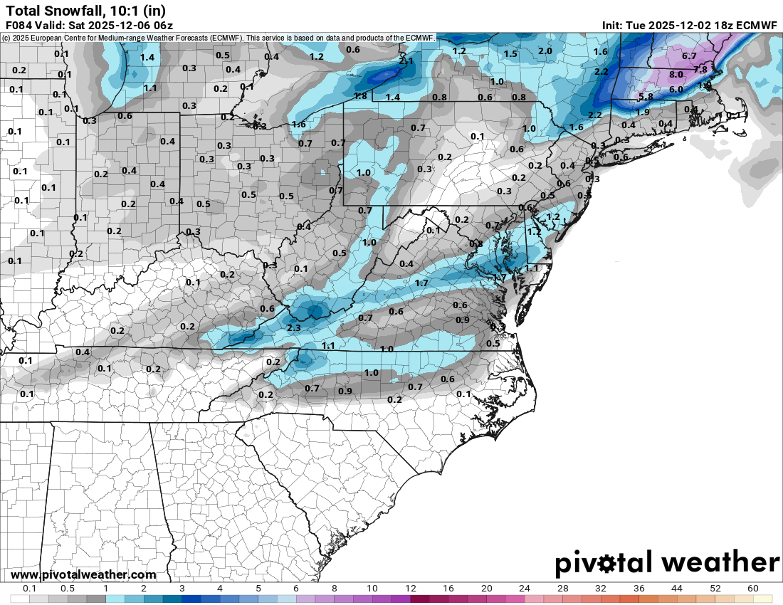
The last four runs of the GFS for Dec 12-17th. -
I'm sure the echoes pivoting east around the Berkshires will fill in a bit more but not impressed so far
-
7” just north of Lake Winni and Sandwich, NH. Did not have the most accums being so far north.
-
That's likely why our storm gets pushed east unfortunately.
-
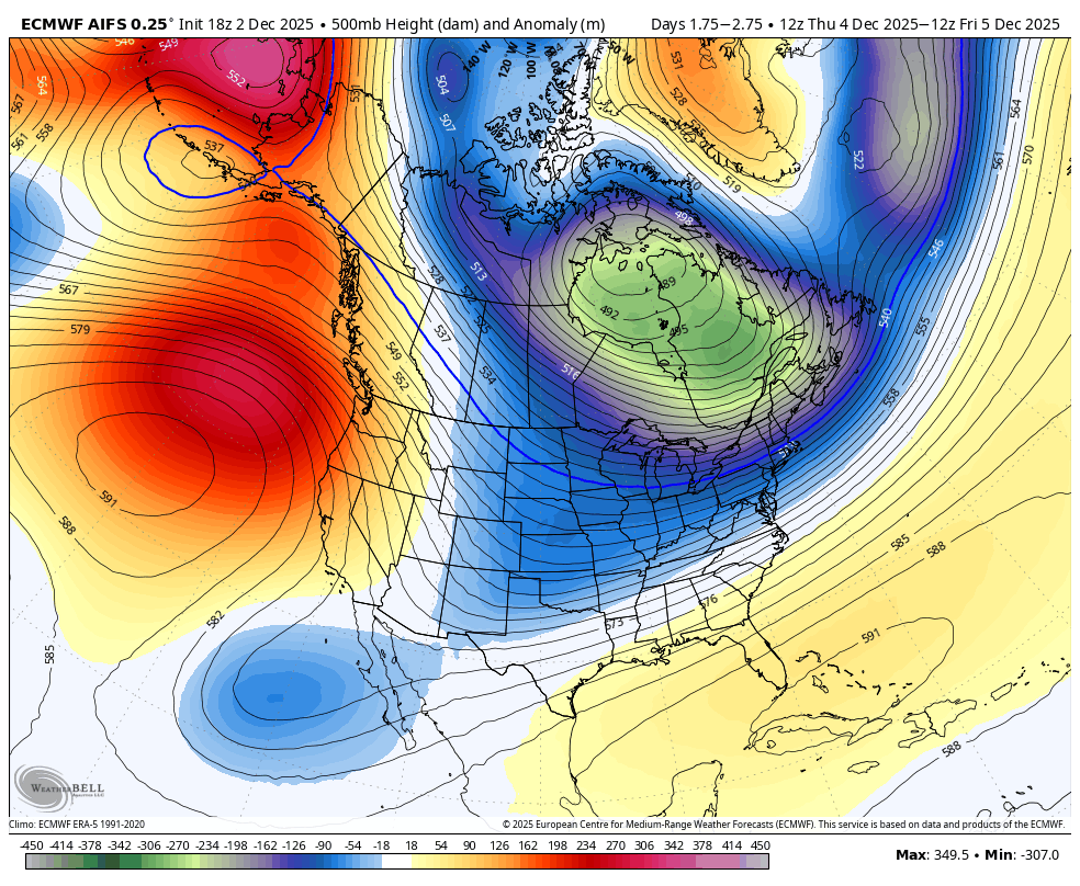
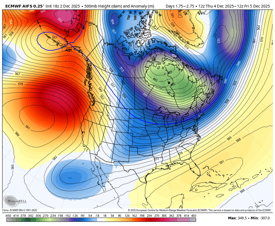
For Friday, as forecasted by the 18Z EURO, the trough is positively tilted, too progressive.
-
 .97 inch of rain, raw, miserable cold day.
 -

Southern MD / Lower Eastern Shore weather discussion
SnowtoRain replied to PrinceFrederickWx's topic in Mid Atlantic
0.91", need a few more of these storms -

December 2025 regional war/obs/disco thread
SouthCoastMA replied to Torch Tiger's topic in New England
I was tempted to post about it, but you have it covered. I'll just pretend I didn't see that abomination and look again tomorrow. -
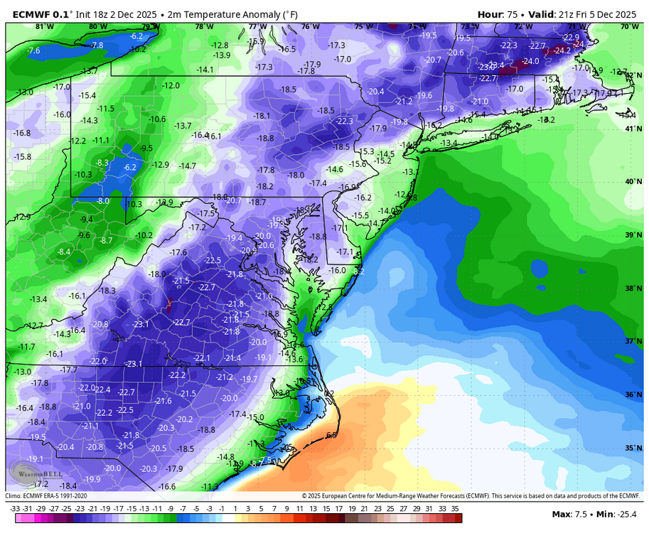
While New York City and its immediate suburbs experienced a cold rain, parts of the region saw some snow. Peekskill picked up 1.1" of snow. 2 SW of Middletown received 3.9". Binghamton saw 5.9". A colder than normal pattern is in place. A prolonged stretch of below normal temperatures will likely continue into or through the second week of December. December 1-10 will be a solidly colder than normal period. The potential exists for the coldest first 10 days of December since at least 2007 (33.4°, 5th coldest December 1-10 since 2000). The five coldest December 1-10 periods since 2000 were: 1. 30.6°, 2002 2. 32.2°, 2003 3. 32.4°, 2000 4. 33.1°, 2005 5. 33.4°, 2007 All 5 of these cases had measurable snowfall in Central Park. Rain will end tonight. Tomorrow will be blustery and cool with highs in the upper 30s and lower 40s. The coldest air mass so far this season will overspread the region starting Thursday or Thursday night. The temperature will tumble into the 20s Thursday night before bottoming out in the lower 20s Friday morning. It now appears that the weekend will be cool but dry. The ENSO Region 1+2 anomaly was -0.1°C and the Region 3.4 anomaly was -0.6°C for the week centered around November 26. For the past six weeks, the ENSO Region 1+2 anomaly has averaged -0.18°C and the ENSO Region 3.4 anomaly has averaged -0.67°C. La Niña conditions will likely continue through at least mid-winter. The SOI was -11.42 today. The preliminary Arctic Oscillation (AO) was +0.016 today.
-
I wont believe it till its over and we have 2 inches
-
-
Ya, not happening…fraud 5.
-
Anyone else miss the DGEX?
-
GFS can probably sniff out a cold pattern as well as the hmon
-
Precip after 0z from the 18z runs for ORH: NAM 0.55" GFS 0.29" no way that verifies looking at radar
-
What is too bad is that we may waste a very anomalous cold shot coming......WB 18Z EURO for Friday.
-

Kick-Off '25-'26 Winter Storm Obs
Damage In Tolland replied to 40/70 Benchmark's topic in New England
This certainly helps me feel better !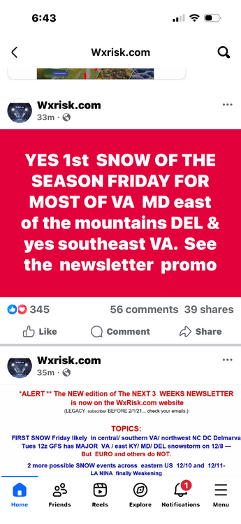
-
Solid my &@$@.
-
They’ll be coming.
-
Solid run? Maybe some chunks, but solid?
-
I feel bad for you.. I really do. Hopefully you get a great storm soon!
-
Would not have guessed we'd have multiple hours of sleet, rain maybe, but not sleet. Sneaky warm layer had to be just above 925.
-
Kick-Off '25-'26 Winter Storm Obs
Damage In Tolland replied to 40/70 Benchmark's topic in New England
Certainly cannot get lower than me today . Hoping for better days ahead