All Activity
- Past hour
-
Scotty too hottie. Worlds best.
-

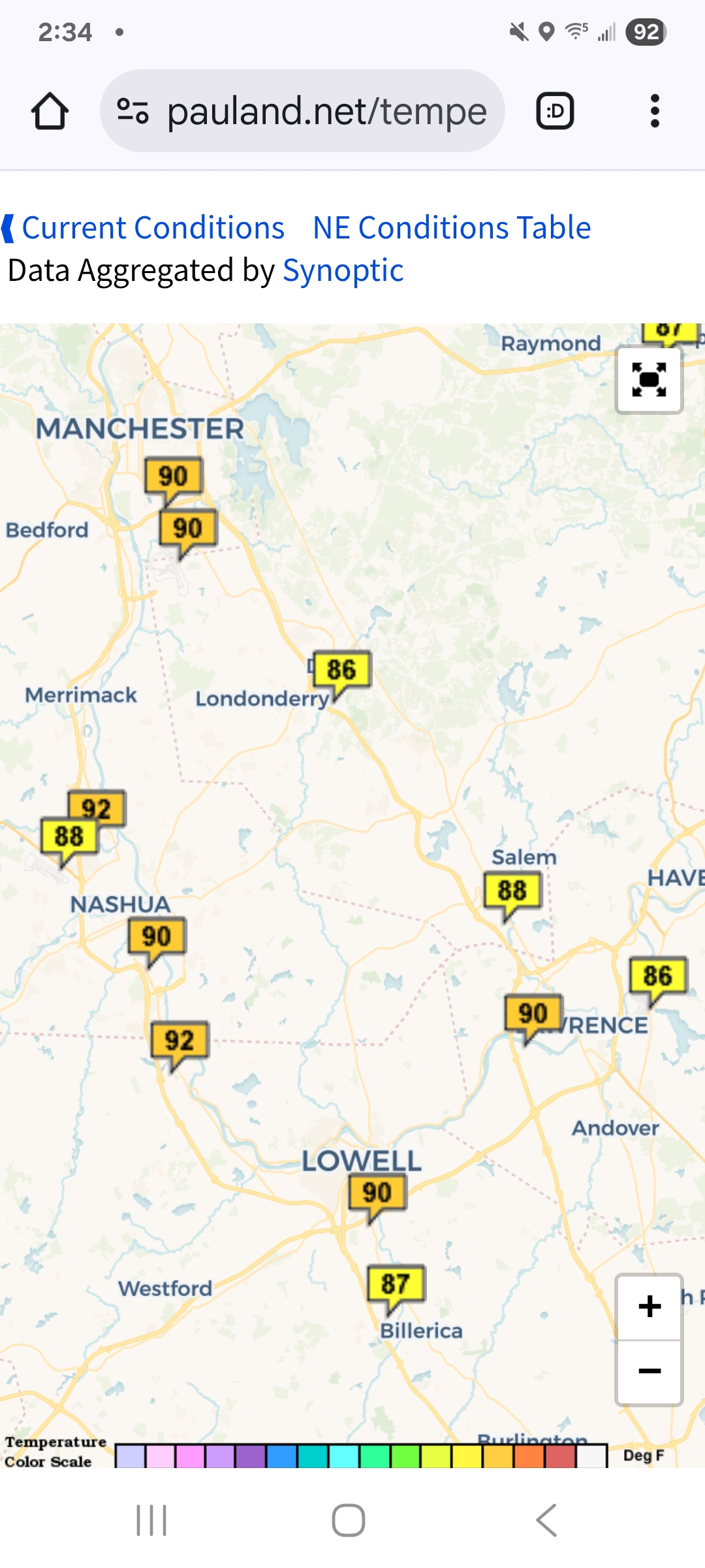
July 2025 Obs/Disco ... possible historic month for heat
Baroclinic Zone replied to Typhoon Tip's topic in New England
Summah has returned, 87/75 -

July 2025 Discussion-OBS - seasonable summer variability
winterwarlock replied to wdrag's topic in New York City Metro
89/78/101 -
THIS. My body has acclimated to the tropics. Running outside on Tuesday morning is going to feel like eating Heaven's spaghetti.
-

July 2025 Obs/Disco ... possible historic month for heat
kdxken replied to Typhoon Tip's topic in New England
Just another day in the MegaHot valley.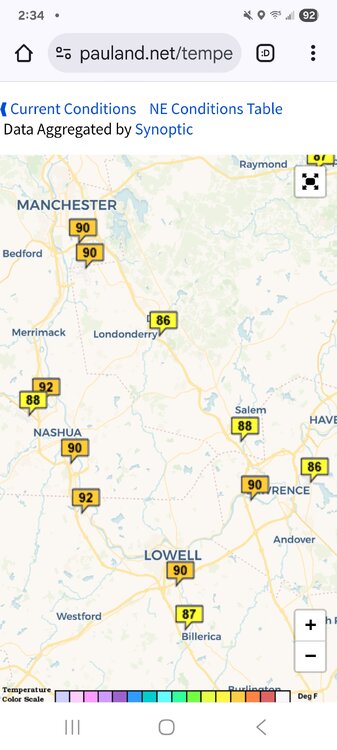
-

July 2025 Obs/Disco ... possible historic month for heat
Torch Tiger replied to Typhoon Tip's topic in New England
stay vigilant and safe. -

July 2025 Obs/Disco ... possible historic month for heat
moneypitmike replied to Typhoon Tip's topic in New England
I wish i had an anemometer here….we just had 15 minutes of howling winds come down the river from that.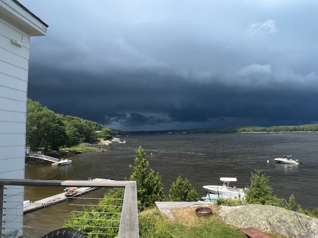
-
If you go to the end of Kemp Mill Shopping Center parking lot off Arcola and go to far end of it I’m very close to that
-
What cross street are you near on Sligo Creek.
-
July 2025 Obs/Disco ... possible historic month for heat
moneypitmike replied to Typhoon Tip's topic in New England
Jeffs storm is sliding just to my north.
-
The Catoctin Cloud Factory has been doing a pretty good job at keeping it partly sunny here today. Otherwise, another beautiful day. Not much aside from drizzle here yesterday, but I noticed the 270 Split Storm Magnet did really well again.
-
A 70F dewpoint feels like gd paradise.
-
July 2025 Obs/Disco ... possible historic month for heat
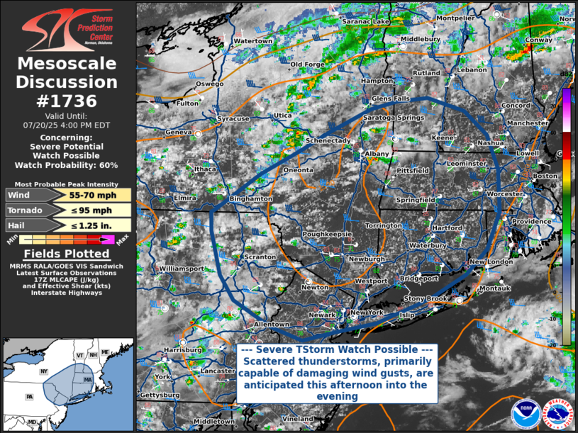
Torch Tiger replied to Typhoon Tip's topic in New England
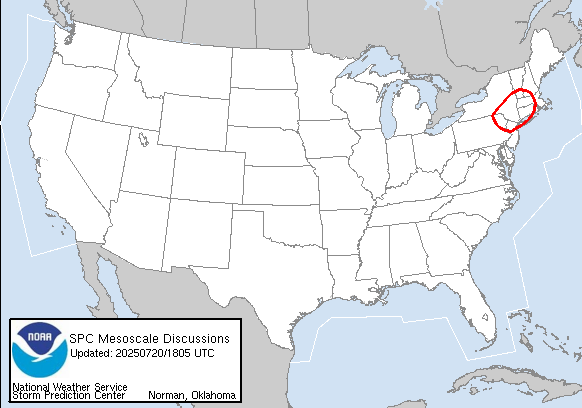
Probability of Watch Issuance...60 percent SUMMARY...Scattered severe thunderstorms, primarily capable of damaging wind gusts, are anticipated this afternoon and into the evening across portions of New England into eastern Pennsylvania, southern New York, and New Jersey. Though there is some uncertainty in the degree of convective organization and evolution, a severe thunderstorm watch could be warranted later this afternoon. DISCUSSION...Satellite and radar trends show convection developing across PA into NY in an environment characterized by moderate buoyancy (~1000-1500 J/kg MLCAPE) and strong deep-layer shear (40-45 kt 0-6km). Though deep convection has yet to form, it is anticipated that as daytime heating and mixing continues, the environment will support strong, organized thunderstorm updrafts. Given long, straight hodographs and appreciable 0-1 km lapse rates approaching 8 C/km, along with seasonably high precipitable water content approaching 2.00 inches, the primary threat will be for damaging straight-line winds of 55-70 MPH within thunderstorm downdrafts. Hail or a brief tornado cannot be ruled out with any stronger, isolated organized convection that occurs, though low-level shear and mid-level lapse rates do not suggest that they are likely at this time. -

July 2025 Obs/Disco ... possible historic month for heat
Typhoon Tip replied to Typhoon Tip's topic in New England
-

July 2025 Obs/Disco ... possible historic month for heat
HoarfrostHubb replied to Typhoon Tip's topic in New England
Heading to Bernardston in a bit. Prob hit the brewery around 4 -

July 2025 Obs/Disco ... possible historic month for heat
ineedsnow replied to Typhoon Tip's topic in New England
-
.thumb.png.4150b06c63a21f61052e47a612bf1818.png)
July 2025 Obs/Disco ... possible historic month for heat
HIPPYVALLEY replied to Typhoon Tip's topic in New England
i’m sure the few cells popping south of Albany will get shredded coming through the Berkshires. -

July 2025 Obs/Disco ... possible historic month for heat
rclab replied to Typhoon Tip's topic in New England
Perhaps a name change to NYC Sanctuary forum might be needed. As always …… -
Sligo creek about 450 feet from me came out of its 6-7’ banks and flooded up to 300 feet away on the level ground side, I’m at elevation, to a depth of 2-3’ right at the bank and up to 300 feet away was 6-12” deep. Last time anything like this leither 2006 or 07 just can’t remember which
-

July 2025 Obs/Disco ... possible historic month for heat
Lava Rock replied to Typhoon Tip's topic in New England
Waiting to light it up at the marina Sent from my SM-S921U using Tapatalk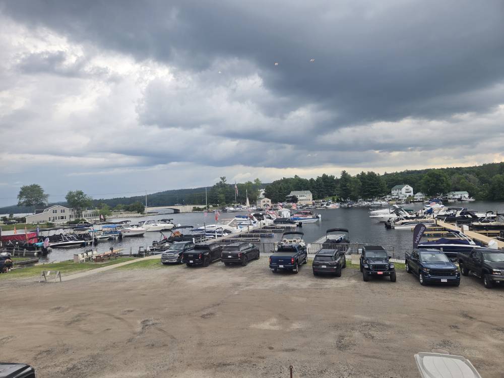
- Today
-
FML... Don't know whether to , , or
-
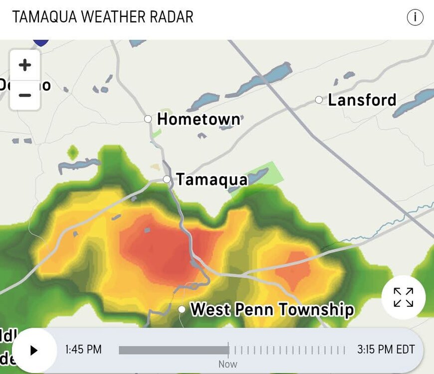
The heavy rain went around me this morning, so I only got 0.25". This weekend's two MCSs only produced 1.18" here, which is a bit disappointing.
-

July 2025 Obs/Disco ... possible historic month for heat
weatherwiz replied to Typhoon Tip's topic in New England
NESN is pricing itself out. I think Xfinity dropped them in Connecticut. I have to use stupid streaming sites when I watch the Bruins or want to watch the Red Sox (though I mostly just follow game day for the Sox). NESN360 is $30/month what an absolute ripoff. -
Occasional Thoughts on Climate Change
Typhoon Tip replied to donsutherland1's topic in Climate Change
Very good 'plain English' written article containing veracious principles of Meteorology and climate, from (surprisingly) CNN source: https://www.cnn.com/2025/07/20/climate/summer-of-flooding -
July 2025 Obs/Disco ... possible historic month for heat
weatherwiz replied to Typhoon Tip's topic in New England
Should be getting an MCD soon I would think