All Activity
- Past hour
-
31 already .... forecast says 22 for tonight's low.
-
We rarely miss a storm to the south. However, last winter it was suppression city around here. I don't think anyone realized the magnitude of last year's big gulf coast storm. Some locations along the gulf coast got more snow in that one storm than the last 100 years of snowfall combined. Think about all those snowless winters before 2025. That's more impressive than folks want to admit. It set all-time records for cold and snow in many places. I would not call last winter average when looking at the south/southeast as a whole. If we would have had just a little SE ridging... western NC would have been buried instead of coastal areas. Then everybody around here would have talked about it being an A+ winter. Guess it all about perspective.
-
Fredluchsinger started following December Medium/Long Range Discussion
-

December 2025 Short/Medium Range Forecast Thread
Daniel Boone replied to John1122's topic in Tennessee Valley
Yeah, it's a slap in the face when you see an LP to our South and we get Rain. -
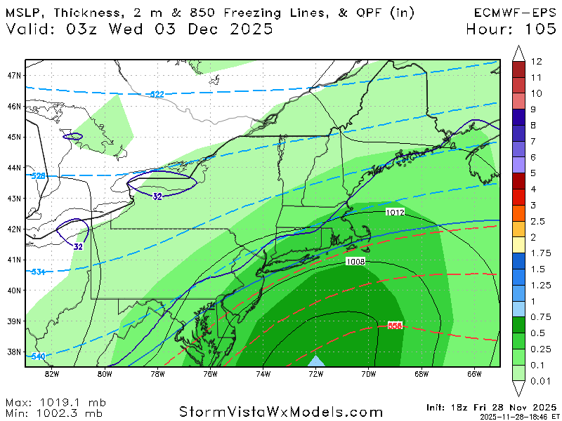
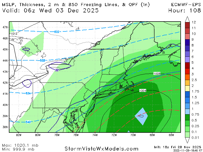
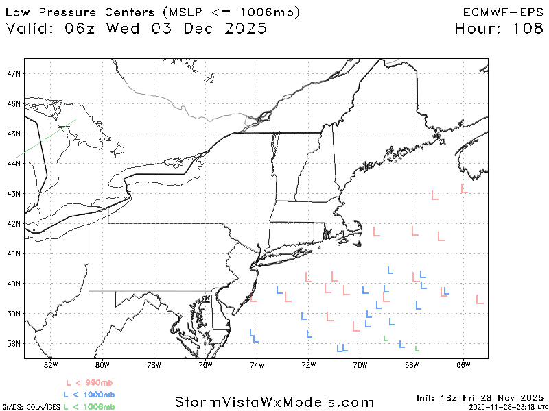
The GFS has mixing issues in areas that are north of the steady precip. shield on the ECM. Contrarily, the 12z EPS is west of the 18z GEFS with the precip. sheild. If you believe in the predictive value of ensembles you might think the GFS will shift south in future cycles. We're still 3.5 days out, so inter-model variability is expected. It will be interesting to see how this plays out.
-
The new moneypit we just bought (1820) has sill plate repair/replace as job #1 as soon as we close on it.
-
Typical for 4 days out.
-
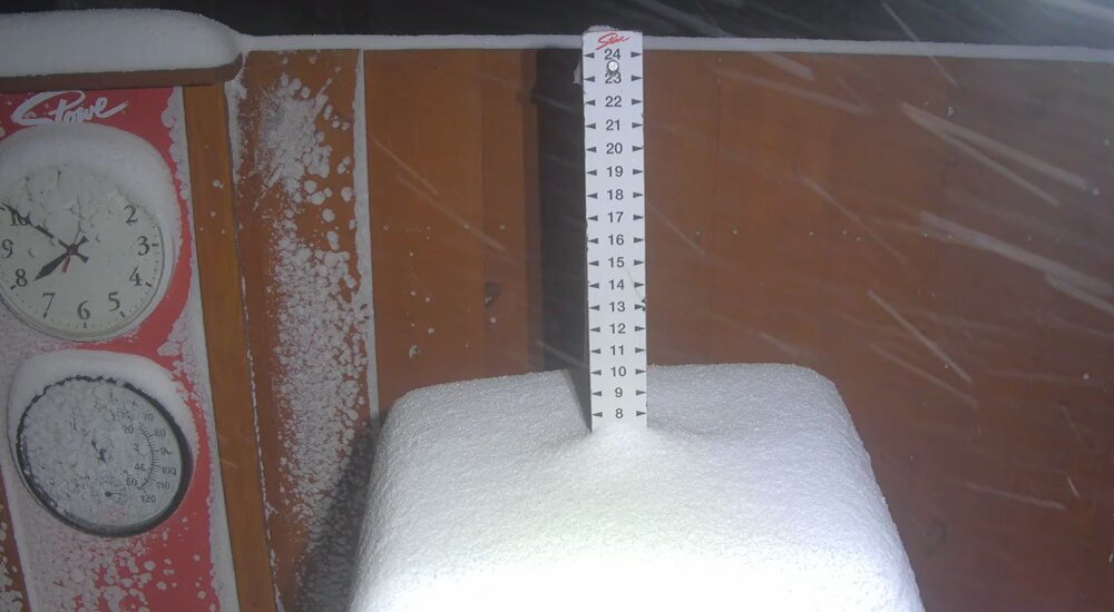
11.5" looks to be storm total here. HRR definitely did well. Impressive start to the season with 18" in November. Have to go back to 2014 for the last time I recorded more for November.
-
Nov 28-30th Post Turkey Day Winter Storm
DocATL replied to Chicago Storm's topic in Lakes/Ohio Valley
Wow never would have guessed that. I’m a Bucs fan so I know the Falcons well. We stink too [emoji2375] . -
Still cranking away. Storm total is what's on the stack plus 1-1.5" that was there between 5-6am before the board flipped. The base area probably is only an inch behind or so.
-

First Winter Storm to kickoff 2025-26 Winter season
moneypitmike replied to Baroclinic Zone's topic in New England
I just watched The American Revolution. The Euro caved. -
The ECM is a strange solution. Its precip. field is well southeast of the 12z EPS and the shortwave is less impressive than 12z, but it still rapidly deepens the SLP into the 970mbs near the benchmark. The ECM family and the GFS are not close. Much more overlap between the ensemble means.
-

First Winter Storm to kickoff 2025-26 Winter season
FXWX replied to Baroclinic Zone's topic in New England
Which has almost become the norm 4 to 5 days out. -
Fair enough. You can have my 8 I’ll take your 13.
-

Nov 28-30th Post Turkey Day Winter Storm
Chambana replied to Chicago Storm's topic in Lakes/Ohio Valley
all jokes aside, enjoy your storm! You all deserve the jackpot -
Man these models are just hilarious
-
Pittsburgh PA Fall 2025 Thread
Rd9108 replied to TheClimateChanger's topic in Upstate New York/Pennsylvania
Depends on the model you look at. GFS is on its own with its NW solution. Most of the models have the weaker and south solutions. It's a fine line if we want better snows. Regardless as of now it looks like tuesday has a high potential to give us pur first real accumulating snow. -

First Winter Storm to kickoff 2025-26 Winter season
George001 replied to Baroclinic Zone's topic in New England
18z gfs looks great for you -

Central PA Fall Discussions and Obs
anotherman replied to ChescoWx's topic in Upstate New York/Pennsylvania
HAHAHAHAHA -

Central PA Fall Discussions and Obs
WmsptWx replied to ChescoWx's topic in Upstate New York/Pennsylvania
This would make too much sense. Ridge and Valley screwzone. -

Pittsburgh PA Fall 2025 Thread
blackngoldrules replied to TheClimateChanger's topic in Upstate New York/Pennsylvania
We've learned over the years that the models almost always underdo that "WTOD" and we're on the edge right now. Sent from my SM-S931U using Tapatalk -

First Winter Storm to kickoff 2025-26 Winter season
WxWatcher007 replied to Baroclinic Zone's topic in New England
-

Nov 28-30th Post Turkey Day Winter Storm
Chambana replied to Chicago Storm's topic in Lakes/Ohio Valley
- 419 replies
-
- 12
-

-

-
Forecast is 28 tonight. Currently 33.4.
-
This secondary push of cold air is legit. Mesonet soil temperatures west of the suburbs are about to dip into the upper 30s.

