All Activity
- Past hour
-

Southern MD / Lower Eastern Shore weather discussion
AlexD1990 replied to PrinceFrederickWx's topic in Mid Atlantic
I think they're jealous of us and want to copy us Sent from my Pixel 9 Pro XL using Tapatalk -
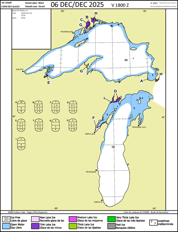
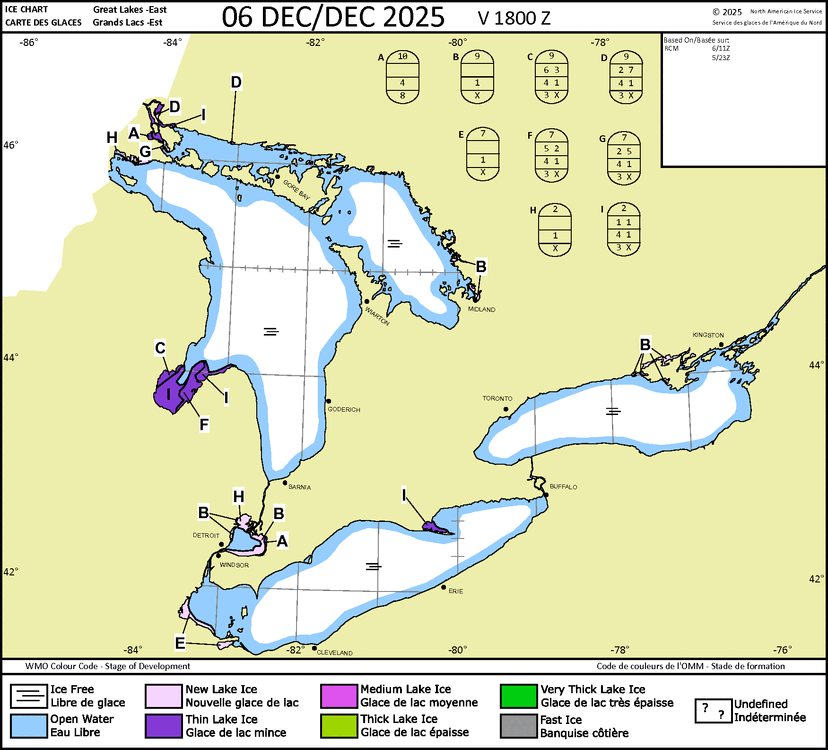
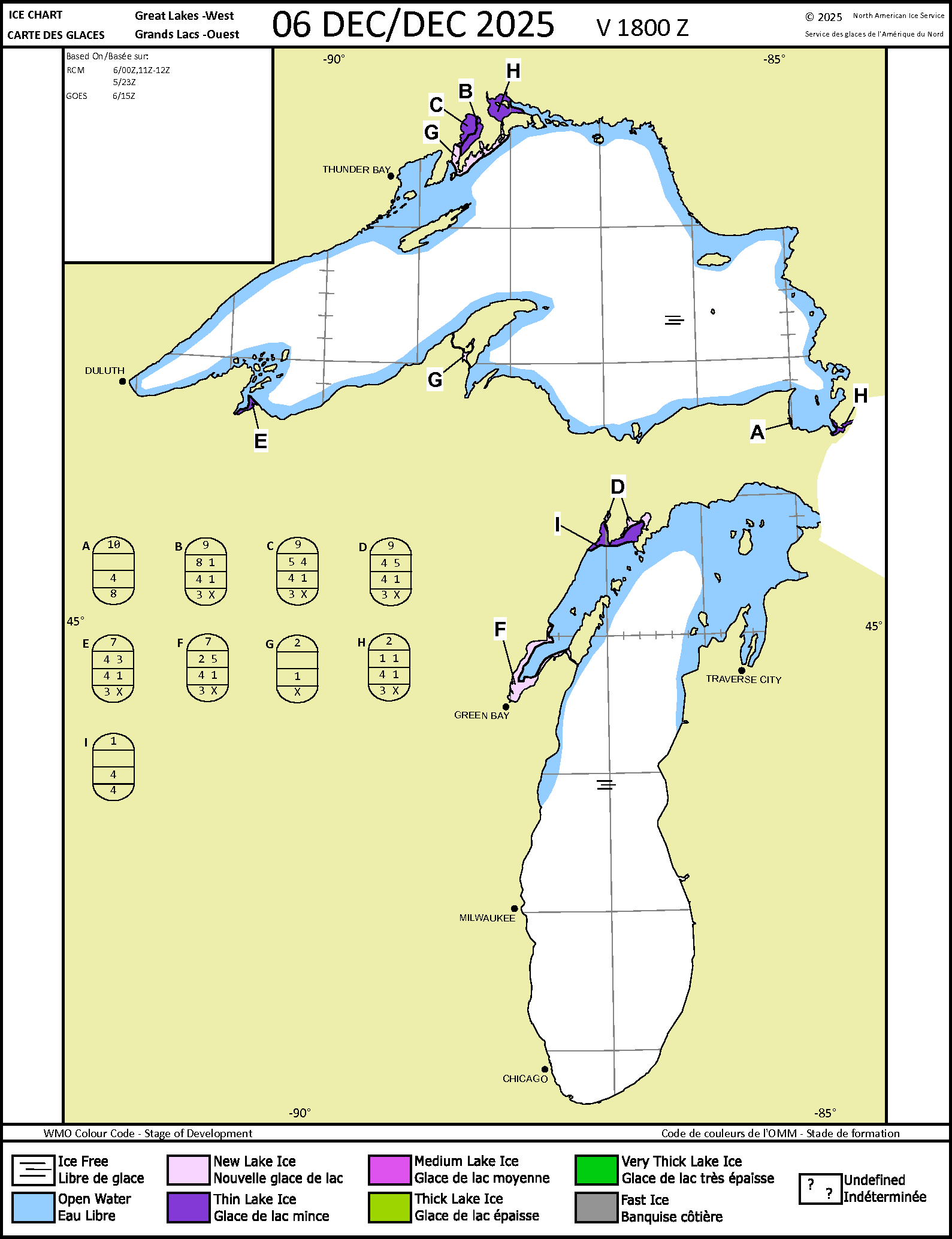
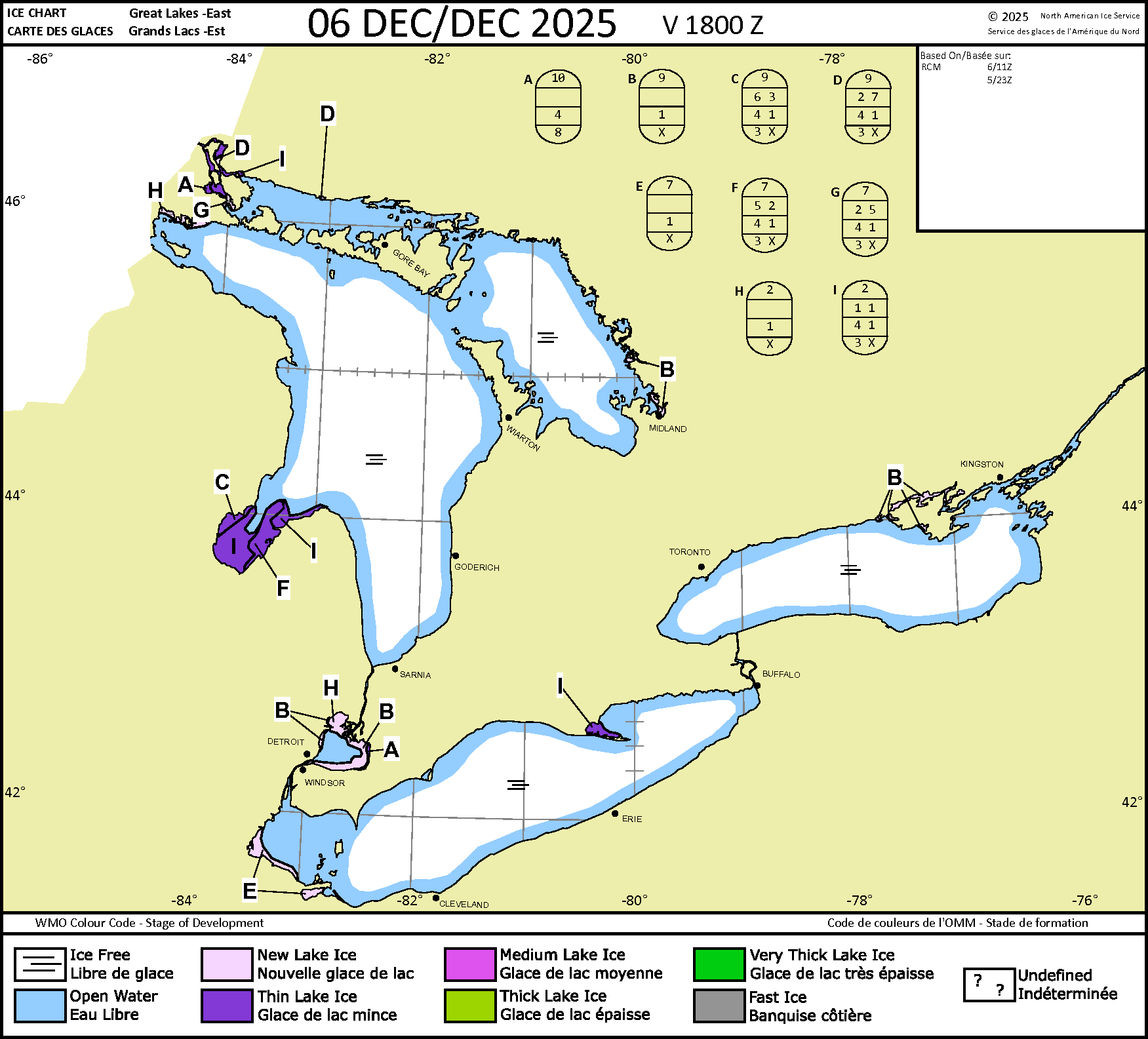
Ice quickly forming in the bays around the Lakes.
-
are you talking about your area in Northwest NJ or the entire NYC metro from Ocean County up to Ulster County in NY ?
-
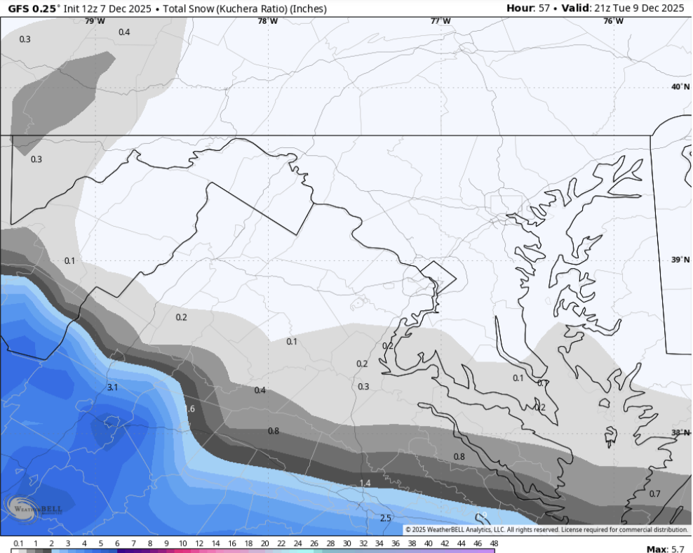
5.0" down
-

Dec 6-7th (It's not a clipper) Clipper
HillsdaleMIWeather replied to Chicago Storm's topic in Lakes/Ohio Valley
Looks like we're gonna end up closer to 2 to 4 than 1 to 2 here. -

E PA/NJ/DE Winter 2025-26 Obs/Discussion
Birds~69 replied to LVblizzard's topic in Philadelphia Region
Who said anything about wanting a big East Coast storm? I'll sure as hell take some clippers... -
Not gonna lie, it’s paltry, but .8” a few weeks before Christmas on a random Monday would still put me in a good mood.
-
Need better meridional flow. Ridge out west getting cut off at the top
-
06Z GFS giveth, 12Z GFS taketh away.
-

E PA/NJ/DE Winter 2025-26 Obs/Discussion
Ralph Wiggum replied to LVblizzard's topic in Philadelphia Region
Patience is sooo 2024. -
E PA/NJ/DE Winter 2025-26 Obs/Discussion
Ralph Wiggum replied to LVblizzard's topic in Philadelphia Region
NS is screaming! Maybe we can cash in on a good old fashioned Saskatchewan Screamer -
Next weekend feels like it's gonna hurt feelings more...it looks like the makings of a potential Miller Too Late storm that could give some in the northeast their first warning snowfall in awhile. But I could be wrong, though
-

Winter 2025-26 Short Range Discussion
Chicago Storm replied to SchaumburgStormer's topic in Lakes/Ohio Valley
-
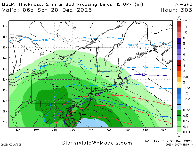
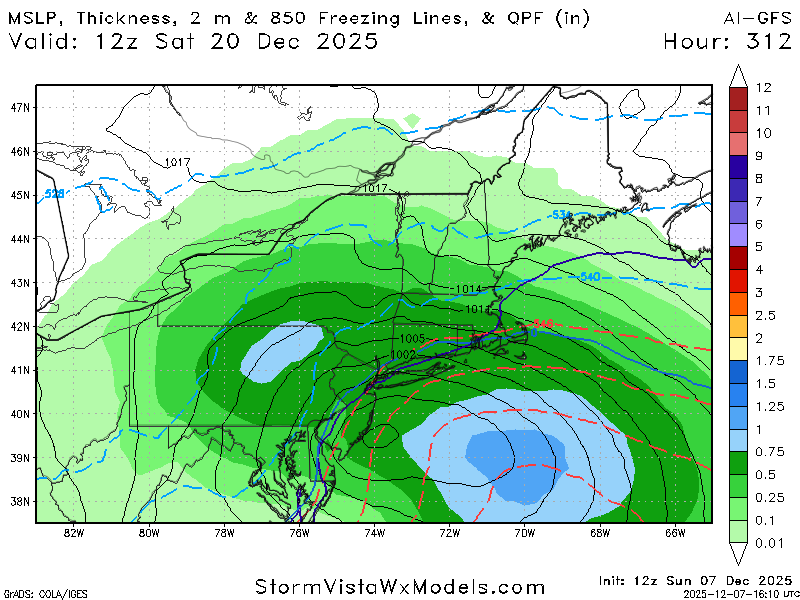
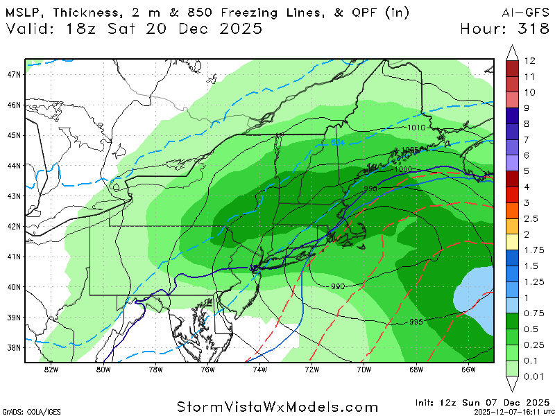
AI GFS
-
Current longer range guidance differs significantly as to what the pattern does just beyond mid-month. ECAI wants nothing to do with any kind of a notable moderation in temperatures. It keeps the cold locked and loaded through Christmas. Other guidance relaxes the cold but nothing suggests any kind of a Christmas torch this year. We'll see. Modeled forecasts of warm ups have been either wrong or muted for the most part since back in October. Snowfall prospects much more uncertain but I'd favor persistence and lean toward possible light clipper / frontal passage events. Don't see any solid evidence at this point in the longer range of anything major 4-8"+. In general I'd favor overall below normal precipitation for the next 7-10 days. Colder and generally dry pattern looks to dominate.
-
Winter 2025-26 Short Range Discussion
Chicago Storm replied to SchaumburgStormer's topic in Lakes/Ohio Valley
-
This is how we roll around these parts. Frustrating, for sure, but it is just the way it tends to be. I suspect that in the middle of the frustration, another, little, surprise event will start to materialize. If not, we go back to chasing pink unicorns in the future. C'est la vie.
-

December 2025 Short/Medium Range Forecast Thread
Daniel Boone replied to John1122's topic in Tennessee Valley
Yep. Snow on snow up that way. -
29.5 with lots of ice around on trees! .
-
Miss one south , then north. Next Fridays clipper has evaporated. Fun times
-

December 2025 regional war/obs/disco thread
DavisStraight replied to Torch Tiger's topic in New England
Usually rain. Looks like a snow game in Buffalo. -
FWIW the 12z GFS a jump north compared to 6z GFS

-
If we have high pressure in place to lock in the cold, everything is suppressed. When the high pressure recedes we get 34 degrees and rain. Dc metro is just brutal for snow lovers. .
-

2025-2026 Fall/Winter Mountain Thread
Maggie Valley Steve replied to Buckethead's topic in Southeastern States
The 12Z GFS solution is coming in with a nice hit..thumb.png.f5a7ed74dd26bbc7821c5a72f1d6d0fd.png)
-

December 2025 regional war/obs/disco thread
WxWatcher007 replied to Torch Tiger's topic in New England
Someone years ago, maybe @donsutherland1, ran an analysis and there’s actually higher precipitation around Dec 25 than other parts of the month.


.png.d2823165dddbb7e42894683ae76f38a9.png)
