All Activity
- Past hour
-
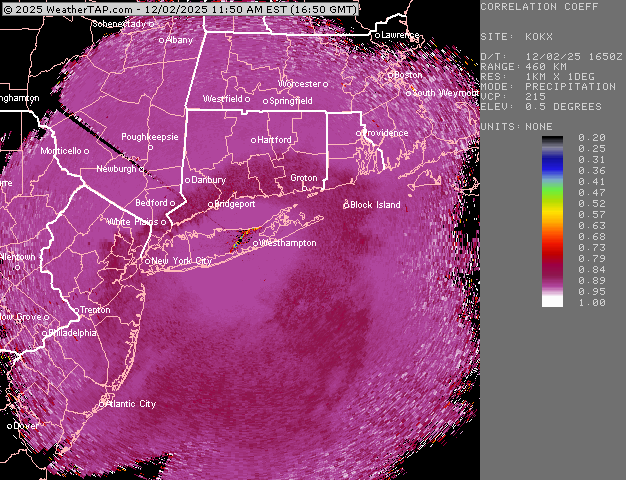
The coastal front is well offshore from where you are . I could see it on radar.
-
1.75 LFG!!
-
If the models are right, there’s gonna be a pretty good surge of milder air just off the deck moving north west over the next few hours. We’ll see how that goes. Hopefully it doesn’t go too far Northwest.
-
Just looked at the HRRR......it's not showing taint (or at least very little). Meanwhile, it shows it ripping here from 4:00 - 10:00. Bring it.
-

Let’s talk winter!! Ohio and surrounding states!! 24'-25'
vespasian70 replied to buckeye's topic in Lakes/Ohio Valley
Ended up with 5" here in Newark. Not bad for the first snow. -
25° 1.5” https://i.imgur.com/Fi6XfeL.mp4
-

First Winter Storm to kickoff 2025-26 Winter season
Brewbeer replied to Baroclinic Zone's topic in New England
29/27 here, about an inch or so on the ground, good snow growth -
As Scott explained….more land to cover to get west in these set ups…, still all frozen mixed precip here.
-
MJO still in 7. Nice try though .
-
This morning my p/c forecast was for 1-3" for the daytime. It's now calling for 3-5" this afternoon. FTW. It still shows a rain mix though. 27*
-
Followed by a spin off of the spin off called "Kuchera In The House"
-

December 2025 regional war/obs/disco thread
TauntonBlizzard2013 replied to Torch Tiger's topic in New England
Canadian has a very weak Norlun trough over eastern ma Saturday. Rain and snow showers. Get excited -
Hrrr might be a tad too cool on the ptype this run based on the obs.
-
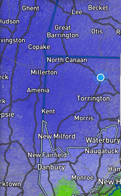
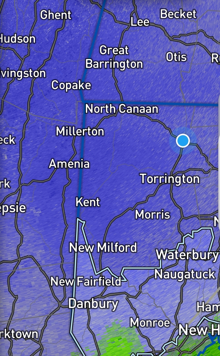
Yeah there’s def longitude component, but also the radar can’t see it beyond a certain distance.Too far away to show up in CT. But it’s there on the OKX radar. But even that radar is prob too far away to show it in northern CT…when it’s lower level warmth punching in and not up at 750-800mb, it’s harder for the radar to see it from far away
-
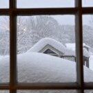
2.2” and still falling. note: I did not measure in the grass. I was also kicking snow around trying to find a ball.
-
26.7° and moderate to almost heavy snow, no mixing yet, wind starting to pick up a little from the NE. Mountain Road at the East Hartland Granby line is closed, 3 inches total snow so far
-
Longitude FTW
-
Fwiw ...the last 1/2 hour we went from no wind/dead calm to a NNE motion. Ageo may be an issue in the headache spectrum
-
24.2F Light snow. Vis est 3/4 mile. About 2" new
-
Temp pinned at 29.8.....S- with subpar growth. Eyeballing maybe an inch?
-
What a sharp gradient. Lol
-
They need to make a spin-off called "That's So Nina"
-
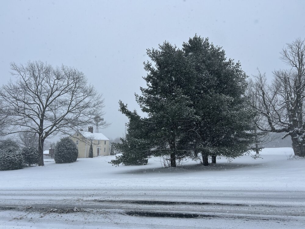
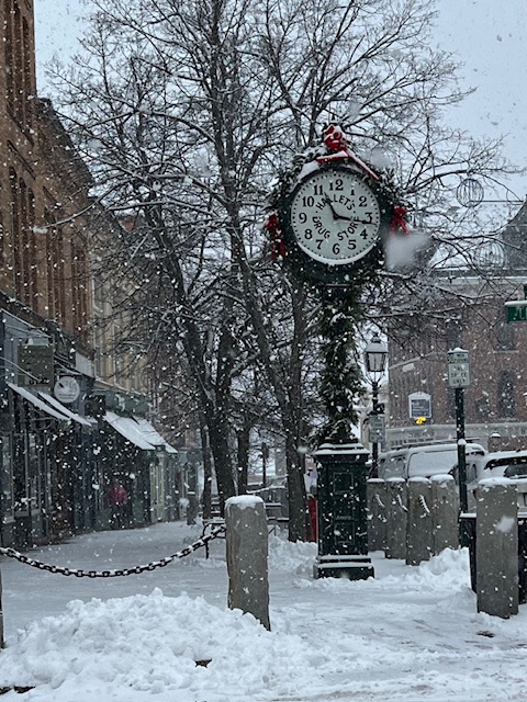
Front Street : Exhibit A dremonstrating the power of the December 2 sun angle.
-
 There was no mixed precip here in Garwood (central Union County NJ), not even at the onset. Steady light to moderate rain. Would have been nice to see a few mood flakes, no doubt there was some just a few miles to my west. At least it was something to track. On to the next "threat"...
 -
some heavier echoes moving in, if we don't flip here I see no reason we can't get to 6, only WWA here but warning just over the border to my north, maybe ALY will upgrade, or is it too late in the game for that? I'm over halfway to verifying here.