All Activity
- Past hour
-

Dec 6-7th (It's not a clipper) Clipper
hawkeye_wx replied to Chicago Storm's topic in Lakes/Ohio Valley
Another inch in the last hour, now up to 4". -

Dec 6-7th (It's not a clipper) Clipper
Radtechwxman replied to Chicago Storm's topic in Lakes/Ohio Valley
Sleet/freezing rain/snow mixture here. Gunna b buried -

Central PA Fall Discussions and Obs
Itstrainingtime replied to ChescoWx's topic in Upstate New York/Pennsylvania
Congratulations Hoosier nation. What a monkey removed from their backs. 58 years in the making. -

December 2025 regional war/obs/disco thread
WinterWolf replied to Torch Tiger's topic in New England
What would be awesome, would be less posting from you. -
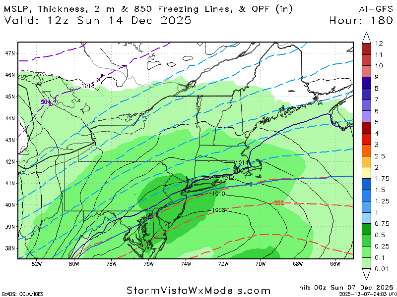
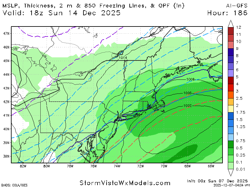
Hard to believe the GFS is not exactly the same eight days out as it was the last run
-
0z CMC fairly robust as well.
-
I tried analyzing how those like 15 NS interactions would impact a downstream storm and all I could gleam was this:
-
-
While the ridge is a bit diminished I think its more so the NS is just completely different around hours 105 which I don't think helps us out.
-
H5 for the follow up got worse unfortunately. Flatter out west
-
GFS has a little something sliding through on the 12th. Weird accum distribution..but like an inch or two
-

Dec 6-7th (It's not a clipper) Clipper
cyclone77 replied to Chicago Storm's topic in Lakes/Ohio Valley
Took awhile but it's pouring pretty nicely now, smallish flakes. Looks like a half inch or so. -
So what I'm hearing is that I'm the Curry of HRRR extrapolations? Should put that on the wall and in my signature tbh
-

Mid to long range discussion- 2025
Leesville Wx Hawk replied to wncsnow's topic in Southeastern States
I wouldn’t worry about GFS losing some precipitation with NAM looking better. . -
New Bern, NC is south coastal NC. That is a terrible place to think it will snow.
-

Dec 6-7th (It's not a clipper) Clipper
McHenrySnow replied to Chicago Storm's topic in Lakes/Ohio Valley
It has begun. -

Dec 6-7th (It's not a clipper) Clipper
ChiTownSnow replied to Chicago Storm's topic in Lakes/Ohio Valley
https://share.google/images/oTxqIFSNUIUIbTdRX -
Freenzing fog, 28.9.
-
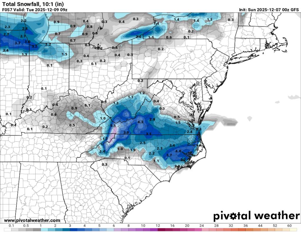
Its similar slightly less QPF western areas.
.thumb.png.ac8fff888971d9e3a65506409f8adcbe.png)
.thumb.png.f06957be679b2208fbcd3d5532f9beff.png)
-
Mid to long range discussion- 2025
Leesville Wx Hawk replied to wncsnow's topic in Southeastern States
Looks similar to previous run to me. . -
curry would make this tho
-
Not bad. I was hoping for it to continue increasing amounts. It was a slight decrease but similar overall
-
This looks to be a northern mountain special amd points eastward. Sent from my SM-G998U using Tapatalk

-
Still a solid run for sure!
-
What Nam?


.png.40752bb60eb50ca2a16d9a205a71600e.png)
.png.c16941f7f6463ddca428648056a88c5c.png)