All Activity
- Today
-
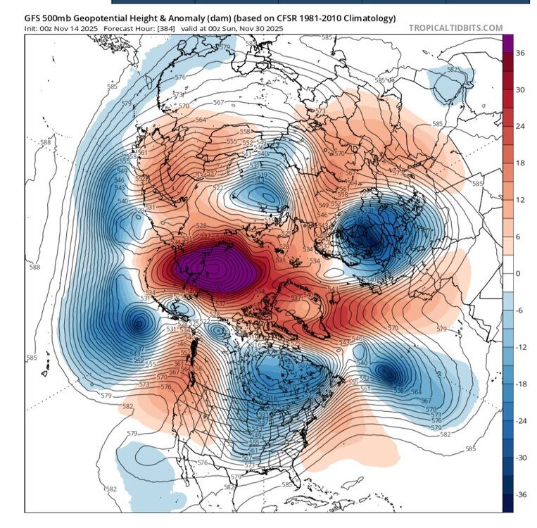
WB latest GEFS control, a magical early December to remember....

-

November 2025 general discussions and probable topic derailings ...
ineedsnow replied to Typhoon Tip's topic in New England
more moderate for about 5 minutes.. went from rain to a mix quick with fat flakes mixed in.. then to snow briefly before going back to a mix.. -
Its pouring heavy, super wet snow in Mammoth, but the damn temperature is 36 degrees. It's snow tv only. It's basically Washington DC in the Sierras tonight folks. This storm is a total FAIL !
-
Hope springs eternal ……. And then ……. as always ……

-
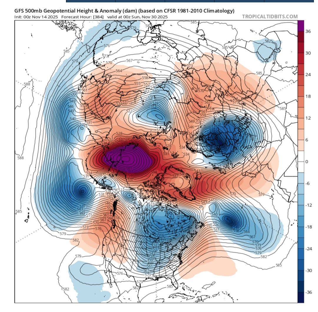
0z GFS, end of month PAC to Atlantic HLT blocking
-
Should have said we'll know more by next week.But some of social media especially on X make it sound like the apocalypse is coming.We're gonna fall -800C below normal,snow drifts as tall as the empire state building,we're all gonna die.Like there hasnt been a SSWE before.
-
His subscriptions should be fading....he said it twice.
-
Keep it in your pants...for now-
-
Yea he got that wrong
-

2025-2026 ENSO
40/70 Benchmark replied to 40/70 Benchmark's topic in Weather Forecasting and Discussion
I had the second week of December as go-time in terms of snow for my area given analogs...still feel that way. It will be a slower than expected progression of the cold to the east given the RNA. -
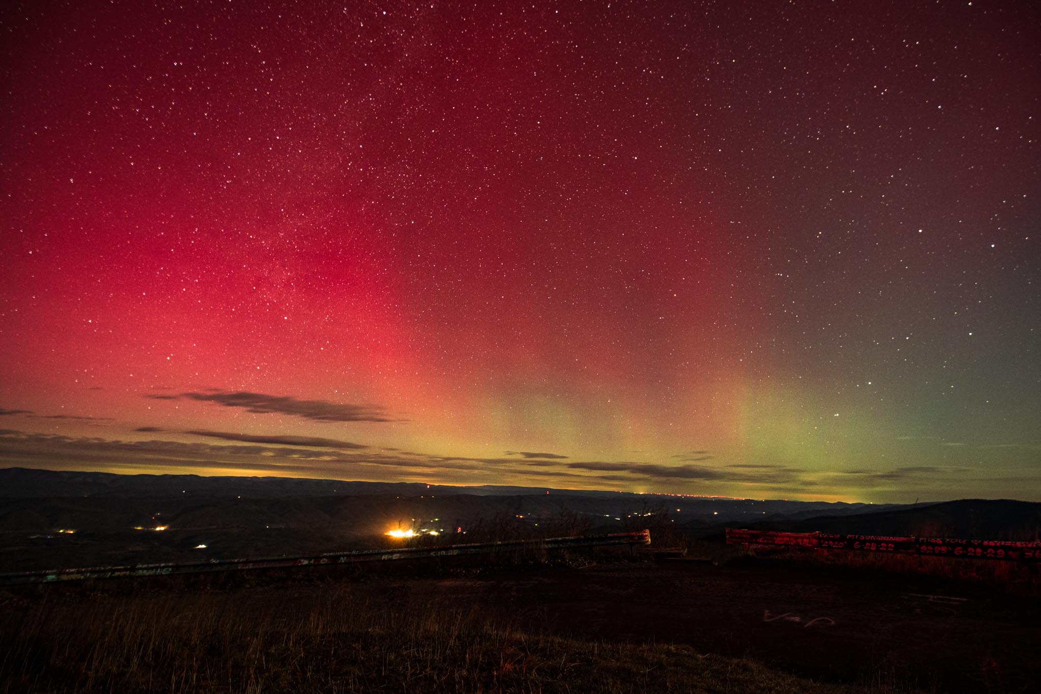
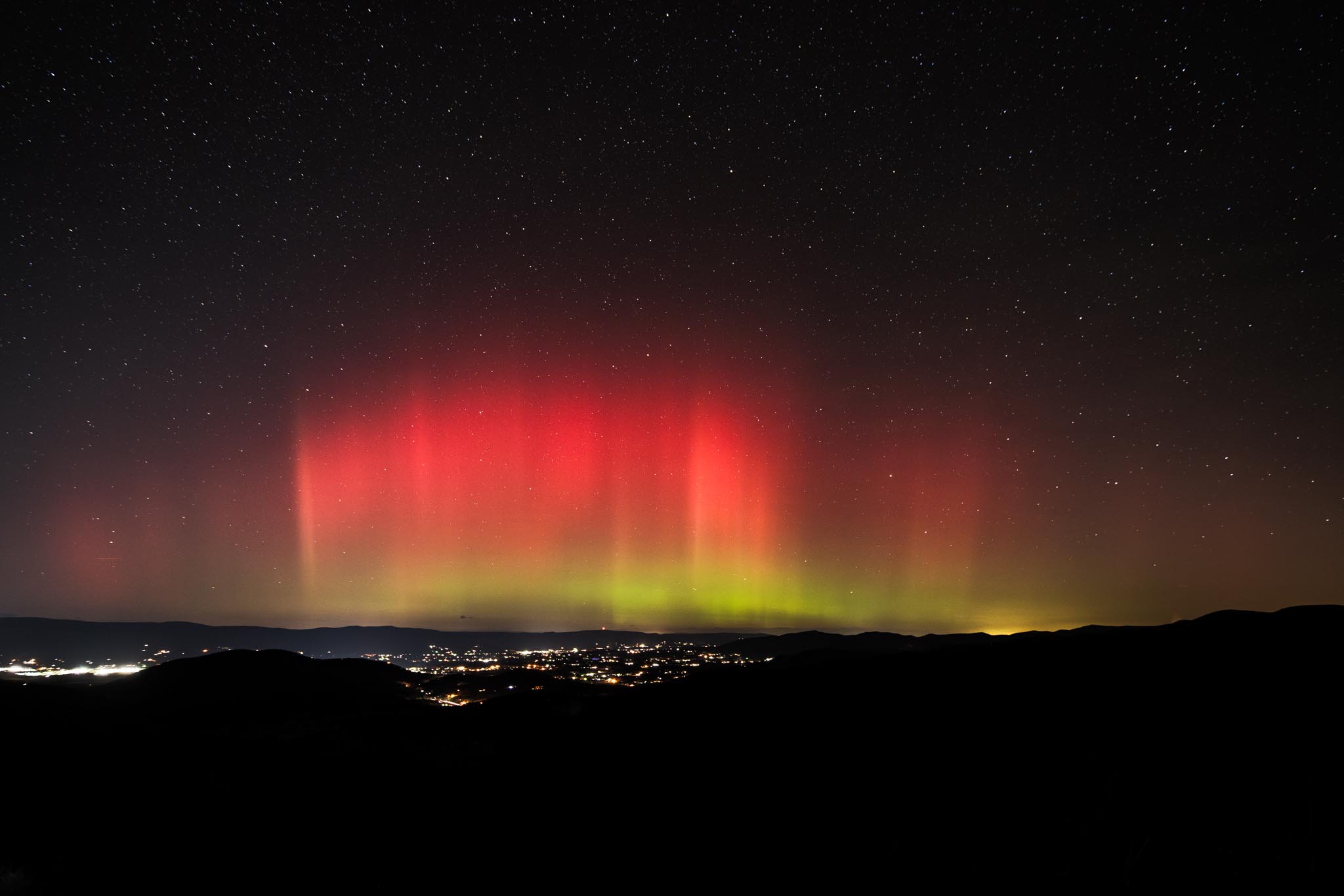
Cross posting to banter since I doubt many people are still looking at the aurora thread (till next storm at least). That said, next storm if anyone would want to meetup at Reddish Knob, Sandy Bottom overlook (Shenandoah) or Spruce Knob Dm me when the time comes.


-
Edited results of the past two days!
-
2025-2026 ENSO
40/70 Benchmark replied to 40/70 Benchmark's topic in Weather Forecasting and Discussion
Far, far too much. -
2025-2026 ENSO
40/70 Benchmark replied to 40/70 Benchmark's topic in Weather Forecasting and Discussion
I still don't buy the reversal. -
2025-2026 ENSO
40/70 Benchmark replied to 40/70 Benchmark's topic in Weather Forecasting and Discussion
He seems like a tool-bag to me....like the Direct Weather bafoon. -

2025-2026 ENSO
Daniel Boone replied to 40/70 Benchmark's topic in Weather Forecasting and Discussion
MJO projected to crawl through P7 first week of December. Looks like Model's picking up in that. -
You beat me to it Jax. Lol. Yeah, looks minor but does appear to be one from what I've gathered. Either way, should keep the PV in a weak State for awhile. As you said, we'll know by next week for sure.
-

November 2025 general discussions and probable topic derailings ...
Ginx snewx replied to Typhoon Tip's topic in New England
Triggering some. Gorgeous -
There's been multiple times IWX or GRR could have issued one and just didn't and did Special Weather Statements instead
-

E PA/NJ/DE Autumn 2025 Obs/Discussion
RedSky replied to PhiEaglesfan712's topic in Philadelphia Region
Yeah I better pull back -
You have to have warming with the wind reversal to be a major SSWE,right now it just seems to be a minor,but thats to early to tell,Euro only shows the wind reversal lasting just a couple days.We'll find out soon enough,next week.
-
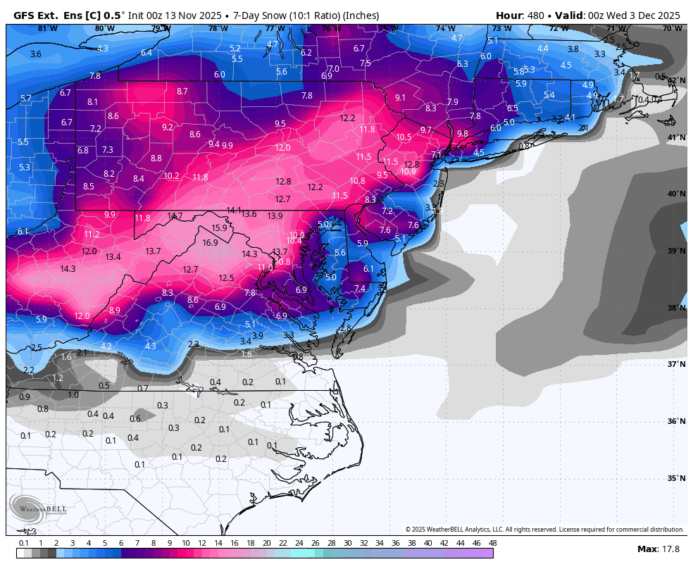
BWI: 17.3” DCA: 12.6” IAD: 20.5” RIC: 5.1” LYH: 6.2”
-
Temp down to 36 at Mammoth. Precip is steady moderate to heavy and appears to have gone over to ALL snow. Still no stickage. Still rain at Village level. Temp now at 35 degrees. Even with no lighting, snow can just be made out falling pretty good up at Mc Coy Station at 9,600 feet. It is likely all snow now at Main Lodge. It is really coming down in the lights there but still no stickage yet, no preconsolidation of any kind as of yet - 7.40pm PST (9.40pm CST in Texas). The surface reflectivity is changing. This is another way of saying that I am seeing it get slushy on the top of the roof of the Main Lodge, and that I no longer can see the puddles of water on the ground either, and the reflectivity there which has been marked with the rainfall as of late ---- is changing quite a bit. This is probably because of the start of slushiness from falling snow, something I refer to as 'preconsolidation' and it is building up. https://www.mammothmountain.com/on-the-mountain/mammoth-webcam/main-lodge
-

November 2025 general discussions and probable topic derailings ...
alex replied to Typhoon Tip's topic in New England
Must have gotten another 4-5 inches since this afternoon. Relentless. One of the best upslope events in a while.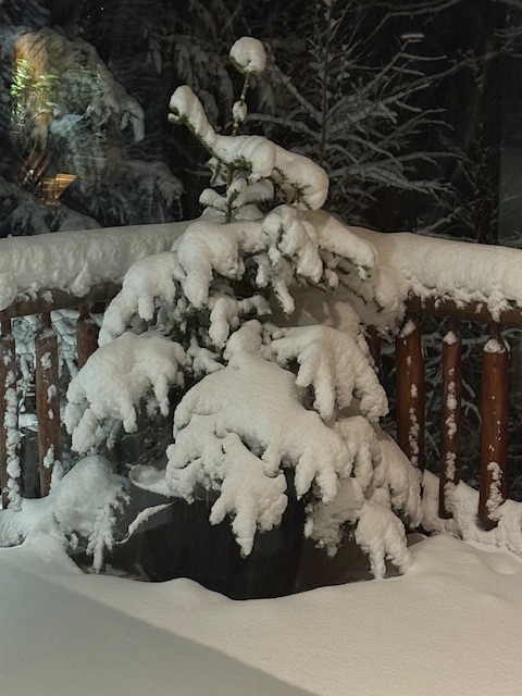
-
 Dude... You're like a windstorm.... Your predictions blow in every direction. You should look back on all your posts, especially during the Winter months.