All Activity
- Past hour
-
3.56 now. Drizzle all day
-
More Below Temps on the way ?
-
Much of NW Suffolk closing in on 3".
-
You don't see this usually in late May. Saturday’s high temp of 58° is the coldest high temp on record for May 23rd in Greensboro
-
Not burned but some spots crispy. Been nice rains this aftn.
-
this a historic storm, is it not?
-
If that happens then we COULD go from drought to excessive rainfall in just a few weeks.
-
There is no chance any lawns are burned anywhere in SE MA. It’s May and even with less rain there’s been enough for green
-
Mine is good, watered once and just enough rain.
-
Post pics !
-
Lawns crispy here.
-

2026 Spring/Summer Mountain Thread
Maggie Valley Steve replied to Buckethead's topic in Southeastern States
The models are suggesting a rather sharp trough axis will develop in Texas and extend down to the Yucatan later this week into next weekend. It's not unusual this time of year to see a broad area of low pressure to fester near the Western Caribbean and Western to Central Gulf in such a setup. I wouldn't be surprised to see copious deep tropical moisture setup over all the SE including the Mountains. We'll need to monitor early this week for any potential tropical mischief attempting to organize W of Florida later this week. -
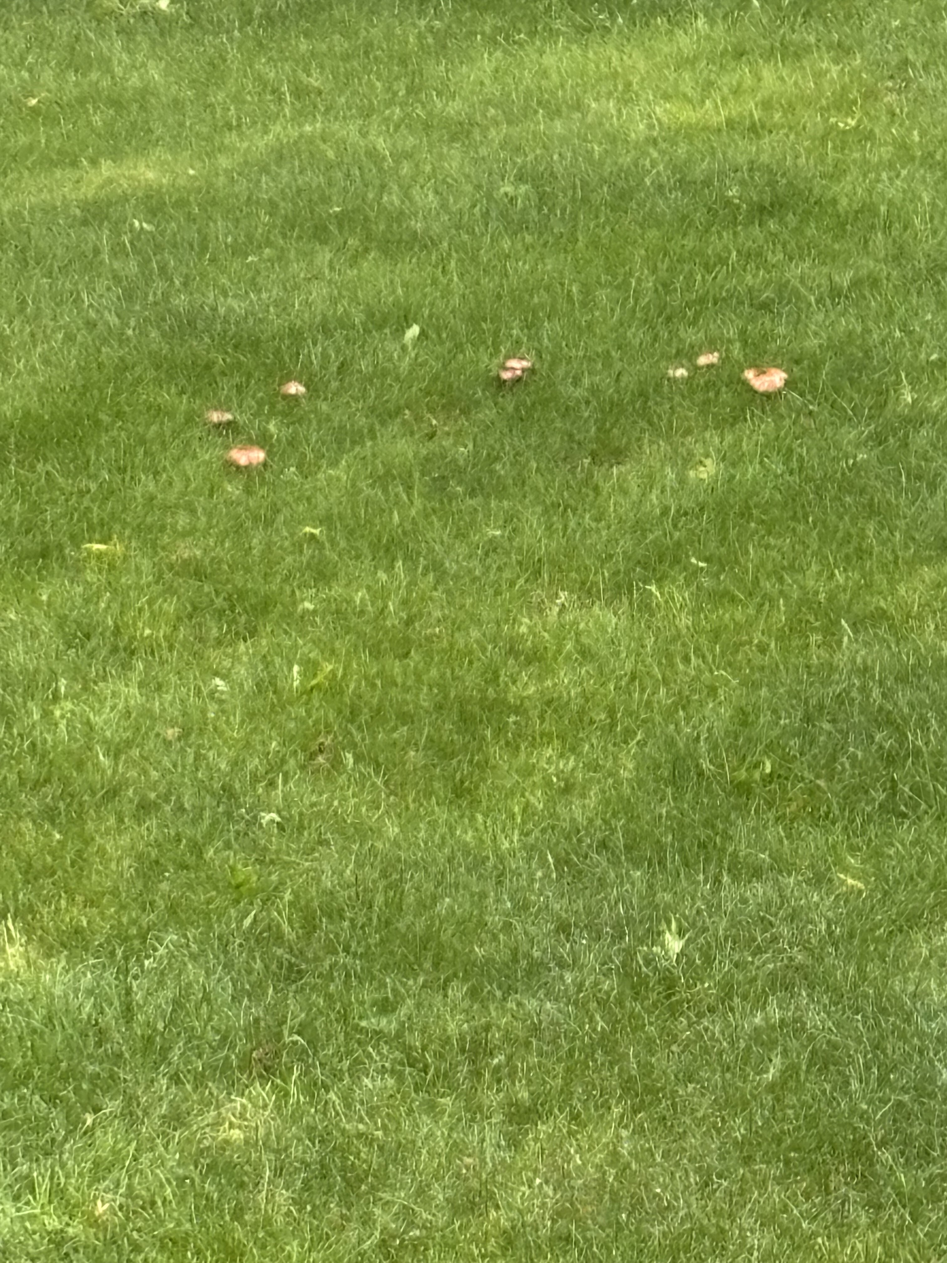
Mushrooms growing ftl. Very early for that . Usually a humid summer thing . Please dry out

-
4.12” just this month here .. and I missed an event with a pollen clogged sensor
-
Stein is dead and buried here…this f’n rain just won’t stop... It’s relentless. pissing me off now.
-
S Wey is at .25 so far with several more hours to go . Then round 2 tomorrow. Let’s see where you her up but over 1/2” is likely
-

E PA/NJ/DE Spring 2026 Obs/Discussion
RedSky replied to PhiEaglesfan712's topic in Philadelphia Region
Very octoberish day 57F high -
Sprinklers out Tuesday.
-
Speak for yourself
-
Our son played around 3 of his disc golf tournament in RI today in this stuff. he still finished second overall. Not bad
- Today
-
There goes the warning drought. Pretty robust rotation but it’s broad.
-
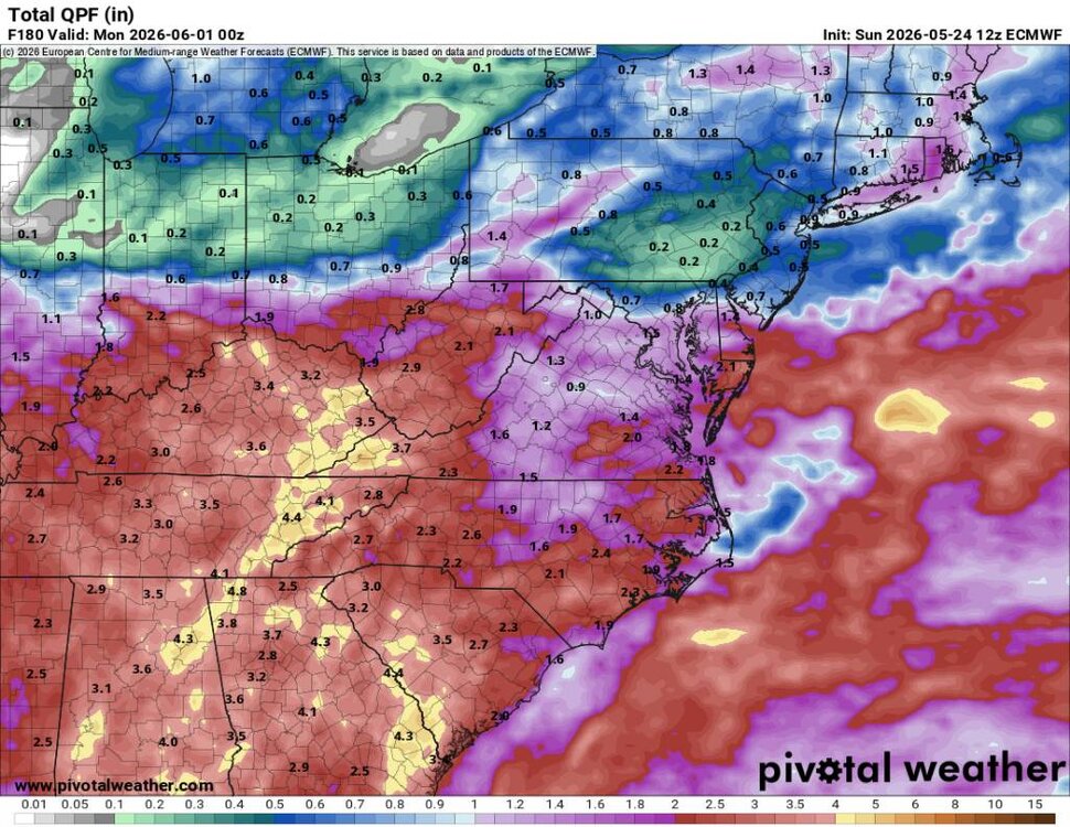
This looks amazing from the Euro. Keep that moisture transport coming. Sent from my SM-G998U using Tapatalk
-

E PA/NJ/DE Spring 2026 Obs/Discussion
Albedoman replied to PhiEaglesfan712's topic in Philadelphia Region
Recent rainfall across portions of the Lehigh Valley, including approximately 1.40 inches at my location, was certainly beneficial for vegetation, lawns, crops, and surface soil moisture. However, despite this rainfall, stream base flows continue to decline rapidly, indicating that the region is still experiencing significant underlying groundwater deficits. One of the primary reasons for this is that late May and early June represent peak seasonal vegetation demand. Trees and crops are now fully leafed out and actively transpiring large amounts of water back into the atmosphere. As a result, much of the recent rainfall is being intercepted by vegetation or absorbed into extremely dry upper soil layers before it can deeply infiltrate and meaningfully recharge aquifers and groundwater systems. The geology of the Lehigh Valley further complicates drought recovery. Carbonate limestone and dolomite formations common throughout the region can rapidly absorb rainfall through fractures and karst features, while upland shale and sandstone areas often have limited groundwater storage capacity. This creates a situation where streams may temporarily rise after rainfall events but then quickly recede once runoff diminishes. Although recent precipitation has helped reduce immediate vegetation stress and temporarily improved surface conditions, true hydrologic recovery will likely require multiple widespread soaking rain events, lower evapotranspiration rates, and sustained groundwater recharge over an extended period of time before stream base flows and aquifer levels fully recover. Lehigh County also recently experienced one of its driest Aprils on record, and year-to-date precipitation deficits continue to contribute to ongoing drought-related concerns throughout the region. -
Yes sir! And a lot more to come.
-
Looks like heavy rain and storms coming in this evening.