All Activity
- Past hour
-

First Winter Storm to kickoff 2025-26 Winter season
40/70 Benchmark replied to Baroclinic Zone's topic in New England
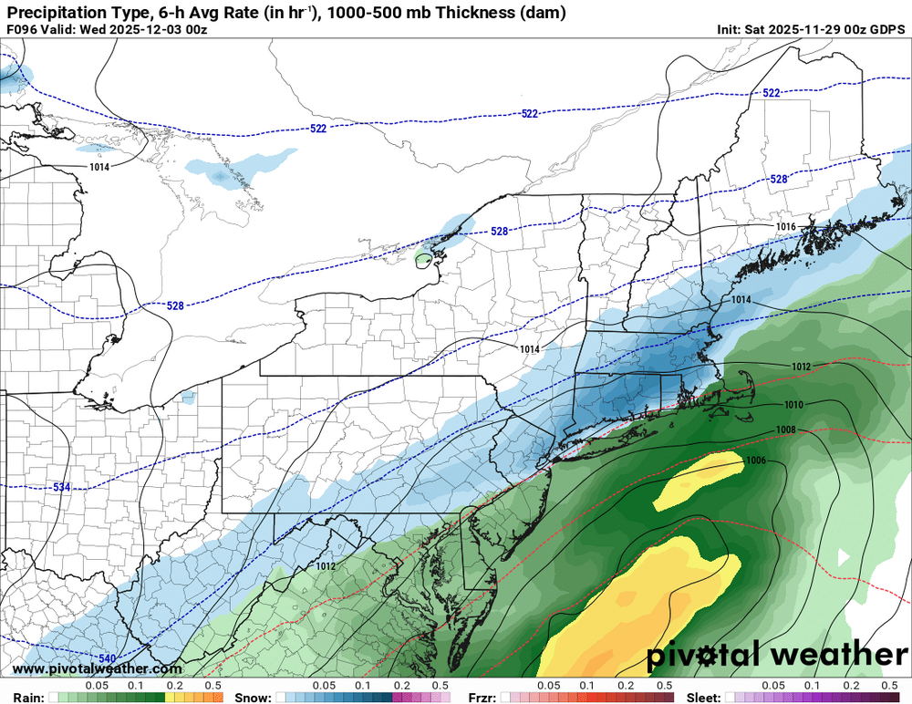
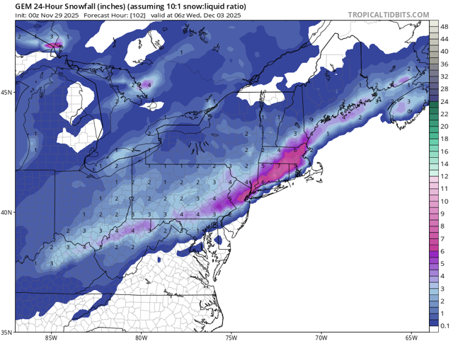
Oddly enough, I think the GEM is most realistic, IMO. -

First Winter Storm to kickoff 2025-26 Winter season
40/70 Benchmark replied to Baroclinic Zone's topic in New England
Yea, I would sign for the GEM. -

E PA/NJ/DE Autumn 2025 Obs/Discussion
RedSky replied to PhiEaglesfan712's topic in Philadelphia Region
What about the GFS -

E PA/NJ/DE Autumn 2025 Obs/Discussion
MJO812 replied to PhiEaglesfan712's topic in Philadelphia Region
Rgem also Gfs also trended weaker. I wonder if its going to fold. -

E PA/NJ/DE Autumn 2025 Obs/Discussion
Ralph Wiggum replied to PhiEaglesfan712's topic in Philadelphia Region
Gotta admire the CMC. Giving us all snow entire event even down to SE PA. -

First Winter Storm to kickoff 2025-26 Winter season
TauntonBlizzard2013 replied to Baroclinic Zone's topic in New England
Canadian a little weaker, but also slighlty colder. Would be a decent event for many in SNE -
It’s kinda clear that this is a N and W thing at this point. Oh well, not too sad. We were playing with house money anyway.
-

First Winter Storm to kickoff 2025-26 Winter season
40/70 Benchmark replied to Baroclinic Zone's topic in New England
Looks like the trend tonight is towards less proficent cyclogensis, regardless of track...which isn't surprising. This isn't a pattern ripe for bombs. -
-

First Winter Storm to kickoff 2025-26 Winter season
MJO812 replied to Baroclinic Zone's topic in New England
-
it's another ice storm (to rain) from the cmc. same output for the last 4 model runs of that. Euro likely to do the exact same thing it did at 18z as well
-
-

First Winter Storm to kickoff 2025-26 Winter season
MJO812 replied to Baroclinic Zone's topic in New England
Cmc might come in flatter than 12z. Following the rgem. -

First Winter Storm to kickoff 2025-26 Winter season
40/70 Benchmark replied to Baroclinic Zone's topic in New England
Same, exact gradient, just more moderate amounts. -

First Winter Storm to kickoff 2025-26 Winter season
CoastalWx replied to Baroclinic Zone's topic in New England
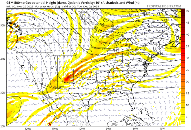
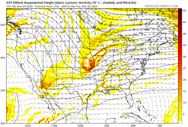
Different and weaker with main s/w. I’m still inclined to toss it. -

First Winter Storm to kickoff 2025-26 Winter season
TauntonBlizzard2013 replied to Baroclinic Zone's topic in New England
The biggest difference this run was definitely the cold side. Where it’s cold enough for snow it ended up pretty meh. Probably talking a 1/3 to 1/2 reduction -

First Winter Storm to kickoff 2025-26 Winter season
40/70 Benchmark replied to Baroclinic Zone's topic in New England
No, it isn't. -
First Winter Storm to kickoff 2025-26 Winter season
dryslot replied to Baroclinic Zone's topic in New England
Strung out POS -
Nov 28-30th Post Turkey Day Winter Storm
Radtechwxman replied to Chicago Storm's topic in Lakes/Ohio Valley
I hope the radar really blossoms and fills in like models are suggesting. Trough seems to be approaching western NE. Isentropric lift should start increasing next few hours. -

First Winter Storm to kickoff 2025-26 Winter season
40/70 Benchmark replied to Baroclinic Zone's topic in New England
GFS is awful. -

First Winter Storm to kickoff 2025-26 Winter season
CoastalWx replied to Baroclinic Zone's topic in New England
Gfs is very warm still in SNE. QPF is best near low track so not much oomph in the colder air for heavier amounts. -

First Winter Storm to kickoff 2025-26 Winter season
H2Otown_WX replied to Baroclinic Zone's topic in New England
Yeah, the vort is not consolidated, strung out POS -

First Winter Storm to kickoff 2025-26 Winter season
TauntonBlizzard2013 replied to Baroclinic Zone's topic in New England
It’s just a lot weaker, not really south. the whole thing is just less impressive by a good margin -
CMC with it's usual ice storm, Euro with it's C-2" before rain and then maybe some back end snow, that's probably what will happen, you don't need to stay up, go to sleep now


.thumb.png.72918cc8b26483c4e18689b0a412e6ab.png)


.thumb.png.b7594e353fc48ff1222bd8e6ef004376.png)
