All Activity
- Past hour
-

First Winter Storm to kickoff 2025-26 Winter season
40/70 Benchmark replied to Baroclinic Zone's topic in New England
Well, I had got issue my Final map last night due to time constraints, so it is what it is....but the fact is that the data has changed since then. If I were doing the map now, the zones would be shifted NW.....the 4-8" area near I 495 would be 2-5" of slush, the 3-6" between 495 and 128 would be 1-3", and the 2-4" area over Boston would be 2" or less and the 2" or less area would be mainly rain. Will grade the map as is, but figured I'd issue a heads up that it's unlikely to verify. -
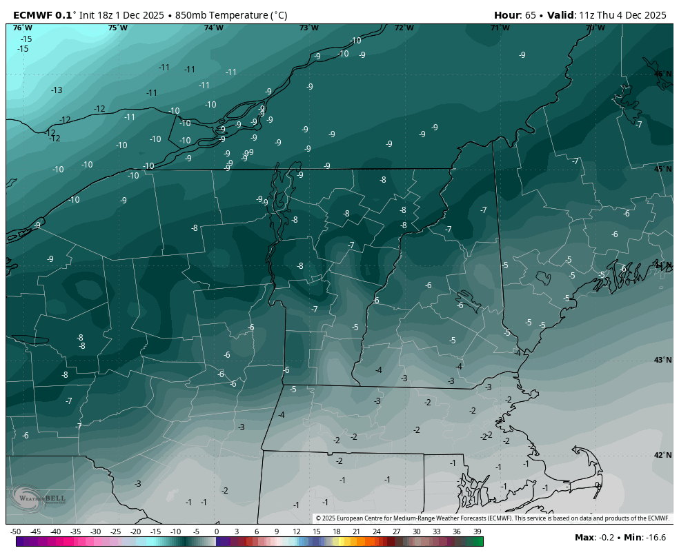
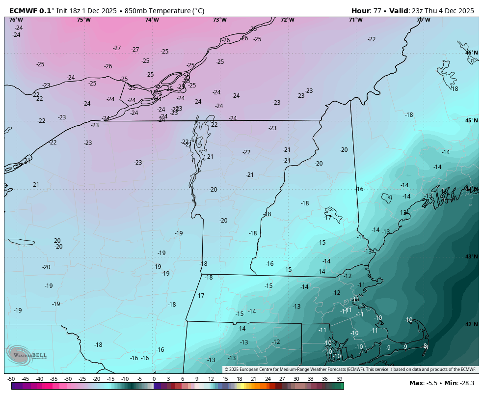
I find the mesoscale stuff in the northern mountains to be the most interesting type of weather. The atmosphere is fluid and Thursday is like watching a shallow ocean wave move over rocks, from NW to SE across the region… the areas with the most churn as the ripple moves through should see the best results in the northeast (the northern terrain).
-
 25 here. Shame it's for nothing.
 -
-
33/26
-

12/3 Snow/Sleet/Mix Bag of Everything Discussion/OBS
Kevin Reilly replied to Mikeymac5306's topic in Philadelphia Region
28f dewpoint 15f Media, PA Delaware County Clear. -
I’m higher than most at 34.5 but still low dewpoint at 22. Frederick has radiated crazy to 25/23.
-
 down to 26, coldest of the season.
 -
Best snowfall rates/intensity of the event currently, down to 3/4SM here at ORD.
-
28/23 I'm supposed to be driving down to Richmond early tomorrow morning for work. Gonna see how things look at 6 and then perhaps issue a two hour delay for myself.
-
Oh yeah, I’ve been tracking this quietly. It’s going to get frigid for a bit. Will be interesting to see how we do here.
-
First Winter Storm to kickoff 2025-26 Winter season
40/70 Benchmark replied to Baroclinic Zone's topic in New England
Yup. No question. Probably over Salem. -

First Winter Storm to kickoff 2025-26 Winter season
powderfreak replied to Baroclinic Zone's topic in New England
You have to feel fairly confident from SW NH to Dendrite to Dryslot. -
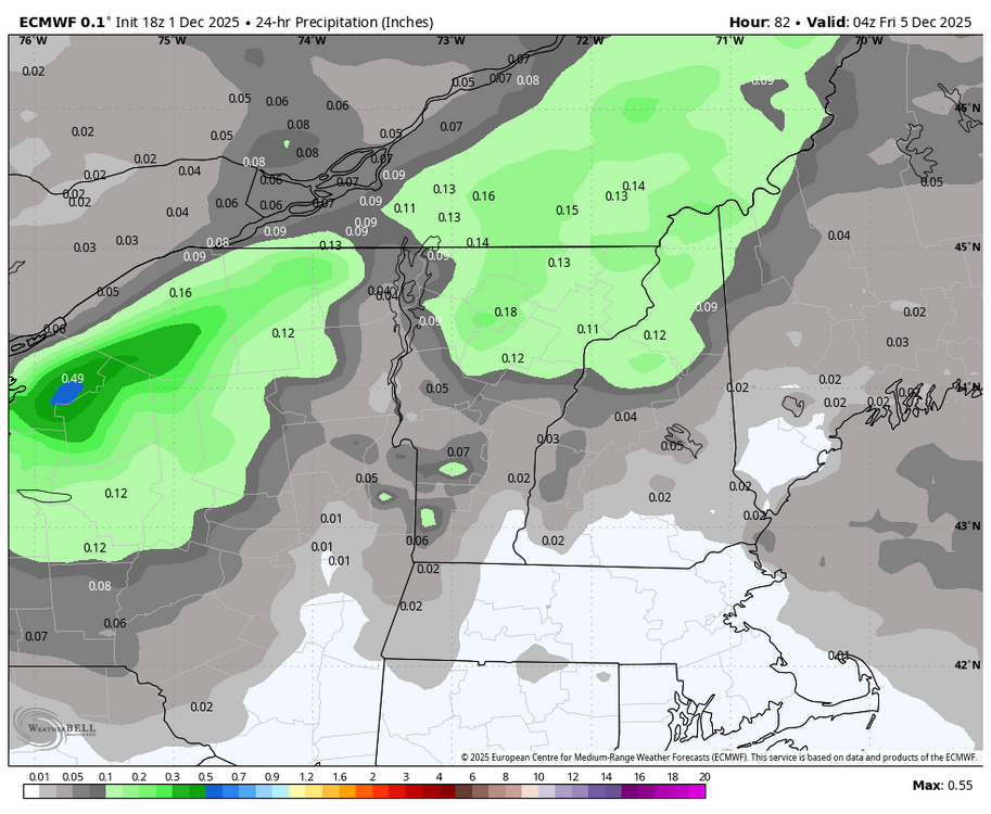
Looks like BTV will be ticking up totals for Thursday along the spine if that modeling holds
-
November total 1.32" Highest temp 71...lowest 25
-
29/20
-

Central PA Fall Discussions and Obs
Jns2183 replied to ChescoWx's topic in Upstate New York/Pennsylvania
We got a halo. Game on Sent from my SM-S731U using Tapatalk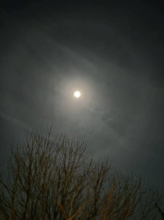
-

First Winter Storm to kickoff 2025-26 Winter season
DomNH replied to Baroclinic Zone's topic in New England
0z mesos not looking any cooler to me. Guessing the CF will end up somewhere between Ray and here. -
-
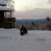
22/16 and dropping, ready to ride the line tomorrow LFG anything white will be okay for me on 12/2...was hoping for a little more but I'll take 4 and be happy.
-

Winter 2025-2026 Offers Return to Normalcy
rimetree replied to 40/70 Benchmark's topic in New England
That 3-6/4-8 line right over my head seems about right. Guessing 6" here if we get those heavy rates tomorrow evening. -
Even hit 32 here in the city
-
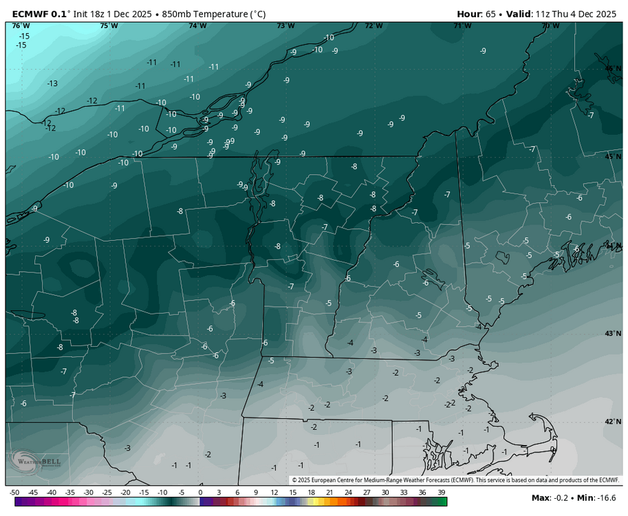
I missed that too, thanks. I honestly am more interested in that arctic front on Thursday. There’s something aesthetically pleasing about snow squalls and wind ahead of an arctic airmass. The SW flow out of the Great Lakes region pools moisture ahead of these FROPAs, then the front drags it over the terrain before drying out again. Looks like a decent early season arctic boundary. That FROPA means business.

-

Central PA Fall Discussions and Obs
Mount Joy Snowman replied to ChescoWx's topic in Upstate New York/Pennsylvania
29/21 as I get ready to hit the hay here. Good luck everyone! -
Might be a bit challenging tomorrow morning, interesting.