All Activity
- Past hour
-
My one and only obs just for the hell of it. 29/23 at 730 Wont be a single flake or sleet pellet here by the time precip starts. On the plus side, might see an inch of rain! Good luck to the NW folks at elevation. An inch or 2 would be a win with this setup imo. Not bad for the very beginning of Dec, esp lately..
-
I see Governor Phil has declared a State of Emergency for 5 NW NJ counties. Might as well go out looking like the arsehole that he is. What a joke.
-
Central PA Fall Discussions and Obs
Blizzard of 93 replied to ChescoWx's topic in Upstate New York/Pennsylvania
-
Temp drop ended. Back up to 34. 33 and rain is bad enough but 34 and rain will suck the balls of a 350lb dude 2 hours after he ate 5 alarm chili with beans in summer
-

First Winter Storm to kickoff 2025-26 Winter season
Damage In Tolland replied to Baroclinic Zone's topic in New England
Don’t see any progression of warmth north . Instead a steady progression of dongs across faces south of pike -
Mid to long range discussion- 2025
WinstonSalemArlington replied to wncsnow's topic in Southeastern States
-
18z GFS has some fantasy cold Dec 17.
-
-
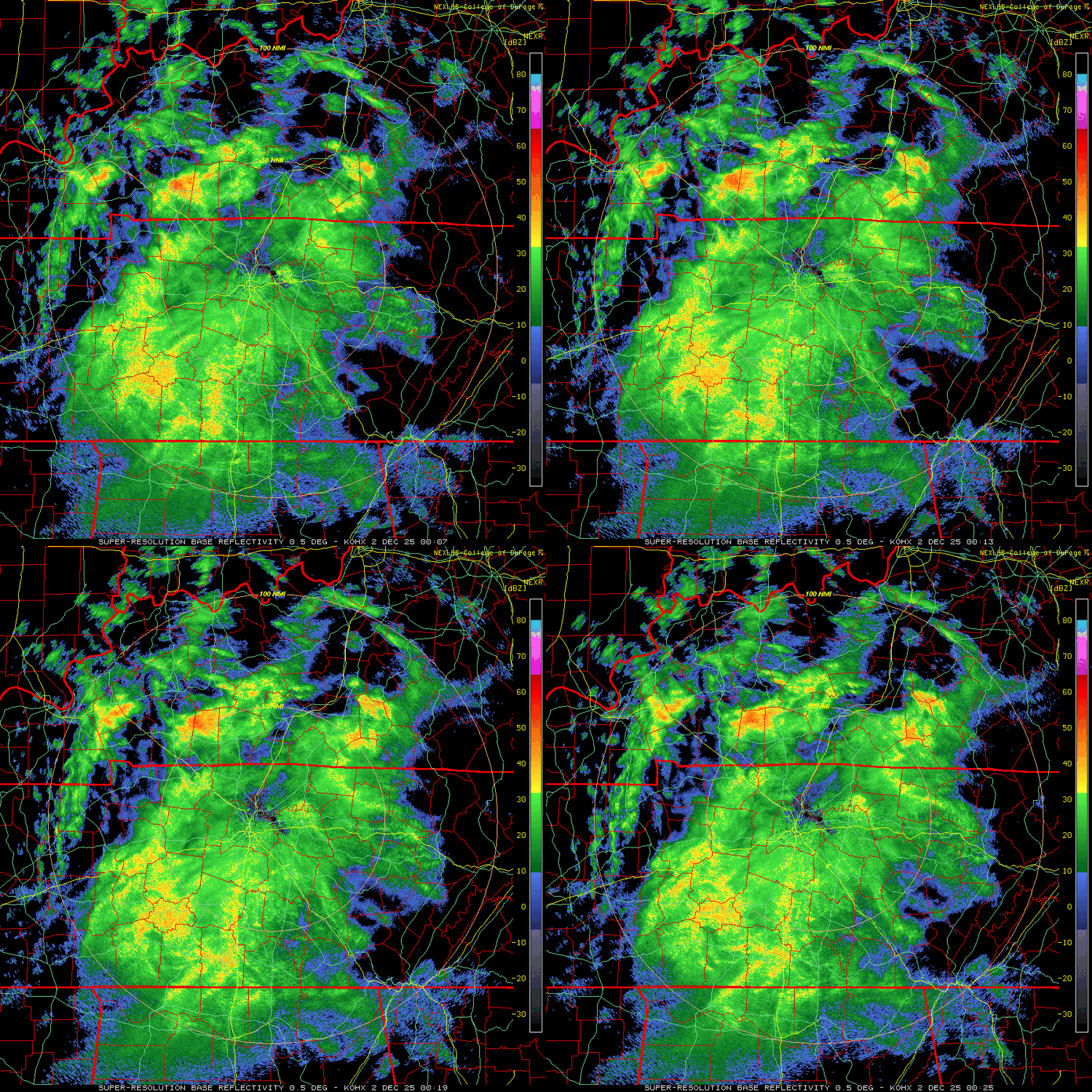
Still clear here, temp down to 28.8/21.7. Looking on satellite I'm on the very northern side of the high cirrus going W to E. Probably another hour before the clouds start filling in. MIGHT see some snow before it goes all sleet/freezing rain, just gonna have to wait and see.
-

First Winter Storm to kickoff 2025-26 Winter season
RUNNAWAYICEBERG replied to Baroclinic Zone's topic in New England
With the warmth progression marching north, you’ll have to retire in NNE or your favorite country, Canada, to experience special winters again… wire to wire seasons. No reason to look at models with constant snowpack and nickel and dimers. Stress free. -

December 2025 Short/Medium Range Forecast Thread
Carvers Gap replied to John1122's topic in Tennessee Valley
Thanks for the heads up. I prob should look at the strat more. Generally, I just wanted it jostled and not spinning in a tight spiral. That would make sense given that this has occurred during recent Nina episodes. That would set the stage or cold by mid January. This could be a crazy winter. -
nukeing started following 12/2 Cold Rain and High Elevation Snow
-
30/21 Sent from my Pixel 9 Pro XL using Tapatalk
-
Temp drop is slowing down. 28.6/22.6.
-
-
BWI: 24.1" DCA: 17.1" IAD: 27.5" RIC: 9.2" _______ Tiebreaker: (SBY) 8.5"
-
32/24, wet bulb 29. the temperature drop is starting to flatten out but it's still going down.
-

December 2025 Short/Medium Range Forecast Thread
Daniel Boone replied to John1122's topic in Tennessee Valley
Yeah, there's some talk of it being a complete SSWE. PV is weak so if there is one it may very split the PV this time. -
31/24
-
28/23 in Haymarket, Dominion Valley
-

First Winter Storm to kickoff 2025-26 Winter season
DavisStraight replied to Baroclinic Zone's topic in New England
Local weatherman agrees with you, im travelling inland for an appt where it should be all snow. Still learning the intricacies of being 2 miles from the ocean. -
28 and clear after a high of 43
-
Looking at the HRRR we just need a model bust of 1-2f colder at ~850 for a decent thump of snow in the immediate NW suburbs
-

December 2025 Short/Medium Range Forecast Thread
Maggie Valley Steve replied to John1122's topic in Tennessee Valley
I'm sure you folks are aware of another SSW Event unfolding for mid month? -
My guess is mPing will have multiple snow flurry - ice pellet reports I95 corridor including within 10 MI NYC at 12z... too warm for acc NYC and probably measuring too late 830AM. n/c to headline... not worth shortening up the time frame 6 hours or completely eliminating the coasts from spotty .1? - agreed highly unlikely coastal occurrence of measurable snow sleet. Mesoscale changes in wind direction due to strong Pres falls to our south could tuck in slightly cooler air toward 17z but for now... let it fly as NWS posted/overall modeled. will check back at 830A Tue.
-
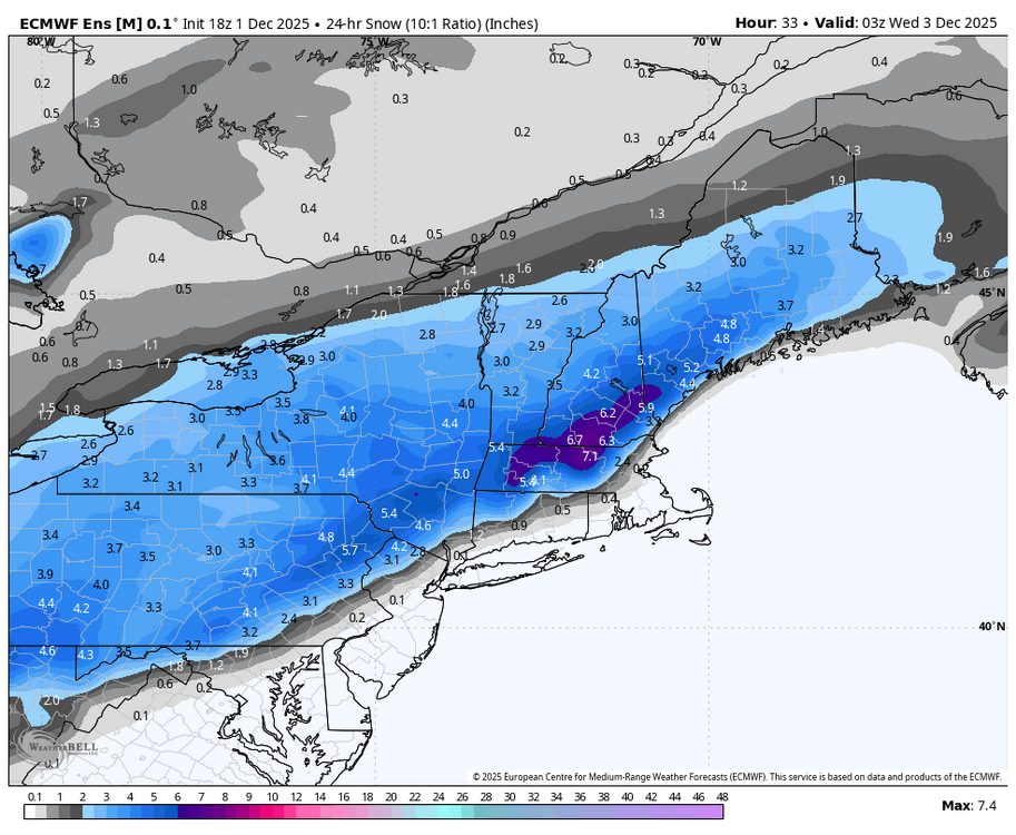
Need the first wave to take over and come in quicker for more frozen precip like the Euro shows.

