All Activity
- Past hour
-
I do know the NWS office reported they've begun to mix...I think the line may stall or even settle back SW soon. Not sure it'll make it to the immediate metro except the S side near the airport for awhile.
-
.thumb.png.4150b06c63a21f61052e47a612bf1818.png)
December 2025 regional war/obs/disco thread
HIPPYVALLEY replied to Torch Tiger's topic in New England
Cutters literally have a 1000 miles of territory to work with to produce the same result. Big coastal storms not so much. -

December 2025 regional war/obs/disco thread
Sey-Mour Snow replied to Torch Tiger's topic in New England
One great winter month here since Winter 2018/19 -
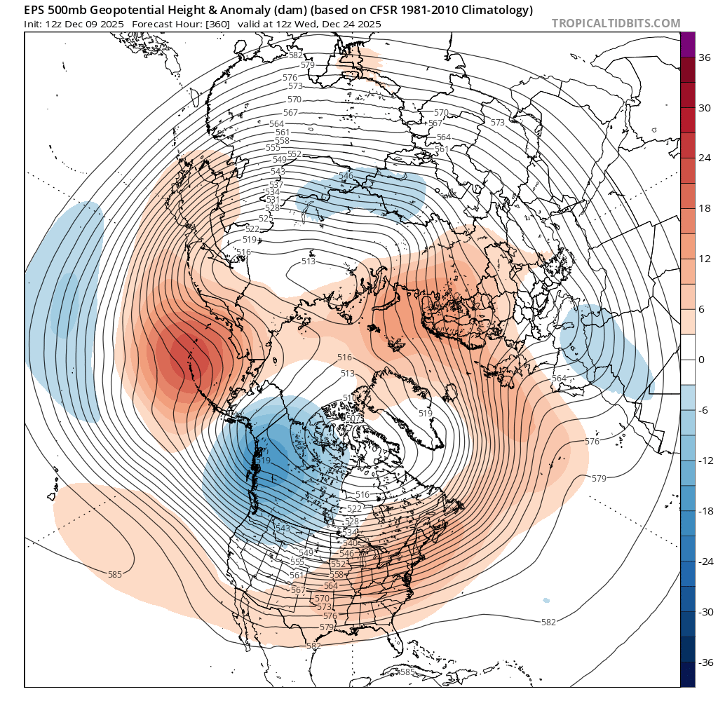
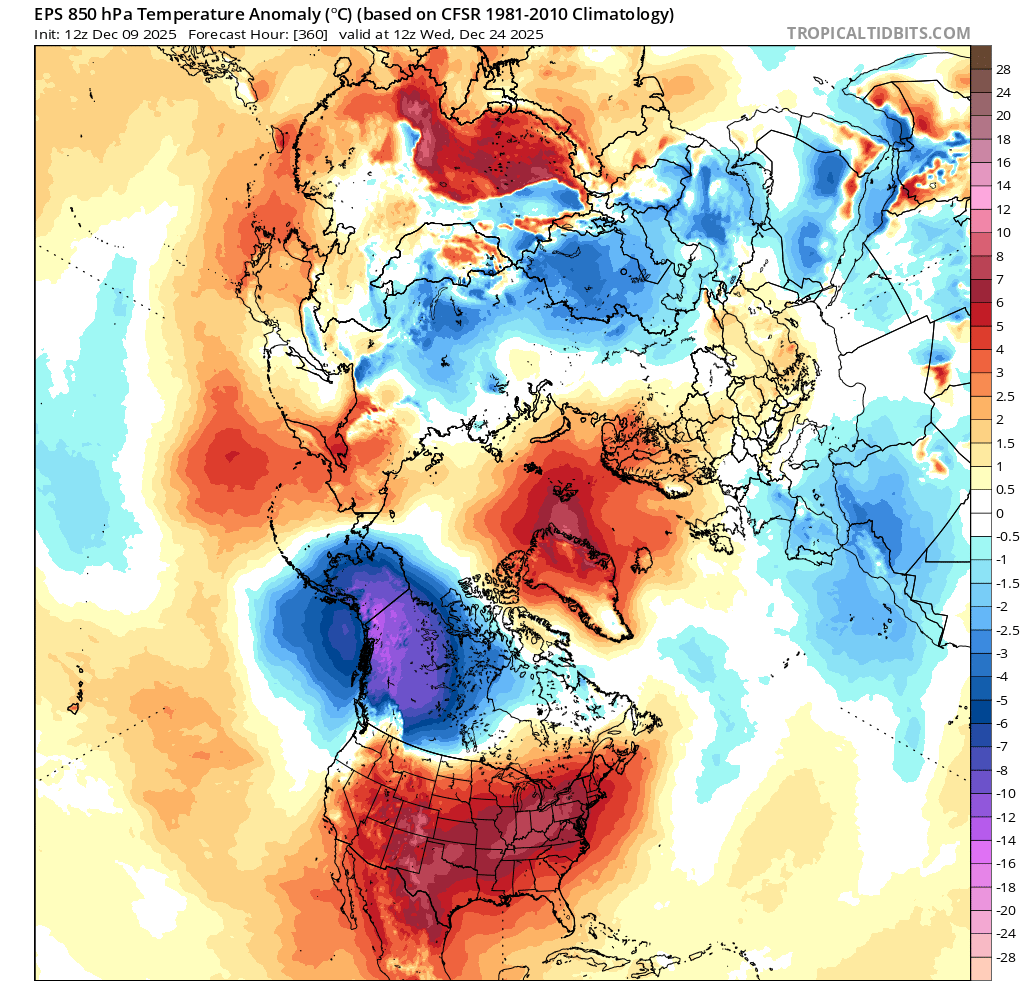
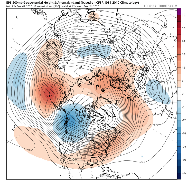
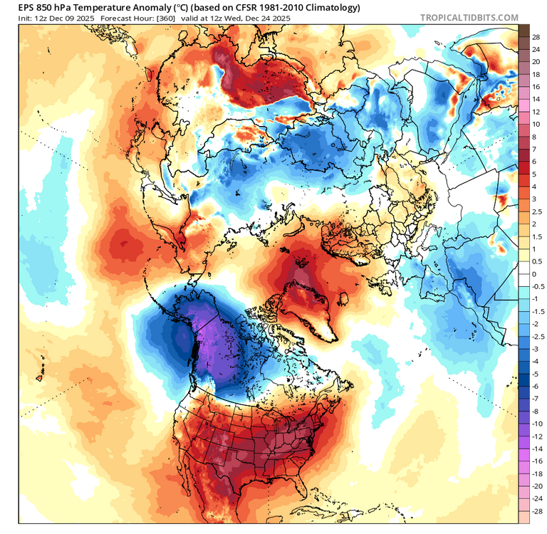
People need to calm down. We’re all having fun and joking about the ridging shown on Christmas. No one is calling for it…yet. With that said, I disagree to some extent. The 12z gefs gained a handful of members with strong SE ridges. Obviously you can’t expect 591dm to verify or be matched on a d16 ens lol. 12z eps is pretty warm looking for the holiday too. Hopefully it pans out cooler. I’d like to have pack for the holiday.
-
Thank you! Now I just need a 6 inch plus event to shoot.
-
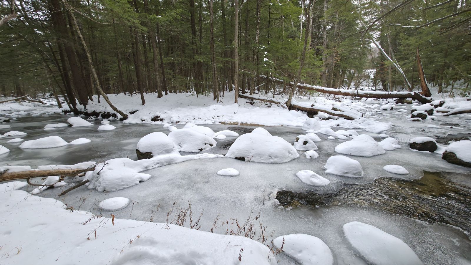
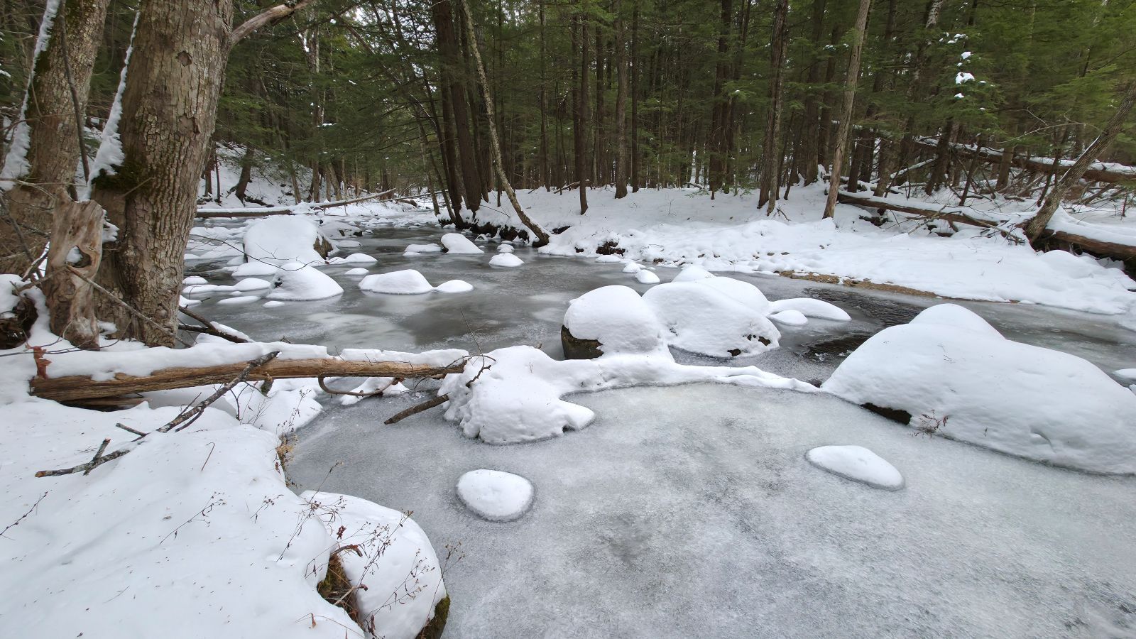
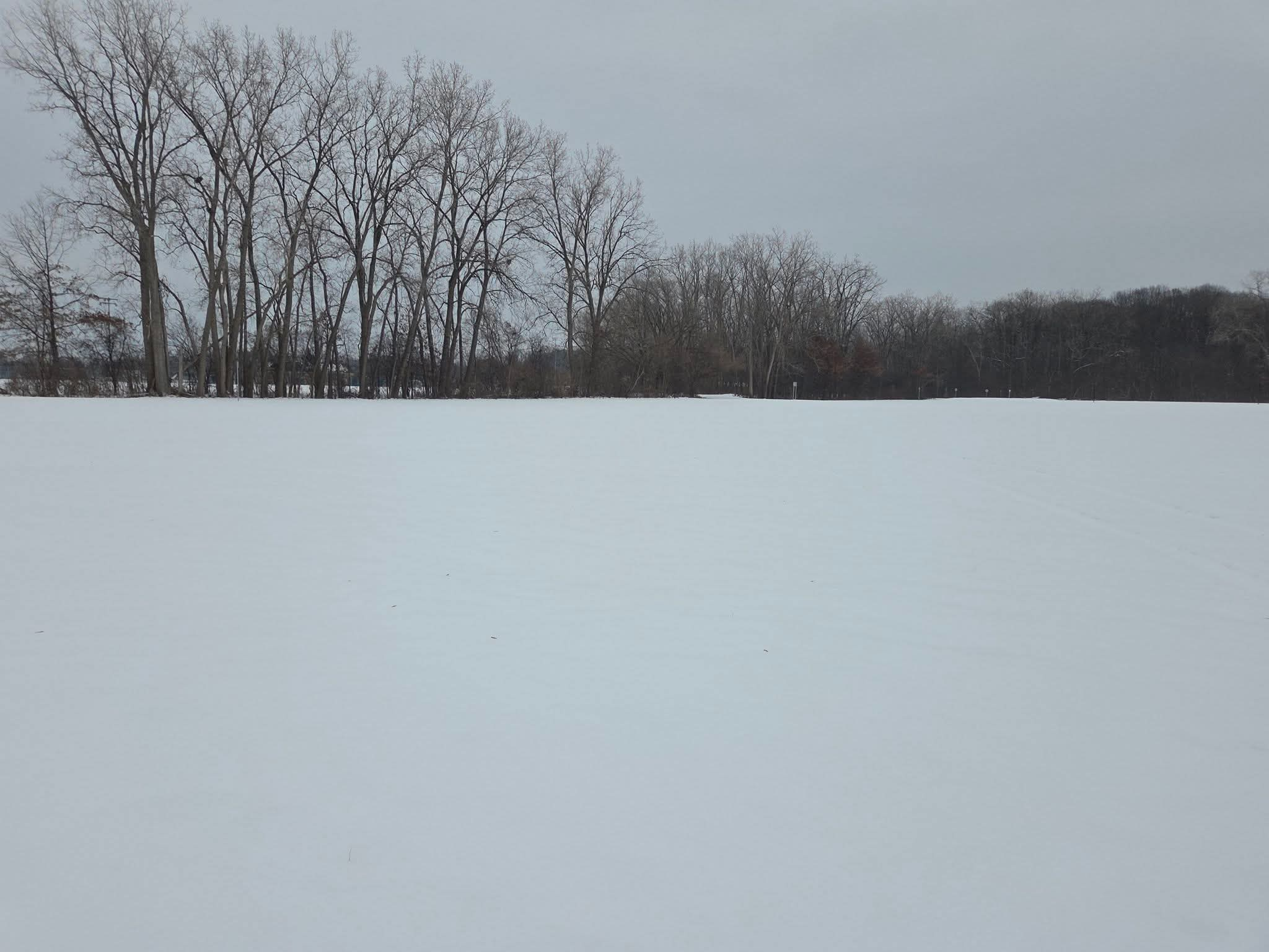
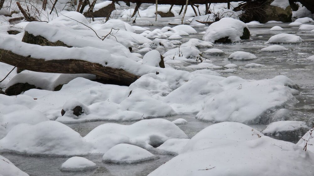
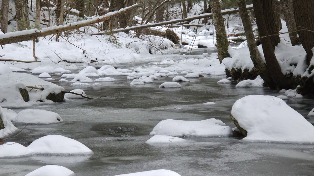
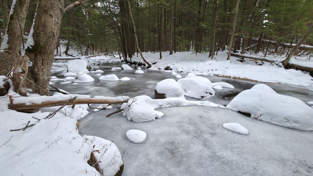
River out back is about as frozen as it's ever been this early in the season.

-
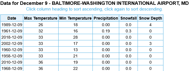
If BWI for the High stays at 32, it will be 2nd coldest high for 12/09 on record.
-
31.5 for a high after a 14 low, both if which are seasonal cold records.
-
Yeah, I don't telework as my clients are always in the office so unfortunately can't chase tomorrow either.
-
 That was PVD
 -
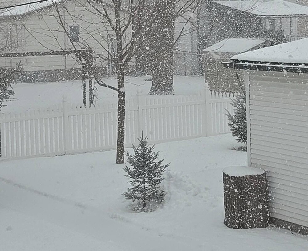
This morning was like a summer squall line on radar, only it was December snow. Picked up 1.2" here and 1.0" at DTW. Pretty consistent 1-1.5" in 1.5 hours with the passage of this morning's mini clipper. Tonight is really nowcast. Dont know what to expect. Season to date snowfall is 10.5" here and 10.3" DTW. Today waa the 4th snowfall of December falling in the 1-1.5" range. Nickel and diming a winter wonderland. The snow blanket is very layered and more dense than it looks.
-

Central PA Winter 25/26 Discussion and Obs
2001kx replied to MAG5035's topic in Upstate New York/Pennsylvania
-3 This morning around Houtzdale -
and that's the pissah. Sn storms are like threading a needle requiring near perfect alignment and coordination of precip and cold
-
Kinda surprised the NWS hasn’t upgraded Hennepin County to a WSW. Roads are a mess and snow covered. Still 27 at the airport, I see some heavier returns moving in from the SW maybe that is the mixing line.
-
Hard to have confidence in anything anymore outside 2/3 days. Though I wouldn’t put my faith in icon for sure.
-
I grew up in Virginia Beach and only remember 2 years when we got slammed with snow. 1980 we ended up with over 40" for the year with it ending with the infamous early March blizzard. And 1989 we had back to back blizzards in February that dropped over a foot each time separated by a week. Other than those, we had a years with no snow or maybe a year with 2 to 6". I moved away in 1996.
-
 That was you that taught me that . Only yourself to blame
 -

Winter 2025-26 Short Range Discussion
A-L-E-K replied to SchaumburgStormer's topic in Lakes/Ohio Valley
You're lucky that I'm wrong all the time -
Some nice looking streamers. Will be localized but I could see it.
-

December 2025 regional war/obs/disco thread
bristolri_wx replied to Torch Tiger's topic in New England
GFS ensembles also don't support what the op is selling in the long range. There is consensus across the board of some relaxing of this colder pattern for at least a few days coming up. How much TBD... -
Low of 29, high of 46. Breeze made it feel colder. No accumulated snow from last night.
-
Rgem and Icon have nothing for Friday. Hard to have confidence in anything but flurries without total model support.
-
Thankfully basically zero similarities between those two years at the moment. We’ve had a different Pacific regime compared to recent years so far…that very strong WPO block is not something that’s been there. In recent years, we’ve seen a generally strong positive WPO which will tend to mute the cold…the negative phase has the opposite effect which is probably why our cold has been overperforming in the medium range.
-

December 2025 Short/Medium Range Forecast Thread
Daniel Boone replied to John1122's topic in Tennessee Valley
Yep. That Aleutian HP is where we need the LP to be. Need that HP over Alaska and need that LP near the GOA to move to Aleutians. As is, that Pac Jet's going to roar between the Goa Low and the Epac and West Coast Ridge. if it comes in strong enough it'll flood the US with Pacific Air and downslope off the Rockies spreading warmth. If it were to blast in further North it could potentially flood western and central Canada scouring the cold out. Kentucky Post was right on with that post about needing that Ridge to link with the Alaskan HP. -
4+ years of garbage winters will do that...