All Activity
- Past hour
-
Keep bleeding away. Euro save us?
-

December 2025 regional war/obs/disco thread
Ginx snewx replied to Torch Tiger's topic in New England
The cutter has been in the exact same spot for a week on the Euro. St Lawrence screamer. -
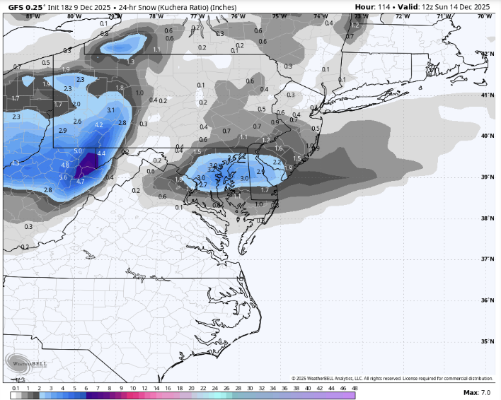
18z GFS dislikes Friday, weekend has small jack zone of 2-4"
-
Gfs offers snow showers pretty much for the weekend. Ain’t much there.
-

Winter 2025-26 Short Range Discussion
Radtechwxman replied to SchaumburgStormer's topic in Lakes/Ohio Valley
Well pattern lately been favoring north shifts and generally I80 north so maybe not. We shall see. Wish I could lock in gfs. Ha -
Snowing hard here in Blaine and the heavier bands keep pushing at me. Might be in a sweet spot here for a while. .
-

2025-2026 ENSO
PhiEaglesfan712 replied to 40/70 Benchmark's topic in Weather Forecasting and Discussion
The MEI finally updated. Here are the values for the past several months: MJ 2025: -1.2 JJ 2025: -1.2 JA 2025: -0.9 AS 2025: -1.1 SO 2025: -1.2 ON 2025: -1.1 -
Ban em
-
Just when I was feeling down about winter weather, I saw shetley commenting on the NWS post about this storm and it made me feel better
-
beware of the snow weenies, like me
-

December 2025 Short/Medium Range Forecast Thread
John1122 replied to John1122's topic in Tennessee Valley
We needed the Pac jet to help pop the PNA but it's not worked out that way. -
As a warminista, I'm hoping that NCEP's GFS claims for the 18th turn out to be pure RAIN, if anything at all.
-

December 2025 regional war/obs/disco thread
Damage In Tolland replied to Torch Tiger's topic in New England
So we’ve got rainer tomorrow .. then either snow or whiff Saturday nite into early Sunday and then Rainer mid week next week ahead of smother cold shot right behind it . Just making sure all the fun is outlined properly -

December 2025 regional war/obs/disco thread
WxWatcher007 replied to Torch Tiger's topic in New England
I’m still skeptical that the ensembles have it right with regard to timing and amplitude. It’d be hard to put up a -10 month so a relaxation from what we’ve seen so far would not be surprising. The real question is if that precludes snow chances and pack retention for Christmas. Nobody cares if it’s 50 on Boxing Day if the day before was 30 with snow on the ground. -
NJ is issuing drought warnings due to how low the reservoirs are right now. We need precip, be it rain, or snow. But something to fill them up.
-
I do know the NWS office reported they've begun to mix...I think the line may stall or even settle back SW soon. Not sure it'll make it to the immediate metro except the S side near the airport for awhile.
-
.thumb.png.4150b06c63a21f61052e47a612bf1818.png)
December 2025 regional war/obs/disco thread
HIPPYVALLEY replied to Torch Tiger's topic in New England
Cutters literally have a 1000 miles of territory to work with to produce the same result. Big coastal storms not so much. -

December 2025 regional war/obs/disco thread
Sey-Mour Snow replied to Torch Tiger's topic in New England
One great winter month here since Winter 2018/19 -
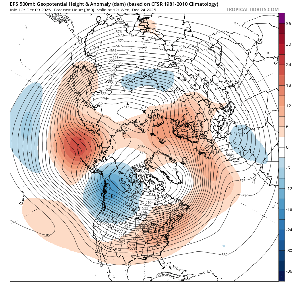
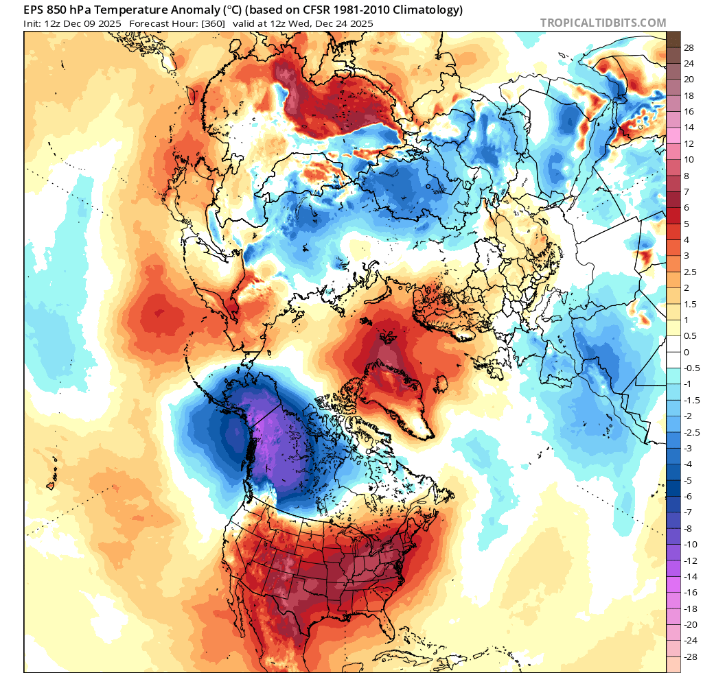
People need to calm down. We’re all having fun and joking about the ridging shown on Christmas. No one is calling for it…yet. With that said, I disagree to some extent. The 12z gefs gained a handful of members with strong SE ridges. Obviously you can’t expect 591dm to verify or be matched on a d16 ens lol. 12z eps is pretty warm looking for the holiday too. Hopefully it pans out cooler. I’d like to have pack for the holiday.
-
Thank you! Now I just need a 6 inch plus event to shoot.
-
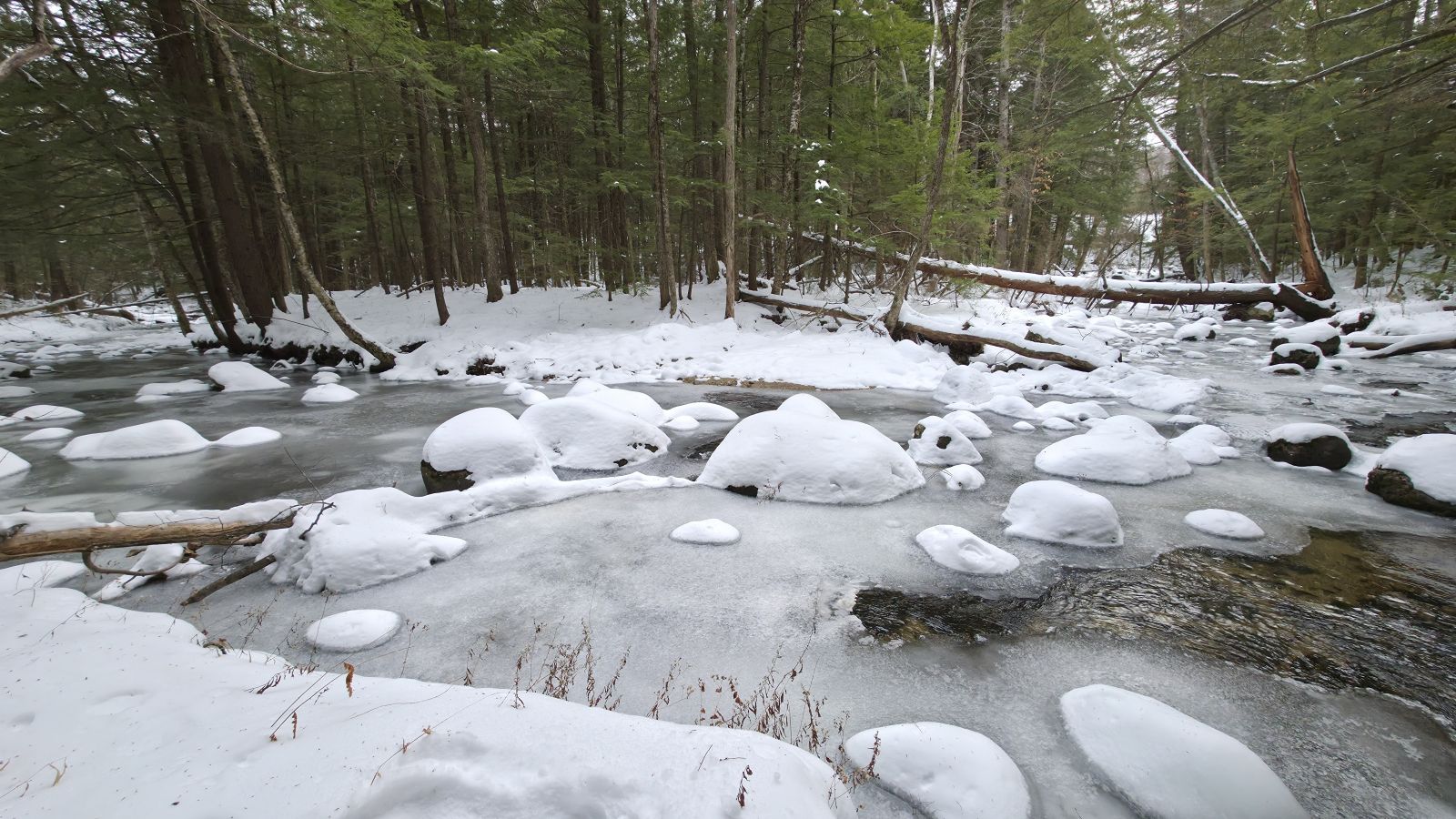
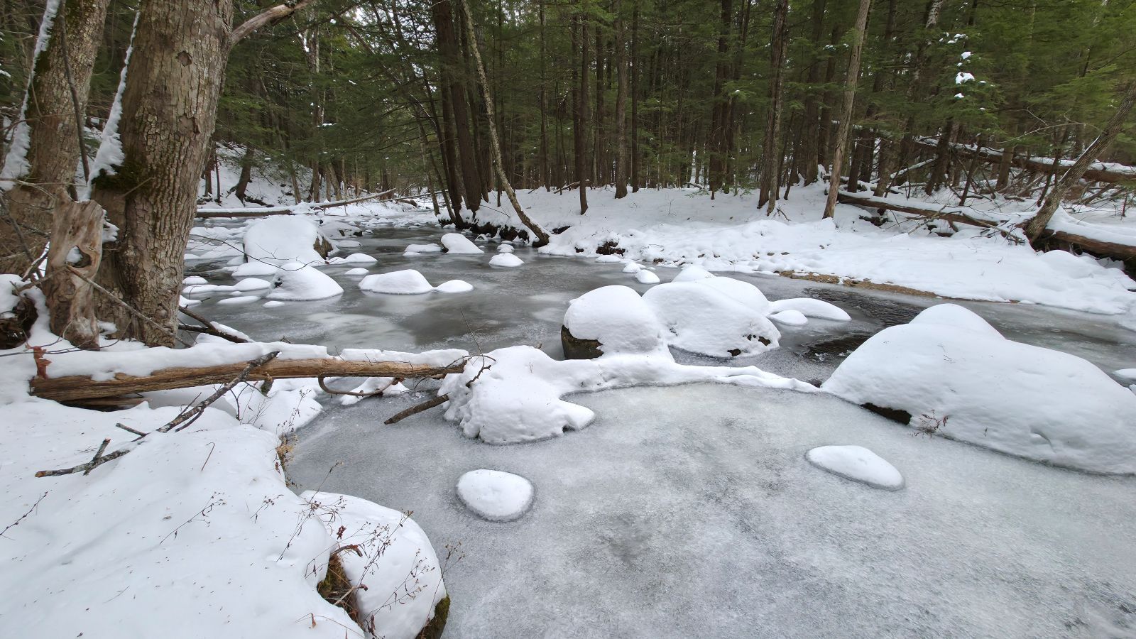
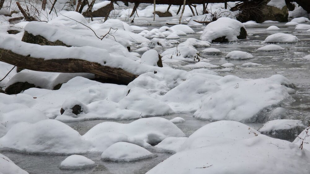
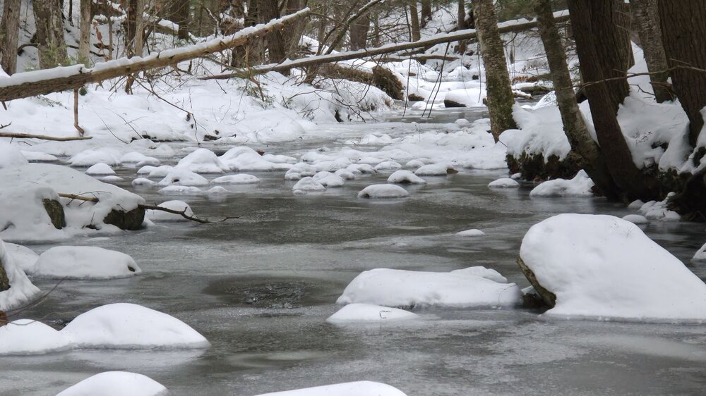
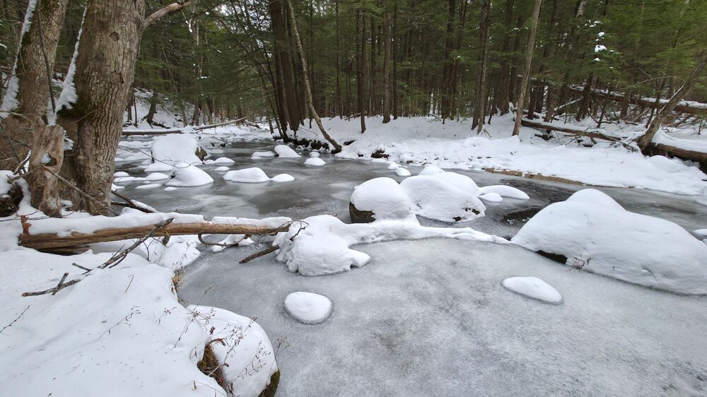
River out back is about as frozen as it's ever been this early in the season.

-
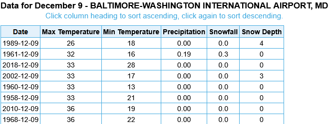
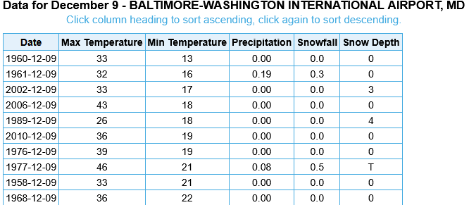
If BWI for the High stays at 32, it will be 2nd coldest high for 12/09 on record. Edit: Also 2nd Coldest Min Temperature with 14 this AM
-
31.5 for a high after a 14 low, both if which are seasonal cold records.
-
Yeah, I don't telework as my clients are always in the office so unfortunately can't chase tomorrow either.
-
That was PVD