All Activity
- Past hour
-

Central PA Fall Discussions and Obs
Voyager replied to ChescoWx's topic in Upstate New York/Pennsylvania
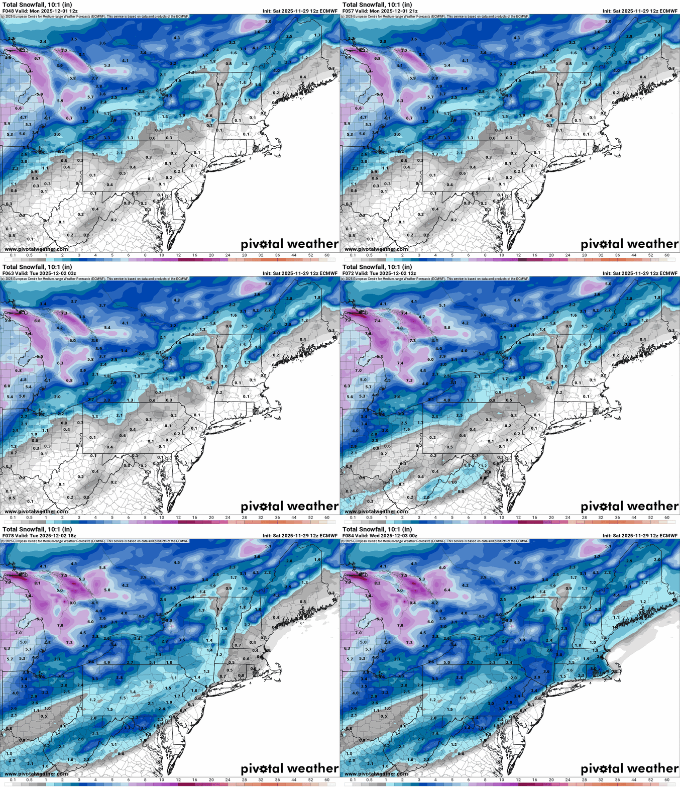
All the globals show a decent to good hit for the region, with some of them taking quite a liking to Schuylkill County. The traditional Euro shows the least, and even that puts down 3 inches here. The NAM on the other hand... -
Nov 28-30th Post Turkey Day Winter Storm
Radtechwxman replied to Chicago Storm's topic in Lakes/Ohio Valley
That was my issue through the morning. Very poor flake quality. Like pixie dust. Finally getting quality snow now. Thinking I may be on lower end of what was forecasted here though. Kind of feel like precip may move out sooner than forecasted. -
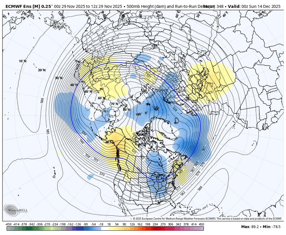
It did. The euro shows a more alternating waveguide (with EPS support). Fast pac jet with some systems bombing into AK while another amps up the ridge behind it. I can’t show the animation due to file size limits.
-

November 2025 general discussions and probable topic derailings ...
mreaves replied to Typhoon Tip's topic in New England
Just drove from PQI and the wind on 95 north of Bangor was pushing us around quite a bit. Driving through Winthrop now. -
@mitchnick putting it in the wrong thread lol
-
Best eps run since Dec 2009, IMO. Prove me wrong, King. Make me believe.
-
Cold? Snowstorms? December 2009?
-

First Winter Storm to kickoff 2025-26 Winter season
ORH_wxman replied to Baroclinic Zone's topic in New England
Yeah it has 6”+ here. I’m still pretty pessimistic for warning snows but maybe advisory has a decent chance. -

E PA/NJ/DE Autumn 2025 Obs/Discussion
Hurricane Agnes replied to PhiEaglesfan712's topic in Philadelphia Region
-

Nov 28-30th Post Turkey Day Winter Storm
Chicago Storm replied to Chicago Storm's topic in Lakes/Ohio Valley
Last hour at ORD... METAR KORD 291751Z 13007KT 1/4SM R10L/2000V3000FT +SN FZFG VV007 M03/M04 A3022 RMK AO2 SLP241 SNINCR 1/3 4/003 933022 P0006 60021 T10281039 11028 21039 58029 $ -
EPS was tasty... but we shall see lol
-
-
It's been bullish for Tuesday almost from the start. We'll know in a few days if it should be belived in the future.
-

December 2025 regional war/obs/disco thread
WxWatcher007 replied to Torch Tiger's topic in New England
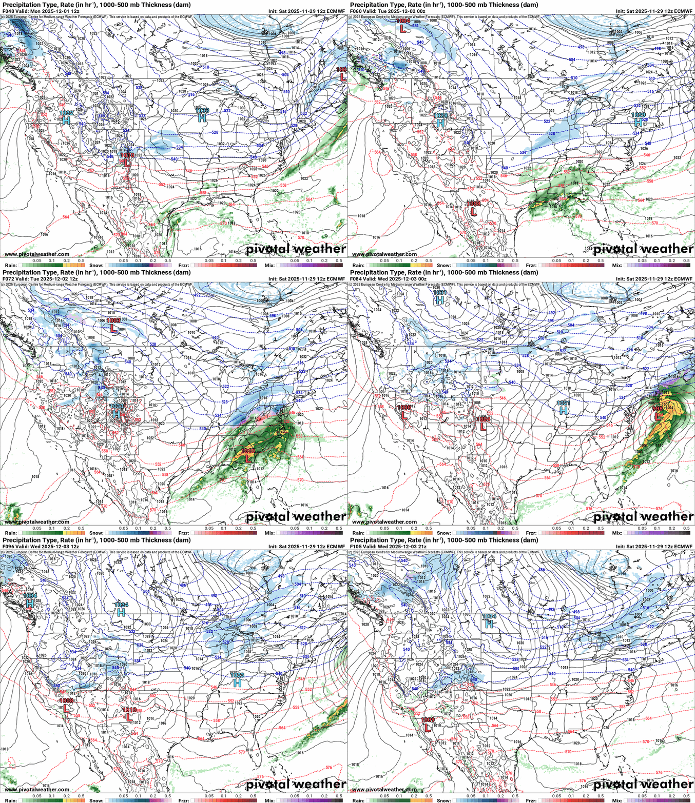
Good cold repeatedly filtering into New England from SE Canada on much of the 12z Euro run. -
Hard to tell with the limited PivotalWX panels, but it appears as if the EPS backed off a bit from the greater +EPO it showed at 0z for the D7+ range.
-

Nov 28-30th Post Turkey Day Winter Storm
hawkeye_wx replied to Chicago Storm's topic in Lakes/Ohio Valley
Snow accumulation has been slow for much of the morning due to light rates and poor flake quality. The best snow is just now getting in here ahead of the low. Reports around CR/IC say about 7", which is probably what I have so far. I had 5.7" a couple+ hours ago. -

Nov 28-30th Post Turkey Day Winter Storm
Chinook replied to Chicago Storm's topic in Lakes/Ohio Valley
kind of a snow-hole south of Chicago at Pontiac. Otherwise, about 7.8" out by Cyclone77 in Erie -

2025-2026 ENSO
40/70 Benchmark replied to 40/70 Benchmark's topic in Weather Forecasting and Discussion
I'm not doom and gloom...I went 19-29" for you on the season. I'm just not as optimistic about December as the consensus for your area. -
First Winter Storm to kickoff 2025-26 Winter season
Snowcrazed71 replied to Baroclinic Zone's topic in New England
Especially at this juncture. It's still early for our Hood. So an advisory event now is perfectly okay with me. Looks like we have another shot of something next Saturday as well -

December 2025 regional war/obs/disco thread
H2Otown_WX replied to Torch Tiger's topic in New England
Not down here -
First Winter Storm to kickoff 2025-26 Winter season
eduggs replied to Baroclinic Zone's topic in New England
There's more going on than whether it's amped or flat. There's the location and amplitude of the shortwave, location of vorticity advection, the tilt of the trof, and its evolution over time. Some runs over the past few days have been "amped" with a sharp shortwave and associated vortmax taking a northerly route near the Great Lakes into NYS (e.g., 0z 28th GFS) and others have been "ampled" but with the shortwave taking a more southerly track from AR through KY to VA (e.g., 06z 27th ECM). Other runs have been a little flat initially but amped up late (e.g., 0z 29th ECM) or initially amped only to quickly flatten (various CMC and UK runs). This combination of variables has led to a spectrum of outcomes that defy a simple binary description. -
First Winter Storm to kickoff 2025-26 Winter season
Snowcrazed71 replied to Baroclinic Zone's topic in New England
Yeah..... I know he loves it as much as we do though. I'm thinking an advisory level is probably the likely outcome for us 84 And north. -
Are you referring to Margavage? His primary audience are people with an IQ < 70, and those who are completely unaware of how meteorology works. Wouldn’t worry too much about those people. A dime a dozen. Grifters. Agreed with @brooklynwx99’s take on the -WPO, but I could see a trough that is not as deep as what is shown if the +EPO verifies stronger. I also don’t see a full blown CONUS torch happening.
-

First Winter Storm to kickoff 2025-26 Winter season
40/70 Benchmark replied to Baroclinic Zone's topic in New England
I would be fine with an advisory event.




(18).thumb.png.d17b27f929532a8cc086a3dec5fdea65.png)


