All Activity
- Past hour
-

First Winter Storm to kickoff 2025-26 Winter season
powderfreak replied to Baroclinic Zone's topic in New England
You have to feel fairly confident from SW NH to Dendrite to Dryslot. -
Looks like BTV will be ticking up totals for Thursday along the spine if that modeling holds
-
November total 1.32" Highest temp 71...lowest 25
-
29/20
-

Central PA Fall Discussions and Obs
Jns2183 replied to ChescoWx's topic in Upstate New York/Pennsylvania
We got a halo. Game on Sent from my SM-S731U using Tapatalk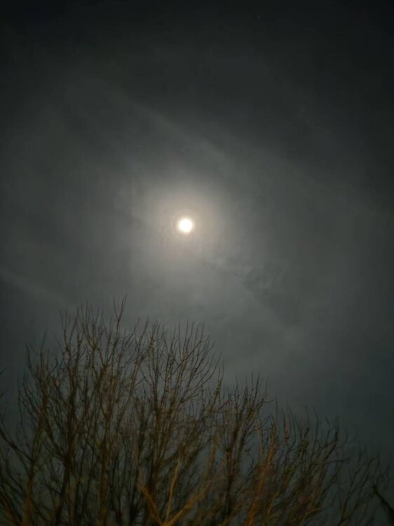
-

First Winter Storm to kickoff 2025-26 Winter season
DomNH replied to Baroclinic Zone's topic in New England
0z mesos not looking any cooler to me. Guessing the CF will end up somewhere between Ray and here. -
-
22/16 and dropping, ready to ride the line tomorrow LFG anything white will be okay for me on 12/2...was hoping for a little more but I'll take 4 and be happy.
-

Winter 2025-2026 Offers Return to Normalcy
rimetree replied to 40/70 Benchmark's topic in New England
That 3-6/4-8 line right over my head seems about right. Guessing 6" here if we get those heavy rates tomorrow evening. -
Even hit 32 here in the city
-
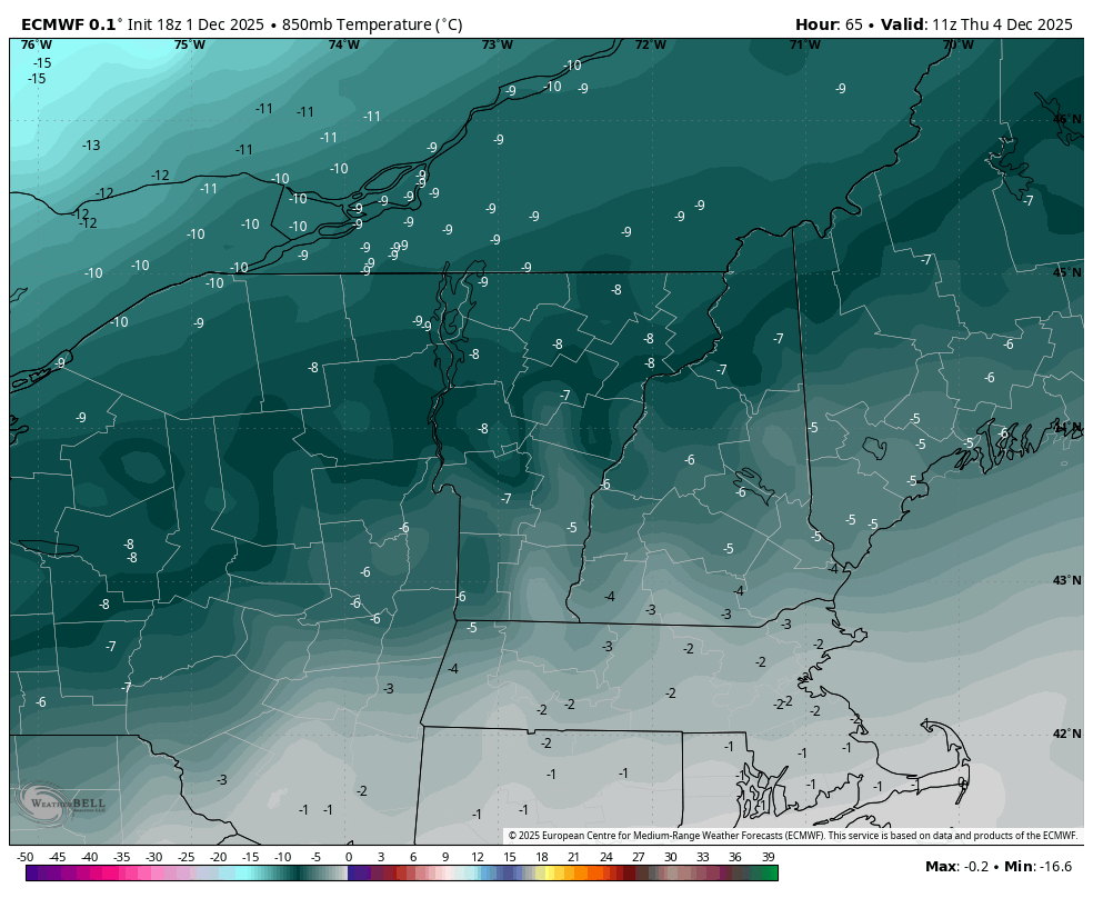
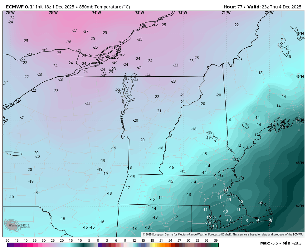
I missed that too, thanks. I honestly am more interested in that arctic front on Thursday. There’s something aesthetically pleasing about snow squalls and wind ahead of an arctic airmass. The SW flow out of the Lakes region pools moisture ahead of these FROPAs, then drag it over the terrain before drying out again. Looks like a decent early season arctic boundary. That FROPA means business.

-

Central PA Fall Discussions and Obs
Mount Joy Snowman replied to ChescoWx's topic in Upstate New York/Pennsylvania
29/21 as I get ready to hit the hay here. Good luck everyone! -
Might be a bit challenging tomorrow morning, interesting.
-
 You will be above freezing before any precipitation falls
 -
26/22 at 10 pm in Haymarket.
-

Occasional Thoughts on Climate Change
wokeupthisam replied to donsutherland1's topic in Climate Change
All this, or... 'they' simply call out gaslighting posts with one-sided 'analyses' for the empty harangues that they are. LOL -

Occasional Thoughts on Climate Change
donsutherland1 replied to donsutherland1's topic in Climate Change
We have both discussed it. It’s laughable to think that sea level rise in Miami has zero cost. By 2100, the sea will be 0.7-1.1 meters above its 2000 level (intermediate-low to intermediate scenarios) for the Southeast. By 2150, the numbers are 1.1-2.1 meters. There is no magical solution to avoid the ocean’s reclaiming land at such changes. Source: https://earth.gov/sealevel/us/internal_resources/756/noaa-nos-techrpt01-global-regional-SLR-scenarios-US.pdf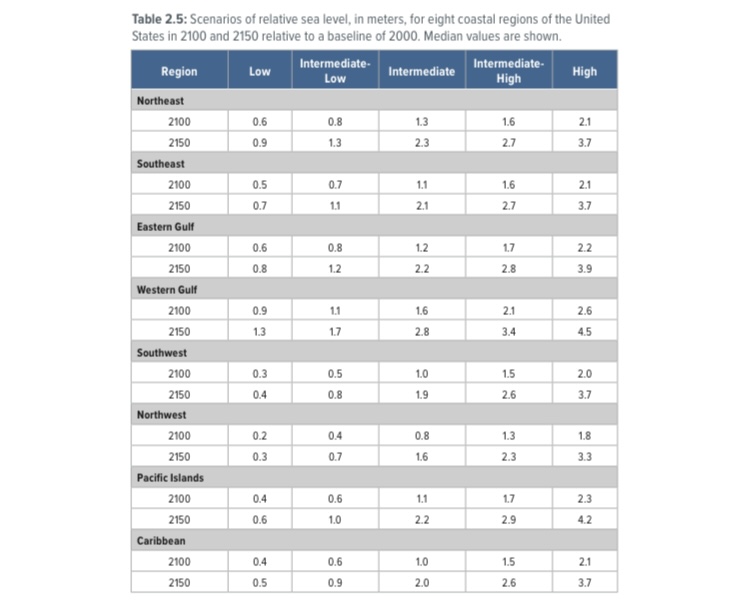
-

First Winter Storm to kickoff 2025-26 Winter season
moneypitmike replied to Baroclinic Zone's topic in New England
ICON has about half or less of the NAM's qpf, and the Reggie would have a number of people happy. -

December 2025 Short/Medium Range Forecast Thread
Carvers Gap replied to John1122's topic in Tennessee Valley
You want wild? The 18z AIFS has mid 60s all they way into Iowa at the same hour as above. Models are ALL OVER THE PLACE this evening. That is a pretty good sign that cold is coming into the Lower 48. Temps differences are almost 70 degrees in some places between the 18z GFS and AIFS. And at 360, that isn't completely unexpected, but it is wild to look at. I think we have cold through mid month, and then paths diverge. I do think we "could" see some strong cold fronts, maybe sever weather, and possible frozen events. -
 Will have a EURO report card with straight As in toe?
 -

First Winter Storm to kickoff 2025-26 Winter season
H2Otown_WX replied to Baroclinic Zone's topic in New England
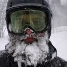
This event sucks...I need to move north. If only MHT had an observer opening. -
Aha! I was just wondering about your age and my quiet guess was...teenager! (Although here you sometimes it's hard to tell the difference, lolol)
-
Central PA Fall Discussions and Obs
Jns2183 replied to ChescoWx's topic in Upstate New York/Pennsylvania
Down to mid 20s and happy Sent from my SM-S731U using Tapatalk -
Central PA Fall Discussions and Obs
Jns2183 replied to ChescoWx's topic in Upstate New York/Pennsylvania
I don't really know who we expected. Terry Smith was going to be absolutely unacceptable to a huge portion of the fan base and a good portion of large boosters. It's a situation where Franklin had to go, but there is no go to go guy. Im happy someone out of the blue because there isn't anyone I could think of Sent from my SM-S731U using Tapatalk -
 I should be able to make it.