All Activity
- Past hour
-
71" BOS 86" ORH 59" PVD 67" TOL 62" Ray
-
You are on the cold and snow train for December? What’s expected??
-

November 2025 general discussions and probable topic derailings ...
powderfreak replied to Typhoon Tip's topic in New England
Classic upslope. Big fluffy flakes mixed with rimed graupel lol. -
-PNA sucks.
-

November 2025 general discussions and probable topic derailings ...
Lava Rock replied to Typhoon Tip's topic in New England
0.5". First measurable Sent from my SM-S921U using Tapatalk -
67"
-
Odds looking good. I’m going out.
-
Not sure where to ask this question ...but anyone have any intel. on whether the new Canadian PARA now on WB is a good model? It will be interesting to see how it tracks storms this winter.
-
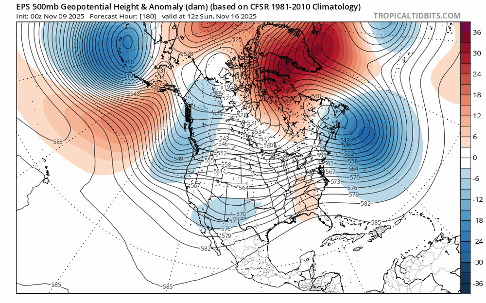
who knows, most guidance missed the cool shot they're now trending towards, maybe the lala land full lat trough out west will evolve into more of a split flow look as we get closer
-
DCA at 47, here in Tenley 45.5F. That generally matches the spread between here and there.
-
I got a good chuckle out of your snow shield lol........
-
DCPS will take every conceivable holiday - but when it snows, they are like - get your asses to school lol.
-
(002).thumb.png.6e3d9d46bca5fe41aab7a74871dd8af8.png)
E PA/NJ/DE Autumn 2025 Obs/Discussion
ChescoWx replied to PhiEaglesfan712's topic in Philadelphia Region
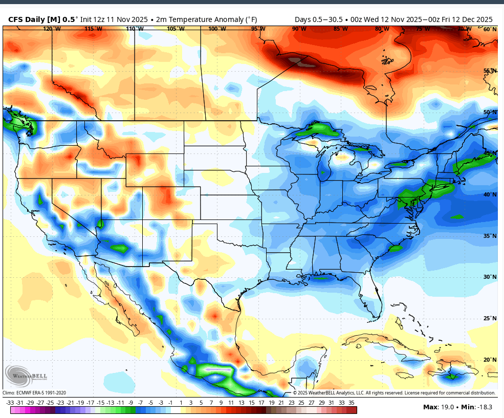
If the below climate forecast model is to be believed....our area in the Northeast across the Northern Mid Atlantic would see some of the coldest temperatures relative to average over the next month through December 11th
-
Thanks for posting this. I wonder if Alan’s cold Jan is largely because of a prog for a very early SSWE followed by a lagged cold effect in Jan. I’d be quite content with this. Not having a warmer than normal La Niña winter in the majority of the SE including another cold Jan would be a victory!
-
It could change or not verify but I don’t see a way there can be any kind of positive outcome here if the Greenland block links up with SE ridging. That would be a disaster. We can’t have too much of a -PNA with the Greenland block or we risk this happening, like in 22-23.
-
 Not super impressive but things are coated up.
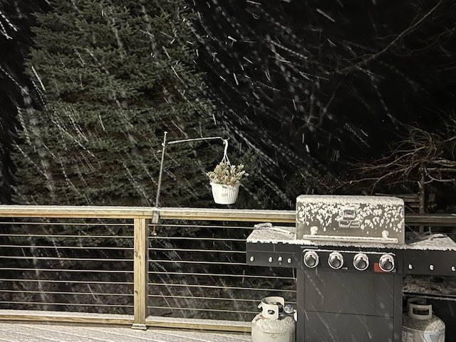
-
My obs....COLD AF....and it took one day of the heat coming on to make me sick. Happens every year! I need a humidifier asap. What a completely unreasonable event yesterday!
-
The upcoming Sierra snowstorm is now progged to be much farther south and a lot warmer, with a ton of rain even at the ski resorts like Mammoth and Palisades. They will be plagued by extremely high snow levels and less precip as well. They might have to move their opening dates to December, because it is so warm up there they can't even make artificial snow at night. Say hello to the La Nina. But this is going to work out to be very good news for the Mid Atlantic this winter, because this is no ordinary Nina. It will be unusually cold in the East this winter and storms will mix with the cold and bring numerous snows to the DC Region. Lately, we have been seeing more Nina-like conditions in the El Nino, and more Nino-like conditions in the La Nina. Go figure. The weather is all messed up. Of course the Great Lakes will get demolished by snow. They get it in spades every time a cold front hits that place.
- Yesterday
-
It started super negative and flipped super positive. Guess we’ll see how it goes.
-
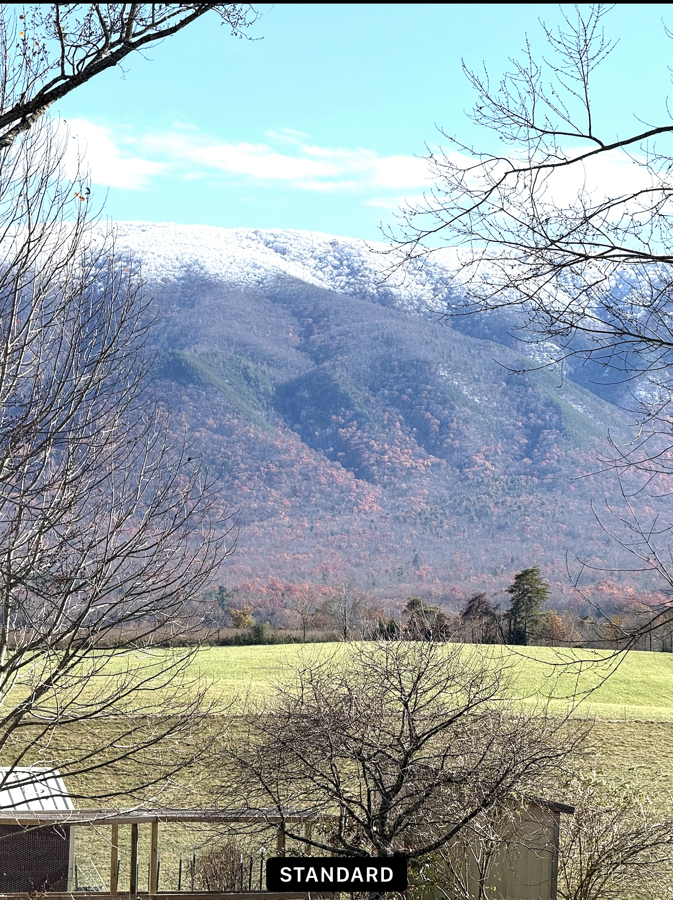
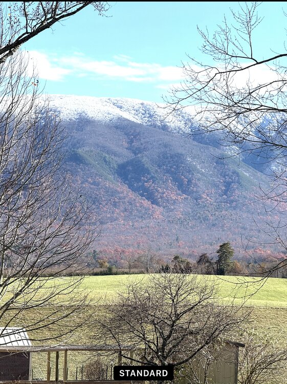
I was working in Camp Creek earlier today and took this picture around 2PM. It’s winter meets Fall! Still some color down low and color up top!
-
that November 18-20 storm has trended really south lol end of the run was kinda cool as well but it also showed flurries for the area tonight lots of things to love

-
The only problem is the Bz needs to drop south.
-
 If 59mph at Islip is real, pretty sure there should’ve been a high wind warning. Today definitely should’ve been a wind advisory.
 -
Spaceweather.com offers it.
-
Looks pretty impressive. Might’ve lied and may go out tonight. First impact should be in ~30m. If we can see it very locally… game on.