All Activity
- Past hour
-
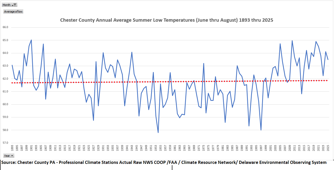
(002).thumb.png.6e3d9d46bca5fe41aab7a74871dd8af8.png) There are some who believe our nightime lows are getting warmer during the summer months. The actual data sees no such warming - almost flat since 1893!
There are some who believe our nightime lows are getting warmer during the summer months. The actual data sees no such warming - almost flat since 1893!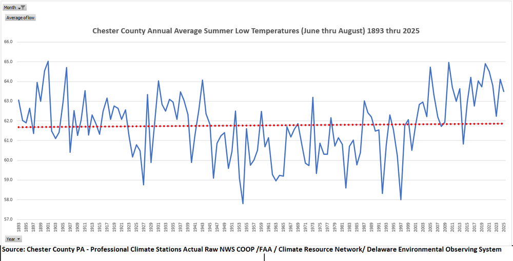
-

Central PA Summer 2026 Discussion/Obs Thread
Eskimo Joe replied to Voyager's topic in Upstate New York/Pennsylvania
Yinzer Alley™ go brrr -

2026-2027 Super El Nino
PhiEaglesfan712 replied to Stormchaserchuck1's topic in Weather Forecasting and Discussion
Yeah, almost all el ninos do that, with the obvious exception of 1986-88 (which peaked in between seasons, in the summer of 87). However, the earlier the peak/fall off, the more likely for a strong la nina the following year. Just look at 1973, and the aforementioned 1988, for example. Those years got very close to, or even breached, -2.0C. -

Winter cancelled/uncancelled banter 25/26
LongBeachSurfFreak replied to Rjay's topic in New York City Metro
I mean it’s a pretty easy forecast. This is a close the blinds winter for snow lovers. Not every super times a big storm with cold like 82/83 and 15/16. Without that it’s warm pac air with a few modified continental polar cool shots. . -
Doesn't appear to be a very hot summer on tap.
-
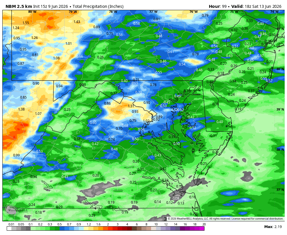
WB 15Z NBM thru day 4
-
Totally agree but he's usually looking for cold/snow so interesting he thinks warm and snowless
-
Get ready to Day 3 Moderate?
-
We are in a drought in the mtns
-
S Wey special
-
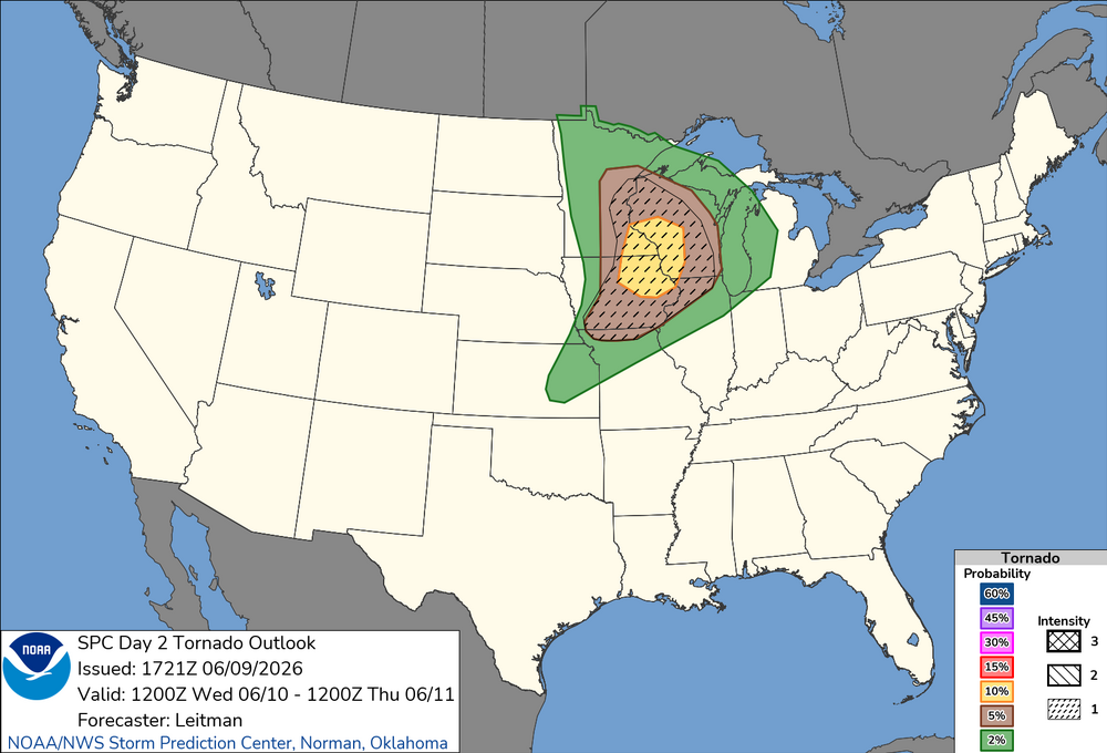
Enhanced for severe wind also expanded into Chicagoland on the new D2.
-
Looks like we may be dealing with convection for the Wednesday morning commute.
-
New D2 Tor Outlook. Seems like SW WI always gets the bullseye these days.
-
Means absolutely nothing just like every other long range forecast. Accuracy on those, no matter how they grade themselves, is similar to pin the tail on the donkey
-

Late May/June 2026 Medium/Long Range
Stormchaserchuck1 replied to JenkinsJinkies's topic in Mid Atlantic
Above average temps https://charts.ecmwf.int/products/extended-anomaly-2t?base_time=202511070000&projection=opencharts_north_america&valid_time=202511170000 -
Yeah possible I guess. Starting to get crispy here.
-
Absolutely disgusting storm.
-
I am in favor of daylight visibility at the expense of overall wow (to a point) so I enjoy that some models pop a mid-afternoon line for tomorrow now. Obviously don't want that to end up dudding the whole day or shifting the crosshair for later by accident but if we could sneak a good hit in the afternoon and then another at night that would be baller. Not even to speak of getting another even better chance Thursday to my understanding
-
Day 3 Thu, expect Friday that to push east
-
Yeah, these types of setups always trend towards best instability/theta-e, and that's nearly always going in the wrong direction. unless there's a strong cf squall line, or it's this type of setup but pegged for NNE many days out, forget it
-
The center of the heat looks to settle into the southeast in that period we'll see if it pushes inorth enough nto the NYC region or teters just south towards SNJ / PHL or DC.
- Today
-

2026-2027 Super El Nino
snowman19 replied to Stormchaserchuck1's topic in Weather Forecasting and Discussion
The normal peak time for El Niños is almost always November/December. That’s the time (November/December) that the majority of models show this one peaking -
some MCV magic it looks like in eastern MI today, quite a few tor warnings
-
Much will depend on wind direction 6/21 and beyond I think. Ongoing dryness could help the heat over perform. On the other hand the lingering rather strong "cool pool" off the North Atlantic coast could temper the heat, especially along the coast if wind has any onshore component. That cooler than normal water has been persistent. We'll see if it gets beaten back in a meaningful way over the next several weeks. I would have to think it will also lessen the chances of locally intense deluges / significant flash flooding events we have seen scattered across the area over the last several warm seasons. Less moisture added to the atmosphere for our area. That area had been quite warm for the last several summer seasons.
-
what am i looking at?


.thumb.gif.f92b16c631a1d15d405ed77b33f0710d.gif)


.thumb.jpg.ad3a2e31d30aff035044689b311a0540.jpg)

