All Activity
- Past hour
-

First Winter Storm to kickoff 2025-26 Winter season
40/70 Benchmark replied to Baroclinic Zone's topic in New England
No, it isn't. -
First Winter Storm to kickoff 2025-26 Winter season
dryslot replied to Baroclinic Zone's topic in New England
Strung out POS -

Nov 28-30th Post Turkey Day Winter Storm
Radtechwxman replied to Chicago Storm's topic in Lakes/Ohio Valley
I hope the radar really blossoms and fills in like models are suggesting. Trough seems to be approaching western NE. Isentropric lift should start increasing next few hours. -

First Winter Storm to kickoff 2025-26 Winter season
40/70 Benchmark replied to Baroclinic Zone's topic in New England
GFS is awful. -

First Winter Storm to kickoff 2025-26 Winter season
CoastalWx replied to Baroclinic Zone's topic in New England
Gfs is very warm still in SNE. QPF is best near low track so not much oomph in the colder air for heavier amounts. -

First Winter Storm to kickoff 2025-26 Winter season
H2Otown_WX replied to Baroclinic Zone's topic in New England
Yeah, the vort is not consolidated, strung out POS -

First Winter Storm to kickoff 2025-26 Winter season
TauntonBlizzard2013 replied to Baroclinic Zone's topic in New England
It’s just a lot weaker, not really south. the whole thing is just less impressive by a good margin -
CMC with it's usual ice storm, Euro with it's C-2" before rain and then maybe some back end snow, that's probably what will happen, you don't need to stay up, go to sleep now
-

First Winter Storm to kickoff 2025-26 Winter season
MJO812 replied to Baroclinic Zone's topic in New England
Gfs is stil nice for interior SNE. It did come further south and east and alot weaker on this run. -

Nov 28-30th Post Turkey Day Winter Storm
cyclone77 replied to Chicago Storm's topic in Lakes/Ohio Valley
Top down saturation almost complete. Should be seeing the first flakes before long. -

First Winter Storm to kickoff 2025-26 Winter season
TauntonBlizzard2013 replied to Baroclinic Zone's topic in New England
Doesn’t look much different to me at all -
Next year could be quite interesting if ElNino develops into summer into late fall,there is alot more correlation with ice storms,ive been doing some research the past few days of ice storms with the ENSO,Typically you'd expect Ice storms with ElNino but i found is when ElNino develops into summer-late autumn the odds dramatically increase into winter time
-

First Winter Storm to kickoff 2025-26 Winter season
Sey-Mour Snow replied to Baroclinic Zone's topic in New England
It’s actually the same or a touch further north with some surface features, just a but colder at first in some spots, looks like icon . Faster less amped meh -
It’s so warm compared to euro/cmc ukemt lol. Takes the 32 line up almost to New York/PA line
-
Temp is fluctuating again. Temp dropped to 29 and now at just before 11 pm it is up to 34. Supposed to see low to mid 20's here. We will see.
-
It is but I forgot how north the GFS was at 18z. More mix this run at least.
-

Central PA Fall Discussions and Obs
WmsptWx replied to ChescoWx's topic in Upstate New York/Pennsylvania
If Texas is left out of the playoff, the SEC is going to abandon the NCAA. You can't have three wins vs top 10 teams, two out of three losses to the #1 and #4 teams in the country and be left out. That's a top two or three resume. -

First Winter Storm to kickoff 2025-26 Winter season
MJO812 replied to Baroclinic Zone's topic in New England
-

First Winter Storm to kickoff 2025-26 Winter season
40/70 Benchmark replied to Baroclinic Zone's topic in New England
What a like about this low is we seem to time the life cycle well, so that could help those areas that are marginal. -
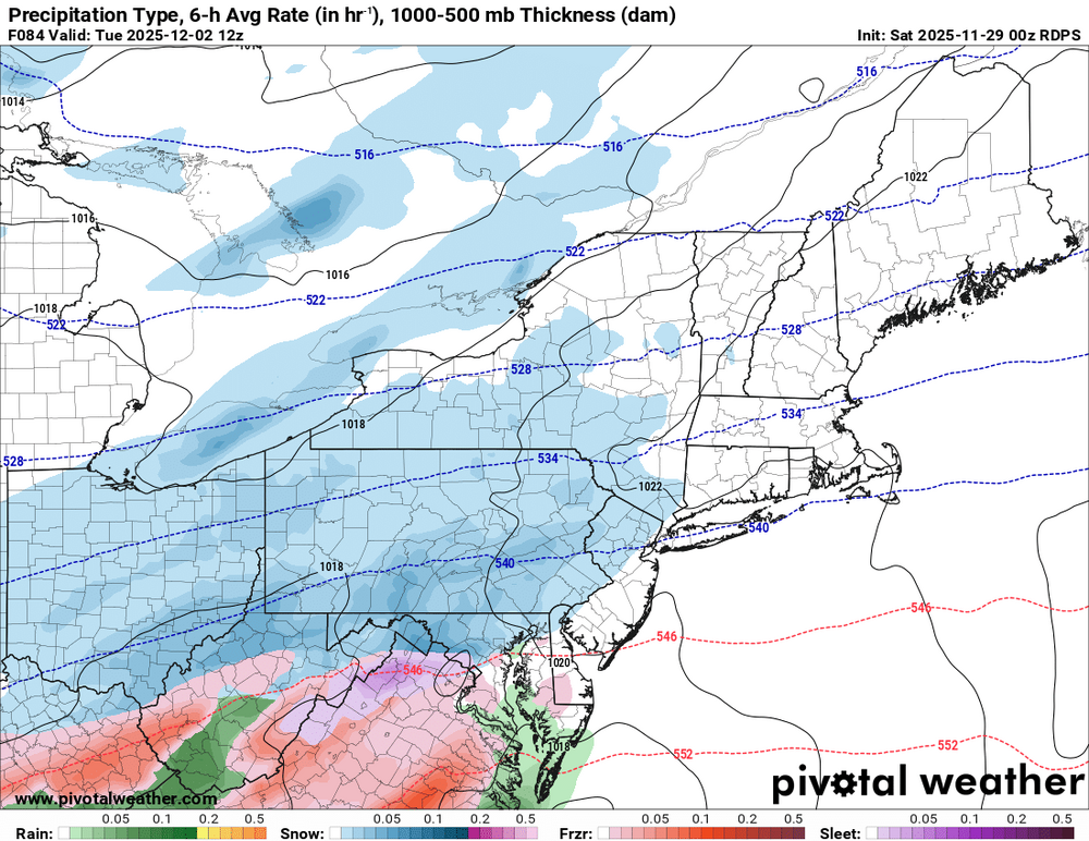
GFS looks south
-

First Winter Storm to kickoff 2025-26 Winter season
MJO812 replied to Baroclinic Zone's topic in New England
Gfs coming back to earth. Gonna be south of past runs. -

First Winter Storm to kickoff 2025-26 Winter season
40/70 Benchmark replied to Baroclinic Zone's topic in New England
Wow, scooter Jr dropped a terd on me...punk -

Winter 2025-26 Medium/Long Range Discussion
Jackstraw replied to michsnowfreak's topic in Lakes/Ohio Valley
I know this Chitowncentric board is focused on tomorrow but the signal of a possible App runner coming up from the S behind this one and partially phasing with some northern stream energy in the Tues to Wed timeframe is gaining a little support with the models. Would be a nice to substantial stat padder for most of the sub and get folks to the S (ILL/IN) and E(OH) that will whiff tomorrow in on a pretty decent early season snowpack that could be around until at least through the weekend. Might be thread worthy if models keep trending up (mainly the stingy fickle Euro). Staying positive as long as I can lol. -

First Winter Storm to kickoff 2025-26 Winter season
40/70 Benchmark replied to Baroclinic Zone's topic in New England
Looks like about 10" here. -
we should probably create a storm thread tomorrow, at least for the NW folks


