All Activity
- Past hour
-
first flakes beginning to fall, albeit small and not many
-
Going on gut 7 inches today in my yard.
-
84 looks to be the actual dividing line this time around 26 here w/ moderate snow falling
-

First Winter Storm to kickoff 2025-26 Winter season
weatherwiz replied to Baroclinic Zone's topic in New England
Yeah no disagreement there...I was just more curious as to where this race is occurring more quickly right now...like where that cutoff is. I could probably pull up radarscope and look for melting layers like Scott referenced. Mesoanalysis is actually not very useful for these warming situations, especially when the warming is in between layers. -
I think Dick Albert retired. Edit: RIP
-
 26 w/ moderate snow coating on all surfaces
 -

First Winter Storm to kickoff 2025-26 Winter season
ORH_wxman replied to Baroclinic Zone's topic in New England
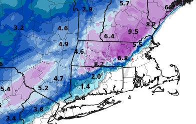
Nice snow map on the HRRR (I'm the red dot)
-

Pittsburgh/Western PA WINTER ‘25/‘26
Mailman replied to Burghblizz's topic in Upstate New York/Pennsylvania
3.5" for me. -

Central PA Fall Discussions and Obs
Jns2183 replied to ChescoWx's topic in Upstate New York/Pennsylvania
Ripping heavy finally Sent from my SM-S731U using Tapatalk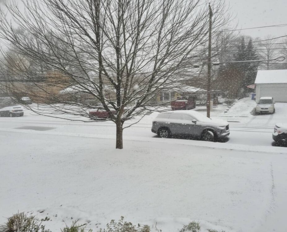
-

First Winter Storm to kickoff 2025-26 Winter season
Typhoon Tip replied to Baroclinic Zone's topic in New England
I added to that....in this situation, I agree with Scott's sentiment to Kevin there - it's a bit of a race. The low is moving well S of LI down there. When it gets roughly to HFD's longitude, the flow will begin to torque around and come more E than S...then, NE and end N... At some point during that rotation, the warm simply won't be able to get farther NW. -

Central PA Fall Discussions and Obs
HBGCPA10 replied to ChescoWx's topic in Upstate New York/Pennsylvania
Roads are awful. Drove from West Hanover Township (by CD High) to Penn State Nyes Road and back between 8 and 9 this morning. Took 22 because I thought it would be better than Jonestown Road. 22 was actually worse than the side streets. Someone was stuck going up the hill on Piketown/Blue Ridge right after you pass under 81 going toward 22. -
Hrrr was way too warm until just now lol
-

Central PA Fall Discussions and Obs
canderson replied to ChescoWx's topic in Upstate New York/Pennsylvania
Huge flakes now. It’s ripping pretty good. That is a scientific weather term. -
Figures I’d leave for work and it changes back to snow
-
 Light snow here, dusting so far. Would be shocked if we scrape out an inch before changing over.
 -
It’s usually wrong! But fun to look when digital snow is the only snow we get down here
-
First Winter Storm to kickoff 2025-26 Winter season
weatherwiz replied to Baroclinic Zone's topic in New England
Funny you say this because I've been thinking the same thing. If we had better positioned highs with these setups, we would see suppressed storms or really strung out garbage in which the northern shield of the precipitation shield gets eroded away with drier air draining in. For HP positioned to our north, we want that when systems are coming up the coast, probably not advancing WNW out of the deep south. -
^what he said
-
It is definitely solid:
-
Had to leave Fallston for downtown at 6:30 - was 35 and rain - but car had a full glaze of ice on it - so I guess freezing rain to start is what I will record for an obs for the day.
-
Well those who are lucky enough to get some accumulating snow will get to look at it for awhile....be nice if we could get a nice region wide Miller A or B with this cold coming up but that looks doubtful. I told my neighbor yesterday not to be surprised if there's only two slushy inches and now that seems like a fantasy lol Cloudy chilly start though 28. Certainly looks like a snow sky for the time being.
-

Central PA Fall Discussions and Obs
Itstrainingtime replied to ChescoWx's topic in Upstate New York/Pennsylvania
Just saw that officially in Lancaster (MU) the official snowfall total was zero. Nothing measurable fell. -
 As per mPING, the precipitation has started as rain in New York City and southern Westchester County. North of White Plains, there was a rain/snow mixture.
 -
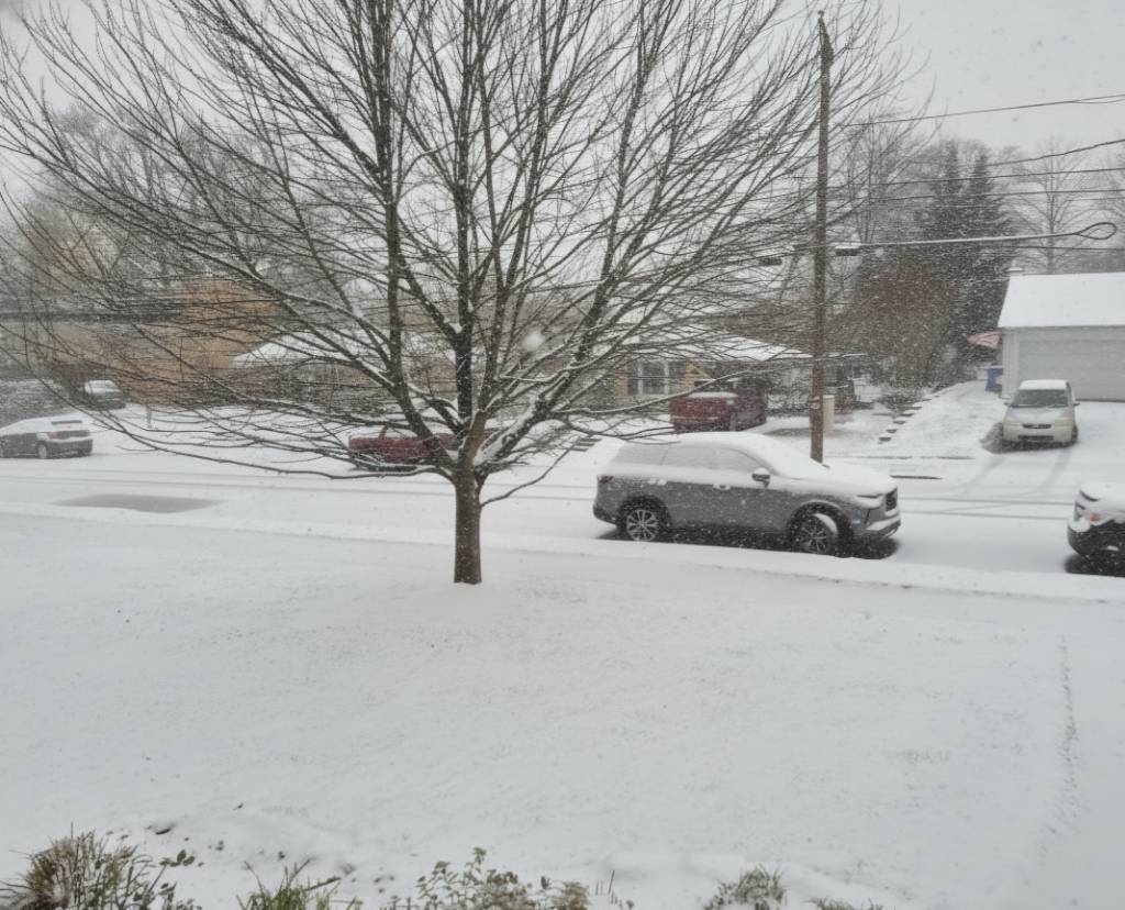
29f, Snowing here. Trying to enjoy it instead of endlessly bitching. Here's the new yard. At '300. Need to update profile. Hoping we get 2-4". It'd be the first memorable snow for my daughter probably. She's 2 in Feb.

-
That model is all over the place.