All Activity
- Past hour
-

December 2025 regional war/obs/disco thread
WxWatcher007 replied to Torch Tiger's topic in New England
December of yore -
Quick question, does anyone have suggestions for good YouTube weather forecasts? I watch WXrisk with DT. I was wondering if anybody had other people who do the overall picture as well.
-

First Winter Storm to kickoff 2025-26 Winter season
ineedsnow replied to Baroclinic Zone's topic in New England
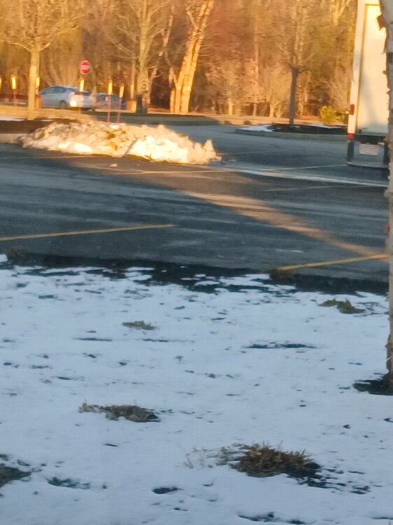
Just got to market basket in Athol.and noticed they must of plowed last night.. Hopefully we can add bigly to that pile -
-

Nov 28-30th Post Turkey Day Winter Storm
Harry Perry replied to Chicago Storm's topic in Lakes/Ohio Valley
We about to be rockin’ -

E PA/NJ/DE Autumn 2025 Obs/Discussion
JTA66 replied to PhiEaglesfan712's topic in Philadelphia Region
This time of year, I’d be happy just to see flakes fly regardless if they amount to anything. -
First Winter Storm to kickoff 2025-26 Winter season
radarman replied to Baroclinic Zone's topic in New England
toss at your peril -
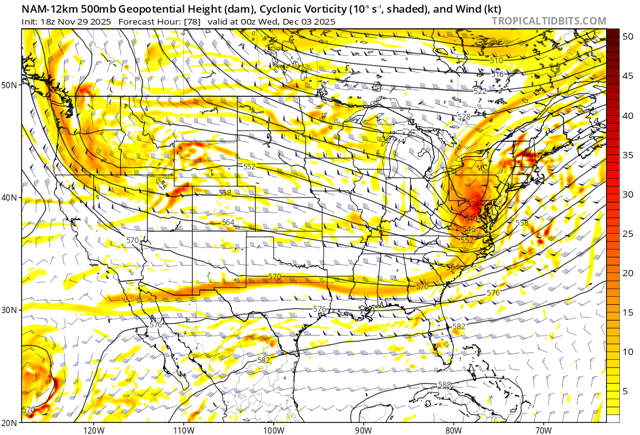
Aren't the NAMs going away next month? I don't know why they don't just put them to rest.
-
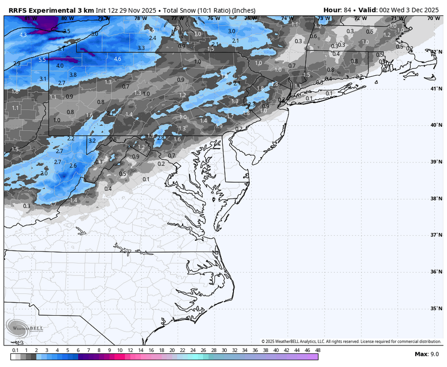
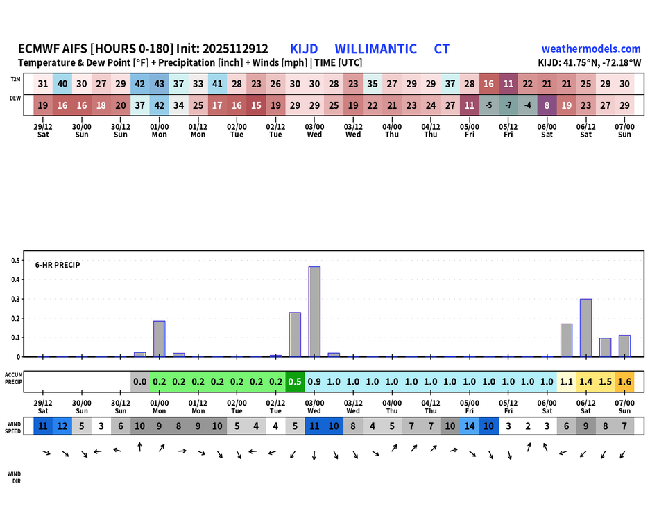
now watch the next Euro's suite only bring the precip as far north as southern NY state - something is seriously wrong with some of these models..........is it GIGO (Garbage In/Garbage Out)??
-
First Winter Storm to kickoff 2025-26 Winter season
Snowcrazed71 replied to Baroclinic Zone's topic in New England
Yeah, I would toss that... Maybe I'd take the Nam more seriously tomorrow night -

E PA/NJ/DE Autumn 2025 Obs/Discussion
simbasad2 replied to PhiEaglesfan712's topic in Philadelphia Region
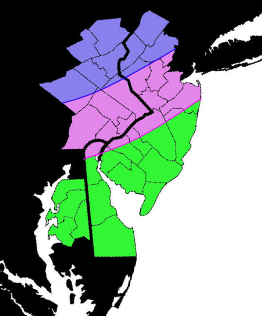
Drew up this quick map to outline some of my thoughts for this storm. Constructive feedback is appreciated! Blue - All Snow expected, accumulations around 2-4" localized 4"+ Pink - Snow, mix, and rain expected. A sharp cutoff will develop here and a slushy 0-2" will fall before changing over to rain, some of which could be heavy Green - All rain. Perhaps maybe a light mix at onset but this will quickly change over. Air temps closer to the shore could even reach into the lower 50s. Some rain could be heavy at times -
First Winter Storm to kickoff 2025-26 Winter season
78Blizzard replied to Baroclinic Zone's topic in New England
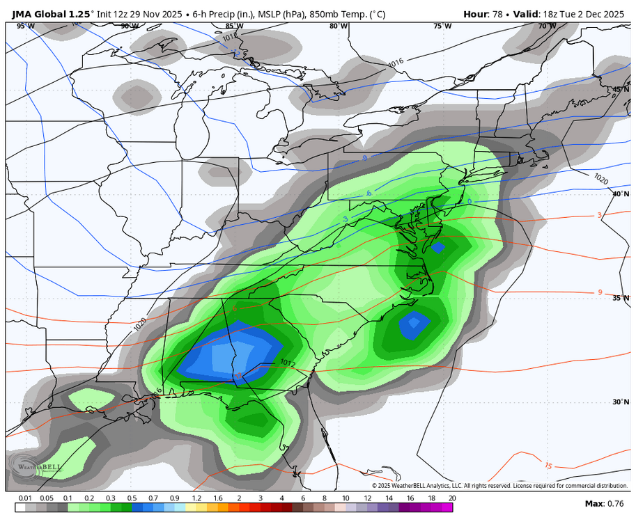
LOL @ these temp maps. Tells you all you need to know - inland runner vs ots: -
First Winter Storm to kickoff 2025-26 Winter season
dryslot replied to Baroclinic Zone's topic in New England
DT’s map is going to -
-

First Winter Storm to kickoff 2025-26 Winter season
weathafella replied to Baroclinic Zone's topic in New England
This looks like a great start! Most areas 20 miles inland should do well and maybe even closer to the coast. I’ll be away for this one but can’t complain given my storm today. -
-
So much for thinking a mere 24 hours ago I was pretty safe in Orange County from any change over. The bright side I will be in Saratoga Springs on Wednesday and should at least see a nice blanket of snow on the ground there. But it's weather three days out, so who knows.
-

December 2025 Short/Medium Range Forecast Thread
jaxjagman replied to John1122's topic in Tennessee Valley
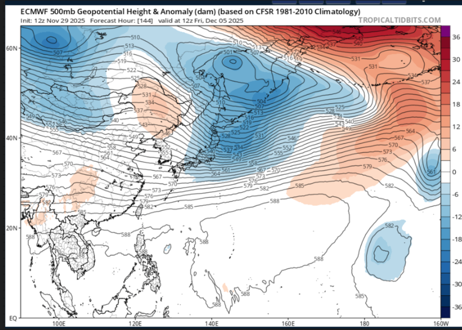
Its just my opinion but when the SOI dropped pretty good around the 23rd then rose before Thanksgiving and the dropped again after,this pattern could should more than likely look like this into East Asis into the first week of Dec,it wouldnt effect our weather until right before the mid month of Dec 29 Nov 2025 1011.21 1008.95 -3.95 14.40 8.89 28 Nov 2025 1011.09 1008.70 -3.12 14.81 8.88 27 Nov 2025 1011.74 1008.55 1.97 15.52 9.00 26 Nov 2025 1012.11 1006.05 20.23 16.24 9.20 25 Nov 2025 1009.58 1005.50 7.63 16.34 9.25 24 Nov 2025 1007.56 1004.90 -1.40 17.10 9.38 23 Nov 2025 1009.73 1000.85 38.17 17.97 9.60 22 Nov 2025 1011.59 1003.75 31.56 17.51 9.41 -

First Winter Storm to kickoff 2025-26 Winter season
WxWatcher007 replied to Baroclinic Zone's topic in New England
It’s just the NAM at the end of its range I mean what could go wrong? -

First Winter Storm to kickoff 2025-26 Winter season
ineedsnow replied to Baroclinic Zone's topic in New England
18z NAM is still super amped -

First Winter Storm to kickoff 2025-26 Winter season
Ginx snewx replied to Baroclinic Zone's topic in New England
Tossed -

December 2025 regional war/obs/disco thread
Ginx snewx replied to Torch Tiger's topic in New England
-
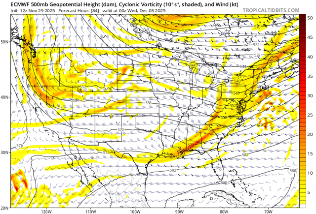
Euro has a less defined/consolidated shortwave than the GFS/Canadian, so its weaker/a bit offshore with the low track as it approaches our latitude. Given the synoptics(HP retreating) that could work for a modest accumulation for central MD. Who knows if it has the right idea.


