All Activity
- Past hour
-

First Winter Storm to kickoff 2025-26 Winter season
moneypitmike replied to Baroclinic Zone's topic in New England
It’s very good, though I was led to believe there were many more musical numbers. -
That makes total sense too... probably a tenth of an inch of liquid or so ahead of Mansfield. With these good ratios, 2-3" storm total increase makes sense. Say a 9" vs 12" event.
-

Nov 28-30th Post Turkey Day Winter Storm
wegoweather replied to Chicago Storm's topic in Lakes/Ohio Valley
-

First Winter Storm to kickoff 2025-26 Winter season
kdxken replied to Baroclinic Zone's topic in New England
What are the first guesses for MetroWest? West of 95 that is. -
First Winter Storm to kickoff 2025-26 Winter season
RDRY replied to Baroclinic Zone's topic in New England
First storm of the season -- Euro scrape, GFS upper-low runner. And our new overlord, AI, is making the ICON look like it has a clue. -
Central PA Fall Discussions and Obs
anotherman replied to ChescoWx's topic in Upstate New York/Pennsylvania
Time for him to be wrong. [emoji23] -
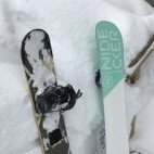
Yeah, it’s still going here. Wind picking up too. We’re probably 2-3” ahead of you. Nice event to fix what could have been a disaster on the slopes. .
-

First Winter Storm to kickoff 2025-26 Winter season
kdxken replied to Baroclinic Zone's topic in New England
It's a good watch. Have only seen bits and pieces. -

Central PA Fall Discussions and Obs
Voyager replied to ChescoWx's topic in Upstate New York/Pennsylvania
And give the I-95ers something to gloat about, which I absolutely hate. -

Central PA Fall Discussions and Obs
canderson replied to ChescoWx's topic in Upstate New York/Pennsylvania
Game over then. He’s never incorrect. -

First Winter Storm to kickoff 2025-26 Winter season
powderfreak replied to Baroclinic Zone's topic in New England
Agreed. The default is certainly more progressive... it has to work to amplify, like all systems do. It's why we know the Messenger ticks are a thing. It's probably a more SNE/CNE event rather than NNE. -
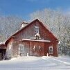
Yeah it's a lot of work / $$ keeping the old ones going but I'm amazed by the work that went into building back in the day without all the modern tools and machinery. The sill beams on the farmhouse are roughly 12"x8" and 38ft long, laid on leveled granite foundation blocks some refrigerator-size, and the sills are still mostly level after 200+ years. I struggle to keep a small patio paver project level...
-
Nebraska vs Iowa game.
-

First Winter Storm to kickoff 2025-26 Winter season
40/70 Benchmark replied to Baroclinic Zone's topic in New England
Thanks for clearing that up. -
Nov 28-30th Post Turkey Day Winter Storm
jlauderdal replied to Chicago Storm's topic in Lakes/Ohio Valley
Has anyone seen any flakes flying from this system yet? -

December 2025 Short/Medium Range Forecast Thread
Carvers Gap replied to John1122's topic in Tennessee Valley
The great thing is that it is late fall and early winter. Should have more chances. Early December is bonus. -

First Winter Storm to kickoff 2025-26 Winter season
brooklynwx99 replied to Baroclinic Zone's topic in New England
you know i’m not IMBY-ing, but i do think that the overall pattern favors less consolidation and an outcome more similar to the foreign guidance. it’s progressive -
Central PA Fall Discussions and Obs
Blizzard of 93 replied to ChescoWx's topic in Upstate New York/Pennsylvania
If I was in Lanco, I’d be concerned about Tuesday, but I think most of us are in good shape for at least our first measurable to maybe plowable event this season. -
Nov 28-30th Post Turkey Day Winter Storm
frostfern replied to Chicago Storm's topic in Lakes/Ohio Valley
Long duration WAA can’t fail too bad. It’s not one of those quick hitting systems that depend entirely on heavy rates. -
One thing to watch are the consistent pulses of southern stream energy popping up in the long range. That’s been another fly in the ointment the past few years. Last year was a parade of northern stream pieces of energy squashing the southern stream. That’s fine for a novelty event but if you want a big dog, we need less of that this winter.
-
coastal weenies gotta pray for 18z euro and euro AI to be seeing something the others dont.
-

Central PA Fall Discussions and Obs
Itstrainingtime replied to ChescoWx's topic in Upstate New York/Pennsylvania
Well I was being somewhat serious. I think it's important to have his contributions but I always feel like the wet blanket. I guess if people are interested they can go read on their own. -
31 already .... forecast says 22 for tonight's low.
-
We rarely miss a storm to the south. However, last winter it was suppression city around here. I don't think anyone realized the magnitude of last year's big gulf coast storm. Some locations along the gulf coast got more snow in that one storm than the last 100 years of snowfall combined. Think about all those snowless winters before 2025. That's more impressive than folks want to admit. It set all-time records for cold and snow in many places. I would not call last winter average when looking at the south/southeast as a whole. If we would have had just a little SE ridging... western NC would have been buried instead of coastal areas. Then everybody around here would have talked about it being an A+ winter. Guess it all about perspective.
-
Fredluchsinger started following December Medium/Long Range Discussion
-

December 2025 Short/Medium Range Forecast Thread
Daniel Boone replied to John1122's topic in Tennessee Valley
Yeah, it's a slap in the face when you see an LP to our South and we get Rain.


