All Activity
- Past hour
-

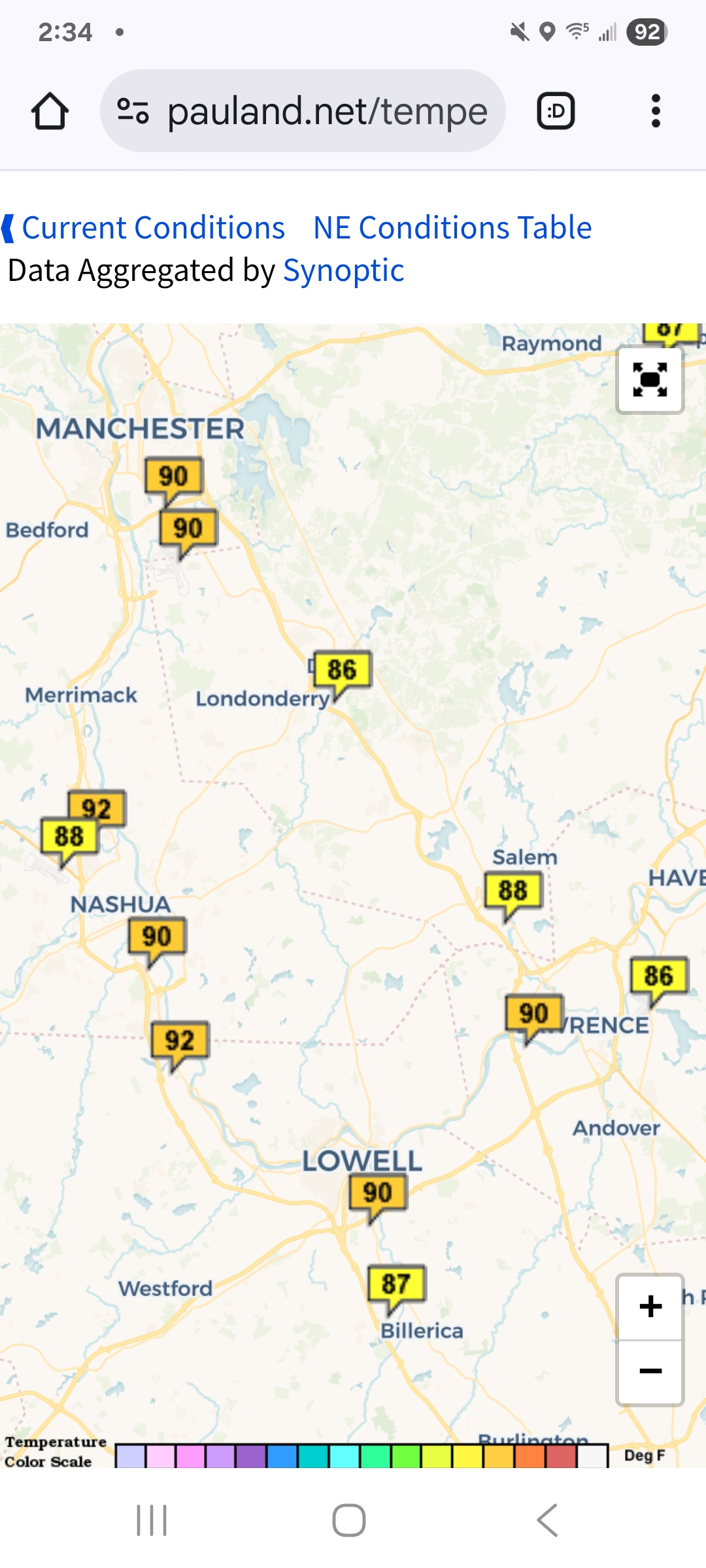
July 2025 Obs/Disco ... possible historic month for heat
kdxken replied to Typhoon Tip's topic in New England
Maybe not.
-

E PA/NJ/DE Summer 2025 Obs/Discussion
BBasile replied to Hurricane Agnes's topic in Philadelphia Region
Just had a quick shower that dropped 0.17". Temp is still 83 with a dew of 78. -
Same here. It apparently rained anll around. Nada here.
-
July 2025 Obs/Disco ... possible historic month for heat
kdxken replied to Typhoon Tip's topic in New England
Say goodbye to Fluffy. -

July 2025 Discussion-OBS - seasonable summer variability
LoboLeader1 replied to wdrag's topic in New York City Metro
89F/71 -

July 2025 Obs/Disco ... possible historic month for heat
DavisStraight replied to Typhoon Tip's topic in New England
No, not sure how I got them, I avoid the woods when I walk the dog, usually stay on the road. -
I suggest it is true ... At least intuitively so - a more advancing/sophisticated corroborative science not withstanding. It aligns well with faster hemispheres that occur as a result of increased gradient associated with CC. More over, this is reproducible observation, folks. I mean we spend all this time with deep statistical comparisons with mid last century longer termed teleconnectors .. trying to find secrets that no one has. Yet from what I'm reading ... no one considers CC enough and or blinking light limits that are materializing now. Can't build expectations based upon the former - not nearly as much so. I've been snarky - admittedly - in recent post with drive-by pot shots ... more for funniness that those who engage in the practice of course don't see the humor. HAHAHA. Seriously though, when joked to just take the last 10 years, average them, and call it a day for temp and precip bias expectation... mm, unfortunately there's more than a mere modicum truth to it. And the why is rooted in the gradient soaked hemisphere. When there's more non-hydrostatic lines demarcating the polar field from the subtropical field, that physically/deterministically speeds up the flow. That does a few things.. But the mains are: faster flow alters the wave frequency; telecon reliance takes a hit because though the correlations are clad, they change faster than the correlation can be realized. This casts an illusion of chaos but's really that the patterns are changing almost as fast as a cold wave synopsis gets underway ( for example), and vice versa. This is why part of the climate reporting, globally, is complaining about dramatic short term changes. It's because the increased speed of wave propagation at planetary scales. This then causes non-linear and linear resonance break down. Think of it as less positive interference. As an aside/anecdotally ( so taken with a grain - ), this is causing a gutting of the "middle class" Less standard model cyclones in lieu of weird events that gets us more or less in the range of seasonal snow - which is also a delta climate metric, so it's silly to think of seasonality if based upon 1980 ... We seem to get more 20 to 30" events making up seasonal totals though. We get nickle dimes by accident, or the big historic wild bombs, otherwise, we're yawing between deep cold and balmy thaws in less time.
-

July 2025 Obs/Disco ... possible historic month for heat
Damage In Tolland replied to Typhoon Tip's topic in New England
Are you mowing with your shirt off? -
The thing I remember most about the 10-11 winter was HM nailing that massive NAO/AO blocking over a month before it even happened. It was right around Halloween and he sounded the alarm that the stratosphere and troposphere were “talking” and major high latitude blocking was coming for December and January. And I know people are going to be shocked at this, but I have to give JB credit for accurately calling the complete breakdown of the blocking in February. Around mid-January he warned that winter was going to come to an abrupt end, over and done in the east in February and the NAO/AO were going to collapse and not come back again. The weenies were furious with him, wanted to rip him apart. He turned out to be right
-
July 2025 Obs/Disco ... possible historic month for heat
DavisStraight replied to Typhoon Tip's topic in New England
Two more ticks my wife had to dig out of my back today, brings my total to 3 this season. They left about an inch red spot. -
Scotty too hottie. Worlds best.
-

July 2025 Obs/Disco ... possible historic month for heat
Baroclinic Zone replied to Typhoon Tip's topic in New England
Summah has returned, 87/75 -

July 2025 Discussion-OBS - seasonable summer variability
winterwarlock replied to wdrag's topic in New York City Metro
89/78/101 -
THIS. My body has acclimated to the tropics. Running outside on Tuesday morning is going to feel like eating Heaven's spaghetti.
-
July 2025 Obs/Disco ... possible historic month for heat
kdxken replied to Typhoon Tip's topic in New England
Just another day in the MegaHot valley.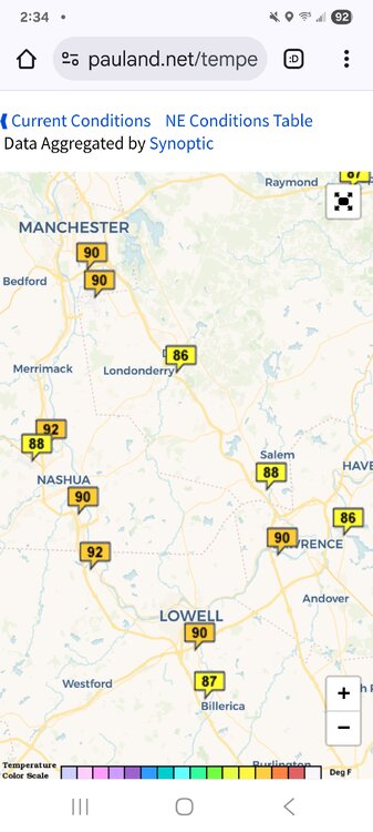
- Today
-

July 2025 Obs/Disco ... possible historic month for heat
Torch Tiger replied to Typhoon Tip's topic in New England
stay vigilant and safe. -

July 2025 Obs/Disco ... possible historic month for heat
moneypitmike replied to Typhoon Tip's topic in New England
I wish i had an anemometer here….we just had 15 minutes of howling winds come down the river from that.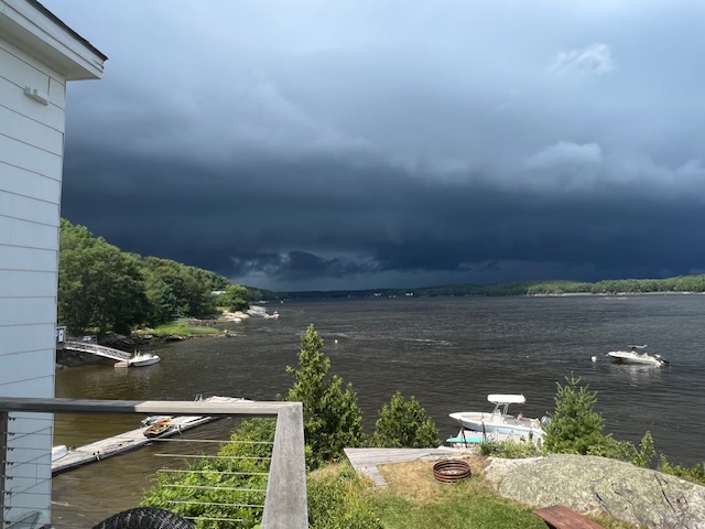
-
If you go to the end of Kemp Mill Shopping Center parking lot off Arcola and go to far end of it I’m very close to that
-
What cross street are you near on Sligo Creek.
-
July 2025 Obs/Disco ... possible historic month for heat
moneypitmike replied to Typhoon Tip's topic in New England
Jeffs storm is sliding just to my north.
-
The Catoctin Cloud Factory has been doing a pretty good job at keeping it partly sunny here today. Otherwise, another beautiful day. Not much aside from drizzle here yesterday, but I noticed the 270 Split Storm Magnet did really well again.
-
A 70F dewpoint feels like gd paradise.
-
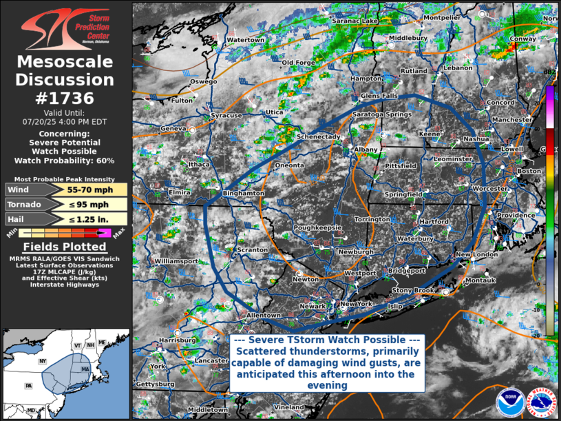
July 2025 Obs/Disco ... possible historic month for heat
Torch Tiger replied to Typhoon Tip's topic in New England
Probability of Watch Issuance...60 percent SUMMARY...Scattered severe thunderstorms, primarily capable of damaging wind gusts, are anticipated this afternoon and into the evening across portions of New England into eastern Pennsylvania, southern New York, and New Jersey. Though there is some uncertainty in the degree of convective organization and evolution, a severe thunderstorm watch could be warranted later this afternoon. DISCUSSION...Satellite and radar trends show convection developing across PA into NY in an environment characterized by moderate buoyancy (~1000-1500 J/kg MLCAPE) and strong deep-layer shear (40-45 kt 0-6km). Though deep convection has yet to form, it is anticipated that as daytime heating and mixing continues, the environment will support strong, organized thunderstorm updrafts. Given long, straight hodographs and appreciable 0-1 km lapse rates approaching 8 C/km, along with seasonably high precipitable water content approaching 2.00 inches, the primary threat will be for damaging straight-line winds of 55-70 MPH within thunderstorm downdrafts. Hail or a brief tornado cannot be ruled out with any stronger, isolated organized convection that occurs, though low-level shear and mid-level lapse rates do not suggest that they are likely at this time. -

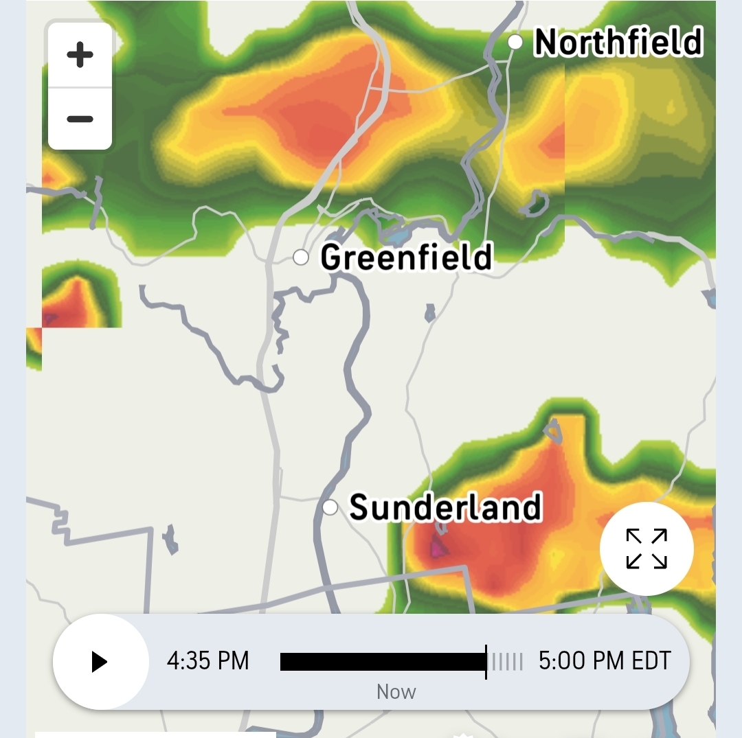
July 2025 Obs/Disco ... possible historic month for heat
Typhoon Tip replied to Typhoon Tip's topic in New England
-

July 2025 Obs/Disco ... possible historic month for heat
HoarfrostHubb replied to Typhoon Tip's topic in New England
Heading to Bernardston in a bit. Prob hit the brewery around 4