
Mid-Atlantic Snow forecast For December 28-29 (Initial)

Entry posted by Ellinwood ·
2,600 views
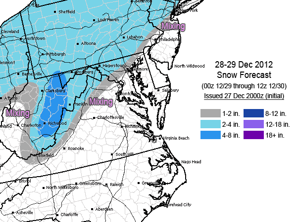
Another quick-turnaround forecast as the next system looks to bring widespread 1-4" totals to the Mid-Atlantic, with higher totals in the central Appalachians. Marginal boundary layer temperatures and initial surface winds out of the southeast makes finding that 1" boundary a challenge yet again. Luckily, the upper-level temperatures are cooperating more this time around, so if your surface temperature is at or below freezing you'll almost certainly be getting some accumulation. Mixing areas will mostly be rain/snow, but some sleet is still possible.
I'll be traveling tomorrow, so if/when I update it will be in the evening.
3 Comments
Recommended Comments
Create an account or sign in to comment
You need to be a member in order to leave a comment
Create an account
Sign up for a new account in our community. It's easy!
Register a new accountSign in
Already have an account? Sign in here.
Sign In Now