
Recap: Tornado in Massachusetts, May 9th, 2013

Entry posted by Quincy ·
7,420 views
 The National Weather Service (NWS) reported that an EF-0 tornado touched down in eastern Massachusetts Thursday afternoon, shortly after 4:30 p.m.
An upper level low lifted northward through New England on Thursday. An unseasonably cold air mass was in place, resulting in cold temperatures aloft. It was the combination of low Lifted Condensation Levels (LCL's) and moderate wind shear aloft that helped create an environment that was marginally supportive of tornado development. It is possible that a land-sea interaction with winds off of the nearby ocean may have played a role in spawning this tornado. The NWS reported that it was a case of a cold air funnel.
The tornado touched down in Stoughton, M.A. in Norfolk County and stayed on the ground for 0.25 miles. The tornado was a strong EF-0 with maximum sustained winds of 85 MPH. Damage was minimal, but a local car dealership reported seeing the tornado and had some vehicles blown around by the winds.
Looking back at historical tornadoes in the Northeastern United States, the helicity values and amounts of instability in place on Thursday were relatively low compared to prior tornadic events. However, it was the low LCL heights and moderate wind shear that did elevate the tornado potential somewhat. On a scale of 0-5, 0 being unfavorable and 5 being highly favorable for tornadoes (based on local climatology), the environment yielded a value of 1.9.
A note that a 2.5 value would be equal to the mean of past tornadoes.
PUBLIC INFORMATION STATEMENT
NATIONAL WEATHER SERVICE TAUNTON MA
158 PM EDT FRI MAY 10 2013
..TORNADO CONFIRMED IN STOUGHTON IN NORFOLK COUNTY MA
LOCATION...
STOUGHTON IN NORFOLK COUNTY MA
DATE...MAY 9 2013
ESTIMATED TIME...431 PM EDT
MAXIMUM EF-SCALE RATING...EF0
ESTIMATED MAXIMUM WIND SPEED...85 MPH
MAXIMUM PATH WIDTH...50 YARDS
PATH LENGTH...0.25 MILES
BEGINNING LAT/LON...42.10N / 71.10W
ENDING LAT/LON...42.10N / 71.10W
* FATALITIES...0
* INJURIES...0
* THE INFORMATION IN THIS STATEMENT IS PRELIMINARY AND SUBJECT TO CHANGE PENDING FINAL REVIEW OF THE EVENT(S) AND PUBLICATION IN
NWS STORM DATA.
..SUMMARY
THE NATIONAL WEATHER SERVICE IN TAUNTON MA HAS CONFIRMED A BRIEF TORNADO TOUCHDOWN IN STOUGHTON MA ON MAY 9 2013.
THE TORNADO TOUCHED DOWN AT A CAR DEALERSHIP ON ROUTE 138 WHERE IT WAS CAPTURED BY A SECURITY CAMERA AND RECORDED ON CELL PHONE CAMERAS BY SEVERAL OF THE DEALERSHIP EMPLOYEES.
THREE RV TRAILERS...WEIGHING ABOUT 5000 POUNDS EACH...WERE PUSHED BACK ABOUT 6 FEET AGAINST A CHAIN LINK FENCE. ONE TRAILER WAS LIFTED ABOUT 15 FEET INTO A LIGHT POLE BUT LANDED ON ITS WHEELS WITH MINIMAL DAMAGE.
AN ALUMINUM DOOR ABOUT 20 FEET HIGH AND 15 FEET WIDE WAS BLOWN OUT OF THE SERVICE GARAGE. EYEWITNESSES REPORTED CEILING TILES BEING LIFTED INSIDE THE DEALERSHIP AS THE TORNADO PASSED OVERHEAD.
THE TORNADO ENTERED A WOODED AREA JUST TO THE NORTHEAST OF THE DEALERSHIP. ABOUT 0.25 MILES AWAY...TWO LARGE PINE TREES WERE DOWNED ON ERICA DRIVE AND DEAN ROAD BEFORE IT DISSIPATED.
BASED UPON A SURVEY OF THE DAMAGE...THE TORNADO IS CLASSIFIED AS EF0 ON THE ENHANCED FUJITA SCALE WITH MAXIMUM WINDS OF 85 MPH. THE PATH LENGTH WAS 0.25 MILES AND THE MAXIMUM WIDTH WAS ABOUT 50 YARDS.
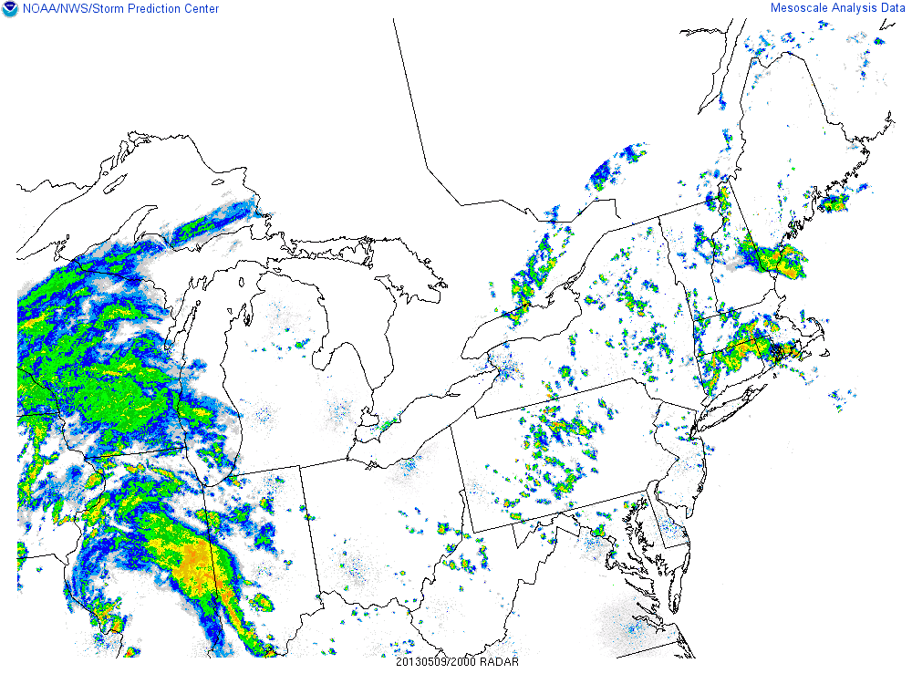
Here's a look at radar imagery about a half hour before the time of the tornado:
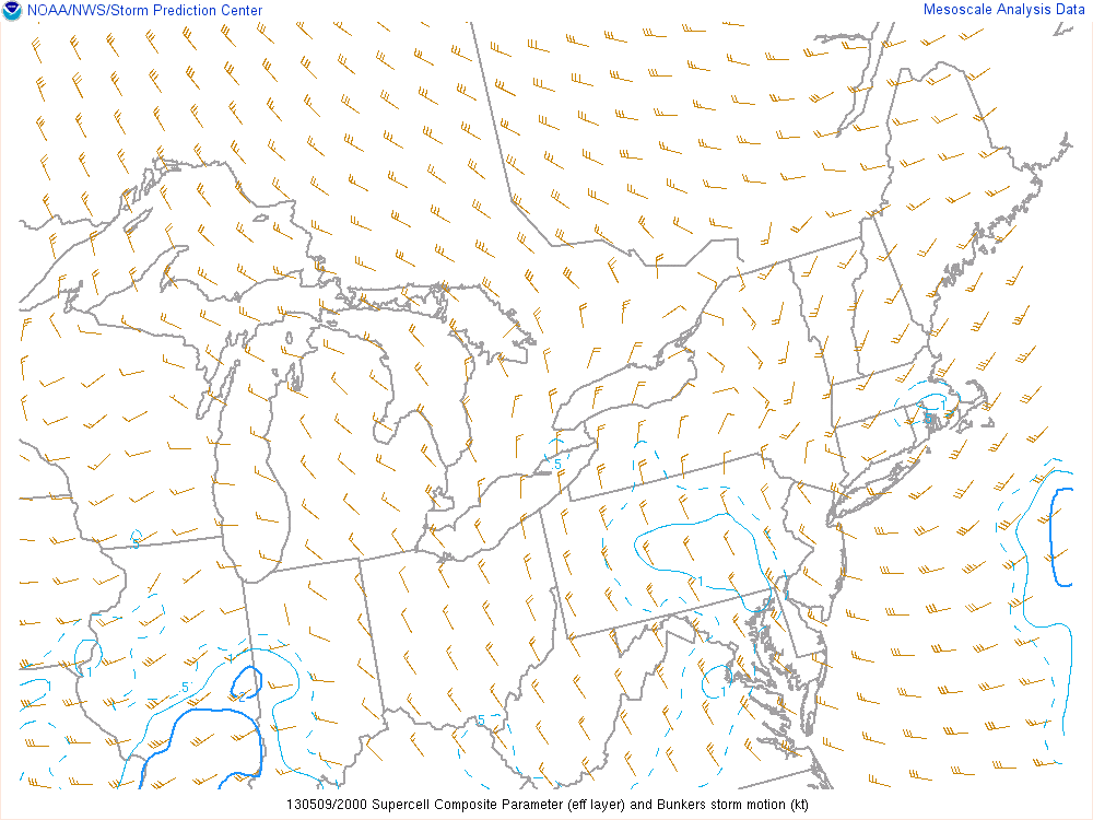
The Supercell Composite Parameter was relatively low, although some slightly higher values did target the area near the tornado touchdown:
The only severe weather report in the Northeast on Thursday was that tornado in Massachusetts!
2 Comments
Recommended Comments
Create an account or sign in to comment
You need to be a member in order to leave a comment
Create an account
Sign up for a new account in our community. It's easy!
Register a new accountSign in
Already have an account? Sign in here.
Sign In Now