-
Posts
4,228 -
Joined
-
Last visited
About jojo762

Profile Information
-
Gender
Not Telling
Recent Profile Visitors
4,409 profile views
-
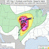
The 00z HRRR was (predictably?) rough for KS/OK. Big time throwback to the 4/9/11 Mapleton, IA tornado though with a lone-ranger INVOF the triple point. HRRR soundings I pulled from KS all exhibited fairly minimal CINh, so I'm honestly curious what exactly we're missing as far as the model not initiating... EDIT: Besides the fact that the wave is probably just a *touch* too far west...
-
Yes, the NAM wasn't convecting the night/days leading up to that event... HOWEVER, it was extremely obvious that we were going to get storms that day given the dynamics at play, etc. I feel as though Tuesday is much less obvious -- however, the NAM is absolutely out to lunch showing zero CI along the dryline, esp in Oklahoma. Some of this morning's 12z NAM soundings in KS had a lot of CINh, which obviously worries me... But when all is said and done I think we get a fairly sizable outbreak of severe storms on Tuesday. Tornado threat is tricky despite pretty looking colors on the parameter maps, because we will likely have at least some residual CINh -- meaning storms could potentially struggle to maintain surface-based status. I'm pretty bullish overall on Tuesday. It *will* be a day we all remember for a while -- but for what reason? Epic cap bust or substantial tornado outbreak are both on the table.
-
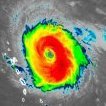
SUMMARY OF 1100 PM CDT...0400 UTC...INFORMATION ---------------------------------------------- LOCATION...30.4N 90.7W ABOUT 5 MI...10 KM W OF KILLIAN LOUISIANA ABOUT 30 MI...50 KM ESE OF BATON ROUGE LOUISIANA ABOUT 45 MI...70 KM NW OF NEW ORLEANS LOUISIANA MAXIMUM SUSTAINED WINDS...95 MPH...155 KM/H PRESENT MOVEMENT...NW OR 340 DEGREES AT 9 MPH...15 KM/H MINIMUM CENTRAL PRESSURE...960 MB...28.35 INCHES
-
What on earth is happening...
-
This has to be a record for strongest sustained, and gusting winds RECORDED in a hurricane... right?
-
Roof top rescues are happing in Laplace, not NOLA. Laplace is getting hammered by both surge and rain-induced flash flooding.
-
Looks like there is some sort of small stream that runs parallel to Donner Dr in NOLA. It looks tiny, so the fact that they're reporting flooding from it is pretty astonishing.
-
That is likely going to take weeks to fix.
-
Looks like 1st and 2nd hand reports on twitter indicate the flooding is pretty much as serious as the Jefferson Parish scanner traffic about roof-top rescues would indicate...
-
This might be a little disruptive to more important things happening... But what a damn child. He begs for help, as if he's in imminent danger... Now he's responding to backlash on twitter for putting himself in a piss poor position? Some emergency, huh?
-
Rather apparent that catastrophic, potentially deadly flooding is taking place in Laplace.
-
):
-
FWIW, believe the Jock Williams dude (the guy with the stream) is also with him... Esp given Jock's SN location being Larose, LA (same as location indicated in the tweets).


