Ozarkwx
-
Posts
316 -
Joined
-
Last visited
About Ozarkwx

-
I will say if I was a kid in Little Rock I would be pretty excited about sliding down the hill in the park on Monday. I would like to think I would be a little bit happy that someone even more snow starved than me gets a decent snow. But not yet. I am still hoping for a grand reversal of trend. One more model cycle and I will wave the white flag if nothing big changes.
-
Last night came through for Eureka Springs (6-10"), heavier to our south. The roads cleared right up, but yikes the power outages. Spending the night out of the home due to continuing power outage. Meanwhile this for mid next week, maybe.....

-
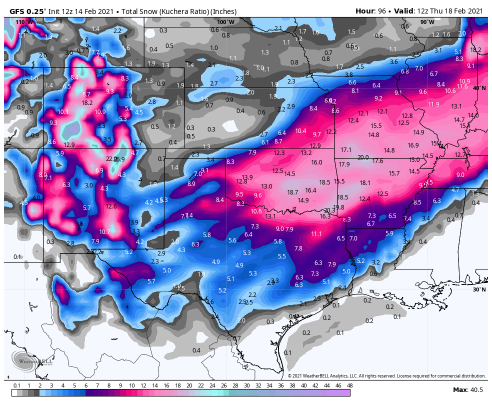
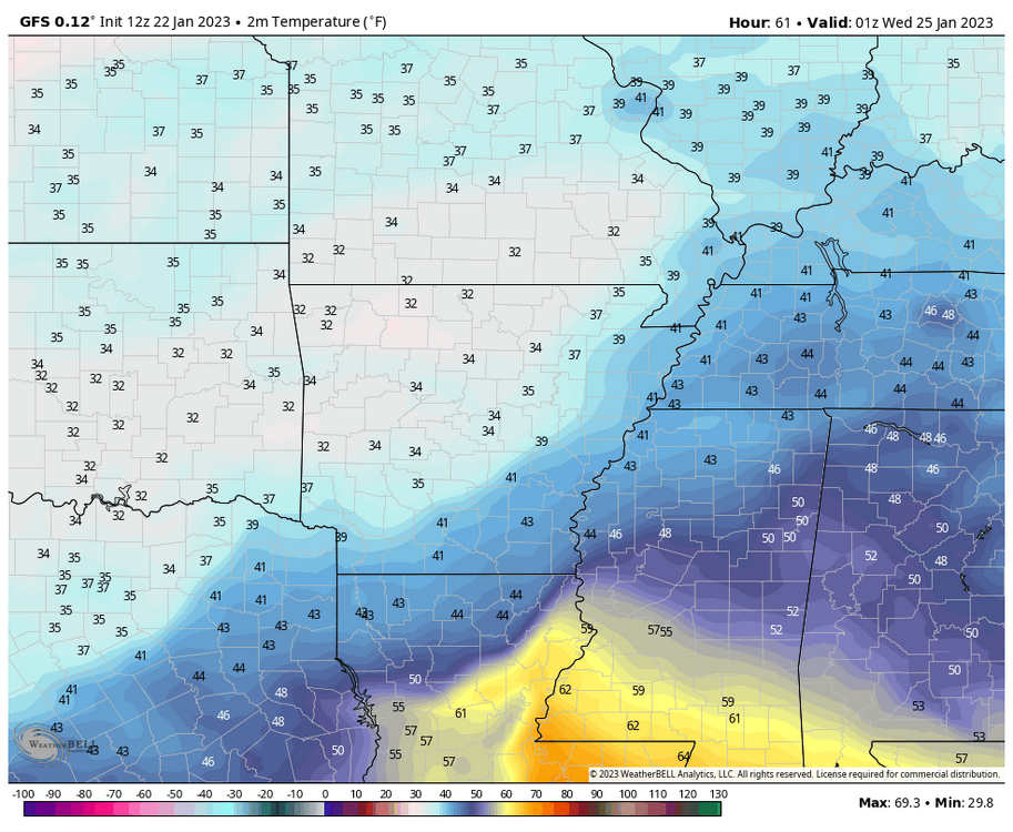
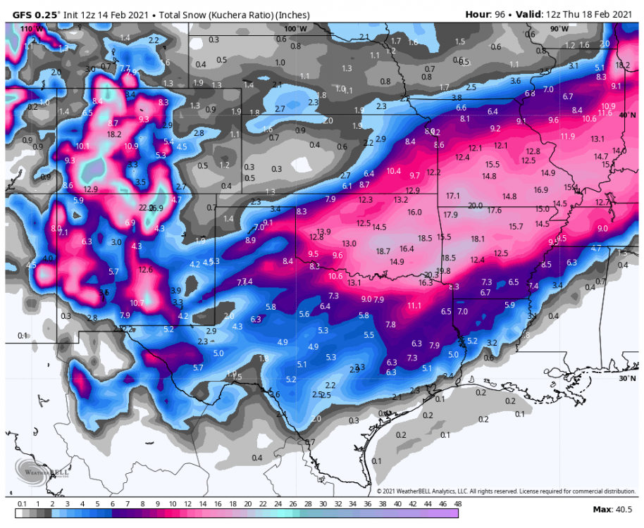
The 12Z GFS from WeatherBell with this porn eye candy snow forecast. Am seriously doubting this as realistic of course, but I do the the storm track for NW AR. Question whether the 10:1 ratio is possible, although time of day does help some. The temps are certainly marginal as depicted by the 7pm Tuesday GFS temp. The Euro is a bit warmer, although I am not sure how well models do with dynamic cooling in the heavier snow bands.
-
Thanks, that is a great tool!
-
Stormdragonwx - When I click on the first link it takes me to what looks like the home page. Not sure where to go from there. Can you describe how to get to (or directly link) to the page to that displays the ensemble snow map. Thx.
-
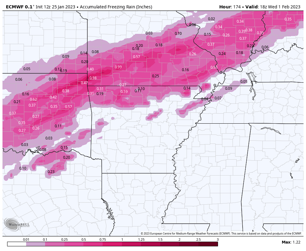
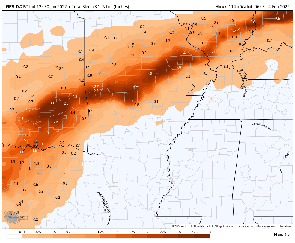
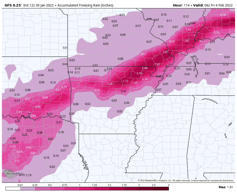
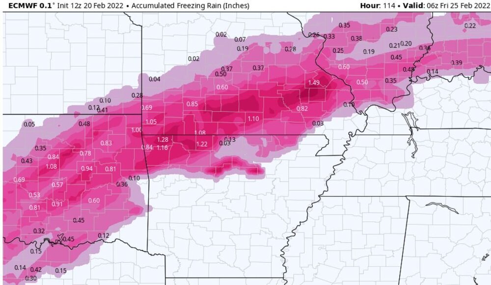
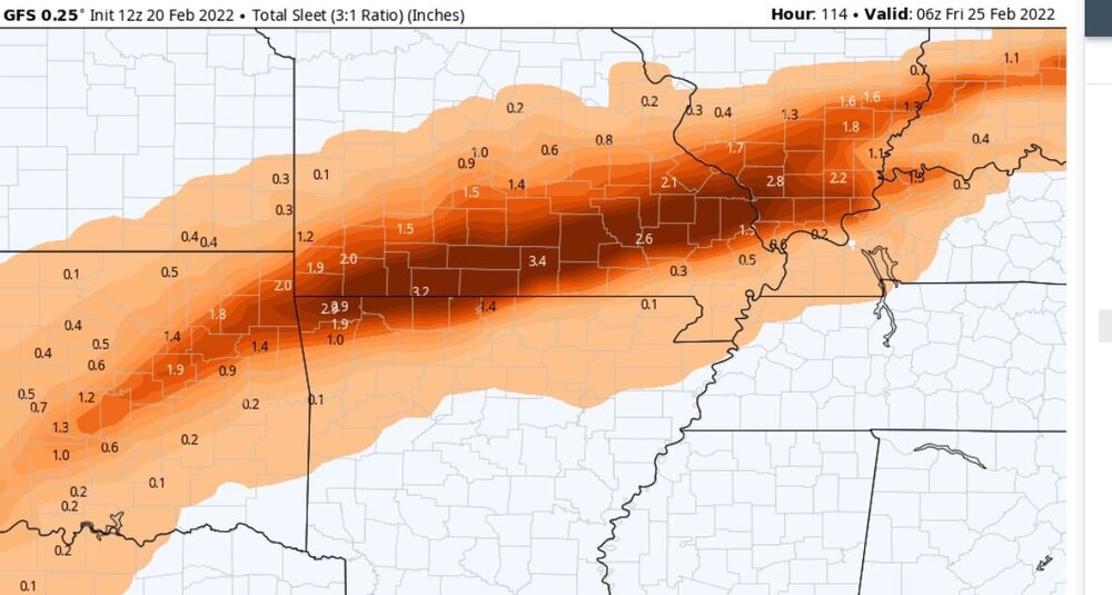
Quite the ice or sleet storm for N. ARK and SE MO on Wednesday/Thursday depending on which model you believe (if you believe either one, lol). GFS is the sleet storm with freezing rain further south and Euro is the ice producer. Neither one shows quite as much precip further north where snow/sleet would be more likely.
-
Sleet is the word in Eureka Springs, as expected for now. Patience needed.
-
Maybe not the NW AR crew getting dry slotted, lol.
-
12Z GFS


-
Let’s call it 4” in Holiday Island. Light snow and fog. Roads becoming snow covered. Temp has been rising all afternoon, now up to 31 (from 24). The sticky wet snow looks nice on trees, fences, etc.
-
Natural gas I assume or did you mean gasoline?
-
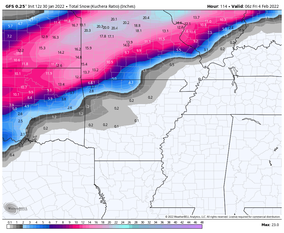
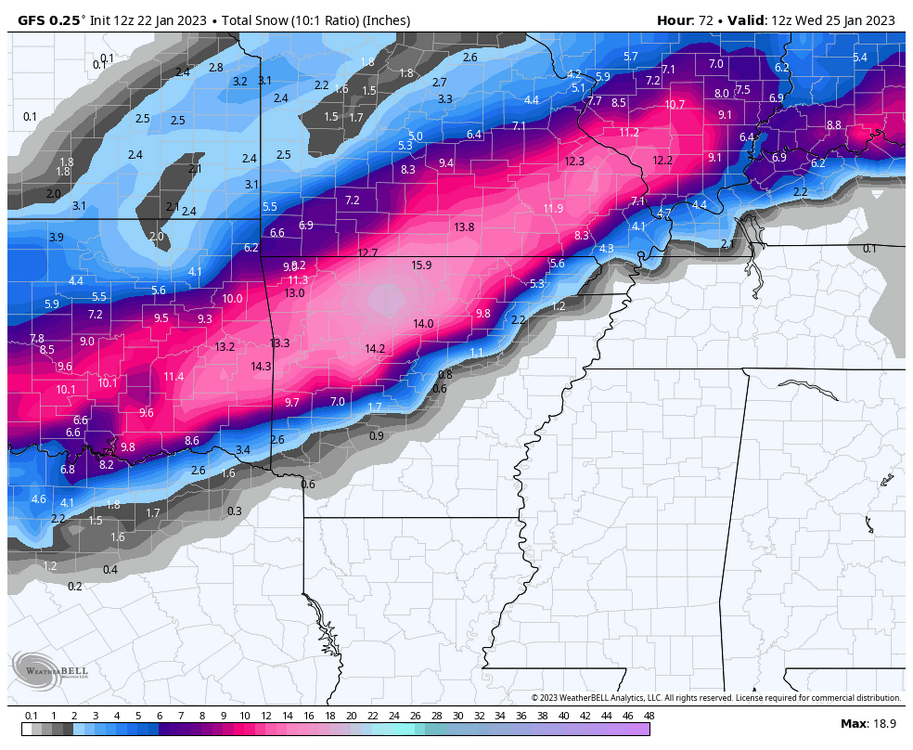
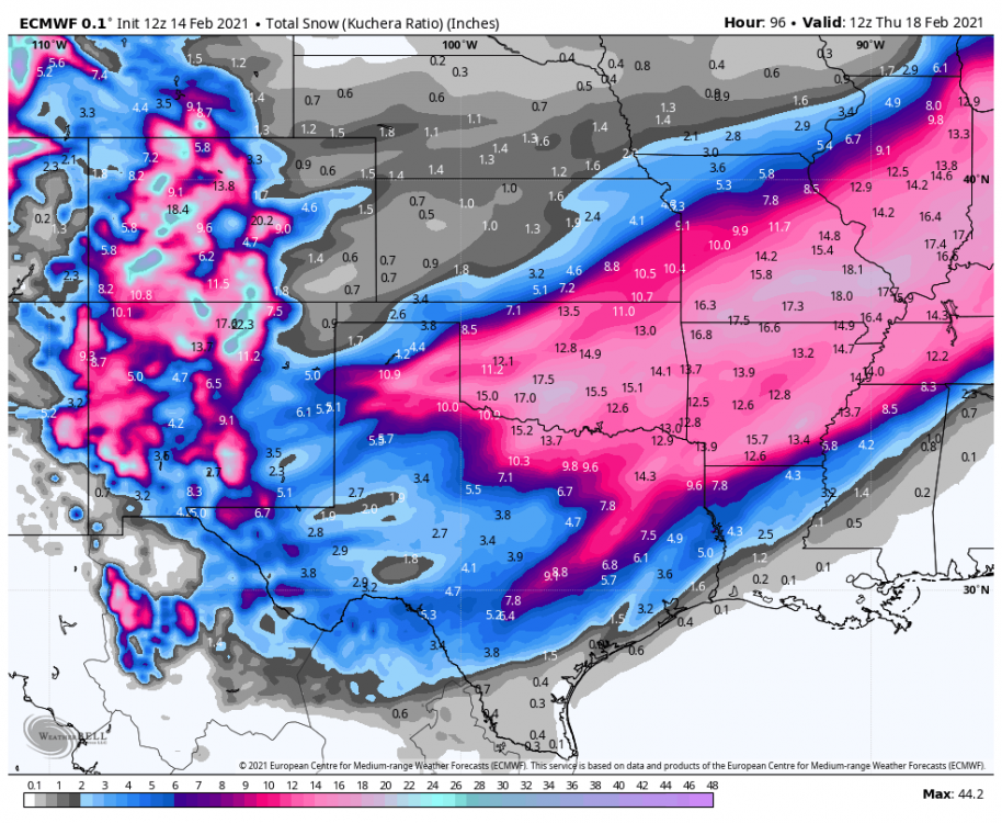
Surprised no one has mentioned the 12Z Euro Kuchera and 12 Z GFS Kuchera suggesting rather beefy totals for the week. Am I missing something?
-
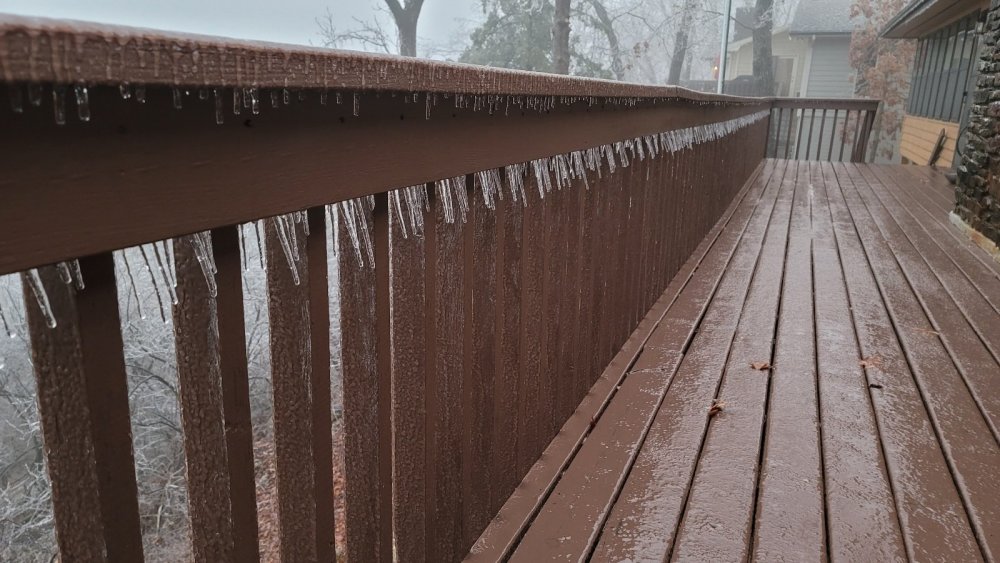
Decent ice coating overnight in Holiday Island, AR
-
2-3" 31° in Holiday Island. Moderate snow. Roads covered.
-
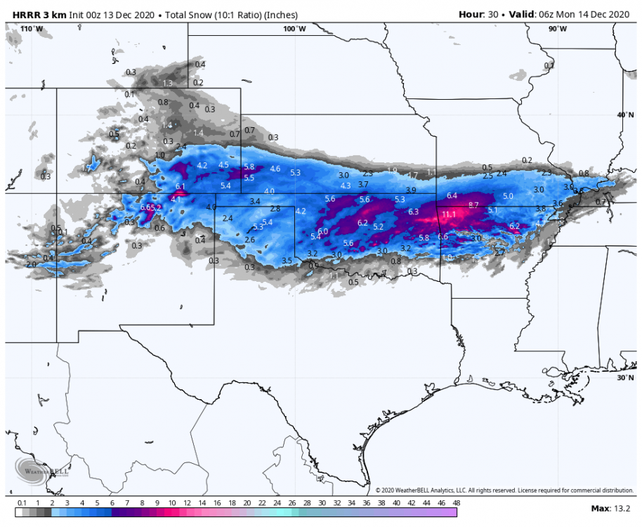
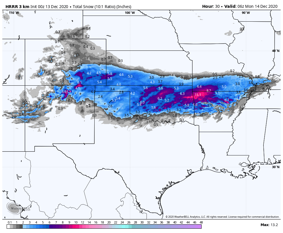
Holy moly, the 3km HRRR going nuts over NW Arkansas. Is this a mirage?