

DixieBlizzard
-
Posts
935 -
Joined
-
Last visited
About DixieBlizzard

- Birthday 06/22/1967
Recent Profile Visitors


-

Mid to Long Range Discussion ~ 2022
DixieBlizzard replied to buckeyefan1's topic in Southeastern States
Fixed that -
So, that 18z GFS was the best run for my area since maybe the Tuesday EURO. Somebody's numerical output gain is someone else's numerical output loss. LOL. Doesn't really mean a thing at this point.
-
If you get that scenario, it won't wash anything away as a matter fact, it will seal it in for you. Good luck my friend. I am pulling for you.
-
Mid to Long Term Discussion 2019
DixieBlizzard replied to Upstate Tiger's topic in Southeastern States
Way to commit! Your obs of the models have been solid today. Sorry you were being sarcastic. Snow is going to ban you for calling it "fatties" anyway. -
December 8-10, 2018 Winter Storm
DixieBlizzard replied to Orangeburgwx's topic in Southeastern States
SREF can be useful as a forecasting tool and have been accurate before in the short range which is its primary objective. I can give scenarios where all models have missed/hit in the past and SREF has be pretty close, more than once, in our area usually within 24 hours. -
December 8-10, 2018 Winter Storm
DixieBlizzard replied to Orangeburgwx's topic in Southeastern States
Every weather board, every winter threat and I have been on these boards longer than some of these posters have been alive. -
Mid to Long Term Discussion 2018
DixieBlizzard replied to Cary_Snow95's topic in Southeastern States
So, Glenn Burns throws this on Facebook last night. He can't even get his description right (Calls colder temps a "blowtorch") and doesn't give any explanation that this isn't an official forecast. I thought @Lookout would appreciate this.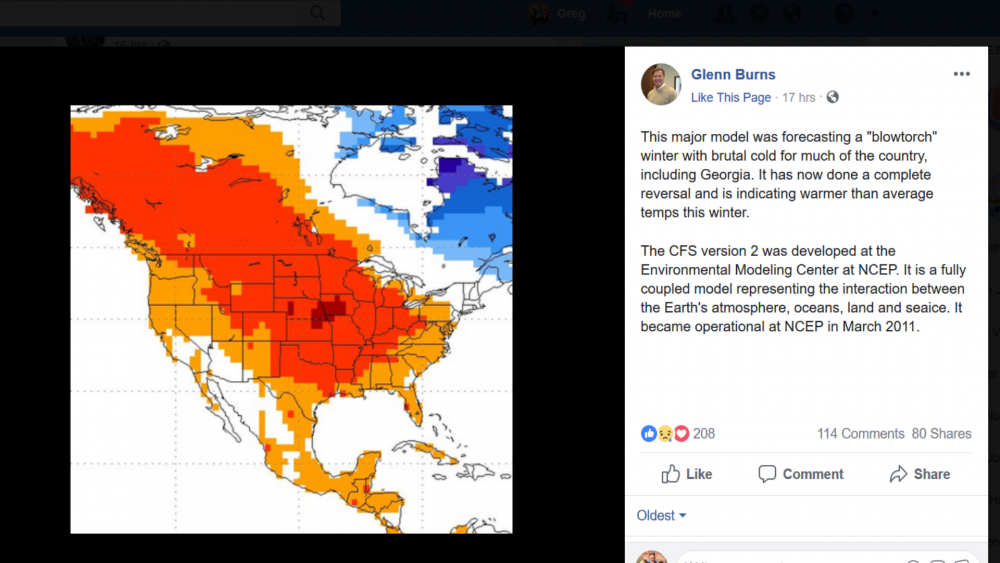
-
Any chance the forecasted "stall" could take place off shore?
-
Mid to Long Term Discussion 2018
DixieBlizzard replied to Cary_Snow95's topic in Southeastern States
That has severe weather written all over it. -
Mid to Long Term Discussion 2018
DixieBlizzard replied to Cary_Snow95's topic in Southeastern States
I knew it hadn't been great but given that look, it could have been worse. Wow. -
Mid to Long Term Discussion 2018
DixieBlizzard replied to Cary_Snow95's topic in Southeastern States
I used to watch JB vids and read his summaries when he was with AccuWeather. If I recall, he always "theorized" that during La Nina's that -NAO's became more likely toward the end of winter into spring. -
Mid to Long Term Discussion 2018
DixieBlizzard replied to Cary_Snow95's topic in Southeastern States
That damn Canadian ridge! -
Mid to Long Term Discussion 2018
DixieBlizzard replied to Cary_Snow95's topic in Southeastern States
Would love where the "battle zones" are located on that map! -
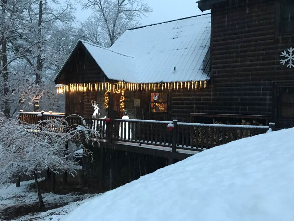
Our cabin in Ellijay this morning. Still coming down steadily.
-
Snowing in Elllijay, GA. Just started.


