jaxjagman
-
Posts
8,271 -
Joined
-
Last visited
About jaxjagman

Recent Profile Visitors
7,146 profile views


-
.SHORT TERM... (Today through Tuesday) Issued at 220 AM CDT Mon Apr 15 2024 Record highs are possible today as a strong ridge axis extending from the Gulf of Mexico to the Upper Midwest builds eastward across Tennessee. Highs yesterday climbed well above all guidance values. The warming and enhanced wind gusts occurred as full sunshine and dry air allowed very deep vertical mixing. Mixing may not be quite as strong today, but we should still meet or exceed yesterday`s highs. Wind speeds will be much lower today as the high pressure builds across the area. BNA climate data for today: Normal high 73 Forecast 87 Record 87 from 1936 BNA climate data for Tuesday: Normal high 73 Forecast 87 Record 88 from 1955 The warm conditions will continue tonight and Tuesday under the strong ridge. Winds will pick up again Tuesday, with gusts as high as 30 mph in the afternoon.
-
Maybe starting to recycle
-
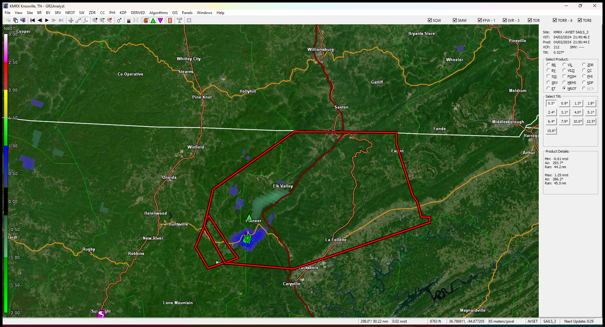
Moving fast,looks like maybe south of Pioneer
-
see it wiped out a funeral home of all places
-
Says thats a confirmed tornado
-
Cells seem to be moving pretty quick now than earlier
-
Some decent rotation starting to show west of Fairview
-
Big tornado
-
Nice thunderstorm,power got knocked off for a few min,wish it was at night,some intense lightning
-
RAP and HRR shows more that will develop later on so we'll see
-
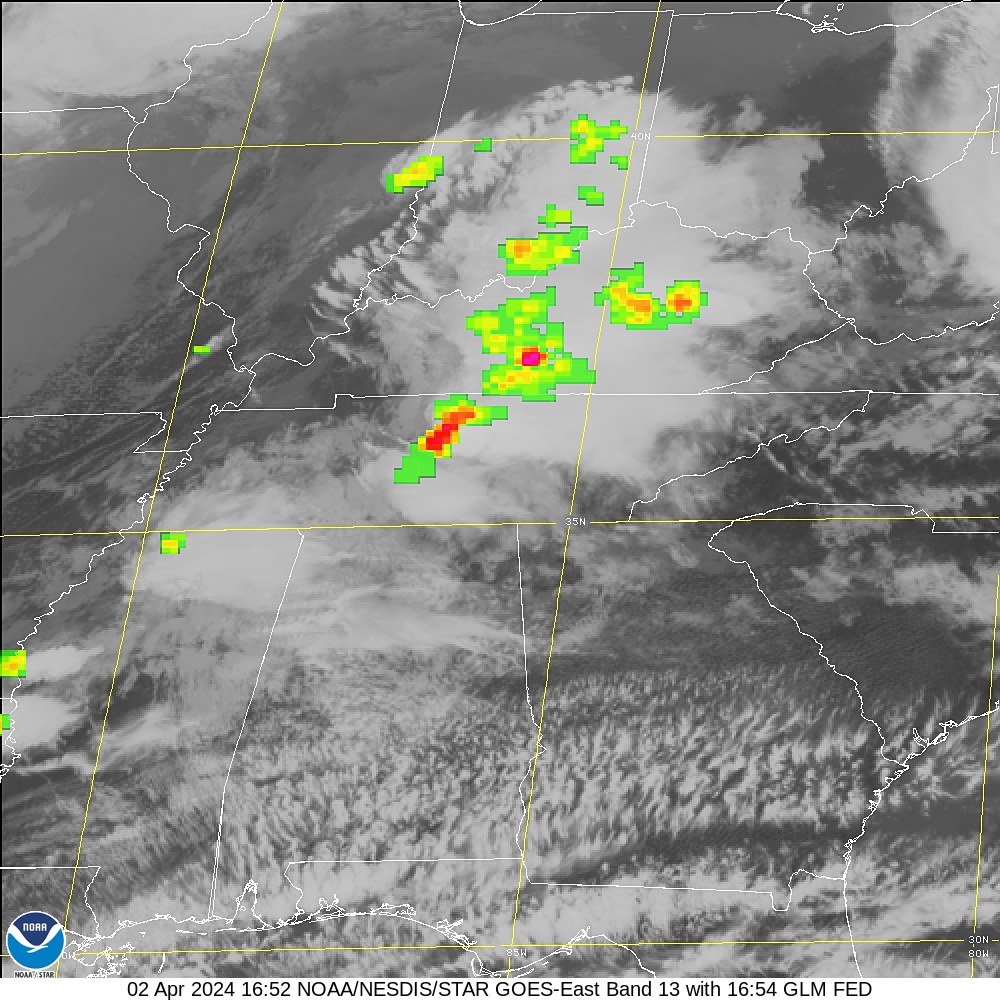
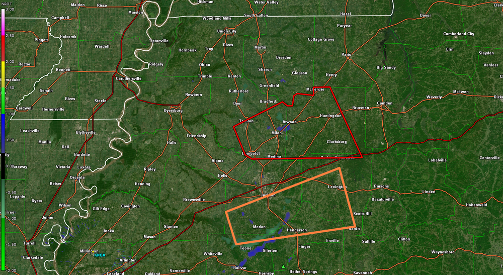
URGENT - IMMEDIATE BROADCAST REQUESTED Tornado Watch Number 75 NWS Storm Prediction Center Norman OK 950 AM CDT Tue Apr 2 2024 The NWS Storm Prediction Center has issued a * Tornado Watch for portions of Southern Kentucky Western and middle Tennessee * Effective this Tuesday morning and afternoon from 950 AM until 300 PM CDT. * Primary threats include... A few tornadoes likely with a couple intense tornadoes possible Widespread damaging winds and isolated significant gusts to 75 mph likely Scattered large hail events to 1.5 inches in diameter likely SUMMARY...A loose cluster of storms in western Tennessee is expected to evolve into a couple of supercells while spreading east-northeastward toward southern Kentucky and middle Tennessee through midday and early afternoon. The environment ahead of the storms will be favorable for tornadoes, a couple of which could be strong (roughly EF2), as well as damaging gusts up to 75 mph and large hail of 1-1.5 inches in diameter. The tornado watch area is approximately along and 50 statute miles north and south of a line from 20 miles north of Jackson TN to 45 miles north of Crossville TN. For a complete depiction of the watch see the associated watch outline update (WOUS64 KWNS WOU5).
-
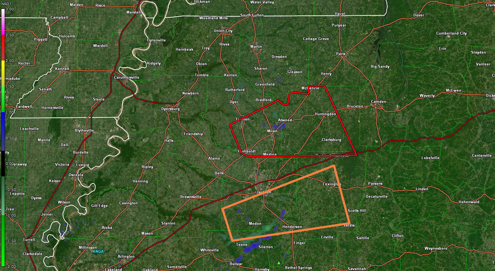
Neither has much rotation right now
-
The thunderstorm cell looks more impressive than the tornado cell in SW TN
-
HRR last couple runs keeps honing in on the TN/KY line for some possible strong tornadoes mid afternoon