

NEG NAO
-
Posts
6,930 -
Joined
-
Last visited
About NEG NAO

Recent Profile Visitors
5,519 profile views


-
it wasn't obvious but shows it has been showing this for several days now.........and a real Meteorologist Typhoon Tip likes how the model is handling this setup.....
-
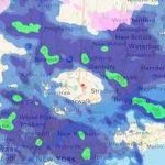
still don't see a thread for this...IMO north of I-80 good chance of a few inches - the coast needs additional model support for the CMC
-
Snow storm, March 31-April 1, 1997 - Storm Summary (raymondcmartinjr.com)
-
CMC once again at 0Z shows potential for accumulating snow.....IMO north of I-80 at least a few inches - TIP suggested a thread be created for this event a couple days ago saying it could extend south and west of southern New England
-
the 12Z Euro shifted south with the snow accumulations in the metro
-
I still think areas north of I-80 have not seen the last of accumulating snow - and the coast is still in question - remember I like my weenies with mustard........
-
CMC is on a roll........a real GEM....
-
no similarities ? is a 100 year Arctic outbreak needed this time around ?
-
how does this setup compare to April 6, 1982 ? - similarities and or differences ......
-
how about covered in snow ?
-
I like mine with mustard on it........
-
and then you have the Canadian solution possibility later in the week with enough cold air dragged into the system to change it to snow
-
12Z regular Euro looks like the previous AI Euro for early april


